Exploring a canyon waterfall and a unique walk-through cave
| Wildwood Park, Paradise Falls & Indian CaveThousand Oaks Exploring a canyon waterfall and a unique walk-through cave |
| Wildwood Park is a
large and scenic expanse of parkland (1750 acres) located on the NW edge of upscale
bedroom community Thousand Oaks,
20 miles up Highway 101 north from LA. The highlights are Paradise Falls and Indian Cave, but this is large and diverse tract of undeveloped range and there's lots of room to roam here. Well-maintained trails for biking, jogging, hiking, and horseback riding let you explore meadows, mountains, canyons and interesting rock formations. |
There is residential
development on many sides, including a water-treatment plant in the
valley below the north end, but enough open space and secluded trails
on which to get lost. Started late at 3pm to beat the 90+ degree heat, I hiked the biggest part of the park, relaxed at the falls, and finished up around 7:30pm. |
| Mostly well-maintained trails and signs throughout the park. A few places could have used better signs. For example, there is a trail from Lizard Rock down to Paradise Falls on the map but I couldn't find anything hikeable. And Indian Cave is difficult to find from Paradise Falls as there are few, if any, signs for it. |
|
| STATISTICS |
| Wildwood Park W. Avenida de Los Arboles, Thousand Oaks, CA Height: 00000' Elevation gain: Less than 300 ft. Distance: 6-7 mi. Duration: 4 hours roundtrip Difficulty: Easy Water availability: 3 water fountains and Paradise Falls stream. |
| Gated park is open from
dawn to dusk, enforced by rangers. From Los Angeles, take Hwy. 101 north to Thousand Oaks. Exit Lynn Rd. Go north 2-3 mi. T/L Avenida de Los Arboles to the end. Free parking in lot or on the street. |
|
|
|
||
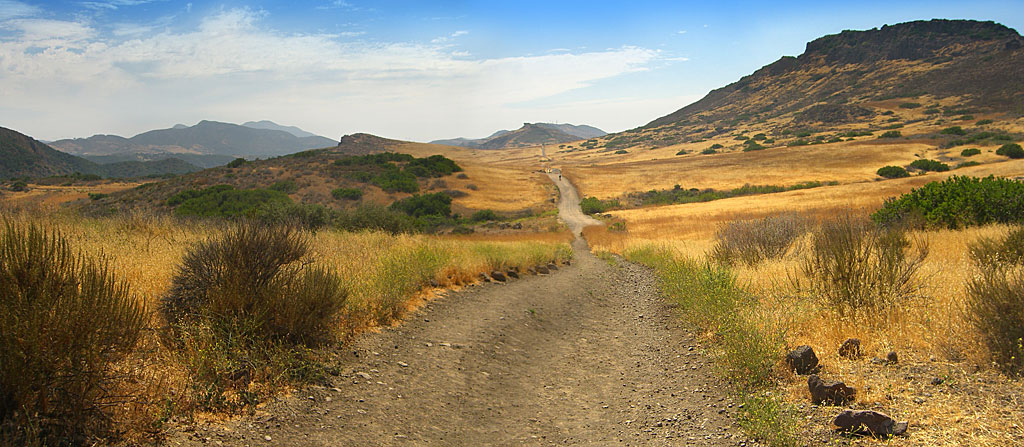 Looking into the park from the trailhead. The yellow color was amazing. The overhanging rock the trail points to in the distant center is Lizard Rock. Collaged from 2 photos. |
 |
 |
 |
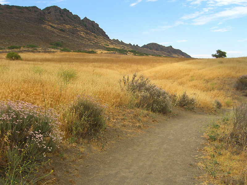
 Share the bigger trails with horses and cyclists. Looking back to trailhead. |
|
 Lizard Rock, impressive from a far away, looks like concrete slag - all bumpity. |
 Looking back from Lizard Rock to where I took the first pic. |
 North toward Los Padres mountains. Note paraglider riding thermals. |
 Looking north towards the end of the Santa Monica mtns. |
 Lizard rock from the other side looking back to trailhead. I guess it looks like the head of a lizard? |
 . |
 |
 Stagecoach bluff above Paradise Falls |
 A slip off this cliff would end in a very prickly fate |
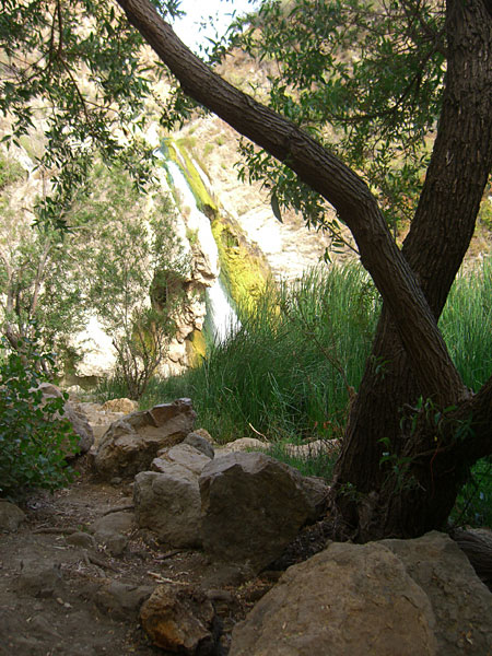
 You arrive at Paradise Falls from above. Apparently, algae likes this stream and waterhole. |
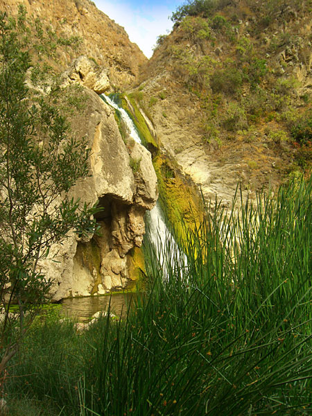 Not "Paradise" exactly, but a nice noisy waterfall. A surprising amount of water was coming through for June. |
 The only way to get a frontal view of the falls is to ford the stream on slippery rocks |
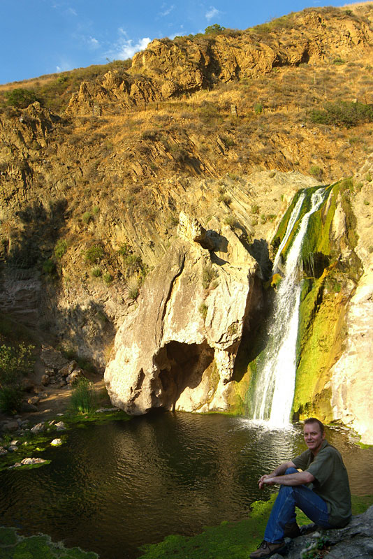 A clear Sunday afternoon, just a few miles out of LA, and everyone had gone. |
 From above the falls. Note contingent of ducks. |
 |
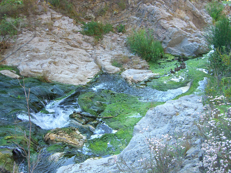 The stream that makes the falls is pretty choked up with algae. |
 |

|
 Shady bower on the way to Eagles Point trailhead. |
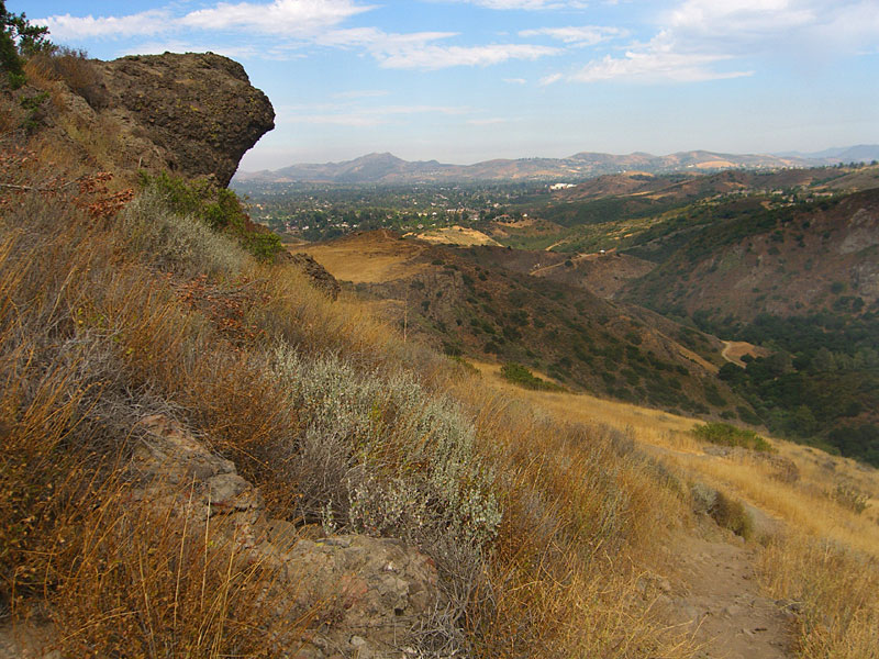
 Stagecoach Bluff from Eagles Point trail |
 Approach to Indian Cave from below. The steps are handy for tourists, but detract from the natural setting, IMHO. |
 A very unique crawl-through cave, big enough to stand up inside. I thought it to be the highlight of the park— a real geologic wonder. |
 You could make a real nice shelter here, if no one knew about it... |
|
 Looking down from inside the cave. |
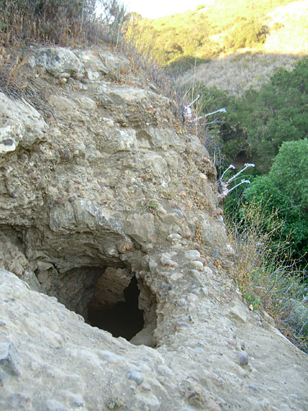 From above, the entrance is steep, tiny and a little daunting. |
 |
 The road back home. |
 A last look back from where I started. |
|
Since
Jan.09
|
