6 miles roundtrip hike up a mountain creek to an amazing waterfall swim hole
| Santa Paula Creek Punch Bowl Los Padres National Forest, Ventura County 6 miles roundtrip hike up a mountain creek to an amazing waterfall swim hole |
| Sixty miles northwest
of Los Angeles, up Hwy 150 a few miles out of Santa Paula, a small 90%
hispanic farming community at the edge of the Los Padres mountains,
is St. Thomas Aquinas College, where the path to an awesome swimming
hole called "the Punch Bowl" begins. "Punch bowl" is a
commonly used term for deep pools created by waterfalls. The Santa Paula Punch Bowl is one of the must-do hikes for any serious SoCal hiker. Santa Paula creek has cut a deep gorge through a sandstone canyon, then pours over a cliff into a natural pool surrounded by rock ledges of various heights you can jump from or picnic on. There are towering cliffs on two sides and a deep gorge above. (See my second trip report). Makeshift damming of the creek has created a much larger and deeper swim hole. Despite the disappointing tradition of spray painting the rocks that some morons still maintain, the Punch Bowl is still an awesome natural wonder. It's popular with locals and college age kids on weekends but you can have the place to yourself if you arrive early or visit weekdays. Not for the unprepared The hike in is disarmingly challenging. A flood wiped out a significant section of trail and trail markers are rare, so often you'll scramble over and around boulders, following the creek as best as you can. Without a clear trail and under the glaring sun, most first-timers (myself included) under-estimate the physical and navigational effort required and their water situation. This is not a path in the park! It's a desert mountain wilderness and you may encounter rattlesnakes, kingsnakes and scorpions. Deer, coyotes, bears and even mountain lions live in the surrounding Los Padres mountains. Watch for poison oak and ticks. Most importantly, stay hydrated to avoid heat stroke. |
As much as it is a visual blight, the trail of
tagged rocks is actually a navigation aid where the trail is gone. If
you miss the creek crossing connection to the easier high trail, (easy
to do) then the last 1.5 miles is clamboring up and around exposed rocks
and boulders in the hot sun — which will take its toll on your energy.
My first trip here I started out at 3:30pm to avoid the 90+ degree heat - the tail end of a record-breaking heat wave across the Southland. A waterfall-swimming hole sounded perfect. I missed the high trail and blazed my own trail much of the way, following the stream. Did I say it was scorching HOT? The Punch bowl is amazing to see and hear the first time. The water, although very cold, is perfect after a hot hike. There were quite a few college age people there, some drinking, but everyone was friendly. I tried my hand at climbing the rope and jumping from the cliffs. I was disgusted by the amount of tagging on the rocks and that idiots had left so much trash in this beautiful place. On my second trip here, I brought and filled up three large garbage bags and with the help of my cousin, carried two of them all the way back out. I had a fantasy about returning with a sand blaster and clearing off all the graffiti, but I know how these things work - it would just be back in a few months. =0| |
| STATISTICS |
| Santa Paula Creek Punch Bowl via St. Thomas Aquinas College trail Elevation gain:Less than 500 ft. Distance: 3-4 miles one way Duration: 1.5-2 hours one way Difficulty: Challenging because of the heat and navigation Water availability: Santa Paula Creek flows year round but water should be treated. |
| You could take I-5 north
to Hwy. 126 west out of Santa Clarita to Santa Paula, but I recommend the scenic route
through Grimes Canyon. From the San Fernando valley in LA, get on the 118 west to Moorpark and exit westbound on Los Angeles Ave. T/R on Moorpark Ave. / Hwy 23, which is the 3rd or 4th light. Follow Hwy. 23 10-15 miles, through a sharp left and a sharp right through the orchards, then down into amazing Grimes Canyon and into Fillmore. T/L on Hwy. 126/W. Ventura St. and follow it 10 mi. or so to Santa Paula. Exit Hwy. 150 and through town, stay right at light. Stay on 150 / Santa Paula Ojai Rd. 5 mi. or so to St. Thomas Aquinas college. Free parking in dirt lot across from entrance |
Leave nothing that looks
valuable visable in your vehicle. Signs at the parking lot warn it won't
be there when you return. You don't need a wilderness permit to overnight in the Los Padres NF, but you are required to carry a free campfire permit, should you want a fire. |
|
| ||
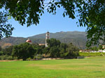
 A little known approach to Santa Paula is Balcom Canyon Road, where you get a nice vista of Santa Paula Peak and the Los Padres range rising up from a lush farmlands. There's a California condor breeding reservation up there. |
 ThePunch Bowl trail starts at St. Thomas Aquinas College, a Catholic school surrounded by avocado groves. |
 Apparently theres some comtempt for the avocado theivery laws. The first half mile of the trail is a road through private property. |
 The path starts out easy. Passed lots of sun-burned, tired-looking college-age hikers coming back. Good, I hope to have the place to myself. |
 In no time, the trail dissolved and I'm struggling to figure out which to go. |
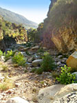
 You can only follow the creek up. On both sides are rugged cliffs. |
 |
 After a hot, strenous hour, no punch bowl in sight, but lots of deep pools to cool off in. I decide hold out for the waterfall... |
 Looking back over the boulders and loose rocks I've been negotiating. Unbeknownst at the time, I'd missed the high trail. |
 Did I mention the heat? |
 Must have been three scorching, rugged miles up and I was getting a little discouraged. Was I going the right way? Maybe I should just quit and get wet... |
 Overtook a group of 5 girls and a guy who were ready to give up finding the waterfall too, and had stopped at one of the many nice cool pools. |
 Finally, where two streams met, I climbed a big rock and there it was. Way up here, a strenuous hike, late afternoon, I was surprised and a little disappointed-over a dozen people here! |
 As I looked around, I could see why this place is so popular - a fantastic waterfall fed swimming hole. Even lots of spray paint and litter doesn't diminish the appeal of this place. |
 I jumped in right away. The water was cold and perfect! Then all but 4 others left. They'd probably been here all day... |
 There were ropes up the cliff you could climb and jump from many different heights. The guys told me about an easier way back - a high trail above the creek. |
 After 45 minutes, the girl group I passed appeared one by one. They must've been heartened to see me keep going beyond where they had stopped. |
 I'm glad for the poor guy leading them. If they followed him up here for nothing, there'd be hell to pay. The rest of us were leaving. Now they had the place pretty much to themselves. You can see a guy sitting at the top of the falls where I'm told there's another waterfall, pool and rock slide. I'll hit that area next trip here. |
 The Punch Bowl. Awesome - yes or no? |
 |
 The mountains here are very stratified. You can imagine there are plenty of fossils. |
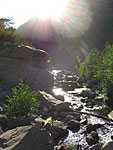
 Going back was a lot easier on the high trail. Looking back up the canyon stream where I'd hiked up. |
 Homeward bound in late afternoon beats the heat. I'll come back here again for sure. |
Since Jan.09
|
|