Car camping, day-hiking and exploring all over the park for 3 days.
| Yosemite National Park Central California Car camping, day-hiking and exploring all over the park for 3 days. |
| This was my first trip
here, to get a feel for the place, see what it was all about, discover
what was where and decide for myself what areas to explore further when I
return for a more immersive trip. The park is a little over 300 miles north of LA, about a 4 hour drive, costs $20 admission for a week. Despite the hype, the crowds and road construction in the valley, there aren't enough superlatives to describe Yosemite: massive, mind-blowing, amazing, unparalleled, awesome. Yosemite is an enormous wilderness with several distinct features: Yosemite Valley, with Yosemite Village, the famous Bridalveil and Yosemite waterfalls, the granite peaks of El Capitan, Half Dome and others; the giant Sequoia Groves in several places throughout the park; and the High Sierra, with Tuolumne Meadows, north of the valley. The Valley has all the civilized highlights that tourons want or need and the wildness is long gone. But a few miles up in the High Sierra, down a twisty gravel campground road, in the inky black night under giant, prehistoric trees, you can still feel the rush of the wilderness and the flush of hyper-alertness that comes with the reality that you might be considered prey! My main hike this trip would be the Mist Trail up from Yosemite Valley, which is the beginning of the 250 mile John Muir trail that ends in the Eastern Sierra at Mt. Whitney, the highest peak in the contiguous 48 states. |
The
Mist Trail from the valley up to Vernal and Nevada Falls is an engineering marvel. The tens of thousands
of steps blasted out of giant walls of stone took years to create. Despite the masses
who climb it from the valley, it is still a formidable and tiring ascent
to Vernal Falls and an exhausting accomplishment to reach Nevada Falls,
especially if you're carrying anything heavier than some water and a
sandwich. There are very steep and narrow sections where the mist from
the falls makes for slippery footing. If you have fear of heights, it
might not be the hike for you. Record temperatures in the high nineties made hiking a lot more exerting and required lugging more water (I didn't have a filter on this trip), but it was cooler by the river, and cold—down into the forties—at night. Even the haze and poor visibility the first two days didn't dilute the experience. Then it cleared nicely Saturday. From my base camp at Porcupine Flats, 40 miles up the High Sierra hwy., I took extended day trips to the valley and out to Tuolomne Meadows and returned in the evenings. Three days and 900 miles of driving later, I was back in LA, already planning my next trip back. Took tons of pix, these are some of the better ones... |
| Overnight hikers must have a permit to camp. Getting one during summer weekends can be difficult, as there is a trailhead quota and the coveted permits can be reserved many months in advance. A few permits are held for walk-ins - those first in line at the closest ranger station at opening time. There's a lot of information out there about the best way to score a Yosemite backcountry permit, more than I can go into here. Simply put, plan far ahead or hike in from an alternate trailhead. |
| There are numerous levels of accomodation for visitors, including the four star Ahwahnee Lodge underneath El Capitan, respite of presidents and kings, and built up camps, but the majority of people who visit Yosemite stay in tents, trailers and RV's in the numerous campgrounds throughout the park available. Reservations can fill up half a year in advance. The Valley floor campgrounds fill up quickly, but others, like those out the High Sierra highway an hours drive from the valley can be virtually empty, even on busy holiday weekends. So it IS possible to wake up in Yosemite without obsessing about reservations beforehand. | ||
 Bridalveil Falls |
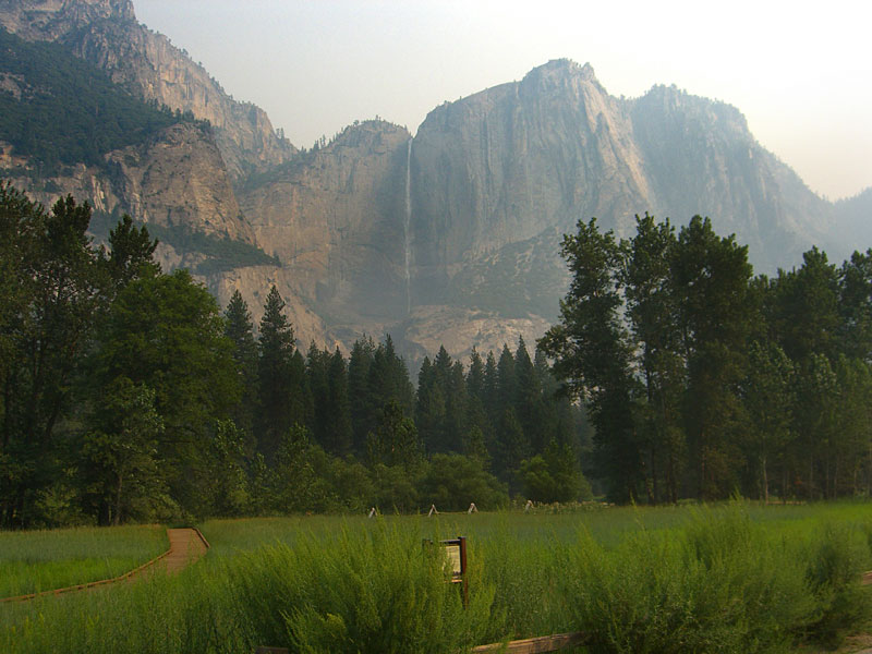
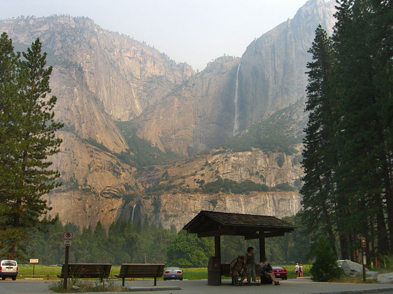 Upper and Lower Yosemite Falls |
 Bridalveil Falls. |
 The Mist Trail up to Vernal Falls (1.5 mi.), Nevada Falls (3.4 mi.) & Half Dome (8.2 mi.) begins in Curry Village & follows the rushing Merced River up the mountain. |
 Half the 1.5 miles is steps. |
 A nice mist from the falls cools things down, but makes for slippery steps. |
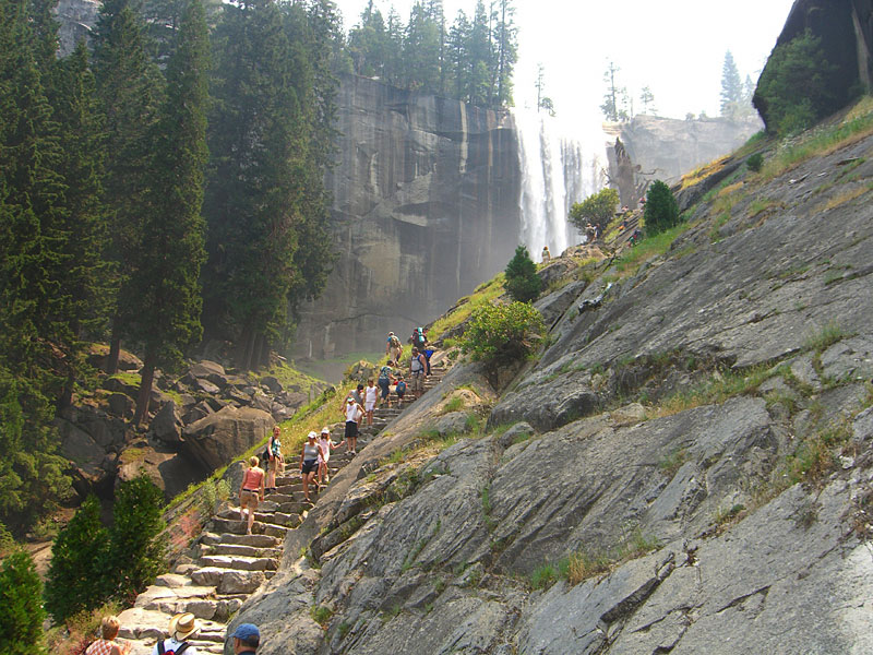 The steps themselves are an amazing feat of engineering, often blasted out of boulders, going miles up into the mtns. |
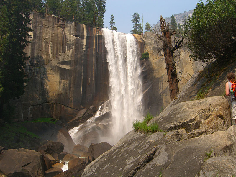 Vernal Falls |
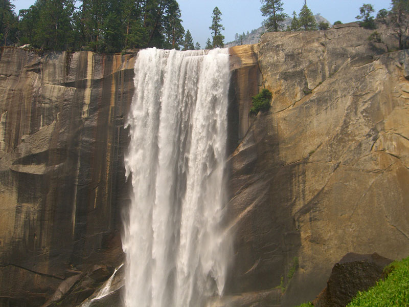 |
 The final spurt to the top of Vernal Falls - not for the timid. |
 Leaning over Vernal Falls, listening to the thunder. See hikers on the trail. |
 At the top of Vernal Falls is Emerald Pool, surrounded by the "Silver Apron" - a smooth, sloping white rock. A big log is stranded on a submerged boulder. |
 The Merced above the falls becomes a wild swift-water slide over smooth rocks into the Emerald Pool, off limits due to accidents. |
|
 Only the hardy continued on to Nevada Falls over the bridge. |
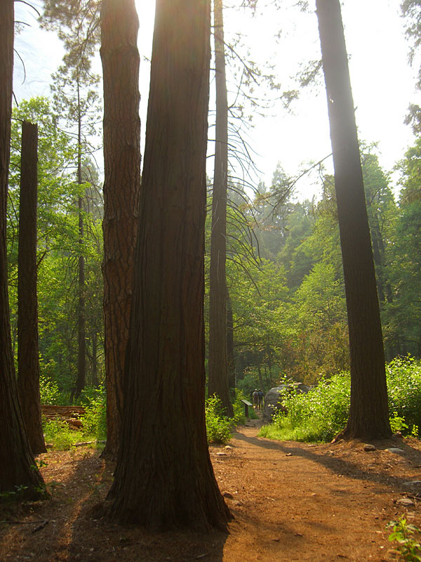
 Impossible to photograph how GIANT the trees are. My neck was sore from looking up all the time. |
 Another hour of steps, sweat and exertion and Nevada Falls comes in to view. |
 You can hear the thunder from across the valley |
 Top of Nevada Falls. There are 5 people in this picture. |
 Watching the water go off into the abyss is hypnotic. After a relaxing break, I continued another mile above for a better view of Half Dome. |
 Back at the bottom, returning through The Fen, an ancient forest with soft, spongy soil. |
 After seven hours out, I was proud of myself for hauling more water than I needed and getting to share it with those who didn't know better. |
 After a dip in the Merced, dusk arrives in the valley. |
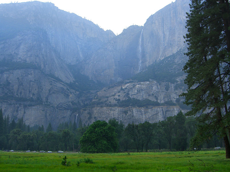 Upper and Lower Yosemite Falls |
 I checked out Ahwahnee Lodge, Yosemites grand hotel where presidents and royalty have stayed. The main dining room is huge. |
 Then back to my home at Porcupine Flats campground in the High Sierra. You're required to store all food and scented items in bear-proof steel lockers (at right), not the car. |
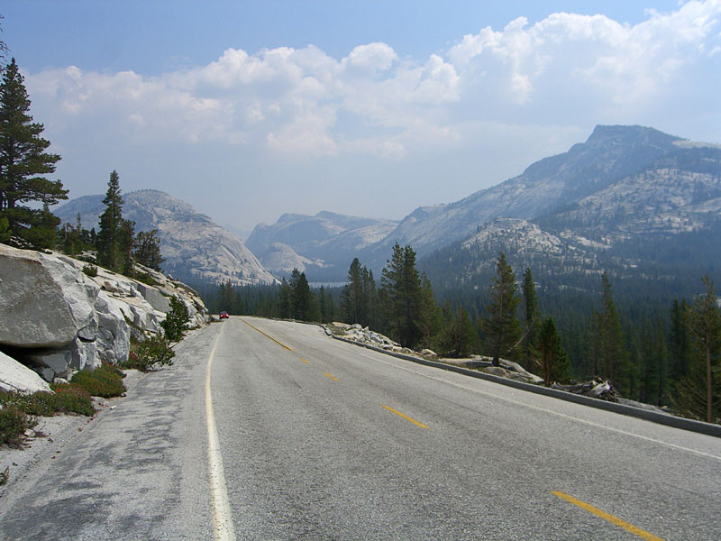 Exploring the High Sierra north of Yosemite Village. The highway winds 50 miles up to Tuolumne Meadows. |
 Tenaya Lake |
 A dozen rock climbers were hanging from ropes all over this mountain, inching their way up the sheer face |
 Tuolumne Meadows is miles of verdant fields, streams and lakes surrounded by glacial peaks. |
 On the road to Tuolumne Meadows |
 |
 Tuolumne Grove of giant Sequoias |
 Big dead tree covered with Russians |
|
 Tunnel made in the late 1800's, big enough to drive a stage coach through. |
 The last day cleared up and I got some better shots. Upper Yosemite Falls |
 Can't get enough of Half Dome. |
 |
 Looking east to Yosemite Valley from the Hwy41 tunnel overlook. El Capitan on the left, Bridalveil Falls on the right, Half Dome in distant center. |
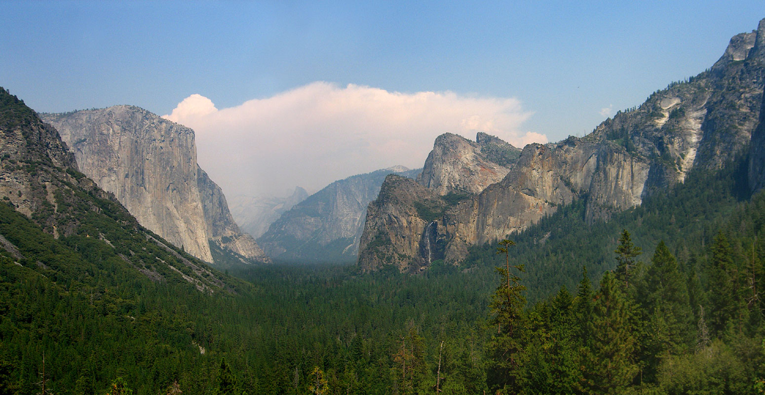 Big version (1550 x 800 pixels, 312k) |
|
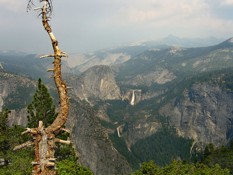 East Yosemite Valley from Glacier Point, with Nevada Falls and Vernal Falls below it. For scale, it's 2 miles by trail between the falls. |
 Half Dome is the most famous icon of Yosemite, but there are other big granite domes here too. |
 The summit of dome rocks are dangerous in storms. Lightning strikes killed two last year. Also, a Japanese tourist slid off and a another guy had a heart attack. |
 A long ways down. Check out cars in parking lot bottom right. |
 I was going to scale Half Dome on the cable steps, but was unaware you have to start at 4-5am to get back in one day. |
 Next trip I'm going to be standing up there, taking a picture back this way! |
Since
Jan.09
|

