10 mile overnight hike into SoCals secret grand wilderness
| Sespe River, Sespe Wilderness
via Piedra Blanca, Rose Valley 10 mile overnight hike into SoCals secret grand wilderness |
| The Sespe River winds
through tall mountains in the grand Los Padres range, through deep canyons
and wide valleys, leaving fertile meadows and a trail of greenery wherever
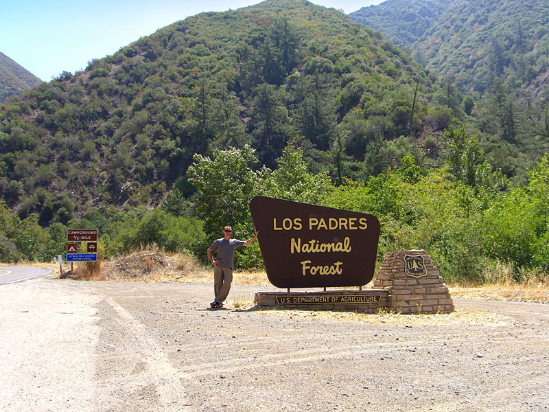
it flows. The Piedra Blanca entrance to the Sespe River trail is marked by giant
white rocks that can be seen for miles. After the winter rains, the Sespe can be a raging torrent with a wide flood plain. But in August, the Piedra Blanca area of Sespe Wilderness is dry, windy and hot and the Sespe River is an arroyo much of its length, reduced by the merciless sun to a few flowing channels and a series of disconnected pools. But there are places along the trail where the water is still deep, clear and cold enough for a perfect wilderness swim, accessible only to those who work to reach it. |
Just the drive to Rose Valley and Piedra Blanca , many miles north of
Ojai, is a trip into the wilderness itself. I picked this spot after
hiking the Matilija Creek
trail, a few dozen miles south, looking for another similar riverside trail.
I'd driven up to scout here after I finished that hike and was blown away by the immense Piedra Blanca rocks and the wide Sespe River valley flanked by tall peaks. I'm told parts of the Sespe River trail have shady canyon paths, but the Piedra Blanca area is a wide valley with high meadows and extensive flood plains. A fire burned through here recently and scarred thousands of acre throughout the first few miles of this hike, but the beauty of these mountains is still in intact, just a little singed. I'll visit again in the Spring when I know it will be an epic transformation. |
The trailhead is
at the end of the parking lot, to the left of the bathrooms. The trail
is an easy to follow hard dirt path, but there are some burned signs.
When you get to the Pattons Cabin area, a wide sandy area with big
shady oaks, watch for where it crosses the stream. |
|
| From LA, the easy way
to get here is the 101 freeway north to Hwy. 33 to Ojai. My favorite is the scenic route through Moorpark, Grimes Canyon and Santa Paula. From the San Fernando valley in LA, get on the 118 west for 10-12 mi. to Moorpark and exit westbound on Los Angeles Ave. T/R on Moorpark Ave. / Hwy 23, which is the 3rd or 4th light. Follow Hwy. 23 10-15 miles, through a sharp left and a sharp right through the orchards, then down into amazing Grimes Canyon and into Fillmore. T/L on Hwy. 126/W. Ventura St. and follow it 10 mi. or so to Santa Paula. Exit Hwy. 150 and through town, stay right at light. Stay on 150 / Santa Paula Ojai Rd. 15-20 mi. or so into Ojai. (Outside Santa Paula, note dirt parking lot across from the entrance to St. Thomas Aquinas college. Park here to hike to the amazing Santa Paula Punchbowl.) A mile or two beyond downtown Ojai, T/R on Hwy. 33 N. Go about 15-20 mi. T/R Rose Valley road. Follow past the Rose Valley Gun Club to the end at Piedra Blanca Trailhead parking lot, about 6-7 mi. |
||
| Getting there | |||||
 Northward up Hwy 33 out of Ojai. (pronounced "O-hi"), 100+ miles from LA. |
 The road climbs high into the Los Padres wilderness. |
 33 is great twisty mountain highway, a popular destination for sport drivers and motorcyclists from all over the Southland. Been through here many times on my bike. |
|
||
| The Trail | |||||
 Hit the trail around 9am, temperatures already in the high '90s. Other than a 3 horse caravan, it was just me out here. |
 A little bummed to discover a fire burned through here recently, blackening trees and denuding mountains, but still an awesome range. |
 Wide canyons provide little protection from the summer sun, so by summers end, the Sespe is mostly dry. |
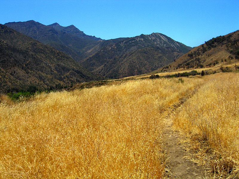 Around every mountain was a new discovery, like this hilltop meadow. |
 Unlike other river trails, the Sespe river trail is often high above the water, probably because the raging spring floods wash out lower passages. Wherever there is water, greenery is bursting forth. |
|
 Burned trail sign shows where the Hines Peak trail up to Lady Bug Camp begins. |
 Stopped for the evening at a large meadow at a wide bend in the river—now almost completely dry—lined with giant oak trees, blackened but making a comeback. Assumed it was Oak Flats at the time, but it was likely beyond that... |
 The riverside camp under big shady oaks would've been idyllic before the fire, especially in the Spring, when the river is flowing big. Its obviously been a favorite of backcountry adventurers over the years as evidenced by camp furnishings, paths & discarded horse brushes. |
 Nearby bear scat made me glad I brought a bear-proof container for my food. Would've liked to had a campfire but there are restrictions this time of year. |
 The next morning, you could see how nice this camp would be in the Spring with rushing mountain water behind it. |
 The cloudless sky was an unreal shade of blue. Pretty sure it got above 100 on the hike out. |
 In a couple of years, this fire damage will have grown out again. |
 Was hoping for a little more water, but prepared for none regardless. It's late August in the desert wilderness, after all. |
|
 This group arrived as as I was leaving. They overnighted out the trail too and had just hiked many miles back in the burning sun. As is often the case, they underestimated the drinking water situation so I lent them my filter. |
 After 16+ miles out and back in this heat, I must have lost 5 pounds! |
|
Since
Aug.09
|
|||||


