6 mile round-trip up a rugged, boulder-strewn mountain to a 360 degree viewpoint
| Rocky Peak, Santa Susana mountains,
Ventura county 6 mile round-trip up a rugged, boulder-strewn mountain to a 360 degree viewpoint |
| With such a simplistic
name, you'd think Rocky Peak must surely have been named by a language-challenged
surveyor. But actually, it's an appropriate description of this high
point in a dramatic landscape of stone mountains, erosion carved rock
formations and giant boulders, where vegetation struggles to find root. Rocky Peak is located in the northwest corner of the Los Angeles metropolitan area, between Chatsworth and Simi Valley, an area distinguished by a mountainous landscape of house-sized boulders and rugged canyons filled with giant oak trees. There is Old West and movie-making history here and it's a popular hiking spot. The Santa Susana mountains run east and west, bordered roughly by Hwy. 118 to the South, Hwy. 126 to the North, I-5 to the East and Hwy 23 to the West. Much of the range is private land, but several organizations are purchasing tracts for parkland. The Santa Susana's have numerous peaks in the 2300-2800 ft. range. Much of the year, there are incessant blue skies here and temperatures in excess of 100 degrees bake the landscape. A winter visit after recent rains is an enjoyable time to experience this usually dry and hot area of the Santa Susana mountains in conditions more accomodating to hikers. |
The Santa Susana mountains
are routinely scoured by wildfires when ferocious Santa Ana winds sweep
over these rugged peaks, blowing west across the San Fernando valley
and on to the Pacific. It's an endless cycle of re-growth and re-burning
and residents of this area know all-too-well the peril of living here.
The last fire was less than two years ago and hundreds of acres remain
scarred and blackened. Although much of the Rocky Peak trail was in the burn area, there is opportunity to observe the contours of the landscape
and unique rock formations that are usually covered by brush and trees. This was my second trip to Rocky Peak. I started about 3pm and got back after 7. It was windy and cool on top, in the fifties, but I put on warm clothes and spent 45 minutes exploring the summit, relaxing and eating a snack. Sun breaks through the low clouds made for interesting light on the surrounding mountains. Only a handful of people were coming down the mountain when I arrived; by the time I left, there were none. I enjoyed walking back down after dark, completely alone in the inky black mountains, contrasting against the million twinkling lights below in the vast San Fernando valley, an immense metropolitan area with millions of people. A new moon peeked through holes in low, fast-moving clouds, bathing the landscape with an eerie glow. I didn't even have to use my light. |
| The Rocky Peak trail
is a fire road up the mountain and then turns right on to a footpath
for the last .25 miles. The fire road continues for miles into the Santa
Susana mountains. The hike is a little over 3 miles one way. The trailhead starts out from the end of Rocky Peak road, which is the next exit west of Topanga Canyon boulevard on Hwy. 118. Several trails branch off from the fire road that makes up most of Rocky Peak trail. There are two diverging fire roads to pass as you climb and several somewhat confusing wide spots that may be stationing points for fire crews. To stay on the road to Rocky Peak, you'll want to go as straight as possible while continuing upward through the middle of the wide spots. Having a compass to point you northward will help as there are no signs. After a 2 mile climb from the trailhead, you'll get your first look at the mountain that holds Rocky Peak, the most prominent of several summit mounds. After you walk to the top of the mountain on the fire road, look to your right for foot path to Rocky Peak. I don't recall a sign but I may be mistaken. |
There is no water up here. In the summer and fall, daytime temperatures are routinely 100 degrees. I wouldn't attempt it then with less than 3 liters. Elevation gain is about1200 ft. over 3 miles. |
| From Hwy. 101 and I-405
in Los Angeles, take the 405 north, go west on Hwy. 118 about 15 miles.
At the top of Santa Susana pass, exit on Rocky Peak road, which dead
ends just right of the ramp at the parking lot/trailhead. There are
a few parking spaces there, but more in a dirt lot on the other side
of the highway overpass bridge. There is no westbound ramp back on to
the 118, only eastbound. Parking is free, but overnight parking is not allowed. There is no ranger presence and the mountain does not close, but camping and campfires aren't allowed. |
|
|
| ||
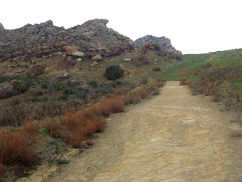
 The first two miles of the Rocky Peak trail is almost all steep uphill on a a fire road. |
 Rocky Peak is on the far right. The summit footpath starts where the road reaches the top of the mountain |
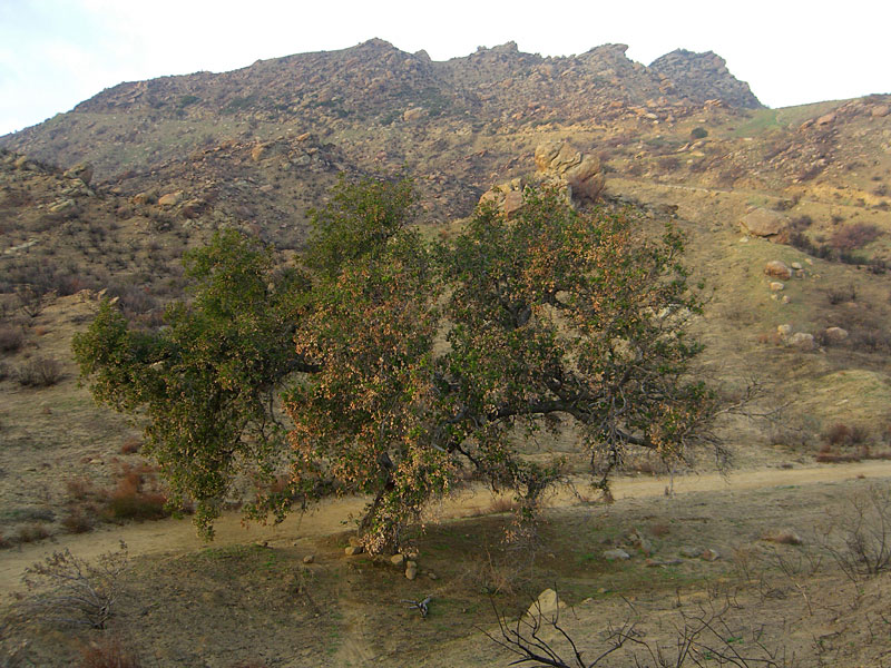 One of the very few trees that survived the recent wildfire. |
 There's a shortcut trail from the green grass area, but it gets steep, slippery and risky |
 Looking back toward the fire ravaged landscape just ascended. It had rained earlier and the sun was feeling moody... |
|
 Although somewhat forlorn, the burned area opens up views and rock formations you wouldn't normally get to see |
 As you walk east on the top of the mountain, you come to the aptly named Rocky Peak |
 Someone must have thought they were so clever to paint this on the summit |
 Unusual eroded pot holes atop many of the boulders in the Santa Susana mountains collect water |
 Looking south to the road up |
|
 Boulder-strewn landscape |
 I prefer visiting this area in moody, post-rain conditions vs. the usual bright sun and intense heat. South toward the road up. |
 I enjoyed clamboring over the boulders all around the peak. East towards a distant fire road. |
 Hwy. 118 (top right) begins to climb Santa Susana Pass |
 The entire mountain seems like a carefully arranged and balanced pile of giant rocks |
|
 Last look back at Rocky Peak. The trail to the right and under the giant boulder is the easiest way to the top. |
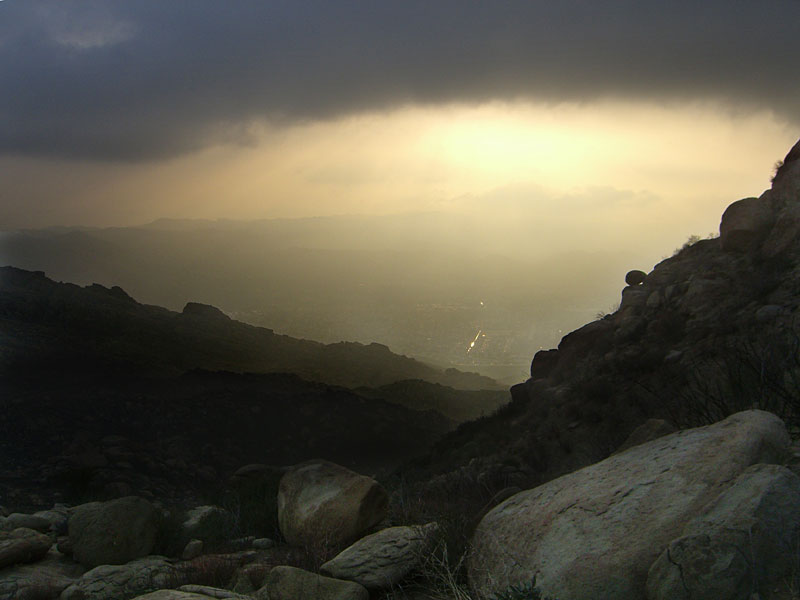 Reflection off a water channel in Simi Valley far below as dusk arrived. |
||||
| 09.02
|
|||||

