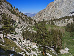
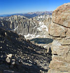
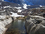
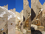
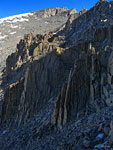
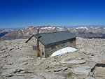
Rae Lakes view southeast

View Mt. Whitney in a larger map
Mt. Whitney Sierra Nevada, Inyo National Forest, CaliforniaJuly 3-4, 2009
Climbing the highest peak in the lower 48 states


Overview
Mt. Whitney is one of numerous jagged peaks that form the massive north-south wall of the Eastern Sierra in Central California. With a vertical prominence (height above its surroundings) of over 12,000 ft., 14,500 ft. Whitney soars prodigiously above the flat plain of Owens Valley. The breathtaking panoramic view from the summit is like looking back at earth from an airliner. From north to south, the jagged ridges and deep, river and lake-filled plateaus and valleys of the Sierra Nevada stretch to infinity. To the west are the serrated peaks of the Great Western Divide. Across wide brown Owens Valley, the formidable high ridgeline of the White Range mirrors that of the Sierra.

Many of the mountains in the surrounding eastern Sierra are also 13-14,000 ft., so Mt. Whitney doesn't stand out dramatically on the ridge. In fact, because it sits back slightly from the eastern Sierra front range, adjacent peaks like Mt. Muir actually appear taller unless you're on the summit. It's difficult to recognize which of the jagged peaks is Whitney, even after you've climbed it.


Mt. Whitney, named after a state geologist, Josiah Whitney, is in the Inyo National Forest and managed by the US Forest Service. Although it's the highest peak in the contiguous USA, and a strenuous hike, climbing Mt. Whitney doesn't require technical skills or special gear. But you do need a permit and because of it's popularity, these can be challenging to score. The "Whitney Zone" is an extended area that begins above Lone Pine Lake where special rules are in force to prevent overuse, e.g. even dayhikers need a permit to enter.
Most hikers reach the summit via the well-maintained trail from Whitney Portal, a concession area on the east side of the mountain with campgrounds, a store, a restaurant and trailhead parking. The trail from 7800 ft. Whitney Portal gains 6000 ft. of elevation over 11 miles for a round trip of 22 miles and 12000 feet of elevation change.

The summit-and-back hike can be accomplished in one very long day, but most commonly, hikers spend the first day climbing to Trail Camp (12000 ft.), setting up camp and acclimatizing overnight, then summiting with a day pack and returning to Whitney Portal the following day.

The western approach is usually via the John Muir Trail, which begins/ends 2 miles below the summit at Trail Crest. There are other entry trailheads from which to access these two trails and there are other established routes to the summit as well, among them the Mountaineers Route up the northeast face.


Trip Report

I'd been looking forward to climbing Whitney for some time and had been reading up on the mountain, the climb and the red tape and preparing myself mentally. When the opportunity presented itself as an unplanned long July 4th weekend and perfect weather forecast, I make an impulse decision to hit the road and see if I can luck out walking in and scoring an unclaimed permit. I call and talk to a ranger about my chances for this and where to be at what time. I'm hopeful I'll get lucky, but will enjoy hiking elsewhere in the area if not. I'd been out backpacking several times already this summer, had been working out and jogging and I'm pretty sure I can handle the notoriously grueling 6000 ft. climb. What concerns me is altitude sickness, which seems to strike randomly to even well-prepared hikers. I've never experienced bad altitude sickness, but know the key is to arrive early to acclimate to the altitude before a summit bid, and drink plenty of water.

I pack my gear into the car the night before and set out after work for the 200 mile drive from LA, arriving in Lone Pine about 4 hours later. In order to be as close as possible to the permit station in the morning, I forego camping the first night and take a room at the Whitney Portal Hostel on Main St. in Lone Pine, a large, clean new building built by the same friendly people who manage the Whitney Portal Store up on the mountain. The place was relatively empty so I have a 6 cot room to myself. After a few hours socializing at Jake's Bar across the street with a fellow hostel guest —a cute babe who was way young for me— I turn in late.

Day 1: Whitney Portal to Trail Camp 6.5 mi., +4000 ft.
Morning is clear and crisp. It's already hot at 8:30am. I drive a couple of miles south to the large, modern
The eastern Sierra from the USFS Visitor Center in Lone Pine. Mt. Whitney is above the back of the trailer
USFS Visitor Center just out of town. Inside it's cool, airy and spacious with large windows and high ceilings, a large diorama of the Sierra and a well-stocked book, map and gift shop. Half a dozen rangers are giving information out to tourists, hikers and sportsmen behind banks of counters.

The Permit gamble
As I wait for 9:00, when reserved but unclaimed permits are released, I ask about mountain info and alternative trails. It's a busy first morning of a long weekend and numerous families and groups are here for information. Over the next half hour, a crowd of almost 2 dozen hiker-types have accumulated, milling about anxiously - the competition. Because there is a lottery for the unclaimed and walk-in permits and not a first-come, first-served queue like other parks, I'm feeling disheartened about my chances as I scope out just how many others want the handful of available permits. Finally, a bearded, long-haired young ranger gets the lottery going by calling for trip leaders only to gather. That narrows the crowd to about a dozen of us and we gather in a circle. There are only 4 permits for the Whitney Portal trail available today, he says, and a few for other trailheads. He writes a number for each of us, 1-12, on a slip of paper, folds them and drops them into a plastic bucket, explaining how we'll stick our hand in one at a time and those with the lowest numbers get to choose which trailhead they want a permit for.

Is it luck that I am standing as close to him as possible as he puts the numbered paper slips in the bucket and gives them a half-hearted twirl? Or that I'm standing at his right as he commences the bucket-diving with the closest person to him, me? I reach down to the very bottom of the bucket and pull out No. 1! Ok that was unexpected! The solo hiker next to me is next, reaches to the bottom of the bucket and pulls out ...No. 2! So, I'm in. The two of us are beaming.

WAG bags
I go over the rules with a female ranger, pay my $15 fee, get my permit and WAG (Waste Alleviation and Gelling) bag. Because of the high volume of hikers and the solid stone alpine terrain, the Leave No Trace dictum in the special "Whitney Zone" also includes "no poo allowed". Hikers are
required to pack it out in a WAG bag, a layered, Ziploc-style plastic bag with a urine-activated powder to encapsulate and deodorize solid waste. There are special WAG bag bins near the trailhead in which to deposit them upon your return. You only get one WAG bag. They say you need only one - I'm not so sure...

The first day is the climb to Trail Camp at 11,400 ft., where I'll camp the night to acclimate. It's only 6 miles so it's okay that I have a tardy start, but
Words of wisdom on the wooden gateway at the trailhead
it's all incline and switchbacks and will take between 4-5 hours at a moderate pace, including a lunch break. I grab breakfast in town, then drive up to Whitney Portal, double-check my gear, put some stuff in the bear box and hit the trail. The wooden gateway at the trailhead is very portal-ish, a hallway of open beams with a map, hanging scale and signs offering words of wisdom. I'm on my way at 12:30, temperature 80 degrees. There is no view of the Whitney Summit, or even the high ridgeline where it lives, for many hours, so a first-timer like me would be hard-pressed to identify it even after studying it. The trail starts zig-zagging up long switchbacks up right away, crossing several streams over stepping stones and past a large waterfall.

Lone Pine Lake
I pass only a few dayhikers. 1500 ft. higher and hour and a half later, I detour down a side trail to Lone Pine Lake and cool off by the water. There are a dozen people enjoying the view, fishing, sleeping, exploring. A group of guys have climbed to the far side of the lake to jump off the rocks.
There are several creek crossings where trek poles will keep you dry
I put my feet in. It's very cold. Jumping in would be a shock, even in this heat. After my lunch break, the trail climbs through some woods above the lake and the Whitney Zone begins, where even day hikers need a permit. I pass a few backpackers coming down, then several groups and then a whole stream of them. Mid-afternoon is when the summiteers are making their way back to Whitney Portal. Another hour up along a stream and across a large meadow is emerald-colored Mirror Lake below giant walls of stone. The serrated peaks of the high ridge now come into view above the lake, offering a glimpse of how much farther there is to go. Numerous hikers are camped in the cool shade beneath ancient trees at 10,365 ft. Outpost Camp. The steep climb up a granite mound south of Mirror Lake starts the ascent into high country, characterized by fewer things green and more things grey. More climbing over exposed mounds brings the hot mid-day sun to bear, as the trail continues incessantly up over more banks of steep switchbacks and the air thins with each mile.

The trail sidles up alongside a cheerful stream and follows the burbling soundtrack up through a wide, V-shaped valley. Striking views east back to the Owens Valley are the norm. Above treeline, there is snow that doesn't melt even in the summer afternoon heat, the path stomped through it. Above 11,000 ft., the thin air has cooled noticeably and when the wind picks up, it can be chilly.

Trail Camp
Finally, in late afternoon,
Campers look for flat spots on and below Trail Camp boulders
I arrive at Trail Camp basin, distinguished by large, icy Consultation Lake to the south below a bowl of
My sheltered Trail Camp site north of the trail. Someone's new purple bag had landed here and was getting covered up by windblown sand.
giant ridges. One of the dozens of jagged peaks high above is Mt. Whitney, another Mt. Muir - but which one? Trail Camp is a rumpled, brown landscape of smooth, weathered boulders and rockfall where snowmelt has formed a large pond, somewhat sheltered between the mountain called Wotan's Throne and the giant towers of stone that form the serrated Mt. Whitney ridgeline. There are probably 2 dozen hikers camped here in a variety of interesting nooks and crannies and more arriving from below regularly. I climb over the granite terrain north of the trail, over a stream hidden beneath large boulders and find a somewhat sheltered sandy area to set up my tent. A nicely walled enclosure nearby is promising but the ground inside has a blanket of ice and snow so I settle for a more open spot. After I set up camp and look around, I discover that someone has lost a relatively new thick synthetic purple sleeping bag. They probably left it out to dry while they summited and a strong gust blew it here against a boulder out of sight, where I rescued it from a sandy demise. As soon as the sun drops behind the high western ridge, the wind picks up and the temperature drops dramatically. I put the wayward bag to good use as an extra layer over my down bag on this cold night.

Full moon glow catches a ridge of Mt. Mallory above Consultation Lake
After dinner, I wander around on the rocks by headlamp and enjoy the last light on the mountains to the east and the epic view of the lights of the Owens Valley far below. A bright full moon peeks in from behind a high ridge. There are no campfires allowed here, and no wood to burn regardless, so everyone turns in early for the big climb in the morning. Sporadic wind gusts blow in hard and temperature drops to 40 degrees. At some point in the night, I struggle to identify with my headlamp a repetitive tugging noise at the base of my tent. I can't tell if it's coming from inside or outside. Then I discover the tiniest little mouse between my tent and groundsheet up to no good and I ask him to leave with a few annoyed swats.
Day 2: Trail Camp to Summit to Whitney Portal 16 mi., +2500 ft. -6000 ft.
I'm up at 6am, preparing my day pack. The sun comes up quickly and another cloudless Sierra day welcomes all of us
Coming of the marmot
Whitney summiteers with

Hikers on the 97 switchbacks

Water on the trail freezes overnight making for slippery footing
luminous blue skies. It's July 4th, Independance Day. As I'm making breakfast, a curious marmot pops in to see if I'll give up some food. It's fun to watch him glide in and out of the crevices and channels - he's a master of these alpine boulders. He leaves hungry. I make sure my food is well secured in my bear can under a big rock and leave nothing in my tent that would interest a marmot. I'm on the trail at 7, temperature 55 degrees, elevation about 12000 ft. I've got 2500 ft. to climb over the next 4-5 miles, and that ascent gets started right away with the infamous 97 switchbacks up the face of the bowl to the jagged ridgeline. Several groups are ahead of me, making the long, strenuous slog up these endless ramps.

97 Switchbacks
The switchbacks start just above Trail Camp and are the steepest part of the Whitney trail. This is where you'll be glad you've been working out before coming here. Looming dropoffs perk up the senses and the feeling of height and verticality is gripping. Wherever water has trickled down over the trail, it has frozen overnight, adding slippery
Hikers traverse big dropoffs on the 97 switchbacks
sheets of ice to the drama. I would not have wanted to maneuver on and around these slick, high alpine ramps on this early July day without my trek poles or an ice ax as it would be slow going. By late summer, I'm told the snow on the trail is usually gone.

The cables
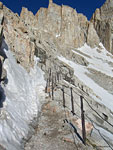
Midway up the switchbacks, the trail traverses the face of a very steep slope along a thin ledge where ice and snow build up regularly. 300 ft. of upright support poles drilled into the rock threaded with braided steel cable make crossing this narrow icy shelf much less risky. But there is still some clambering over ice using your arm strength to pull yourself along, which make the cables one of the most challenging sections of the hike. It's thousands of feet down and can be a daunting traverse. Because it's a place where slow-going is the rule, there can be a queue as most of the ledge is only wide enough for one person to pass at a time. On the last half mile to the top of the switchbacks, there are several more stretches of ice and snow to traverse, then finally you're at the top of the ridge.

Trail Crest
After a long, strenuous climb, the first glimpse out the other side of a high mountain pass is always eagerly anticipated and the expansive view of the
Trail Crest is the first view of the west side of Whitney
western Sierra from Trail Crest is one of the most impressive I've seen. Winding north behind the mountain
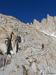
The trail (top right) climbs out of the jagged spires onto a boulder slope for the last 1.5 miles to the Whitney summit (top)
from Trail Crest, the trail tucks against big vertical walls. Stepping into the deeply shadowed western flank of the Whitney ridgeline is like walking from day into night. Looking out from the cool cloak of these shadows at the brilliant mountainscape arrayed below reminds me of seeing a movie from inside a darkened theater. The two deep blue Hitchcock Lakes below 13184 ft. Mt. Hitchcock seem like a mile almost straight down. The trail climbs through immense spires and turrets of granite, winding around, above and below vertical pinnacles that soar above the steep rubble slopes.

Many miles in the distance above Kings Canyon National Park in the west, smoke from a forest fire begins to rise. The last two miles climb through boulder fields, following deep crevices and contours in the mountain around dramatic dropoffs and through craggy gateways. I strike up a conversation with fellow solo hiker Dan from Oregon, who is finishing up a multi-day hike from the north. The summit is a large, somewhat flat terrain covered with giant slabs of granite in every shape. There are a dozen or more people clambering over the boulders, marveling at the vista. More arrive regularly. Although the sun is high, the combination of altitude, thin air and exertion sweat add a chill.

Smithsonian Hut shelter

Smithsonian Hut


Dire warning sign installed after a fatal lightning strike

Dan from Oregon and the view north from Whitney summit

Inside the hut

Summit marker plaque
The shelter, built in 1909 for conducting scientific studies, is the most prominent feature on the summit. Although constructed from the surrounding rocks, the steel-roofed structure is incongruent with this alpine wilderness and just seems out of place. A sign on the door warns of lightning danger. I sign the register at the front and push open the heavy door to explore the graffiti-covered room that is open to the public. A plaque on the floor says "Wooden floor is an integral part of lightning protection. Do not remove." Another adjacent chamber is locked. The hut has a chimney, but since there is no wood to burn for miles, it seems irrelevant. On such a clear, beautiful day, it's unsettling to think that people have died in this building, taking refuge from a lightning storm inside the highest feature on the highest mountain in the land - an unfortunate decision. I've read several gripping tales of hikers who experienced scary Whitney lightning storms up close and personal and lived to tell about it. Mt. Whitney holds many sad tales of fatal decisions and accidents - among them, an airliner crash in 1969 that killed 35. The shelter exists now only as an historic landmark.

After a long drive here and a long hike up, it feels good to soak up the amazing panorama and there's an air of exuberance among the spirited summiteers. A tall bearded guy and his lovely companion, who also scored permits at the lottery in the Visitor Center the day before, arrive and strip down to some hilarious old-fashioned one piece body suit underwear for a souvenir photo, to the delight of the crowd. After an adequate respite, it's time to leave. Dan needs a ride back to his truck where he started his trip 30 miles
north, so I offer him one if he cares to hang out with me for the long hike back down to Whitney Portal and we set out together down the trail.

The plume of smoke from the fire in the west has tripled in size and has
Eastern Sierra sunset from Lone Pine
drifted many miles north. We make our way over Trail Crest and down the 97 switchbacks. I'm happy to discover much of the slippery ice of the morning has melted. I pack up my tent and gear that I left at Trail Camp and have a last look back at the high peaks above the basin. Several hours later, after a long hot climb down, it feels good to take a break at Lone Pine Lake and cool off in the water. We keep a pretty fast pace and make it back to my car at Whitney Portal in about 4 1/2 hours. It feels good to ditch the WAG bag in the disposal, as they are not odor-free. I drive Dan to his truck at Onion Valley, the next pass north in the mountains above Independance and then hit the 395 for the long drive home.
Trail / Conditions / Maps
The trail from Whitney Portal to the summit of Mt. Whitney is approx. 11 miles with an elevation gain of 6000 ft. It's 6.3 mi. to Trail Camp and 4.7 mi. from Trail Camp to the summit at 14,496 ft. This is a strenuous, tough hike and will be much more enjoyable if your prepare yourself with a good cardio workout before attempting it.

When to go
The best hiking conditions are from mid-June to mid-September, when the most of the snow has melted and before the first Fall storms. There is snow and ice on Mt. Whitney year round at the higher elevations but usually just a handful of slippery places on the trail along the 97 switchbacks until August.

The temperature on this July 4 hike went from high 80's at Lone Pine to low 40's at Trail Camp. With wind chill, it can get down below freezing year round.

Acclimating
Altitude sickness is a major concern and acclimatizing overnight at elevation is the best preparation. Commonly, hikers spend a day or two camping at Whitney Portal (8360 ft.), or a nearby area of similar elevation, and dayhiking so respiratory systems can adjust to the thinner air. Hiking to 12000 ft. Trail Camp for the first night worked for me and I had no problems. Drinking lots of water is reported to be helpful.
Trekking poles are recommended
Trail map of Mt. Whitney
not only for balance on the many stepping stone stream crossings and leverage on icy sections, but also to take some of the load off your legs on the 6000 ft. climb and 6000 ft. descent.

If you're hiking out the same day you summit, you should plan on leaving the summit before noon.

Gear
For 3 season hiking, you'll want a sleeping system that will keep you warm in temperatures down to freezing, even in the summer. Many people hike to the summit in short sleeves and shorts, but carrying extra layers and hat and gloves for a sudden storm is wise. Lugged sole shoes and trek poles will help on ice and snow. There's plenty of water to filter in streams and lakes along the trail year round, but no water above Trail Camp. Sunscreen is a must and a wide brimmed hat will keep you cool.

Permits / Directions / Links
Permits
Climbing Mt. Whitney is one of the most popular hikes in the USA, so the US Forest Service has developed a complex quota system to restrict the flow to a certain number of entries per day for each access trailhead in the "Mt. Whitney Zone". If you can plan in advance, you'll have the best chance of climbing Whitney on your chosen date. For the Mt Whitney Zone, the permit reservation fee is $15.00 per person.

The Mt. Whitney Lottery
At the beginning of the season, permits are distributed via a lottery system and permit applicants are selected randomly from February through the end of March. Permit quota's for the most popular weekends of the season will usually get filled up during this lottery. Applications must have a February postmark - the final due date is Feb. 28 - if you wish to reserve a wilderness permit for a trip that begins between May 1 and November 1. Permit reservations are given out beginning Feb. 16. Permits must be picked up in person by the trip leader on the day before your hike or before 9:00 on the day of your hike at the USFS Visitor Center south of Lone Pine.

Walk in permits
The quota space for the Mt. Whitney trail is all reservable. Space is not saved or set aside for walk-in permits. However, cancellations and any space that was not filled by reservations will be available one day before the entry date at the Visitor Center south of Lone Pine. If you don't mind taking chances, you can try to score one of the walk-in permits by showing up at the Visitor Center the day of your hike.

You have better chances of getting a permit if you are flexible with dates or have a smaller party.

Other rules
Bear resistant cannisters are required in the Mt. Whitney Zone and no fires are allowed. Human waste must be packed out in a provided WAG (Waste Alleviation and Gelling) bag, a layered, Ziploc-style plastic bag with a urine-activated powder to encapsulate and deodorize solid waste. According to the USFS website, Mt. Whitney visitors packed out over 3 tons of human waste in 2007.

Whitney Portal is an active bear prowl area and all food, trash, toiletries and coolers are required to be removed from your parked vehicle and stored in provided bear steel bear boxes.

Directions

From Los Angeles to Mt. Whitney is 200 mi. north on I-5 to Hwy. 14 to Hwy. 395 to Lone Pine, CA.Whitney Portal Rd. begins in the middle of Lone Pine and goes west 8 miles up the mountain, where it ends at Whitney Portal. There are several large free parking lots with no time limit.

The trailhead is through a wooden beam gateway structure on the north side of the road across from some toilets.

Pictures

Getting there
On the road west to Whitney Portal, the wall of the eastern Sierra rises up from the flat Owens Valley. Mt. Whitney appears much lower than the closer front range peaks. Whitney is pyramid-shaped with two chimney peaks to the left, directly above the first yellow dash in the road.
On the trail

A wooden gateway marks the entrance to the Mt. Whitney trail
The path to Mt. Whitney climbs up this gap beyond a noisy waterfall
Looking back, a sliver of the last turn in the road up to Whitney Portal is visible center left
Lone Pine Lake is 1/8 mi. down an access path. A group of guys were doing flips off the rocks across the lake into the icy water. Brrrr
Twisty tree
Twisty tree
Lone Pine Lake from up canyon
Big granite walls obscure the serrated ridge where Whitney lives
A waterfall near Bighorn Park
High walls on the way to Outpost Camp
High walls on the way
to Outpost Camp
Backpackers take a break in the shade of a grove of ancient trees
A hiker descends into Outpost Camp, the last big meadow
Emerald-colored Mirror Lake enclosed in a granite bowl
After a welcome respite in the cool shade of big trees around Mirror Lake, the trail climbs an exposed mound
The water that carved this impressive canyon seems to originate at this snow bank below a high basinThe water that carved this impressive canyon seems to originate at this snow bank below a high basin The serrated peaks of the Whitney ridge peek in
The serrated peaks of the Whitney ridge peek in
Climbing high above Mirror Lake
View east over the Outpost Camp meadow to the Owens Valley

Only a few trees remain as the trail climbs past 10,000 ft.Only a few trees remain as the trail climbs past 10,000 ft.

Last look back at Mirror Lake and the granite mound just climbed
The stream sometimes hides under boulders and snow, sometime flows out in the open
Some of the last greenery at the edge of treelineSome of the last greenery at the edge of treeline High ridges are soaring now. A cross-country hiker has left his footprints in the snowbank.
High ridges are soaring now. A cross-country hiker has left his footprints in the snowbank.
Consultation Lake in the south of the Trail Camp basin. You can make out a hiker, bottom of lake, left of center, standing on the rocks
A weary group makes the final push through snow to Trail Camp
A hiker on a boulder (center left) checks out the view. Most Trail Camp'ers set up near this lake-like strip of water.
Dusk comes early to Trail Camp in the shadow of the Mt. Whitney ridgeline
Last light on Consultation Lake. You can see a light blue tent nestled in the rocks left of the sunlight reflection at bottom center
Dawn on the pond at Trail Camp
Morning of day 2, hikers start up the infamously steep 97 switchbacks. Mt. Whitney is out of frame to the right
Windblown snow drifts below the trail
Like Yosemite's Halfdome, Whitney also has its "cables"
The cables traverse a notoriously icy spot above a looming dropoff. View east to Trail Camp and the valley upThe cables traverse a notoriously icy spot above a looming dropoff. View east to Trail Camp and the valley up Hikers on a steep section of the 97 switchbacks
Hikers on a steep section of the 97 switchbacks
A marmot poses below the pointy peak of Mt. Muir
Another traverse of snow and ice
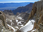
View east from atop the 97 switchbacks
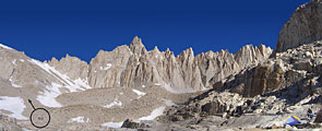
Panorama east with Mt. Whitney (L) above the snow-streaked terrain of the Mountaineer's Route to Trail Camp (lake, center right). The rock in the center is Wutan's Throne. The trail from Whitney Portal came through the slot valley at center right.
The summit of Mt. Whitney is the flatter mountain just right of Mt. Muir, the pointed peak at centerThe summit of Mt. Whitney is the flatter mountain just right of Mt. Muir, the pointed peak at center Just below Trail Crest, a last icy traverse above a half mile long 45 degree slope
Just below Trail Crest, a last icy traverse above a half mile long 45 degree slope
At Trail Crest is the first view to the other side of the mountain
The trail enters deep morning shadow on the west side of Whitney.
It's like looking out from inside a darkened theater
 
 View north (R) and west (L) to the Hitchcock Lakes below 13184 ft. Mt. Hitchcock. Behind them in the distant center are the peaks of the Kaweah Range and the Great Western Divide. The John Muir Trail follows the wide valley at right and turns north to Forester Pass.
View north (R) and west (L) to the Hitchcock Lakes below 13184 ft. Mt. Hitchcock. Behind them in the distant center are the peaks of the Kaweah Range and the Great Western Divide. The John Muir Trail follows the wide valley at right and turns north to Forester Pass.
From inside the shadows, the brilliant colors of the western Sierra are luminous.From inside the shadows, the brilliant colors of the western Sierra are luminous. It must be a mile almost straight down
It must be a mile almost straight down
 
A hiker (far left) makes his way up through the rubble field that is the western side of Mt. Whitney
Smoke from a wildfire rises above ridges to the west
2 hikers (top left) on the west side of the Mt. Whitney trail through boulders and rubble
Several gaping chutes along the path offer a quick ride down
View east through the "windows"
Aptly named Guitar Lake
View SW over Hitchcock Lake
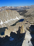
As the Whitney trail winds north around the final approach to the summit, more of the western Sierra comes into view. On it's way south from Yosemite to Mt. Whitney, the John Muir Trail skirts the banks of Guitar Lake (center right), the last lake on the trail. The neck of the guitar points through the gap to the Kaweah Range.
As the Whitney trail winds north around the final approach to the summit, more of the western Sierra comes into view. On it's way south from Yosemite to Mt. Whitney, the John Muir Trail skirts the banks of Guitar Lake (center right), the last lake on the trail. The neck of the guitar points through the gap to the Kaweah Range. Here are the Kaweahs from the other side, from my trip to the Great Western Divide.
West-southeast panorama from the summit of Mt. Whitney
Variations of this view, from 14495 ft., down to Lone Pine are visible throughout the hike up
View west (L) to east (R) at noon atop Mt. Whitney


TOPHikes Index

Since 12.09