 |
|
| Grand Canyon of the Tuolumne RiverYosemite National Park, California 3 days along a wilderness river full of spectacular waterfalls |
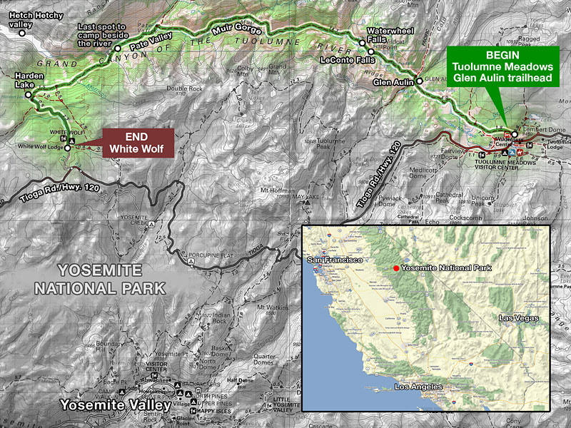
| If you like untamed mountain rivers, magnificent waterfalls, towering granite peaks, lots of warm sunshine—and oh yeah, solitude—then this is an unsurpassed Sierra hike to experience. The Grand Canyon of the Tuolumne (pronounced too all' um ee) River is 30 miles of backcountry wilderness that slices down through the northern High Sierra of Yosemite National Park from east to west. An impressively engineered and well-maintained trail through this rugged canyon follows the river as it flows below towering peaks, between sheer granite canyon walls, and through ancient forests. In the 30 miles from Tuolumne Meadows to Hetch Hetchy valley, the river passes through a variety of topography and drops over 3000 feet, encompassing many moods and characteristics. At times, it flows wide and lazy and relaxed, trout leaping from emerald pools in the shade of immense pine trees. In narrow, steeper sections, it becomes a raging torrent of violent whitewater power, launching over steep cliffs, pounding channels through granite chutes, pumping millions of gallons of snow melt over spectacular spray-shrouded waterfalls. Always, majestic peaks tower above, astounding vertical curtains of granite. Although there is a deep gorge midway and walls of granite mountains too steep to hike over much of its length, the Grand Canyon of the Tuolumne isn't a sunken canyon like the Grand Canyon in Arizona. It was carved by glaciers, not erosion. Bears and deer are seen here regularly, along with marmots and rattlesnakes and a host of forest animals and birds. Rarely seen are resident mountain goats and cougars. Mosquitoes can be fierce from early Spring to mid-Summer. The trail crosses back and forth over the river on numerous wooden and steel bridges, but the majority of its length is on the north side. In the middle of the journey, the path circumnavigates deep Muir Gorge, where sheer canyon walls rise up 1500 feet directly from the river bank, requiring a strenuous reroute up an adjacent mountain and down again. At the western terminus, the dammed Hetch Hetchy valley is a large reservoir that is the water supply for the Bay Area. |
Hike East or West? From either direction, the Grand Canyon of the Tuolumne River trail is a workout and you'll need to be in good shape to enjoy it. The western end of the trail is White Wolf Resort and campground, 3000+ ft. up an extremely steep mountain trail from the river level. If you start at White Wolf lodge/campground and hike east, there is a 4 mile descent through thick forest on fire roads to the trail, then you hike down, down, down (hope you've got good knees) to the river and spend the next 30 miles slowly ascending to Tuolumne Meadows. If you start at Tuolumne Meadows and hike west, you slowly (sometimes very steeply) drop the 3000+ feet in 3 days, then ascend the strenuous, exposed, awesomely-steep mountain to White Wolf all at once - over 3000 feet of it in just 2 miles - an infamously grueling, relationship-ending brute of a climb, especially in the hot sun. Although there are several access trailheads on which to begin this hike from the east, the main one is Glen Aulin trailhead in Tuolumne Meadows, at a similar altitude as White Wolf. The Glen Aulin trailhead begins from the Lembert Dome parking road. Glen Aulin (Gaelic for beautiful valley) is a spot about 4 miles west of the trailhead along the Tuolumne River below a large waterfall where a tributary stream flows in and the Park Service operates a High Sierra Camp (HSC). Each of the 5 seasonal HSC's throughout Yosemite offer large canvas walk-in dormitory-style tents with cots that cater to families, groups and those who want to get out in the wilderness without roughing it. A variety of well appointed breakfast and dinner meals are included. I do the hike from east to west, starting in Tuolumne Meadows and descending for 3 days, then toughing out the big, bad hill at the end of the hike, when my food is nearly gone and my pack lighter. |
A fellow hiker recommended Grand Canyon of the Tuolumne on one of my 2008 Yosemite trips and after some research, I plan on hiking it the following summer. I get my permit reservation online several months in advance and spend some quality time getting in shape for the trip. In the days leading up to my trip, I check on the Yosemite website regularly. A large, lightning-sparked wildfire in the Harden Lake area - north of White Wolf atop the west end of the canyon - has been burning several weeks, but is supposedly 95% contained. I have tentative plans to camp the last night near there - I'll have to play it by ear. On the phone the day before I drive up, a ranger assures me there is no lingering smoky haze over the High Sierra, much to my relief. According to the National Weather Service, the weather looks like it will cooperate too. That reduces my concerns to just mosquitoes—which this time of year are always an issue—rattlesnakes, bears and mountain lions. I pack supplies for 4 days to hike the 35 miles, allowing plenty of time to wander and explore places that interest me.
I break in my new Gossamer Gear Mariposa Plus lightweight backpack (1lb., 8 oz.) on this trip. The full pack with 2 liters of water, 4 days of food, a bear can, and gear weighs in at 23.5 pounds. A Tom Harrison Yosemite topo map keeps me situated. I took lots of video and will put some clips online when I learn how to do it right.
Wednesday July 15 - Driving In
I leave work early, at 3:00, for the 300 mile, 4.5 hour drive from Los Angeles to the south Yosemite entrance and drive straight through the park to Tuolumne Meadows campground in the northeast, another 75 minutes. I stop just to eat and to fill up outside the parks over-priced gas. Just beyond Tenaya Lake on Tioga Road, I see in my headlights an eighth mile ahead what appears to be a cougar crossing the road in the distance. The size, color and distinctive amble make me think it isn't big enough to be a bear, but it's dark and I can't see it that well. Was it a wolverine? It's after 9:30 when I reach the large, sprawling Tuolumne Meadows campground. It's very dark and most everyone's turned in. After some confusion, I locate the walk-in backpackers campground, where backpackers with Wilderness Permits can stay for $5/night, but don't know where I'm supposed to park. Later, I find that backpackers are required to park on the road beside Lembert Dome parking lot 1/4 mi. away and walk in. But since it's late and everyone's asleep, I find an unused campsite in the car camping area and lay out my sleeping bag on a groundsheet near the car. If someone comes along and asks, I'll get up and move. Not long after I settle in, a guy in the camp next door starts shouting "Hey! Get out of here!" I turn my light on and there is a large cinnamon colored bear strolling through the campground not 100 feet away. The temperature drops down in to the low forties this first night and I'm glad I have my new 25 degree down bag.
| Day 1: Tuolumne Meadows, Tuolumne Falls, Glen Aulin, LeConte Falls, Waterwheel Falls 12 mi., -1700 ft. | ||||||
|


| Day 2: Waterwheel Falls, Muir Gorge, Pate Valley 11 mi., +900 / -1600 ft. | |||||||||||||||
|
|||||||||||||||
|


The Grand Canyon of the Tuolumne trail is a well-maintained, mostly hard-pack dirt trail. Depending on which direction you hike, east-west
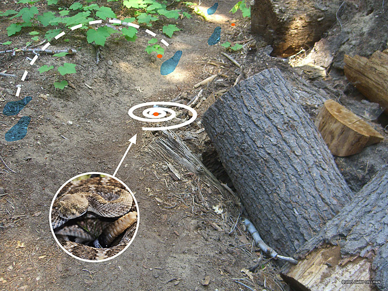
When to go The highway to Tuolumne Meadows - Tioga Rd./Hwy 120 - is closed in the winter after the first storms and doesn't open until the last storms of the season have passed, sometimes as late as June. The ideal time to hike is July-September, but overnight temperatures can drop below freezing even in the Summer. Mosquitoes are swarming from late Spring through mid Summer, then mostly disappear. Cautions Like you, rattlesnakes love it here. When climbing rocks, never put your hand in a place you can't see and pay attention to where you're stepping at all times. Check for ticks on your clothes after you pass through overgrowth and learn to recognize poison oak. Stock The Sierra has a long history of use by stock and you may have to share the trail with horses and mules at anytime. You're supposed to move downhill of the trail when they pass and stand still - some of them get nervous around backpacks and trek poles. |
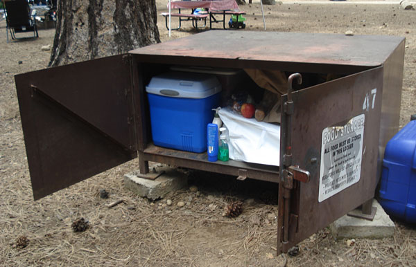
Bears You're required to remove all food from your parked vehicle—and whenever it's not within arms reach—and place it in provided steel bear boxes. It's a federal law. "Food" includes all food and drinks, regardless of packaging, along with trash, toiletries, and other scented items. If a ranger sees "food" in your parked vehicle, you can get a whopping fine and even towed. If a
Remember to pick up your food again out of the bear boxes after your hike (I leave a reminder note on my steering wheel). Bear boxes operate under the honor system and you may have to share the small space with many others. No one wants your half-eaten bag of chips (it's illegal to feed any wild animals in Yosemite-even squirrels) and park employees don't appreciate cleaning up your leftovers. Experienced backpackers who leave their vehicle parked for days in high bear prowl areas (all of Yosemite) know not to eat odorous meals (e.g. hamburgers and fries) in their vehicle just before or during the drive in. Bears will break in just to investigate the scent. I even vacuum my car before my trips to make sure there aren't any curly fries between the seats. |
The entrance fee for Yosemite is $20 per car, valid for seven days. The gates are open 24/7 and if it's late when you arrive and no one is at the booth, you're supposed to pay when you leave. Parking |
The quota for reservable Wilderness Permits is filled early in the season. If you've ever backpacked in a popular national park before, you know that you should plan many months in advance, even the year before. The good news is that in Yosemite, 40% of the permits are reserved for walk-in, first-come, first-served hikers. Here's the best way to get your Yosemite permit: Decide which trailhead you want to depart from (use your topo map or get recommendations from a ranger), go to the Wilderness Permits page (link below), follow the Check Availability link to see if your trailhead choice has openings, download the Reservation Form pdf, fill it out with your hike and credit card info and fax it in. Cost is $5 per permit plus $5/person. Have an alternate trailhead - everyone wants the most popular ones. An extra mile or 3 is not going to kill you if you're going on a multi-day hike.You should get a response in 2 weeks - an official envelope from the Department of the Interior with your reservation form. Permits then need to be picked up in person the day before or before 9:00am the morning of the hike. You can pick up your permit at any Yosemite Ranger or Permit Station. You may be able to get a closer trailhead when you walk in to get your permit. Permits must be carried by the trip leader at all times. Hikers with valid Wilderness Permits (or Permit Reservations) are allowed to stay in the Tuolumne Meadow Campground's backpackers camp without reservations on the night before and the night after their hike. It's $5 per tent at the self-serve kiosk. In most of Yosemite, permit holders have free reign to camp pretty much where they want in the wilderness, as long as you follow the basics - i.e., 100 ft. from water, use existing sites when you can, don't build new fire rings, pack out everything, etc. The process of securing Wilderness Permits can be time-consuming and frustrating, but when you're out in the backcountry experiencing the serenity and natural beauty that you've gone through so much effort to enjoy, you don't want to deal with a massive influx of careless tourons, so you come to appreciate the wisdom of the system. |
|
| ||
 The beginning of the hike near Glen Aulin trailhead, the domes in the high Sierra to the south. |
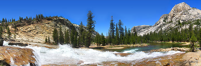
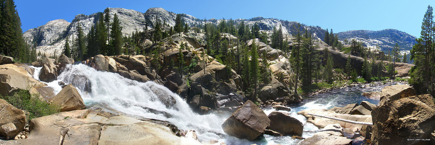
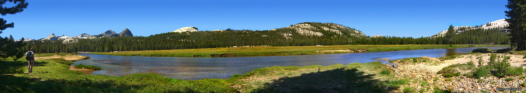 East (L) to west panorama in a remote section of Tuolumne Meadows. The river glides like a snake through the middle, rarely more than 3 ft. deep and 100 ft. wide |
||||
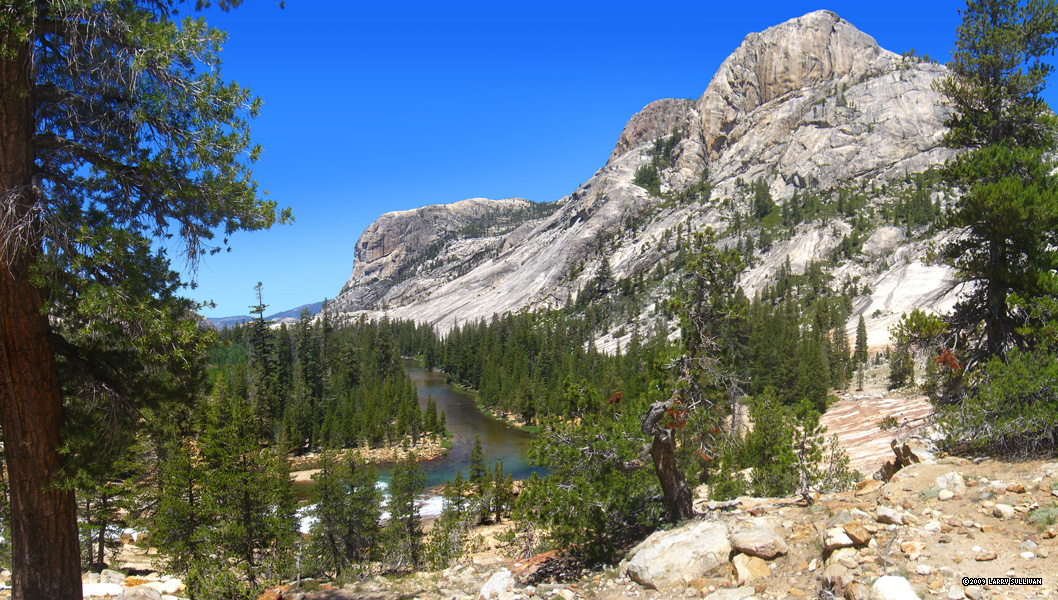
 Leaving the Meadow, the trail enters the forest and emerges in a landscape of granite |
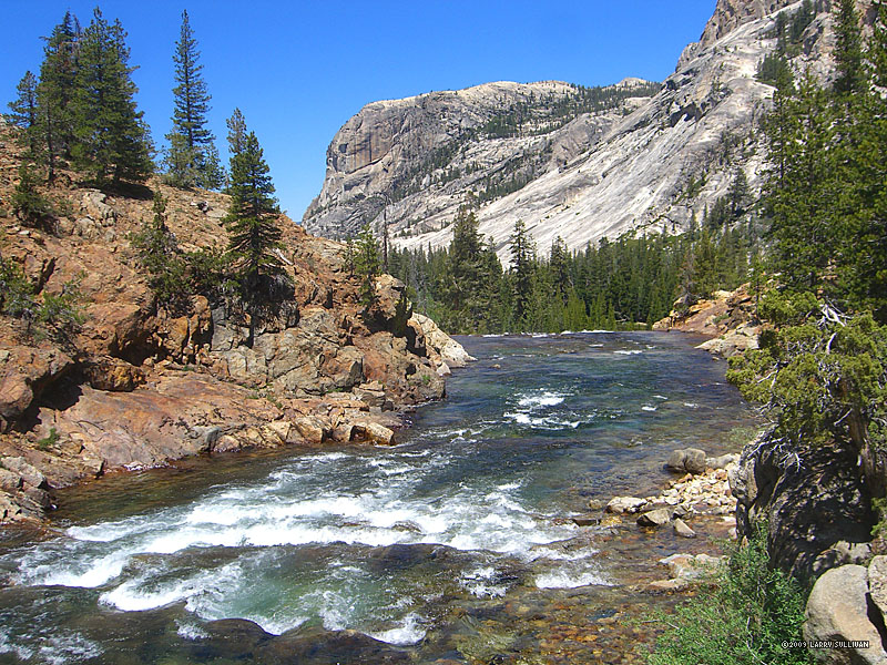
 The mountains, the hills, the ground - even the river bed - are all solid granite. Little drops in elevation create gurgling cascades with swirling eddys |
 After 3 miles, the descent begins and the river starts sprinting |
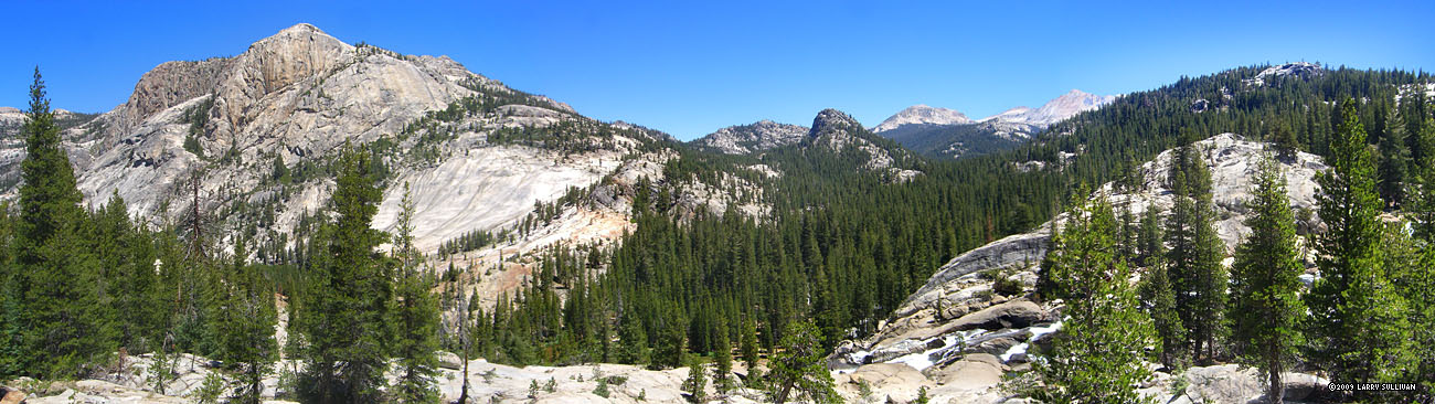
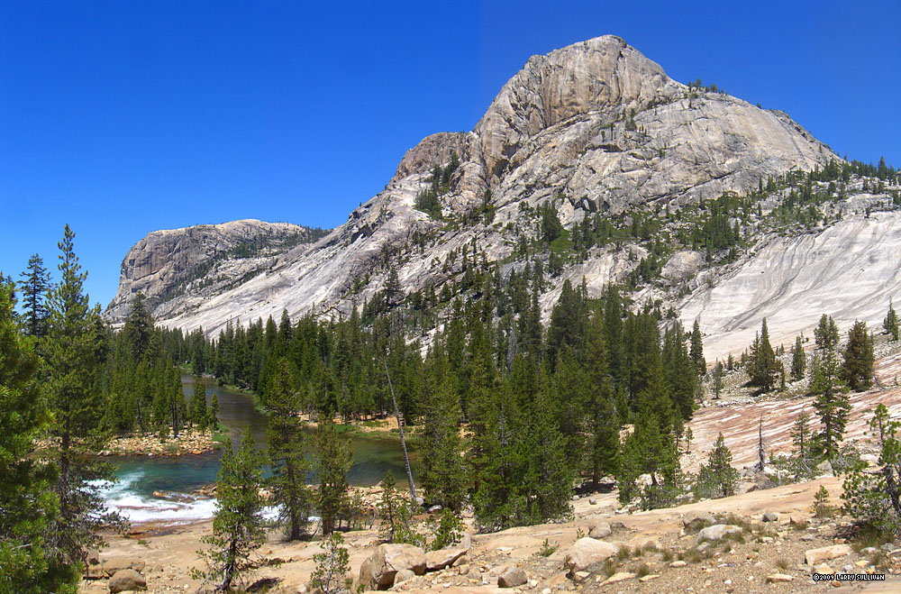
 Over the next 30 miles, the river will drop almost 3000 ft. Looking west from above Tuolumne Falls |
||
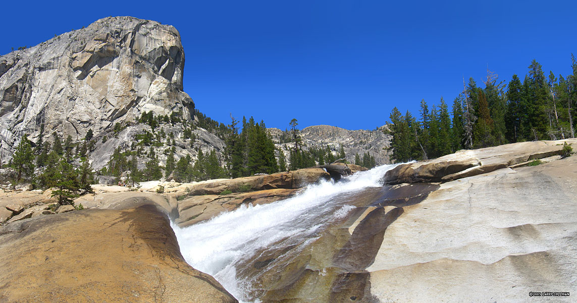
 The first big drop is thundering Tuolumne Falls. |
 |
 Northwest from below Tuolumne Falls |
 Looking back east to Tuolumne Falls from downstream. A videographer is setting up on a spot where I'd just stood. |
 The river (bottom right) picks up snow melt from numerous surrounding high ranges. View north from west (L) to east (R) |
|
 Glen Aulin Falls, just up river from the Glen Aulin High Sierra Camp |
 The Tuolumne west below Glen Aulin |
 You can hear the big noisy drops before you can see them |
 Granite giants rise up from both sides of the river |
 This hike delivers the Sierra in its full glory |
|
 View west |
 A noisy whitewater cascade surges west under luminous blue Sierra skies. Can't you just hear the sound? |
 The river slows to catch its breath |
 At this wide, tranquil spot, the Tuolumne gathers energy for the next plunge. Probably not a good spot to launch the boat... |
||
 This next dramatic waterfall features an abrupt 90 degree turn mid-cascade where a granite ledge protrudes into the river |
 The corralled river slams into the ledge furiously, compacting into a narrow surging channel. A pair of dayhikers (L) observe the drama. |
 Released from the constraints of the channel, the Tuolumne explodes into a white water torrent and races down the mountain |
|||
 Looking back east from below. This fall may be California Falls |
 Colorful ancient conifers complement the stone and sky Colorful ancient conifers complement the stone and sky |
 The river grows wide during a brief respite before the next drop |
 Another energetic waterfall as the Tuolumne drops from east (L) to west (R) |
||
 After descending a steep grade, the first glimpse of LeConte Falls from above. The rushing water slams into deep pits, shoots vertically into the air and falls back on itself, giving the impression of turning "water wheels" |
 Looking down LeConte. |
 The deep valley west below LeConte from the top of the falls The deep valley west below LeConte from the top of the falls |
 Impressive mid-summer, imagine this flow almost doubled with Spring snow melt |
||
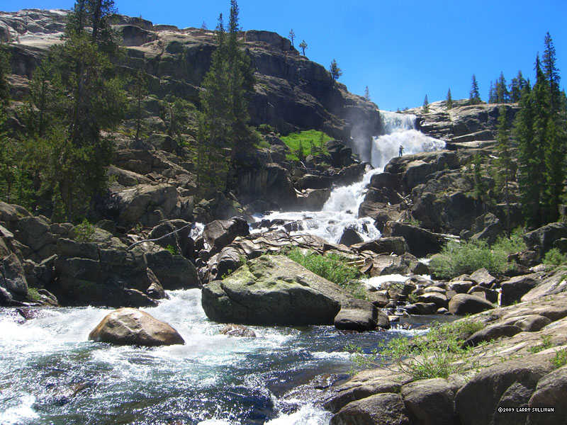
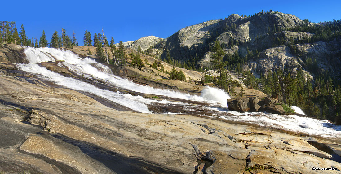 LeConte Falls, one of the wonders of the Grand Canyon of the Tuolumne River |
 3/4 mi. below LeConte, another equally impressive cascade - Waterwheel Falls |
 The river leaps over the cliff and slams down into submerged pits, creating more "water wheel" effects, then roars into a narrow channel. |
 Mini-rainbow in the channel below Waterwheel |
||
 With skillful down-climbing, you can inch your way right up to the base of this thundering bad boy |
 Several miles downriver, the flow is relaxed again. That's the trail traversing the slanted slope at left |
 The river twists and turns through high canyon walls |
 Looking back east up the canyon, on the the climb to bypass impassable Muir Gorge. The canyon up is to the left. Avalanche chutes stripe the mountain at right |
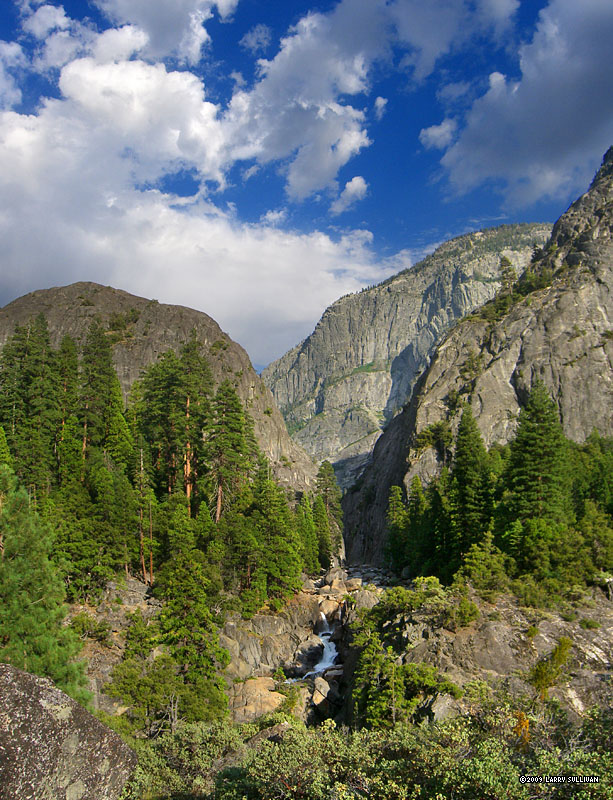
 At the highest point of the bypass trail, you can climb to the domed summit to get this glimpse into Muir Gorge |
|
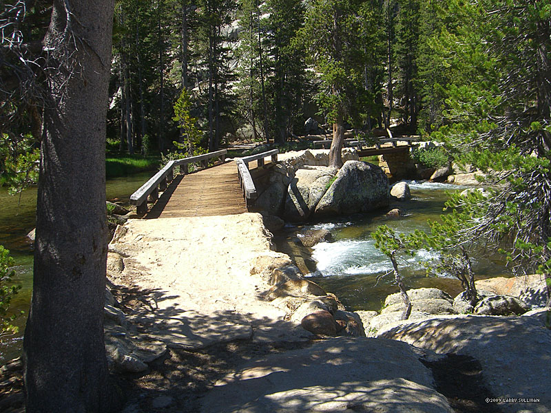
 At the western base of the Muir Gorge bypass by a bridge, this waterfall from a tributary stream |
 I waited for the clouds to move to capture the emerald colors |
 Looking back toward the high ridges above Muir Gorge |
 Long shadows in the late afternoon |
 Evening settles in along the trail (R) in the Grand Canyon of the Tuolumne |
|
 Morning of day 3 from my camp beside this energetic cascade |
 The water assumes the emerald color of the mineral-laden stream bed |
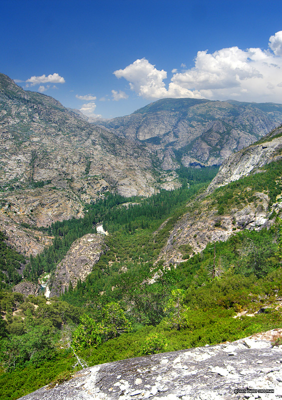
 Towering peaks in Pate Valley |
|||
 The big drop falls are behind me but plenty of lively waterworks await discovery |
 One of the last riverside segments of the trail |
 Northeast back to the canyon from the strenuous climb up to White Wolf |
 About halfway up, an easy-to-miss overlook is the only clear view of Hetch Hetchy. There are no trails near the water in this part of Hetch Hetchy. |
||
 Last look back northeast to the GC of the T |
 High on the mountain again, the trail passes through lush forest |
More photos in the Trip Report top of page |
|||
TOP
Since 11.09