|
I got my permit reservation months in advance for a Monday start day to escape the weekend crowds and get parking. I brought enough food for 6 nights/7 days as I planned a relaxed and thorough exploration of the area, checking out lakes, waterfalls and vistas off the main trail, so I built in extra time and supplies. But even with several off-piste explorations, I made better time than expected and finished one day early.
On Sunday afternoon, I drove the 275 miles from LA through Bakersfield and Fresno to Yosemite's south entrance, then 50 more through the park to Porcupine Flats Campground on Hwy. 120/ Tioga Rd.
I've always gotten a campsite without a reservation at Porcupine Flats, even on the busiest holiday weekends. Porcupine Flats is a large primitive campground with some unique sites among giant boulders. It's only a short 15 mile drive to the Tuolumne Meadows trailheads, so you can escape the tumult of the expansive and crowded Tuolumne Meadows Campground, which is typically sold out shortly after reservations for the season are available. Remember to bring cash for the self-pay box ($10/night).
|
If you have a Wilderness Permit or a reservation for one, you're allowed to camp the night before and the night after your trip in the backpackers walk-in campground ($5 per night, honor system), hidden in the center of the Tuolumne Meadows Campground. As implied, there is no car camping here for backpackers - you're required to park a quarter of a mile away on the dirt road beside Lembert Dome
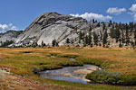
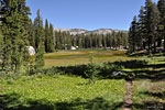
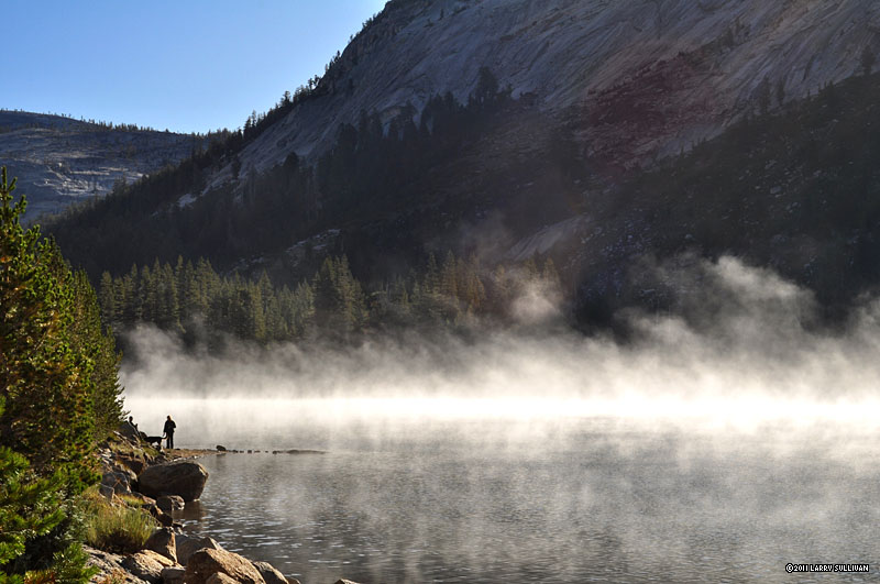
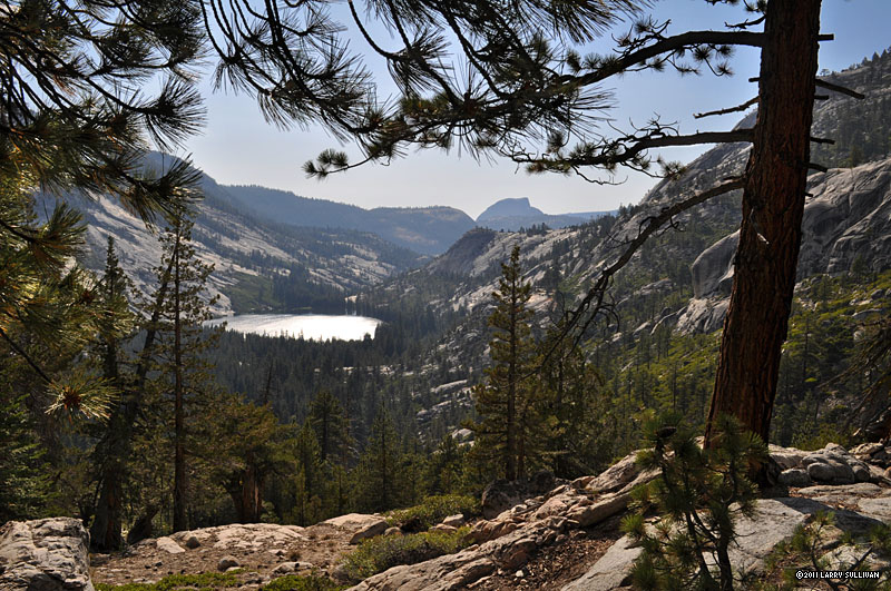
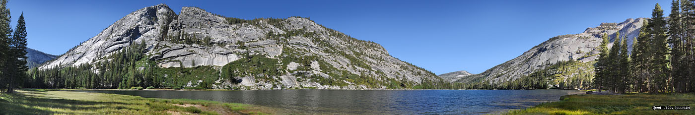
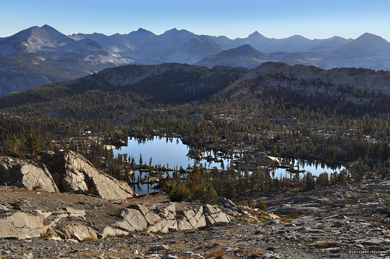
 Morning on Tenaya Lake
|
parking lot and hike in with your overnight gear. It's not particularly easy to find the walk-in campground for the first time, especially after dark, so you may want to reconnoiter in your car before setting out on foot.
The next morning, after breakfast and breaking camp, I drove the 15 miles along Tioga Road to Tuolumne Meadows and picked up my permit at the Wilderness Permit Station. Since it was Monday, I easily got a parking spot at the normally packed Dog Lake lot adjacent to the JMT trailhead, double-checked my gear and hit the trail at 8:30 in sunny 50 degree weather.
|
|
|
From Tuolumne Meadows, there are several paths to the John Muir Trail, and several bridges and junctions until you are at the trail to Vogelsang High Sierra Camp
 Family breakfast along the John Muir Trail
|
(HSC), which climbs up into the forest for 700 ft. of elevation. Through several miles of climbing out of light forest and across rocky meadows, I met numerous groups of families and seniors coming back from the HSC. What a luxury not to be burdened with carrying your food and shelter into the wilderness and just
enjoy the walk. There are 5 HSC's throughout Yosemite and they sell out for the season early. They are reknowned for having excellent meals and dinner requires reservations. HSC supplies are mule-trained in. I stood aside to let one pass just before the intersection for Vogelsang and the high trail that will be the route back.
A short distance beyond the split to Vogelsang, there's an unmarked intersection as you approach a
 Mule train on the climb to Vogelsang High Sierra Camp
|
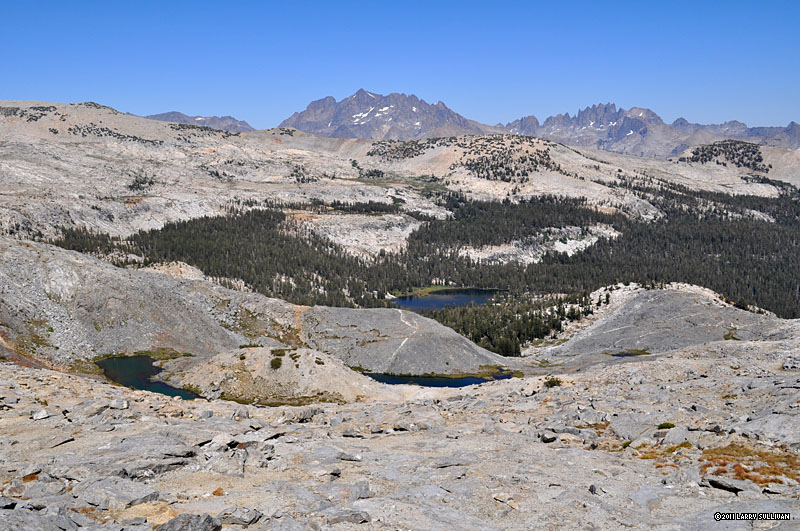
large lake that's not identified on my Harrison topo, but marked with a small sign as Eliza Lake. After some confusion - the map shows the main trail skirts the lake - I discovered the left/east path up away from the lake is the main trail. I take the right/west path down to Eliza's grassy shores for a lunch break. Afterwards, I follow along the shoreline through a rockslide, where the path disappears. After a scramble over boulders above the water, I located an overgrown path that rejoins the main trail. At the south end of Eliza are several tranquil, forest-lined small lakes/ponds in row, then the path drops down through the forest for several miles toward a joiner path between the Eastern high and Western low trails, and the path to Emeric Lake. You can get a good view of Emeric from above after just 1/8 mi. up that path's intersection.
Going south again, there is a giant meadow to cross with an unusual
 Giant skateboard ramp mountain
|
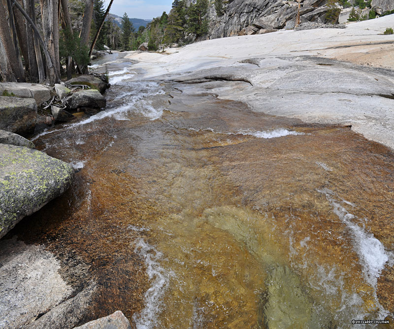
smooth-sloped mountain that looks like an immense skateboard ramp. Then the path sidles alongside Fletcher Creek, gurgling out of the flat field and sliding down a wide, slick granite slope which drops 1/2 mi. down into a large canyon. I took a welcome break from the mid-day heat atop this plateau and read my book with feet in the stream. |
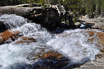
 Bankless Fletcher Creek slides down a wide granite slope
|
On the descent south over the granite slope beside this rushing water slide, the trail passes through a large burn area with many scorched and downed trees. Past this big granite bowl, the trail enters thick old-growth forest. I detour to Babcock Lake to have a look, but after just 1/8 mi., the trail disappears at a stream crossing where the ground is one giant stone and I couldn't make out where it picked up again.
Beyond Babcock Lake, the forest opens into a wide, deep canyon that would
 Dropping into the big basin below Babcock Lake
|
require the remainder of the afternoon to cross. Sheer granite mountains tower above the noisy, cascading stream as it races southward, carving a smooth path to the depths of the canyon. Several miles of descent ensue, offering sweeping views south and west. Towards late afternoon, I pass a second connector route between the high East and low West trails, and then Halfdome in the distance and Merced Lake below come in view. A rough-hewn trail of jagged rocks mercilessly switchbacks down the mountain to the intersection with the Merced Lake trail to Yosemite Valley. Then, beyond the nicely constructed compound of the Merced Ranger station, there are 2 miles of welcomingly flat terrain through lightly-forested sandy soil. My Harrison map shows 2.1 miles between the ranger station and Washburn Lake, but after a full first day of hiking with a full pack, it seemed more like 3+, especially on the last 1/2 mile climb up beside a stream through heavy, darkening forest.
As evening settled in, Washburn Lake greeted me with an expansive clearing in the forest, tall peaks mirrored in the tranquil waters. At the far south end, a grass-covered clearing added a friendly touch, and looked like an ideal spot to camp. I started hiking around the big lake to check it out, but I was bonking after over 19 miles with a full pack so I turned around and set up at the north end. There is a nice place to camp right off trail on the north shore, but it's within 100 ft. of the water and would incur disfavor with the ranger, so I camped in a sheltered spot among the trees on the other side of a rocky hump that serves as a levy. No lake view, but sheltered from the wind and some leftover firewood as a bonus. As dusk faded into night, I fought the mosquitoes to set up camp and make dinner, then took my pad atop the smooth rocks above the lake to sip cocoa and watch shooting stars reflected in the glassy surface.
|
|
|
In the morning, packed up and filled with blueberry oatmeal, I discovered an excellent campsite through the woods on my way out. The primo Washburn Lake site is on the south end of the lake, an established spot that would serve a small group well.
 Lively cascades south of Washburn Lake
|
Today would be spent gaining back much of the elevation I'd lost yesterday, climbing out of the forest toward distant alpine Red Peak Pass. Another beautiful warm day and the Sierra sparkled with life. As I climbed south around and up the valley, I passed through an idyllic grove of unusually tall aspens, detoured to explore some awesome cascades, then crossed a bridge where the climb begins in earnest, switchbacking up a mountainous granite slope. At the top, I'd gained the first 1000 ft. in a day of big elevation.
After a few hours and a lunch break, I reached the junction for the trail to Isberg Pass. At the crest of some switchbacks, the trail tops off in a stony forest at 9430 ft. - over 2000 ft. gain from Washburn Lake. As I'm following the trail atop this massive stone mound, north, west, east, every which way but south - the direction I want to go - I'm formulating this idea that the trail builders must be getting paid by the mile!
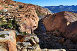
Back down the south side of this giant mound, a bed of dark stone underlies Merced Creek, running strong. I filter some water then cross on some stones. Red Peak Pass is looming high in the distance now, and more climbing leads to expansive views of a red-tinted landscape surrounded by rugged, treeless peaks. By late afternoon, the trail has ascended to a large, rocky basin and I pass tarn after tarn among a scattered debris field of giant craggy slabs, as if the earth exploded and rained boulder shards for hours. Finally, I get my first view of amoeba shaped Red Devil Lake half a mile down the mountain. I discuss pass conditions with a couple of guys who just came down from Red Peak Pass, waiting for their friends before hiking down to Red Devil. They're the first people I've seen all day. I had tentatively planned on camping at Red Devil Lake also, but there is a large unnamed tarn adjacent to the trail which looks accommodating for camping and won't involve 1/2 mile of down-climbing and subsequent up-climbing the following morning. |
Although it's still sunny and warm, the wind is strong up here above tree line on this big exposed mountain and 40 mph gusts push through every few minutes. The shores of the of this decent-sized lake are covered with soft, mossy grass that feels like walking on sponge, with amazing little water channels winding serpentine through it - like an intricately planned garden.
I spend some time exploring the tarn, figuring out the wind direction and find a somewhat sheltered spot by a rock cropping to set up for the night, securing my tent guylines as tightly as possible.
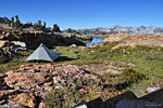 Camping on the large alpine plateau north of Red Peak Pass
|
Behind me to the east is the massive wall that is Red Peak and environs, in front, a sweeping vista of distant western peaks. It feels good to make camp before sunset and get to relax after dinner and soak up the awesome 280 degree wraparound view. Tomorrow is the big climb over 11200 ft. Red Peak Pass and the discovery of what lies beyond, in addition to two other passes and I need to be rested.
Later that night, the wind picked up dramatically. It would be calm for 35-45 minutes, then voluminous blasts of 5-7 minutes duration howled down from the high peaks on the ridge line above. Getting up to water the rocks in the middle of the night, I'm awestruck by the brilliant star field visible from high atop this remote mountain, without canyon walls to block the horizon. Planets are glowing brightly, satellites orbit in space, shooting stars streak across the heavens, the Milky Way floats like a giant cloud. Magical. |
|
|
|
 The trail up the north side of Red Peak
|
Red Peak Pass
I'm fed, packed and on the way up Red Peak Pass at 7:30 in cool morning sunshine. On the agenda today are 3 different mountain passes to climb. It will be a strenuous day but I'm looking forward to the thrill of discovering this remote part of Yosemite where few go. Climbing the scrappy NW face of Red Peak, the colorfully-hued boulders and shards change from bread-sized to stove-sized to truck-sized. Several tarns, pondlets and streams appear as the trail winds up through the tumultuously craggy debris field. Whenever approaching an unknown mountain pass, I like to play the guessing game: Which gap in the ridge will reveal itself as the pass? As is often the case, I guessed the more obvious low point in the ridgeline and was wrong.
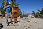
After surmounting numerous switchbacks one foot after the other, I was finally near the top of Red Peak Pass, where I stopped to converse with a young Parks trail crew member named Stephen, who was enjoying the warm morning sun atop the pass before starting his day. The trail crew has work planned into October, when the mountain passes will surely be coated in snow. Reaching the narrow saddle of an alpine pass, it's always a thrill to pass from one sweeping mountain landscape—etched into familiarity through hard-won effort—into a completely new, unseen vista, like passing through a doorway into another world.
The south side of Red Peak Pass is a more confined view south and west over Yosemite, rugged treeless peaks giving way to rolling forested terrain.
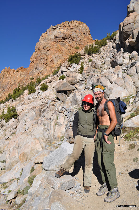
 Trail crew heroes Lindsey & Steve on the south side of Red Peak Pass
|
To the south, the deep blue water of exposed, alpine Upper Ottoway Lakes (there are at least two upper lakes) reflect the surrounding red and granite peaks. The south face switchbacks below the Pass are much steeper but not as far down to where the base levels off. More trail crew workers are climbing the steep switchbacks from their southside work camp at Ottoway Lake, getting
ready to start their day working on the pass trail. Think your commute is brutal? Try climbing an 11,000 ft mountain to start your work day! I stop to chat with Steve and Lindsey, who offer insight about my route. They relate that few hikers follow my path through the Clarks, that most get a brief glimpse by coming up from the Valley to Merced Lake before turning away north, or driving in the long, washboarded fire road and starting from the eastern Sierra side. Three more young women Park employees are commuting up the steep slope, as they do every morning. The trail crew on this remote peak appears to be 3 guys and 4 tough gals, an interesting mix.
I descend the switchbacks off the rugged pass down in to the trees. Lower Ottoway Lake is a beauty, lined with tall trees and sloping boulders, sublimely
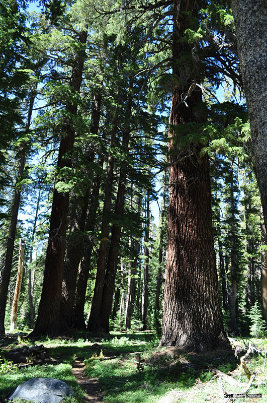
 Giant Sugar Pine
|
reflecting the granite peaks that surround it. The trail crew and 3 hikers I pass near Ottoway are the only people I'll see for the next 9 hours. The trail drops down below the lake into the forest, down rocky slopes and through sunny glades, descending 800 ft., then climbing again for a mile, past the junction to Glacier Point trail.
The remoteness of this forest is magically peaceful - giant Sugar pines scrape the sky, dragonflies skate on clear ponds, streams splash and gurgle, singing birds swoop and dive, the scent of the pines and flowers fill the senses. As I pass through fields of ferns, shady glens and fragrant meadows, I'm grinning and zenning.
I'm relieved to find that Merced Pass is little more than the high point of small mountain. Soon, I'm in thick forest on a soft dirt trail, passing the junction for Wawona/Buck Camp. By lunch time, I've descended over 2200 ft. from Red Peak Pass. After a break, I pass the trail to Chiquito Pass and climb more switchbacks. I climb up for several miles, some mild grades, some strenuous. By early afternoon, I'm at the trail to Breeze Lake at the base of Fernandez Pass. |
Fernandez Pass
The summit of Fernandez Pass isn't visible from the trail and only after the steepness of the grade starts to take effect do I get an inkling of the difficulty. As I climb, I see first a small lake behind me, then a much larger lake 1/2 mi. south behind it that must be Breeze Lake. I regret not having the time to explore it but this is one of the most strenuous days of the trip, and I choose to press on. Although it's not the tallest pass, Fernandez seems to be extremely steep and there are few switchbacks. The trail just goes straight up the grade, 700 ft. of elevation gain in 3/4 mi. The sun is beating down now and it's one foot after another, slowly trudging up the steep slope. I'm thinking the trail crew was in a hurry when they "built" this path - much
 10180 ft. Fernandez Pass separates Yosemite & Ansel Adams Wilderness. In the distance - The Minarets
|
of it little more than a dirt deer trail - because they could've put in some #$@! switchbacks. I surmised that it must have been constructed on a Friday before weekend leave and they were anxious to get off work.
Finally, it's late afternoon and I'm on top of Fernandez Pass. The brutal climb is behind me and I'm exhausted. I'm standing at a handsome wooden sign that marks the border and entrance to the Ansel Adams Wilderness. Arrayed below me is an astounding vista across east/southeastern Yosemite, Ansel Adams Wilderness, Sequoia and Inyo National Forests to the south. I must be looking at 100 miles of landscape southward where there are no roads and few visitors. The jagged peaks of the eastern Sierra form a seemingly impassible barrier of 12-13,000 ft peaks. I pick out Mt. Ritter and the Minarets, but the rest seem like an indecipherable morass of serrated monoliths stretching to infinity.
Rutherford Lake
Now there are switchbacks to descend, a large meadow to cross and after a mile, I'm at the trail to Rutherford Lake before 5:00. Another steep half mile climb uphill, past the split to Anne Lake, and
 Arriving at Rutherford Lake
|
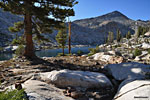
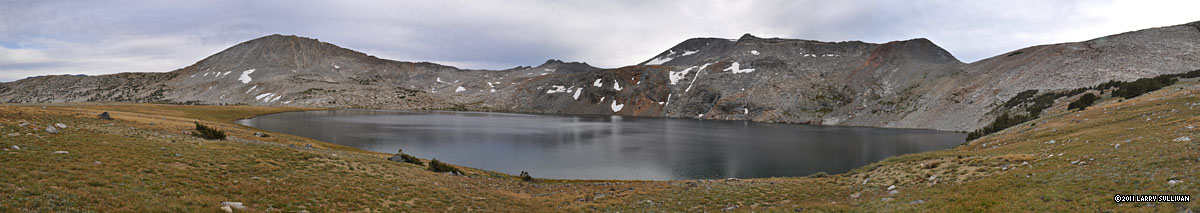
the large alpine Rutherford rewards me with late afternoon colors reflecting off its cold, still waters. On the far north end, a giant granite pyramid fills the sky, it's double mirrored in the lake.
Rutherford is boomerang shaped and sits in a depression of granite mountains. The steep access trail reaches a lip, then enters the basin at the long end, so you can't see the whole lake. A few big trees line the shore, but mostly it's bordered by large, smooth granite formations and giant broken boulders of every shape. I made my way around the lake via an on-again/off-again trail, clambering over boulders and downed trees, passing a well-appointed group-sized campsite and then two smaller ones. At the far end of the lake, I was surprised to find a well-constructed retaining wall/dam that apparently prevents some dastardly fate. On the way out, I discovered there was one at either end of the boomerang. It was nice to have this large lake to myself - a well-deserved reward for a strenuous 3-pass day of exertion.
I chose a great site on a bluff overlooking most of the lake, collected some wood and had a welcome fire and dinner going in no time. I'd sleep out under the stars tonight. Daylight waned, shadows grew long and the wind calmed. I was totally relaxed. Then, suddenly, a noisy hiker emerged from the trail into the lake basin, loud triumphant shouts echoing across the lake; then another and another arrived, until four backpackers were making their way around the lake toward me looking for a campsite. I was somewhat annoyed at the loud behavior, disturbing the calm of the twilight when they could see my campfire and knew they were newcomers. I correctly determined that they'd be pleased when they came upon the group site I'd passed by earlier. As evening set in, two of them got fishing right away, landed some 10 inchers with little effort, and I was pleased that they quieted down respectfully in short order. |
|
|
|
On this trip, Rutherford Lake is half way. From this point on, I was basically going back, but returning via different paths with new landscapes to discover and new mountains to climb. After breakfast and breaking camp, I chatted with the newcomers, an older couple with a grown son. Apparently a teenager, still asleep in the tent, was the noisemaker. They'd driven up the long, washboarded fire road from the eastern Sierra and then hiked 9 miles uphill to the lake. I chuckled when the older fellow complained of how much effort it was to hike 9 miles.
Before heading off, I hiked down to the end of this spur trail to check out Anne Lake, shown on the map to be much smaller but closer to the trail. It's actually further from the trail than Rutherford, and down a significant grade from the signed junction at the main trail. Anne is lush and green, with grassy, lily-covered banks. The large pyramid mountain above Rutherford and it's own tall trees mirror in the crystal clear water. Ducks cackled and hummingbirds swooped. A cooling breeze ruffled the leaves as warm morning sun streaks broke up deep blue shadows. I thought Anne Lake the epitome of tranquility: pristine, untouched, virginal. It reminded me of an idyll like Walden Pond must have been to Thoreau. I regretted not camping here, but was glad that I got to check out larger Rutherford and it's dramatic mountain backdrop.
Back on the main trail, the grade below the lakes was significant, dropping almost 1000 ft. in less than 2 miles on a series of switchbacks. No wonder the newcomers were complaining - it was steep!
Missed turn
The National Forest Service maintains the Ansel Adams Wilderness and it
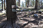 Hiking from left to right, I missed this trail junction and sign on the back side of a tree. The turnoff trail (straight ahead) didn't look much like a trail either.
|
was clear they weren't putting the same effort into trail maintenance as the National Park Service as there was a lot of overgrowth, and neglected and eroded trails.The unfortunate result for me was that I missed my junction with the Post Peak Pass trail. The small wooden sign was posted on the backside of a tree and the intersecting trail was overgrown and faint from neglect. I'm a mile and a half down the mountain before I realize my error and have to slug back up the hill —an hour of lost time and effort - one of the disadvantages of going solo. An extra pair of eyes probably would've noticed the badly positioned sign. I must have been focused on something else when I passed it, so be alert if you're doing this route.
 Meadow in the Clark Range
|
Once again on the correct trail and going north, I pass a signed trail to Frying Pan Lake, Slab Lake and Walton Lake that curiously isn't on my map. Then I come across an unusually large, flat dirt clearing in the forest where a pond must have been. It was so hard
and flat, it could have been a basketball court. Beyond the ball court, the trail skirts a very large, mostly dry lake covered in bright green reeds and tall grass and the mosquitoes are swarming. Further on are are some vibrant green meadows. You get a much fuller appreciation of mountain meadows after spending hours climbing through miles of harsh, craggy granite in the hot sun. And then, through the deep forest, a big clearing - a lake or an expanse of lush vivid greenery to break up the gray tones and refresh the senses. Meadows are always a good place to spot bears and deer.
I'm getting low on water when I arrive at a stream I'd counted on and find it dry. The trail begins to climb up, up, mercilessly up, without any switchbacks to ease the grade. Where it levels out some, I take a lunch break, and then it's back to climbing through the forest and up the valley, beside a large meadow with some stock fencing, until the giant mountain that holds the Post Peak Pass looms. Once again, the trail proceeds directly up the mountain, with little regard for switchbacks. The sun is out full and it's a very steep grade. I'm relieved when I see my first actual steps created by a trail crew and offer them a heartfelt thanks. The higher you climb up Post Peak Pass trail, the more rugged and chaotic is the terrain. But the trail improves dramatically as there are well defined steps and stone path to make the going easier. Far below, a large deep blue tarn reflects the distant peaks. There are several somewhat stagnant pools where I decide not to refill my water, even with a filter, preferring to climb light. |
In the distant west behind Red Peak, I see billowing smoke rising above the ridgeline, the beginnings of a large forest fire. Later, I find out it was a "prescribed" burn in Yosemite's Oak Flats area that got out of control and became a major hazard, closing Hwy. 120 and cutting off access to the Valley from Tioga Rd for days. Thankfully, the wind was blowing it due north so it wouldn't impact me directly or the visibility of my trip.
Finally, after almost 1800 ft. of elevation gain and subsequent loss, I'm atop Post Peak Pass and putting the southern vista behind me. Far below to the northwest is an awesome grassy basin probably 1 mile in diameter with 2 large lakes. I can see from way up here that the trail cuts straight across the middle. From high on this ridge, the hard-won views across the park are astounding, but I'm eager to get down now. I'm on top of a sun-baked pass and have had enough of windy, exposed, treeless alpine ascent for today. It should be all down from here, and I'm anxious to descend back into the cool forest. But the trail builders have installed one last, frustrating uphill segment for me to climb before they let me start down into the grassy basin.
Signs declare I'm leaving Ansel Adams Wilderness and entering Yosemite again. The path continues down across the expansive green meadow and
 1000 ft. drop to Lyell Fork Creek
|
past the 2 lakes - hidden from view save from above - dropping over 1000 ft. in less than 2 miles and enters the forest once again. Mile after mile of descent ensue, down to the depths of the valley, where the trail crosses a stream and I top off my water supply. Then it's back up the next mountain north, 500 ft. of gain over two miles to a high point in thin forest cover. By late afternoon, I arrive at the dramatic mountainside dropoff down to Lyell Fork Creek (a long ways from Lyell Creek in Lyell Canyon), where I've planned the nights camp. As I make my way down the steep switchbacks, the sun is setting big and red, bathing the immense eastern peaks in crimson light and adding a warming glow to giant trees that thrive on this mountain face.
It's getting dark as I cross the wide, rushing stream. I find a spot on some boulders to lay out my bag and make dinner. Some brazen deer make their way down a ravine just yards away. I haven't seen a soul all day except for the Rutherford Lake family I'd spoken with in the morning. I'm deep in the wilderness here - the trees are immense, the mountains towering, the boulders building-sized. Though dead-tired, I find I'm alert to every sound and movement as I'm near a major water source where I can expect all sorts of late night activity. Lying under the stars, I listen to the soothing rhythyms of the creek and watch an immense full moon creep up from behind the blackness of a towering adjacent peak, silhouetting giant trees on the ridge line, becoming entangled in their branches. When I woke up again in the middle of the night, it had disappeared and the sky was full of shooting stars. The temperature dropped into the low '40's but I was toasty in my down bag. |
|
|
In the morning, there's a thin layer of clouds, not quite overcast, but little sun, just cool enough to be the perfect weather for big elevation gains like I'll be doing today. I'm on the trail at 8:30, climbing up 700 ft. through thick
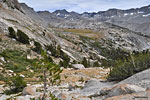
 Yosemite's distinctive granite terrain
|
forest, then down 350 ft., up 200, down 500, a seemingly endless pattern of ascent/descent. This is the high trail north from Isberg Pass to Vogelsang. It traverses the side of a mountain across the canyon from the low trail I traveled south on days earlier. The ground is changing from dirt to a smooth granite face between warped walls of stone.
After a pair of steep switchbacks down, I pass the connecting path to the low trail and Merced Lake. From here, I turn northeast along a lively stream, and begin climbing up, up—600, 800 feet, passing a beautiful waterfall slide, 1000 ft., 1200 ft. up. By noon, I'm at the trail to Bernice Lake and climb the steep 1 mile rocky grade to have a look. Bernice is large and beautiful, her shores covered in grassy greenery. A giant peak drops into the water on one end, a waterfall at the other. The sun comes out as I make lunch and soaking my feet in the icy water is a real treat. On the way down to the main trail, several groups of deer scamper nearby.
 Gallison Lake across the valley from Vogelsang Pass
|
Vogelsang Pass is a long, tough slog up endless switchbacks, but the panoramic views of the high lakes, wide valleys and sky-scraping peaks south and west offset the effort. Toward the top, the wind picks up dramatically, blowing 50mph gusts from below. The north side of the pass is much calmer. It's higher ground and about a mile to Vogelsang Lake and High Sierra Camp. On the way down to the camp, I chat with two gals, Sabina and Tanya, who joined up to hike the HSC camps. Tanya lives in Santa Barbara, California, and Sabina is from my fathers hometown of Malden, Massuchusetts, part of Boston. She's been out on the trail over a week, doing all the HSC route.
Vogelsang is a beautiful, serene lake beneath a giant mountain of granite. The camp is in high season and busy with activity. The tent lodges and meals are reserved, but there is a public cafeteria where hikers can buy treats. But I have 7-8 miles to Ireland Lake, another pass to climb and it's 3:30, so I don't linger. The trail east from Vogelsang toward Lyell Canyon crosses expansive grassy high country meadows dotted with younger trees. It's relatively level terrain until Evelyn Lake, where the path rises up to cross the mountainous rise that is Tuolumne Pass. It's not a distinctive alpine pass, just a high point on the trail. There's not even a sign. Nevertheless, it's been a long day and climbing up any slope adds to the fatigue and envie to stop and make camp. |
After 4-5 miles, I reach the trail to Ireland Lake. My Harrison map shows it to be 1.5 miles from the main trail, but I'm dismayed to read the sign at the junction which says 3 miles. The terrain is rocky and eroded and the path is more of a one foot wide trench, so it's easier to make your way up to Ireland Lake beside the trail than on it. The dirt and rock path climbs up to a high alpine basin surrounded by dark, brooding peaks. Finally, atop a wide grassy ridge, Ireland Lake comes into view, another 1/4 mile down a slope. It's a somewhat foreboding destination as the sun drops behind a ridge, the treeless grassy shore slopes steeply down to the dark water on the all sides, save across the lake, where sheer cliffs rise out of the water, patches of snow clinging stubbornly. The grassy slope is pockmarked with deep indentations that are difficult to see and you can twist an ankle if you're not careful. The wind has picked up dramatically up here in this high basin and furious blasts shoot down from the western ridges and whip across the water.
I set up my tent in the only level, un-pitted spot I can find in acres of grass, a little closer to the lake than I preferred, and secure it tightly against the wind. I soon have a warm dinner inside me and I'm able to relax and contemplate the remote isolation of this rugged, windswept lake. I hope it was named after a person named Ireland and not because it reminded its discoverer of some forlorn part of that beautiful island nation from which my grandparents emigrated. I could see how it could be an attractive lake in the right calm and sunny conditions. I put in about 18 miles today, was exhausted and craved the release of REM sleep, but throughout the night, gale force winds howled through the tent, preventing any meaningful rest. I was glad when morning came so I could move on to a more relaxing setting. |
|
|
After an energy bar breakfast to avoid cooking in the powerful gusts, I struggled to break down my tent without the thing blowing off across the lake. I head out at 7:00, climbing back up the ridge and down the eroded trail to rejoin the main trail toward Lyell Canyon, marked by high ridges that fill the eastern horizon. In short order, the trail begins a steep descent from the Vogelsang plateau to Lyell's valley floor, a drop of almost 1000 ft. through thick pine forest. I pass 2 early risers finishing up the long climb, then at the junction with the John Muir Trail, come across numerous camps and parties getting started on the day. The JMT is very busy at this high season date (some might say "crowded") and it's rare to go a mile without seeing others.
|
The sun is out and the lush, green beauty of mellow Lyell Canyon is a welcome change from the stark, muted colors and harsh terrain of Ireland Lake. Lyell Creek cascades playfully over warped plates of of smooth granite, meandering unpurposefully through the wide, verdant meadow. Groups of deer graze in the tall grass; chipmunks, squirrels and pikas dart about from hole to hole.
It's only 10 miles from Tuolumne Meadows JMT junction to Ireland Lake, and even though I'm ambling along at a relaxed pace to fill my sensory capacities with this last awesome new day in Yosemite for the season, I'm back at the car before 11.
|
|
|
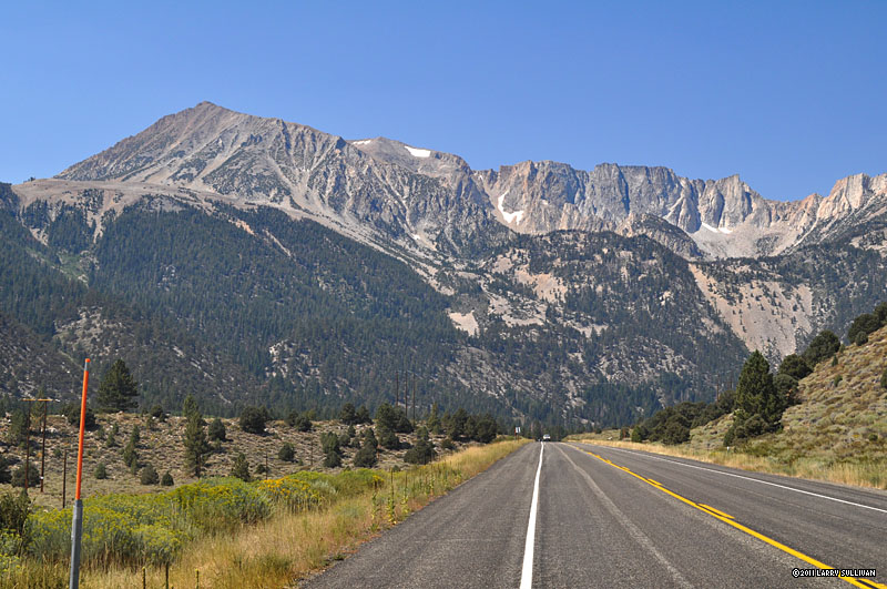
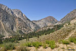 East approach to Yosemite. You can make out the highway on the mountain in the center
 For you flatlanders, the orange poles mark the road for snow plows
|
I find out at the Tuolumne Meadows Ranger Station that indeed Tioga Rd./Hwy. 120 is closed at Big Oak Flats due to the fire and only a 4-5 hour detour would get you into
Yosemite Valley. It's a major disappointment to miss my traditional leaving-day breakfast at Yosemite Lodge and rental bike ride up to Mirror Lake. Sigh... Oh well, I've never actually left the park to the east so it will be a new adventure.
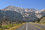
I'm not surprised to find that the eastern exit from Yosemite is a beautiful and scenic drive that drops down steadily from Tuolumne through an immense canyon beneath high ridges. There's a dramatic, deep blue lake and then you are at Hwy. 395, considered by many to be one of the most beautiful roads in California, flanked by the immense, rugged and impressively tall peaks of the White Mountains and the Eastern Sierra.
Traveling south on Hwy. 395 past Mammoth Lakes, the incredible height and majesty of the seemingly endless variety of immense, serrated ridges is magical - a virtually impassible wall as far as the eye can see for hundreds of miles. One giant peak is so startlingly over-sized and symmetrical, that I make a U-
 Convict Lake
|
turn to go back and check it out. Morrison Peak is the guardian of Convict Lake, towering over the serenely deep blue waters with large oak
trees along the shore providing shade for fisherman, though partly obscured by closer intermediate peaks. The lake is named after an incident in the late 19th century, when escaped convicts fled to a canyon above it's remote shores. A posse lead by a community leader named Morrison had them trapped briefly, but the escapees overran the line, killing Morrison, and apparently all of the convicts escaped. The peak was named in his honor. There's a lodge, a restaurant and a store and it's a beautiful spot to get off the highway and take a relaxing break.
|
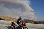
Another wild fire
 LA Armageddon? Approaching Mojave CA on Hwy. 395 south
 Surreal midday drive
|
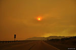
As I continued south on Hwy. 395 below Big Pine, the sky turned overcast, then haze and visibility dropped from ridgeline level down toward the highway. By Bishop and Lone Pine, the sky was white and light brown in the middle of what had been a beautiful sunny afternoon. Wildfire. A big one. You could smell it. The Station fire in the San Gabriel
mountains and foothills in eastern Los Angeles county had just begun - the most disastrous wild fire the LA area has seen in decades. It was blowing due north out of LA county and straight up the Owens Valley, obscuring the beautiful view and filling the air with smoke and ash from hundreds of miles south.
Approaching LA county, enormous plumes of smoke boiled up in to the blue sky, rising high into
the atmosphere and spreading like an ashen veil across the northern sky. This is what it would look like if LA was destroyed by a nuclear bomb, I thought. On Hwy. 14 from Palmdale to Santa Clarita, the air was a thick haze of red smoke and the sun a giant
 The Station fire from Hwy. 14
|
red disc. For dozens
 Smoke from the Station fire over the San Gabriel mountains
|
of miles, it was like being on Mars - a spooky and surreal experience. Then south of Santa Clarita, I emerged from the smoke into another hot, beautiful, sun-shiny LA afternoon, albeit one with a sky full full of immense billowing smoke behind me. It would take weeks to knock down this fire, which was ruled to be arson. Hundreds of people lost their homes, thousands of acres in the beautiful San Gabriel range were turned to blackened ash, and 2 firefighters died after their position on a remote fire road was overrun by smoke and flames and their truck crashed off a ravine. Very sad...
|
|
|


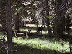
 Bears
Bears


