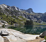
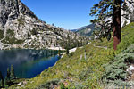
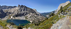
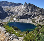
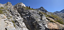
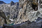
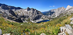
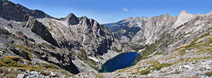
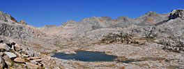
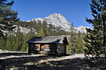
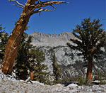
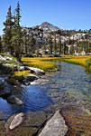
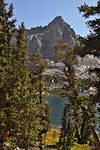
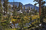
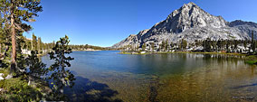
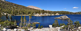
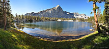
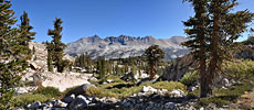
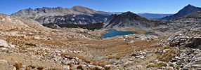
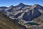
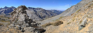
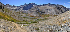
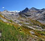
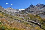
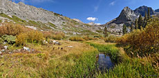
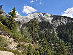
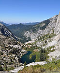
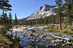
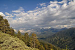
Hamilton Lake and Valhalla

View Great Western Divide in a larger map
The Great Western Divide, Sequoia National Park, CA via High Sierra Trail & Black Rock Pass TrailSep. 14-18, 2009
5 day, 64 mile lasso loop through some of the most breathtaking terrain in the Sierra Nevada


Overview

This epic hike is a loop route that immerses you in what is arguably the most breathtaking region of the entire Sierra Nevada - Kaweah Gap and Black Rock Pass over the Great Western Divide. Some of the highlights include Valhalla, a high valley of immense stone walls encompassing the Hamilton Lakes, the deep blue Precipice Lake and the amazing vista on the climb to Kaweah Gap, the remote Nine Lakes basin and wide, lush Big Arroyo valley, the pristine, peak-lined Big and Little Five Lakes areas, the spectacular panorama from Black Rock Pass of stair step lakes nestled among jagged granite monoliths, and Redwood Meadow, where you can experience the massive scale of the planets largest living things up close. All through this rugged wilderness, you'll cross countless noisy cascades tumbling from great heights, skirt numerous virgin meadows teaming with colorful varieties of foliage and flowers,and of course, be joined by hungry black bears, brazen deer, scolding jays, bushy marmots, frisky chipmunks, endearingly curious lizards and Kamikaze grasshoppers.

The Great Western Divide is the appropriately imposing moniker bestowed upon a towering north-to-south range of rugged Sierra Nevada peaks in central California's Sequoia/Kings Canyon National Park (SEKI), two separate, adjacent wildernesses that are managed as one. This vast and remote mountain range is accessible only on foot or stock as there are no roads within a dozen miles. Here, a handful of chiseled footpaths climb steep mountain passes to offer some of the most jaw-dropping scenery in the entire Sierra, in all of California, in the whole USA. One of these trails, the High Sierra Trail (HST) begins in the Giant Forest region on the western edge of Sequoia NP, and ends at it's junction with the John Muir Trail to Mt. Whitney, the highest peak in the contiguous USA, a distance of approximately 50 miles. This well-maintained route begins among immense Giant Sequoia's, penetrates deep sugar pine forests on cliff-edged, cascade-carved canyons, skirts dozens of wondrously deep blue lakes and climbs far above tree line into the rocky alpine high country before descending into an immense round-walled valley and on to the Kern River.

From the trailhead in Crescent Meadows, the pine needle-covered soft dirt path hugs the contours of the mountains beneath a welcomingly shady canopy of thick forest. The High Sierra Trail starts high up on a mountain and the trail builders did a good job of keeping elevation changes to a minimum, avoiding numerous and tiring climbs and descents. After Bear Paw Meadow, home of the only High Sierra Camp in Sequoia NP and the Bear Paw Meadow Ranger Station, the climb up to Valhalla and Hamilton Lakes, the first night's destination, becomes more steep, rocky and challenging as the trail ascends the deep granite canyon to Kaweah Gap. On the second day, the climb from Hamilton Lake to the top of the gap is an elevation gain of 2300 feet in under 3 miles, enough exertion to limit high mileage gains afterwards. East of the gap, there is the rugged and exposed Nine Lakes Basin to explore, if you have more energy to climb further above tree line to make camp, or a descent into lush Big Arroyo beside a tree-lined river.

Day three is due south toward Little Five Lakes, to experience the awesome massif high above the eastern side of The Arroyo containing the Kaweahs: Black Kaweah, Red Kaweah, Second Kaweah and 13,802 foot Mt. Kaweah, the highest peak in the park. It's here we leave the High Sierra Trail and climb up to the Little Five Lakes area. Around and up the mountain south of Little Five Lakes lie the remote and pristine Big Five Lakes, campsite for the third night, guarded by a massive, towering pyramid of granite. Day four entails backtracking 3 miles to the Little Five Lakes and then the daunting 1200 ft. climb out of tree line up steep Black Rock Pass, from where you say farewell to the rugged Kaweah Range and hello to the immense and impressive Cliff Creek valley on the Black Rock Pass trail. The long descent from the pass allows plenty of opportunity to marvel at the wide, deep valley, taking in the stair step lakes of Columbine, Cyclamen and Spring Lakes, cascading into one another, surrounded by ruggedly steep peaks and cliffs and glacially carved terrain. Many waterfall, stream and meadow-filled miles lower, Black Rock Pass trail descends into thick forest again, where the fourth nights camp will be creek side among towering sugar pines. Day five begins with a 1500 ft. climb to Bear Meadows, where you rejoin the High Sierra Trail back to Crescent Meadows.

September is typically a month of dramatic change in the Sierra - daytime temperatures are routinely in the '90's and the nights get increasingly cooler, with marked differences at higher altitudes. As the hot summer days give way to fall, the rains come back to the high country and the nighttime alpine temperatures drop toward freezing. The animals become more active and noticeable as they prepare for winter. The mosquitoes, swarming throughout the spring and summer, have mostly disappeared. September is usually the last month to hike the Sierra backcountry with 3 season gear, but freak storms can and do happen at anytime in these mountains. It is folly to underestimate the severity of a mountain wilderness storm, as many unprepared backcountry adventurers are no longer around to attest to. From mid-September to the end of the month, monitor forecasts religiously, plan on days of rain and hope for the best. Sierra days typically stay warm into October, but precipitation usually means snow has fallen on the high passes and carrying winter gear is necessary to cross them safely.


Trip Report

Because of the legendary beauty of Sequoia National Park and the Great Western Divide, it can be challenging to score a Wilderness Permit for this hike from Crescent Meadows. I made my reservation online almost 5 months in advance and still couldn't get a weekend departure date. But Monday is an ideal start day for a long hike as the majority of the weekend crowds have left and you can enjoy the wonders of this amazing area without waiting in line, getting stuck in traffic or struggling to find a parking spot. This would be my third solo backpacking trip to Sequoia/Kings Canyon (SEKI) National Park this summer. My Memorial Day weekend hike from Big Meadow/Horse Corral to check out the Roaring River area was likely the first hiker trip of the year to that area since the park opened that weekend, before the backcountry rangers arrived. In August, I spent an incredible week hiking to Rae Lakes and the Sixty Lakes basin, from Roads End in the north of the park. And this mid-September trip would end 3 days after the backcountry rangers had packed and gone home for the season.

After carefully scrutinizing my topo map, adding up elevation and mileage, I tentatively planned on 6 days and 5 nights, with an extra days rationing in case things got interesting. The plan was to take it easy and explore off-trail as much as I wanted. I didn't want this to be a trail-pounding hike, constrained by time and distance goals. I made some loose daily destination estimates, but otherwise, I'd play it by-ear and make decisions about where I'd stay and for how long on the fly. I was concerned that numerous wild fires of late would hamper visibility and detract from the natural beauty I'd come for, but I posted my concerns on some hiking forums, and spoke with rangers on the phone and was assured by several people that Sequoia NP's skies were clear.

I took my Osprey Exos 58 backpack on this trip, which weighs 2.5 lbs. Total full pack weight including 1.5 liters of water, 20 oz. electrolyte drink bottle, and food and fuel for 6 days, 5 nights was 30 lbs., 8oz., of which 8 lbs., 13oz. was a large bear cannister (2lbs. 9.5 oz) and food (6lbs., 3.5oz). In addition to a Nikon DSLR in a holster case attached across my chest to the shoulder straps and a Garmin GPS unit in a pocket on my pack belt, I also carried trek poles, a pocketknife, compass and topo map. I'm constantly refining my gear list to reduce weight without detracting from a high level of camping comfort that I prefer (e.g.- my collapsible pillow). Here's a pdf of my 2009 3-season gear list for 5 nights in the Sierra that works well for me, which you can download if you're interested. A couple of things, like the extra tent pole, pertains to my particular gear setup.

I left LA on Sunday afternoon for the 215 mile drive north through Bakersfield and Visalia to the park's southern entrance at the town of Three Rivers, where they took my $20 for a one week stay. There is only one through-highway in Sequoia NP, Hwy. 198 or the Generals Highway. It winds up through the mountains from north to south in the far western region of the park, a twisty, slow, 2 lane road that accesses all the park's attractions including the fantastic
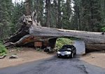
Obligatory car through tree shot - Auto Log near Crescent Meadow
redwood grove at Giant Forest, campgrounds, lodging, private communities, employee housing, trailheads - everything. There has been road construction north of Lodgepole throughout the summer of 2009. The highway is closed 11pm - 6am for night road work and signs warn of daytime delays of 1 hour or more, so planning ahead is prudent. Because I'd arrive in the park after the Wilderness Permit station in the Visitor Center at Lodgepole had closed at 3:30, I car camped the first night. Rather than wait in line at the entrance and then search for a vacant site at busy Lodgepole campground, the parks most popular, I drove a few miles north and camped at Dorst Creek campground, which was virtually empty, and returned first thing in the morning to pick up my permit before the hour-long roadwork delays kicked in.

It was overcast and partly sunny when I arrived at Sequoia's Three River entrance late Sunday afternoon, and started drizzling soon after. But the National Weather Service (noaa.gov)
had forecast clear and sunny skies for the remainder of the week. I was well-rewarded when their predictions became accurate. On a week-long hike, I don't mind a day of light rain to wash away the haze, cool things down and brighten up the wilderness — preferably the day before I arrive! After a cleansing rain, the skies are luminous, the air is crisp and fresh, the streams and lakes are more vibrant, the animals more animated, and the forest is rejuvenated with exuberant life.

Day 1: Crescent Meadows to Bear Paw Meadow to Upper Hamilton Lake - 16 mi., +2400 / -800 ft.
The day dawned overcast with sun breaks, temperature in the low '50's. I threw my wet tent in the trunk and left Dorst Creek campground early, picked up my permit at the Lodgepole Visitor Center shortly after they opened at 7:30am, then drove down to Crescent Meadows.
It was difficult to tell where the ground ended and the sky began
There was a 10 minute construction delay - not too bad. I parked near the trailhead, spread out some of my wet stuff to dry a little while I made some breakfast, then hit the trail at 9:15. The trail breaks out of the forest after half a mile and runs high on the side of a wide valley, offering nice vistas south and east across the valley to dramatic Castle Rocks, a mountainous cluster of jagged spires and turrets of granite. Low clouds swirled in and out of its peaks and crags, setting a moody atmosphere. In some areas far across the park, it looked like it would be sunny for hours, maybe all day. On the High Sierra Trail, the clouds were closing in. Soon, it was difficult to tell where the ground ended and the sky began and there was little to be seen through the thick fog beyond a few hundred yards.

Bear cub
After an hour or so of hiking, in an area where the path drops steeply down the mountain, I rounded a corner and saw a large black bear cub several hundred feet away on the path. We both stopped and evaluated each other for a few short seconds. He was less than a year old, likely 8-9 months, very cute, with long black fur, his big ears perked up and eyes wide. I assumed his mother would be nearby and didn't want to make any sudden moves. Then he bolted down the slope as fast as he could go, disappearing over the steep dropoff in a few bounds. I thought with that speed and that slope, surely he must have tumbled end over end a few times. I listened as he crashed down through the vegetation towards the base of the canyon far below. Apparently he was on his own, mother having kicked him out. I thought it was a good sign for an interesting trek to have such an elusive and beautiful young animal appear within the first hour and a half of my trip.

Bear Paw Meadow Ranger
The first few hours were pensive and meditative as the fog drifted dreamily through the thick forest, cloaking giant trees in a shroud of gray mist, with bright spots where the sun struggled to break through.
Bear Paw Mdw. Backcountry Ranger Nina (R) and visiting Supervisor Chris (L) were busy packing up the station to close for the season, but took time to help me with my route.
After a lunch break, I followed the trail down switchbacks to a deep, boulder-filled gully with a bridge and then beneath a nasty-looking, recently-active dirt and rock landslide bluff that I hurried under nervously. Then there's a 600 ft. elevation gain up and around the mountain to Bear Paw Meadow, where I stopped at the A-framed Ranger Station to chat with career backcountry ranger Nina Weisman for insight about my destinations. Ranger Nina helpfully pointed out places of interest on my map and convinced me to change my last day to return to Crescent Meadows via the HST, as opposed to the low trail I'd planned, so I could see what I was missing in the fog on the way up. Her supervisor Chris was visiting before the Ranger Station and the adjacent Bear Paw Meadows High Sierra Camp (HSC) would be closed two days later and everything packed out on mules. The 3 of us chatted about the promising weather forecast, about the bear cub, about the busy HSC next door, about life as a backcountry ranger. I mentioned the book I recently read, The Last Season, about a highly experienced backcountry Sierra ranger named Randy Morgenson, who disappeared on patrol in 1995, a mystery that wasn't solved until his body was found 5 years later, apparently victim of a snow bridge collapse. It turns out that Nina played a significant role in the drama and was mentioned many times in the book. I offered some chocolate chip cookies as a token of my appreciation for the job the backcountry rangers do. As we chatted on her porch, a family of 2 does and 3 fawns wandered through a few yards from where we stood. The weather slowly shifted from wet mist to light drizzle and it was getting chilly as I set out for the four mile climb to Hamilton Lakes.

The trail winds along steep drop offs, climbing out of the forest along vertical granite walls, the path changing from soft dirt to jagged stones. With the mist and drizzle, I passed several overlooks where I couldn't see further than a couple of hundred yards. The tops of towering trees appeared and disappeared through the gray veil of clouds, floating in the sky, their roots hundreds of feet below on the steep slope.

Fallen bridge
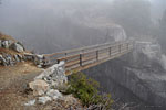
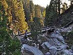
A few miles up, there's a wooden footbridge over a dramatic chasm, a narrow but extremely deep eroded gash in the mountain,
with a lively
Bridge over deep chasm east of Bear Paw Meadow

Fallen bridge in narrow, deep canyon. It's a long way down!
Fallen bridge below.
It's a long way down!

stream rushing through far below. An old bridge either gave way or was knocked down, but for whatever reason - probably because it was dangerous and therefore expensive - the crumpled metal structure is still wedged half way down the crevasse. I hope they plan to remove that twisted steel carcass and restore a semblance of natural conditions to this striking crevasse. The park service has certainly undertaken more dangerous engineering feats.

Dusk arrived early in the wet fog. At 14 miles up from Crescent Meadow, I passed by Lower Hamilton Lake without even
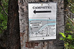
Kudos to the graphic artist who makes these helpful site diagrams
seeing it. I climbed around the shore path of Upper Hamilton Lake looking at campsite direction signs before I even realized I was a few yards away from the water. A couple was setting up camp there, but other than the rangers and a few HSC guests, they were the only people I'd seen on the trail all day. Many wilderness destinations in SEKI NP require you to camp in designated campsites and so these posted campsite diagrams showing individual sites are helpful. You can quickly see where the sites are in relation to the natural features so you don't have to wander around trying figure out where they're all scattered about, especially helpful in poor visibility or when most are occupied.

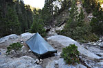
I threw the tent together, ate dinner in the thick fog, and collapsed in my bag. Condensation dripped from the tent roof and my down bag was getting wet, so I had to wipe the walls frequently; consequently, I didn't get much sleep. I got up in the middle of the night and found that the sky was clear and full of stars and that I was camped on the shore of a large lake surrounded by massive towering palisades. Tomorrow was going to be a beautiful day.

Day 2: Hamilton Lake to Kaweah Gap, Nine Lakes and the Big Arroyo - 7 mi., +2300 / -750 ft.
Tuesday dawned beautifully without a cloud in the sky. I slept in late as the sun was stuck behind the high canyon
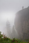
Valhalla from the shores of Hamilton Lake
walls and I needed it to dry off my gear before I hit the trail. Today would be a strenuous climb over Kaweah Gap with over 2300 ft. of elevation gain from camp. I heard the other
Lower Hamilton Lake and the canyon down to Bear Paw Mdw., Moro Rock visible in distant center
campers pack and leave and but didn't get out of my bag until after 9:00, when I saw sunshine on my tent. I climbed out and into one of the most spectacularly vivid wilderness mornings I've ever experienced. I was inside a cathedral of granite, dominated by the immense, sheer wall they call Valhalla soaring above absurdly deep blue Lake Hamilton, with its shoreline of smooth granite shelves. Everywhere the gray stone shades are punctuated by vibrant green of massive Sugar Pines. Far up the valley, jagged peaks crown the ridgeline. Down the canyon below, rolling green forests marched to infinity. The thin air was crisp and new and warm sunlight sprayed into the basin like a heat lamp; already the stoney shores were dry.

I had this huge wilderness basin all to myself. I spread out all my things to dry and got breakfast going. I wasn't sure I was actually at Upper Hamilton Lake as I hadn't seen the first lake when I passed it, and had to scrutinize my topo to get situated. It was 10:45 before I was packed and ready to go. But that was okay because I wasn't shooting for a high mileage day today. It would take much of the next four hours just to climb up and over the steep gap and I didn't want to haul wet, heavy gear up there. I could decide how far I wanted to go today once I reached the gap.

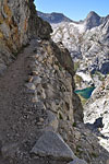
The view got more impressive as I climbed the trail hewn out of the rugged north canyon wall above tree line. After almost 1000 ft. up, the trail veers into a deep side canyon beneath massive overhanging slabs and through a short tunnel. Hamilton Lake grew smaller and smaller and
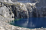
Magical blue Precipice Lake
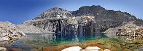
finally disappeared altogether as I climbed and climbed and climbed. Shortly after passing a beautiful blue tarn sparkling in the sun, I passed a tired trail crew of 5 guys taking a break and thanked them for their hard work. I arrived at spectacular Precipice Lake at 1:30 and had lunch. The walls of a huge mountain drop straight into this serene blue lake, hence the name. The other side is open to the expansive vista of the valley
The creek draining from Precipice Lake
just ascended and the high peaks to the north. As I absorbed this sublime wilderness lake, I realized I'd seen it before in a photo by reknowned Sierra photog Galen Rowell, whose Mountain Light I'd just read, and also made famous by Ansel Adams back in 1932. Both were enamored by the sheer cliffs against the serene water and cropped their pictures tightly into the wall, which is why I didn't immediately connect them with this large, deep lake. The most striking element to me was the magical blue and green shades of the water.

By 2:15, I was atop Kaweah Gap, where a new mountainscape revealed itself. Ahead of me below was the first of the so-called Nine Lakes, (there are more than nine, apparently), surrounded by a rough-hewn landscape of giant scattered stone shards in a basin of tall desert-colored peaks. The Big Arroyo, a wide, round-bottomed canyon, fills the vista south and east. Contrary to its name, the Big Arroyo (Spanish for dry river) has a playful stream running through it, and vibrant greenery follows it's course down the valley. As I rested on a rock in the hot afternoon sun absorbing this new landscape I'd be traveling through, I noted where the tree line ended at this first lake, how the upper Nine Lakes basin I'd penciled in as my second night's camp was several more miles of climbing down, then up, and completely above treeline and exposed. Then I noted how lush and welcomingly cool the water and trees down below in the Big Arroyo looked. I decided I'd forego climbing up to the Nine Lakes basin and turned south to the Big Arroyo.

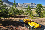
I wandered down the trail through Big Arroyo for a mile and found a sheltered spot a few hundred yards off the trail among a grove of small pines
Tonight I'd sleep under the stars in the Big Arroyo
by the stream. What a treat to lay back on the smooth stoney stream banks in the warm afternoon sun, soak my feet in the cold water and read a few chapters of the book I brought, Kerouac's On the Road. It felt good to just stop when I felt like stopping and take the rest of the day off. In no time, the sun was dropping behind the tall mountains that line the canyon. Dusk comes early to the Big Arroyo and a wave of purple shadow swarms into the canyon from the high western ridges, enveloping trees and boulders and streams. A group of 5 does and 4 fawns crossed the creek a hundred yards away and made their way into the last of the sunshine. The sloping walls funnel wind into the canyon bottom and as the afternoon grew cool, strong gusts blew down the stream, so I retreated to make dinner. Tonight I'd forego the tent and sleep under the stars. I tucked myself in as darkness settled in this giant wilderness arena and brilliant flecks of stars littered every available space in the moonless sky. Thankfully, the wind died down after dark. I lost count of the shooting stars after 10. Unfortunately, the calmness was shattered again and again by overflights of pairs of military jets. I suppose this immense park is just an unoccupied wilderness to the pilots, and better than flying over a town. By 10pm, the temperature had dropped into the low 30's and I realized my bag was starting to get very wet from condensation. So I set up my tent after all. I didn't want to have to dry off my bag every morning.
Day 3: Big Arroyo to Kaweah Range, Little Five Lakes and Big Five Lakes - 10 mi., +1400 / -1200 ft.
Once again I slept in so the sun would come up over the high canyon walls enough to dry off my stuff - a good excuse to not get up early. It was a chilly morning and the tent had frozen condensation all over it. But when the sun came out, the day warmed up quickly. I got my bag and tent dried
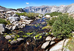
Big Arroyo Creek
Big Arroyo Creek
out and set off at 10:30. The HST slowly descends south along burbling Big Arroyo Creek through colorful fields of grass and brush and then into thickening forest. After a couple of miles down the valley, I left the High Sierra Trail and turned on to the path to Little Five Lakes and Black Rock Pass. From the nicely preserved log Big Arroyo Cabin, the trail climbs almost 1000 ft. up switchbacks toward the Little Five Lakes plateau. I was looking forward to seeing the Kaweah Range I'd been reading about for a long time. Each turn in the trail reveals tantalizing new glimpses east through giant trees, down across the wide valley and up to serrated Black Kaweah and Red Kaweah and smoothly rounded Mt. Kaweah. To get a clear view of these towering peaks, I hiked off-trail to the edge of the mountain for a sweeping vista of this grand range above the Big Arroyo unobstructed by trees. After lunch, the trail dropped down the mountain to the west for the first glimpse of one of the Little Five Lakes, shimmering blue waters reflecting guardian peaks, it's shoreline leaking out into a canal of brilliant green reeds. A pair of identical twin hikers resting in the shade by the trail would be the only people I'd see today. I passed another of the Little Five Lakes and briefly entertained the thought of stopping early again today and making camp here. I didn't know what to expect of the Big Five Lakes and it was going to be several more miles of climbing away from my Black Rock Pass trail destination to find out.

Big Five Lakes
From Little Five Lakes, it's three miles south down one mountain and up another and then a steep descent through tall trees when you get a glimpse of the first of the beautiful Big Five Lakes. From the towering peak above, the contoured granite and tree-lined shores, I was relieved to find this lake basin was even
more impressive than Little Five Lakes. A faint use trail runs along the northern shore to a second and a third lake, and my topo shows a fourth cross-country west up the mountain. Where the other one is, I couldn't tell from my map.

The second Big Five Lake is much bigger than the first, separated by a tree-covered isthmus of stone. It's deep blue waters are sheltered by an immense pyramid of granite that slopes down to the south shoreline and fills the sky. I followed an indistinct path that parallels the northern shoreline to the far west end of lake 3, scouting for the perfect site. Much of the lakes' northern shores are a series of large, steeply sloped, tree-covered granite mounds, so the lakeside path has to diverge several hundred feet from the water's edge. From the trail, the water often disappears behind the mounds, which give the lakes an organic, amoeba-like shape. On the forest side of these natural stone levies, a series of shallow drainage streams connected by moist fern meadows parallels the shore, dropping into the lower lake. Unlike most lakes where the forest extends to the waters edge, this separate water system skirting the northern shoreline, filled with colorful vegetation and flowers, gives the lake a primitive feel, like there was no consideration for man in it's creation.

It's almost a quarter of mile through this unique terrain to the far western end of Lake 3, where the lake becomes big, open and exposed.
Ducks dive for treats by my camp on the shore of Big Five Lake. no.2
The wind blew firmly across the water here, and finding no sheltered spots to make camp, I backtracked and found what I was looking for closer to the middle of lake 2 - a flat spot facing east to get the first rays of sunlight, below a naturally protective levy of stone and trees. There was even a big slanted boulder to recline against where I could read my book and watch the stars over the lake. I set up camp, gathered firewood, made dinner and was ready to relax before sunset - for a change. A billion stars mirrored in the glassy surface of the lake, doubling the sky. The fire danced and writhed in exotic plumes, crackling and popping, glowing warmly. I studied how the monochromatic shades of night slowly drained away the rich colors of the day. The trees on the distant shore were the purest black, the towering mountain a dark grey, and the star-filled sky, the lightest of the three. All 3 reflected toward me across the water and where ever I moved, they followed. I was two days from the nearest road and had this big, serene mountain lake all to myself, a massively waycool evening in a remote and beautiful wonderland. I stayed up late contemplating the heavens and the wilderness and my existence, to absorb as much as possible of this hard-won situation. This would be my last lakeside campfire, and my most memorable campsite of the trip.

Day 4: Big Five Lakes to Black Rock Pass, Cliff Creek valley and Redwood Meadow - 16 mi., +1800 / -4100 ft.
Today would be the strenuous climb up and over Black Rock Pass to the west side of the Great Western Divide, a 1200 ft. gain from Little Five Lake #2, over a distance of 2-3 miles. I was on the trail at 8:30, backtracking up the slope above the lake, then around and down the first mountain and back up another to the Little Five Lakes basin to rejoin the trail to the pass. I explored the second of the Little Five Lakes, another beautiful lake that follows the contours of a large guardian mountain. The Ranger Station at the far end of the lake had just closed for the season earlier in the week.

Black Rock Pass
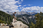
From the north side of Little Five #2, the climb up begins in earnest, through great ancient pines and up and over mini-canyons of huge jagged boulders. As I climbed through the last of the greenery into the brown and grey boulder-strewn terrain, I tried to identify which of the countless serrated ridges above me would be The Pass. Soon I was above tree line, looking up at numerous dauntingly craggy ridge lines of the Great Western Divide high above. Behind me, the upper Little Five Lakes come into view as the trail climbs higher and higher. Atop one of the plateau's, the switchbacks to the pass become visable. There is indeed a giant, craggy, very dark rock formation on one side of the pass that is it's namesake, but the same color rock can be seen atop the entire ridgeline. "Dark Brown Rock Pass" just doesn't have the same zippy appeal. On the final approach to the wide gap between two peaks, the switchbacks get dramatically steeper. The last quarter mile has grades that must be close to 40 degrees! I trudged one step after another to the top, where I bid farewell to the awesome panorama behind me to the east - the distant, rugged Kaweahs towering above the Big Arroyo, with it's forests of ancient trees, and all of the Little Five Lakes arrayed below. In front of me to the west was an immense new, completely different vista, dominated by mammoth granite mountains to the south, seemingly close enough to reach out and touch, but separated by the long, wide and deep Cliff Creek canyon that seemed to drop down to infinity.

This big, loud hawk taunted me at the top of Black Rock Pass
The descent on the west side of Black Rock Pass, though not as steep, is much longer and more dramatic than the descent on the eastern side, which ends at a clearly defined plateau that holds the second of the Little Five Lakes. The western slope of the mountain doesn't seem to have any obvious terminus; the mountain merges seamlessly into the deep valley, which continues down sharply until it curves out of sight. As I made my way down the gently sloping but endless switchbacks, I was glad I wasn't someone who had to climb this impressive grade! What I'd say should I meet such an unfortunate person played in my mind: "I'm glad I'm not you for the next hour!" As you descend west from the pass, more of the immense southern bowl is revealed. Serrated, broken off peaks top massive walls of granite, sloping to the canyon floor far below. The myriad of colors and textures and shapes is an indescribable awakening of the senses: the feel of the warm sun and cooling breezes; the sound of the hawk's cry overhead and the
Spring Lake adjacent to a smooth granite mountain with long fissure
gurgling stream far below echoing across the chasm; the scent of the flowers and grass in the crisp alpine air. I take dozens of photos knowing they can't capture the true scale or height or sense of isolation and wildness of this magnificent arena.

Stair step lakes
One of the most spectacular features of the basin is a series of 3 lakes that drop down a rugged valley from the high peaks north of Sawtooth Pass. The highest is Columbine, then Cyclamen and finally Spring Lake, each draining into the lower via lively cascades. The drainage creek from Spring Lake is the beginning of Cliff Creek, which carves through the canyon bottom for miles. Above Spring Lake is a towering sheer granite face reminiscent of
A cowboy leads his mule train to Black Rock Pass
El Capitan in Yosemite. The three sister lakes glistening in the sun soften these massive granite slopes of contorted, tortured stone topped with harsh craggy peaks.
Information Ranger Leslie, here below Spring Lake, on a week-long solo trek
A thousand foot long, gaping fissure splits one hulking mountain of smooth rock. During lunch break in the shade of a giant tree, a uniformed lady ranger climbs the switchbacks towards me with a full pack and a satellite phone. She is an information ranger stationed at park headquarters in Three Rivers. I ask her to join me for a break in the shade. Her name is Leslie and she's taking paid leave to do a week-long solo hike over the Great Western Divide and back for the first time, to get a hands-on look at the park that she speaks about to visitors as part of her job. Wow, getting paid to hike here! She's a tough lady as few men would even consider doing this strenuous hike solo. Shortly after I resume the descent, a cowboy and his 4 mule train climb past me. He asks how far is the pass and what's it like for stock and seems unfazed when I tell him the east side is extremely steep. Several of his mules are unloaded - maybe he's training them.

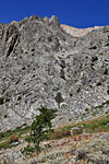
3000 ft. below the pass, and I'm still high above the valley floor, descending the mountain on the north side of the canyon. The enormous serrated
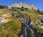
Waterfalls pour down tortured rock
peaks of The Divide slowly disappear behind me, replaced by less abrupt ridgelines. The mountains on the north side of the canyon become a harsh and craggy morass of sharp, chaotic brown rock, beautiful in it's uniquely grotesque façade. The canyon drops interminably, passing golden meadows and lively cascades rushing down noisily from high above. At last I enter the shady cool of the forest again and the trail changes from sharp, broken rock to soft, pine-needle covered dirt. The descent continues unabated, slicing across steep slopes filled with soaring sugar pines high above the stream, with few places to access the water. One such access point is the junction with the Timber Gap trail south to Mineral King, which I reach by late afteroon. There is an established campsite above the stream and I see the final 2 of the 4 people I'd see today, a pair of young guys. They left their packs unguarded at the site and were 100 yards away down the hill and across the stream filtering water—a risky action—as Sierra bears are known to confiscate unattended luggage and disappear with it before one is even aware of them. I consider camping here while bagging up some water, but the thick forest offers little to see and I could easily finish up my hike in another day if I push on a few more miles today, so I continue on my way. The trail traverses the steep, heavily-wooded slope and passes through an old burn area for the last several miles before Redwood Meadows, then turns north, at last leaving Cliff Creek valley.

Giant Sequoia grove
As the trail descends across the sloping mountain toward the plateau of Redwood Meadow, it passes a single, immense Giant Sequoia tree,
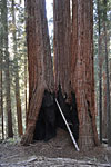
3 huge trees have grown together, each trunk is over 8 ft. wide. A dozen people could stand in the fire-carved cave.
standing
The trail passes a single, immense Giant Sequoia
The trail passes a single, immense Giant Sequoia. Here's a reminder of the scale I'm referring to.
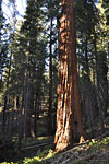
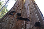
erectly at attention, dwarfing the huge sugar pines around it, golden late afternoon rays illuminating its titanic trunk and flaring canopy. Soon there is a second and a third, and then I find myself in a entire grove of these colossal titans of the forest, soaring skyward on a steep southern slope. This is the first grove I've experienced in the wilderness, unprotected by fences and signs and rangers, without cars and tourists and parking lots nearby. No matter how many times I stand under one of these ancient giants looking up, it's impossible not to gape in wonder. A Giant Sequoia grove is a magical, almost sacred place, where all the rules of nature to which you've been exposed your entire life are discarded and surpassed and a new paradigm has risen. The scale of their mighty trunks defies belief. Their ancient, furrowed bark is thicker than a wall. Their top branches are so high above the forest canopy, they can't be seen, even from far above on the trail. Each of their lower branches, which start over a hundred feet above the ground, are as big as a Live Oak tree. Sequoia's can live to be over 2000 years old and their formidable mass makes them the largest living things on earth. Some of the trees in this grove are conjoined twins, with one immense base and 2, even 3 monstrous trees shooting straight into the heavens from it. Many have blackened fire-scarred caverns gouged out of their bases and all wear deep pock marks in their foot thick bark - wounds from lightning strikes.

Black bears
As I wander through the grove, I detect movement a few hundred yards across and down the slope
Burn scars from lightning strikes
and see an adult black bear walking in my direction. We stop and size each other up. I have the high ground so I'm pretty relaxed. He's a mid-sized bear, probably about 2 years old, with a beautiful shiny coat of jet black fur, and behaving in a non-aggressive posture. As I fumble for my camera, he hops on to a fallen log to facilitate movement through the thick undergrowth and continues directly toward me. I'm shooting video, making my way down the trail for a better line of sight at him through the trees until we're 200 feet apart, where he stops momentarily, decides to cut out, jumps down off the log and strolls casually into the forest in the opposite direction.

A quarter of mile down the trail later, I hear a big noise just a few yards away on a bushy slope above the trail and see another large black bear turn away grunting and push through the bushes away from me. Then a second runs after it. Hmm.. two bears, above me, very close by. I pick up a thick heavy stick and cautiously continue a few yards to a clearing, where I look up to see a very large mother bear poking her head out from behind a bush and two young cubs behind her, 50-60 feet away, above me. The mother has been making low, guttural alert noises and one of the cubs jumps on to a half-fallen tree and starts climbing a few feet, then turns and stares at me. Knowing about mother bears and their temperaments and keenly aware of my close proximity, I played this cautiously and made no sudden moves. For a few long seconds, the mother glared down at me from behind a bush without moving, her ears twitching, seeing what I was going to do, what I was all about, more out of curiosity it seemed, than fear or anger. The treed cub stared like he'd never seen a human before, this close anyways. I tossed the stick to get my camera out. The picture of this beautiful wide-eyed cub clinging to that diagonal tree, framed perfectly in the green, sun-dappled glen, would be one to die for, though I hoped it wouldn't come to that. But the instant the heavy stick hit the ground so I could get to my camera, the three of them raced off, crashing through the undergrowth and quickly disappeared.

I was surprised at how calm I felt. We had checked each other out at close quarters and reached a mutual understanding - no one was going to get hurt here. It was a precious moment. She had probably had some dealings with the young male I'd seen earlier, who had been coming from this same direction. Maybe he was the father. Or a grown son. I kept my camera handy for the next half hour until the light started fading as dusk settled in and the thick forest grew darker by the minute, but saw no more bears.

At Redwood Meadow is a large, handsome log cabin lodge, recently boarded up for the season, a horse corral and a trail junction. A sign indicated campsites
The only flat spot I could find was on this boulder above a rushing creek.
would
The Granite Creek bridge spans a small but dramatic gorge.
be found .2 miles up my trail, but I missed them somehow and wound around the mountain looking for the next large stream shown on my map to camp beside. I descended a steep slope which led to a bridge over a deep gorge where the S. Fork of Granite Creek rushed noisily down the mountain. It was 6:30, and there was just enough daylight left to pitch my tent at a flat spot on a boulder above the stream and get dinner going. Thousands of feet lower than my last camps, the weather was mild and warm. In the narrow slot above the steep canyon walls was a star-filled night sky under which to read a few more chapters of my book. Then it was sweet dreams.

Day 5: Redwood Meadow, Bear Paw Meadow Crescent Meadow and out - 15 mi., +1900 / - 1500 ft.
Friday was sunny and hazy and the morning was much warmer than I'd been used to. There wasn't any condensation on the tent at all. I ate and broke camp and was on the trail going north at 9:15. After a mile or so, the trail crossed another stream with a more established, proper campsite than the makeshift boulder top I'd settled for. Then it drops steadily down the mountain through sun-streaked forest to Hamilton Creek, which begins at Hamilton Lakes. The creek is 35-40 ft. wide and divided by bush-covered islets, with only stones to cross on. Without multiple cairns strategically placed on boulders mid-stream, it would be easy to miss the path as the banks of the stream are rocky and grown over and it's not a straight-across ford. The gnats were out in swarms down at this warm, moist elevation and had little regard for committing suicide in to my eyes, nose and mouth. They are amazing flyers, these pesky little no-see'ums - such tiny little terrors with miniscule brains and microscopic legs able to thwart and impede another animal as colossal in scale as a human. I wonder how they're able to hover inches away from my face while I'm walking at a good pace. Do they fly backwards? They swarm into your heat signature in the shady parts of the trail but avoid the sun. No amount of swatting and waving deters them, but I didn't get bitten even once.

Across the stream, the big climb up to Bear Paw Meadows begins. The day is now hot and the slope is steep with switchbacks. The gnats are ruthless and relentless so I pull on my no-see'um micro-mesh head net - a major piece of survival gear in the woods! Fortunately, much of the
Some predator dropped it's meal of mice in the middle of the trail
climb is in the shade of big trees, but it's a tough hike. The no-see'ums are upset that they can't get at me and intensify their unyielding but futile assault on my netted face. I pass a pile of 4 or 5 dead mice that some predator has dropped in the middle of the trail. I can see they are freshly killed and the animals mouth marks still on their fur. How did they get so many? And what could have made them drop such a welcome meal? Maybe they became prey themselves and fled. A reminder that every moment can be a life and death struggle here. I looked around carefully! As the trail climbs higher through thick forest, occasional breaks in the trees reveal magnificent, high, rounded mountains to the northeast, but there is never a clear panorama from this trail. I slowly gain almost 1400 ft. of vertical before I reach the Bear Paw camping area in the woods on the side of the mountain, about a quarter mile below Bear Paw Meadows Ranger Station. The gnats have tapered off and I can take off my bug net. At first, I think I must be in a work yard of a timber operation. The campsites are spread about in thick woods that have been severely chainsawed and cleared. All around, there are severed trees and stumps. Each site has multiple stools of sawed tree trunks. I don't know the details of why the Park Service has cut down all these big trees - I certainly hope not just to make this once grand forest into a tourist campground. The trail splits in two at the campground - one goes north up to the Ranger Station and High Sierra Camp, the other, a shortcut west toward Crescent Meadow. It's a very steep hill, not one you'd want to skip up and down every day.

By the time I reach the High Sierra Trail, I've climbed over 1500 ft. up from the stream. Now it's backtracking the way I came, 11 miles to Crescent
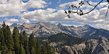
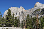
The Great Western Divide from the High Sierra Trail
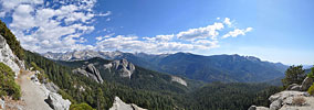
Meadows; but this time, it's a clear day - mostly sunny, but clouds are moving in from the east - and I get to marvel for the first time at all the vistas I'd missed out on coming in through the fog. And there is a lot to see. I descend the thickly-forested mountain from Bear Paw, pass under the scary landslide bluff, and cross the big boulder gully on the bridge. After climbing up another hill, the trail begins a mostly level course that it will follow all the way back to Crescent Meadows. I pass a pair of backpackers heading out, father and grown son, probably. I wish I could've hiked in the Sierra with my dad. The afternoon has become very hot, into the '90's, and at lunch, I cool off in a stream and catch up on some reading. I'm really enjoying soaking in the incredible new views I'd missed and amble along at a moderate pace, stopping again and again to take pics. The trail follows the contours of the mountains, ducking through thick woods into canyons and over streams, then out in to the sun, around giant boulders and off to the very edge of the mountain above formidable drop-offs. Some of the most breathtaking views of the Great Western Divide are from the High Sierra Trail, high on a cliff, with all of the distant, serrated peaks lined up above swollen granite domes protruding from a vast forested valley.

A weather front is moving in over the mountains for the weekend, but the early stages are just some dramatically puffy white clouds in a startlingly
Walk-through burn hole, east of Eagle View
blue sky. I can't get enough. A few miles later, I pass 2 more hikers, a pair of older guys taking a break from the relentless heat. Within the last few
A weather front moves in from the east
miles to Crescent Meadows, the trail leaves it's rocky, cliffside perch and enters thick forest again for most of the remainder of it's length. The no-see'ums come out in earnest as the sun slips behind thickening clouds. A fifth hiker, a young guy heading east into the worsening weather just like I did on my first day, is the final backpacker I'll see today.

Finally, I'm back at Eagles View lookout point, and the last mile to Crescent Meadow, which I reach at 5:30 in a swarm of insects. Asian tourists ask me which trail in the woods behind me is best for their after-dinner stroll, but keep their distance. I must look pretty grubby. I'm smiling. I thought I'd climb Moro Rock before leaving, but the sky east above The Divide was now too overcast for the hoped-for parting view. I'm relieved to find my car right where I left it - way dirtier but no worse for wear. I stow my gear and sink back into the plush seat like it was my first time in a car, with it's multi-level heating and AC and Surround Sound and wind and water and animal proofing and effortless conveyance - thinking how much we take this marvel of comfort for granted. I sneak a glimpse in the mirror - yeah, pretty grubby. Kinda smelly too.

Late afternoon sun breaks streamed through the forest canopy as I made my way out of the Giant Forest grove of ancient Sequoia's, probably for the last time this year. I sang a goodbye song to the immense trees and towering mountains and pristine lakes, then began the 250 mile drive down the mountain and back to sprawling, noisy LA, tired and dirty and hungry and happy that I'd challenged myself, endured hardship and successfully completed this long-anticipated journey, a formidable solo trek to one of the most magical places on the planet. On the long drive back, there is a lot of time to be reflective. To me, backpacking is much more than just a walk in the woods. To venture outside our civilized comfort zone, living in and for the moment among elements of consciousness-altering beauty and life-ending risk is a spiritual reawakening of the senses, a visceral reconnection with our primal heritage, a transcendant renewal of our sense of awe and wonder. There's a whole lot of sublime wonder out there that relatively few of us - the lucky ones - will ever get to experience firsthand. Sure makes a double cheeseburger, fries and shake taste good.
Trail / Conditions / Maps
The trails in Sequoia/Kings Canyon National Park are well-maintained and signed. On this hike route, there are 7-8 bridges over creeks, gorges and wetlands and even a tunnel.

The High Sierra Trail from Crescent Meadows to the junction with the spur trail to Black Rock Pass is about 30 miles. The first 11 miles are packed dirt/pine needles and relatively level. Beyond Bearpaw Mdw., it becomes mostly jagged stone and rock as it climbs up to Kaweah Gap and Black Rock Pass. In the Big Arroyo and Little/Big Five Lakes and the Cliff Creek Trail, it's mostly hard pack dirt and gravel.

Over 5 days, and 64 miles, total elevation gain/drop was approx. 9500 ft. up, 8400 ft. down.

Water is available year round on this loop route, from numerous lakes and stream crossings every mile or two.
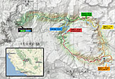
Trail map of 5 day lasso loop around the Great Western Divide in Sequoia National Park, California
The Sierra has long history of use by stock and you may have to share the trail with horses and mules at anytime.

In most of the park, permit holders have free reign to camp pretty much where you want, as long as you follow the basics - e.g., 100 ft. from water, use existing sites when you can, etc. The Ranger goes over the rules when you get your permit. In some places, like Hamilton Lake, you're required to camp in the designated campsites.

Directions / Permits / Links
From north Los Angeles, it's approximately 215 miles to the parks southwest entrance at Three Rivers, CA. It took me 3 1/2 hours up I-5, Hwy. 99 through Bakersfield and then Hwy. 198 east out of Visalia. From the park entrance, it's about 12 miles up the mountain to Crescent Meadows Rd. in Giant Forest, and about 17 miles to Lodgepole.

Wilderness permits are required for all overnight camping outside designated car campgrounds in Sequoia/Kings Canyon National Park. (SEKI). Day hikes do not require permits.

Reservations for a Wilderness Permit ($15) should be made online. Permits then need to be picked up in person the day before or before 9:00am the morning of the hike. Unlike other National Parks where you can pick up your permit at any Ranger Station, SEKI permits are issued based on the trailhead where you begin your trip and must be obtained from the permit station closest to your trailhead, which for this hike is the Lodgepole Visitors Center. Permits must be carried by the trip leader at all times.
During off-season, Sep. 26 - May 27—when the backcountry Ranger Stations are closed—there is no trailhead quota, no reservation required and Wilderness Permits are self-serve at the Visitor Centers and Permit Stations.
Sequoia-Kings Canyon National Park (SEKI) website
SEKI Wilderness Permit info and reservations
National Weather Service (NOAA) forecast for the Great Western Divide area of Sequoia National Park

Pictures
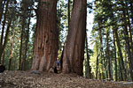
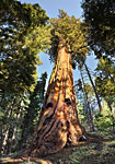
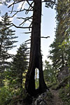
The High Sierra Trail (HST) starts in the Crescent Meadows area of Giant Forest, among some of the worlds largest trees. About a mile in, this conjoined giant Sequoia was split by fire.
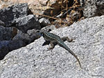
From atop boulders, brave and endearingly curious blue lizards study you as long as possible before dashing away.
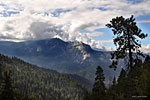
The sky was choked up with clouds on day one, and soon the forest was shrouded with mist and fog. Late afternoon brought drizzle and rain showers. Looking south at Castle Rocks.
 
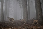
On that first foggy day, I came face to face with a black bear cub and numerous families of deer - this one a few feet from the Bear Paw Ranger Station on the climb up to Hamilton Lakes.
Morning dawns clear and dry on big Hamilton Lake. Looking east from the granite-lined shore up towards Kaweah Gap
Morning dawns clear and dry on Hamilton Lake. Looking east from the granite-lined shore up towards the ridgeline that holds Kaweah Gap
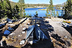
Hamilton assumes amazing shades of blue as you climb around and above it. The designated campsite area is above the flat rocks on this, the western lakeshore.
The HST ascends the north valley wall above the lake, the high cliffs of Valhalla peering out at right.
The HST ascends the north valley wall above the lake, the high cliffs of Valhalla peering out at right. Smallish lower Hamilton Lake is a short ways down the valley out of sight.
Giant trees along the shore fool the eye as to the actual scale
After a couple of miles up, the trail follows the contours of a large, deep crevice in the canyon where there's a tunnel. You can see a notch in the overhanging cliff where the trail turns in.
After a couple of miles up, the trail follows the contours of a large, deep crevice in the canyon wall, where there's a tunnel. You can see a notch in the overhanging cliff where the trail turns in.
The HST tunnel in the deep gouge of a side canyon
Hamilton Lake seems like miles below
The narrow trail skirts the lip of a very steep cliff
The trail climbs above treeline through grass and shrubs. This 180 degree vista west shows the sheer cliff escarpment known as Valhalla rising above the NW end (right side) of the lake.
The trail climbs above treeline through grass and shrubs. This panorama west shows the sheer cliff escarpment known as Valhalla rising above the NW end (right side) of the lake.
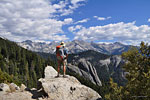
I climbed a boulder off trail to get this sweeping view of Hamilton Lk., her surrounding peaks, the High Sierra Trail and the valley west down to Bear Paw Meadow
A last look back at Hamilton Lk. and Valhalla before the trail climbs around the mountain
A Park Service trail crew takes a break above a brilliant blue tarn
Precipice Lake is almost completely hidden from the trail in a large bowl near the top of Kaweah Gap. The magical blue water color was lost in Ansel Adams famous 1932 photo taken here
Precipice Lake is almost completely hidden from the trail in a large bowl near the top of Kaweah Gap. The magical blue water color was lost in Ansel Adams famous 1932 photo taken here.
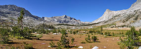
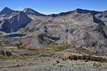
On the east side of Kaweah Gap, a new mountainscape is revealed. In this 230 degree panorama, Nine Lakes Basin is on the left (north-northeast) To the right is the grand rounded valley known as the Big Arroyo going due south, lined with tall, rugged peaks
First of the Nine Lakes. Streams cascade down from the others, which are beyond and above it out of sight behind the mounds.
View south down the Big Arroyo. It's several miles around the bend before the Kaweah range comes into view on the left
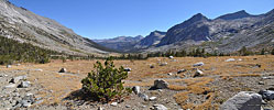
North from the Big Arroyo towards Nine Lakes Basin and Kaweah Gap, which is the deep notch on the left center side of the ridgeline, right of the tallest tree.
Deer (bottom center) cross Big Arroyo Creek out of the shadow of encroaching evening.
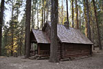
On day 3, the Big Arroyo cabin below Lippincott Mtn., where the Black Rock Pass trail splits from the HST, turning west and climbing 1200' to the Little Five Lakes.

180 degree panorama of the Kaweah's. After many miles of climbing up through the forest from the floor of the Big Arroyo, with only tentative, partial views through the trees, the trail at last reaches a ridge offering an unobstructed view of the dramatic Kaweah Range.
Ancient trees crowning the ridgeline above the Big Arroyo frame Red and Second Kaweah
An outlet stream of the first of the Little Five Lks. with its lush, grassy banks.
East across Little Five Lakes no. 1, the Kaweah range rising above it on the far side of the Big Arroyo.
Initial glimpse of the first of the Big Five Lakes, guarded by a rugged peak.
Much of Lake 2's north shore is tree-covered boulders. Between this natural levy and the forest are a series of shallow drainage streams connected by wetland meadows that parallel the shore
Much of Lake 2's north shore is tree-covered boulders. Between this natural levy and the forest are a series of shallow drainage streams connected by wetland meadows that parallel the shore.
The second Big Five lake is large and amoeba-shaped, with granite shores and islets.
View east over Big Five Lake no.2 from my campsite, Mt. Kaweah in the distance. The late afternoon colors were magical, and not retouched.
Early morning and farewell to Big Five Lake no.1
Climbing above the Little Five Lakes on the Black Rock Pass trail, looking back east at the Kaweah's.
Massive pines at the edge of the treeline

Looking back east and south from the Black Rock Pass trail over the Little Five Lakes plateau, and across the Big Arroyo to the Kaweahs
Near the top of Black Rock Pass, the grade is extremely steep, in places almost 40 degreesNear the top of Black Rock Pass, the grade is extremely steep, in places almost 40 degrees Final look back at the Kaweahs and most of the Little Five Lakes from the top of Black Rock Pass.
Final look back at the Kaweahs and most of the Little Five Lakes from the top of Black Rock Pass.
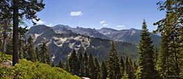
First look west at the Cliff Creek valley from the top of Black Rock Pass. At left are the peaks above Sawtooth Pass and 3 awesome stairstep lakes cascading into one another to form Cliff Creek.
Columbine Lake(top), Cyclamen Lake and Spring Lake, below massive sheer cliffs
A unique rock formation on the Black Rock Pass trail, which follows the valley west (right) down
.From the top of Black Rock Pass, the trail switchbacks endlessly down and still remains high above the canyon floor.
From the top of Black Rock Pass, the trail switchbacks endlessly down and still remains high above the canyon floor.
Looking back up to Black Rock Pass (top left), almost a mile up the mountain
360 degree pano of Cliff Creek valley 2 miles west below Black Rock Pass. Center left is east, center right is west
Looking east back up to the lakes basin
A horseman leads his mule train up towards Black Rock Pass
After the stark, rugged pass, the trail descends into a lush valley
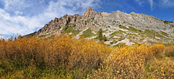
Fall colors in the high Sierra
Cascades splash down the canyon walls from high lakes
Rugged ridgeline 3 miles west below Black Rock Pass
The trail drops 1000's of feet as it descends the Cliff Creek valley. Looking east back up the mountain the way I came.
Ancient giant catches evening light in Redwood Mdw. grove
A black bear debates whether to continue up towards me on this giant dead Sugar Pine or play it safe. This is a screen capture of a video which I'll post when I get the file reduced for web viewing
The handsome log lodge at Redwood Meadows, boarded up for the season days earlier
Vista east from trail between Redwood Mdw. and Bear Paw Mdw
Vista east from trail between Redwood Mdw. and Bear Paw Mdw.
High dome mountain east of Bear Paw Mdw.
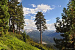
Canopy of immense Sugar Pines
View east of the peaks of the Great Western Divide from the High Sierra Trail west of Bear Paw Mdw.
The final day, looking back east and soaking up the views I'd missed on the foggy hike in
The High Sierra Trail to the Great Western Divide
As the HST winds around the mountains and returns west to Crescent Mdws., the Great Western Divide (left) slowly disappears from view. Just left of center is Cliff Creek valley, which I descended from Black Rock Pass. At right is Castle Rocks.
Land of giants
Land of giants
Magnicifent Sugar Pines tower over the landscape
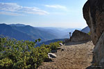
Looking west from Eagle View
Moro Rock at the southern edge of Giant Forest, draws closer, signaling the end to the journey. From atop the giant dome, there's a commanding 360 degree view of the park. People can be seen silhouetted on the summit from miles away.
  More photos in
the Trip Report
top of page

TOPHikes Index

Since 10.09