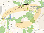
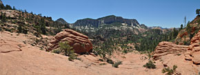
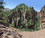
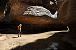
View Zion National Park in a larger map
Canyoneering in & around Zion National Park, UtahApr. 12-17, 2011
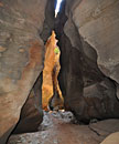
5 days climbing in and out of southern Utah's sublime hidden canyons


Overview

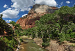
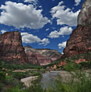
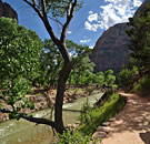
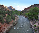
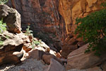
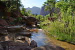
Zion National Park, near Springdale in southern Utah, is one of the countries most popular parks. Each year, over 2 million visitors from around the world are drawn to the deep canyons with sheer red cliffs soaring thousands of feet above a lush, green valley. The Virgin River has sculpted a magnificent landscape with fascinating rock formations. Once situated under the ocean, this part of the Colorado Plateau is characterized by water-formed desert geology and multi-layered sandstone called slickrock. In addition to cycling and rafting, miles of well-maintained trails offer panoramic vistas to every level of hiker. But hidden from view, there are myriad secretive canyons, wondrous subterranean passageways and exquisitely formed chambers filled with magical light, at times directly under popular areas and unknown to the casual visitors above. These are the realms of the canyoneer!


Canyoneering
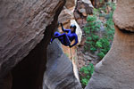
Canyoneering is the sport of hiking and exploring canyons using technical
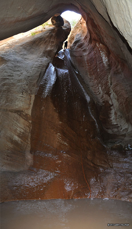
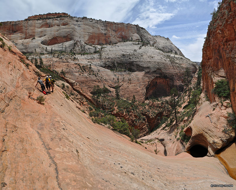
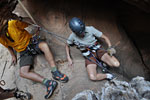
The final rappel in Pine Creek canyon
Canyoneering in Zion National Park, Utah
gear and skills, ie. ropes, harnesses, safety gear, and climbing and rappelling skills. Begun in Europe, where it's known as canyoning, canyoneering is a fast growing sport here in the US. Many of the most active canyoneers consider ground zero for the sport domestically to be Utah, famous for it's variety of beautiful and challenging canyons. Typically, canyoneering involves starting at the top and moving down the canyon; once you've rappelled a big drop and pulled the rope, climbing back up is not an option, so having done your homework beforehand is critical.

In addition to safe techniques and best practices, there are many things to learn about climbing and backcountry ethics when canyoneering. The best way to get started is to find an experienced teacher or join up with a professional organization. This is a sport that requires teamwork and typically, canyoneering groups number 3 to 5 people for safety and logistics.

By some estimates, over half of Zions canyons are considered technical or semi-technical. Along with the sublime beauty of these ancient slot canyons comes the risk of adventuring in to a remote wilderness where there is no cell-phone signal, rescue can be days away or non-existant, and danger awaits the ignorant and unprepared.
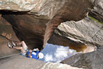
Keeper pothole
Keeper pothole
Many have multiple 100 foot drops and more. Some are filled with icy water and require wetsuits. Others have deep "keeper" potholes. All require athletic ability and backcountry hiking skills. And always there is the danger of flash-flooding.

This eliminates them as a destination for the majority of visitors, but backcountry canyoneering has become so popular, leading to several tragedies, that a quota system was instituted allowing access to limited numbers of hikers each day. All canyons where a rope is necessary in Zion National Park now require a permit, even for a short dayhike. The area outside the park, however, has many extraordinary canyons that don't require a permit. There are several outfitters around Zion that offer instruction and trips to these outlying canyons.

Canyoneering is not an "extreme" sport, but it's not without risk. When done correctly with preparation and planning by competent, equipped and informed participants, it's very safe. Canyoneers get the exhilaration of exploring some of the worlds most fascinating terrain - unavailable to any other.

The canyons explored this trip:
Birch Hollow
Keyhole Canyon
Pine Creek Canyon
Left fork of North Creek / The Subway
Lower Refrigerator Canyon
Behunin Canyon

Trip Report

During my last hiking trip to Zion in September 2009, I learned about the spectacular hidden canyons here that required ropes to explore. I had no technical experience, but I decided that on my next trip here, I'd be prepared. I had to see them!

Zion would be the first leg of a 2 week trip in June of 2011. I'd spend a week there, then 3 days exploring Buckskin Gulch and Paria canyon to the east, and finishing up with a Rim to River hike in the Grand Canyon. I also built in time to relax in between. At first, I only planned to hike the Subway, eastern Zion's iconic tube-shaped geologic wonder, not considered technical, and the Narrows, a 15 mile overnighter in the bed of the Virgin River that any backpacker can hike. Permits for these coveted trips are snatched up early in the year in a lottery, but I did my homework and scored a reservation for each.

To get ready, I did a lot of online searches, checked out tons of pics, lurked at canyoneering forums like Bogley.com and Yahoo! Canyons groups, where I learned of the debates about over-usage and permits, about minimum impact and Leave No Trace climbing, about bolts vs. natural anchors, about who's who in the community, about preferred gear and special canyoneering equipment. I read canyoneering primers and trip reports and poured over accident descriptions, grim statistics and narrow escapes. Then I posted a message looking for an experienced Zion canyoneer who would take me through. I offered to buy dinner and carry the ropes. Guiding for hire is illegal in Zion National Park.

High water in the Subway. From the park service website June 12, 2011
High water in the Subway.
An unusually wet 2010 winter had left snow on the ground throughout the Colorado Plateau much later than normal. The big run-off had damaged all the Narrows campsites and the river was too fast to hike in, so the Park Service had yet to open the Narrows for hiking. Their website had an image of high and fast water in the Subway too, so I was apprehensive that it might be more of an ordeal than fun. As my trip approached, I monitored the Zion weather reports carefully.

A few weeks before my trip, I got lucky and received a note from Rick T., an experienced canyoneering group leader from Salt Lake City, whose rafting trip fell through and now had a week free to do Zion. Rick is the consumate canyoneer, an excellent climber and canyoneering leader of the Wasatch Mountain Club, a venerable Utah outdoors club. He has years of experience leading groups into almost every Zion canyon and throughout Utah and environs.
Me, Brandon, Carrie, Rick
Canyoneering crew 1

Gina & Tim R., Tim P., Rick, me
Canyoneering crew 2
With his agility and confidence climbing big boulders, you'd never guess he's a retired father of 5 grown children, as I found out. In addition to the Subway, he invited me to spend several days exploring some of the slot canyons in and around the park with him and some others who would join us. I was pleased that I'd have other canyons to explore now that it looked like both my planned Zion hikes were in jeopardy.

Next I bought a harness, belay device, helmet and got some experience rappelling with some friends locally. Finally, I splurged on sticky-soled canyoneering shoes and a wetsuit, rather than rent them.

On Sunday June 12, I drove the 440 miles from LA to Zion in about 7 hours. The park's campgrounds always fill up early in the day, so I found a spot to camp a few miles outside Rockville at the Coal Pits wash area, a Bureau of Land Mgmt. (BLM) property. It's free to camp for 2 weeks on any BLM property, so you can expect all sorts of uncontrolled behavior from every kind of person here.

In the morning, I found a large site at Zion's South campground suitable for a group, and hooked up with Rick and two others - his nephew Brandon and wife Carrie from Idaho, both with some experience rappelling who were tough, natural hikers and rafting enthusiasts. We'd spend 3 of the next 4 days canyoneering together as a group and by the last day, the four of us had started working like a team, watching out for each other, managing the ropes. They graciously didn't splash me when I had my camera out. Rick always led on the trail, set up the anchors, monitored our rappeling and was the last down. I usually went first so that I could get some nice pictures. We took turns belaying each other on the big drops. Brandon and Carrie left on Thursday night, and on Friday morning, we were joined by experienced canyoneers Tim & Gina R., and Tim P., all from Salt Lake City, who had been on outings with Rick before.

We begin each day with what will become our morning routine, queueing at the Backcountry window of the nearby Zion Visitor Center to secure permits for the following day. Walk-in permits are only available one day in advance, or the day of the hike, if any are left. This line often has an interesting mix of canyoneering veterans and newcomers, most of whom are looking to score the 20 walk-in permits to the Subway available each morning. 40 other reservable Subway permits for each day are won in the Lottery months earlier. (I have two reservations I won long ago for Wednesdays's hike.) One person can take 12 of the 20 for his group. On the first day, there are about 15 people waiting for the window to open. When the Ranger arrives at 8:30, the first person in line - who's been here since 4am, I find out - takes 12 permits for his group. The second guy takes 8. Everyone groans and leaves..
Day 1: Birch Hollow
Climbing in to Birch Hollow, Zion National Park, Utah
Birch Hollow is outside Zion Park, on the North Fork road to Chamberlains Ranch, so no permit is required. A two car shuttle is necessary, one left at the trailhead, one at the end. Birch Hollow starts with a scramble through dense brush, down slippery dirt slopes, then enters the stone
canyon for several short rappels over obstacles, a series of 50-100 foot raps, and ends with a 3 mile hike out in the hot sun. It took us about 3 hours to get through the the canyon. A trickle of a stream accompanied us the entire trip but Birch is often dry this time of year.

After a 30 mile drive to the trailhead, and dropping off the 2nd car, Rick, Brandon, Carrie and I get started at 11:30 and make our way down the stream bed. It's already a hot morning and we quickly work up a sweat. After a mile of scrambling, the stream ends in a 75 foot cliff. We're a little anxious that this big drop will be our first rappel of the trip and Rick plays up our concerns with good-natured ribbing. He then leads us on a steep detour path around and we continue. It's common to rappel that drop, but I'm relieved just the same.

Our first rappel is a 50 footer near a cooling spray of stream water. Next come several boulders we rap over. Further down, the canyon becomes deep and slotted and beautifully warped. A 60 foot drop into a wet half-tube and on to a platform, then down into a pool is pure pleasure. Continuing down, we drop in to several wet caverns and finally in to a magnificent warped stone chamber with a big rock stuck in it, the highlight of Birch Canyon.

We exit into the heat of the afternoon, make our way up canyon to a massive slide where a big piece of mountain has come down, filling up the canyon with hardened mud. We make our way above the drainage, to a high rocky spot over the canyon with big view down. Then we follow the stream bed for a mile, dispersing a herd of cows in tall shrubs. Finally, we're on a dirt road for a long slog up, up, up 2-3 hot miles to our shuttle car. Later, we all drink thirstily and eat big helpings at the Pizza Noodle restaurant in Springdale.
Day 2: Keyhole canyon, Pine Creek canyon
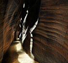
the Hallway of Keyhole canyon, Zion National Park, Utah
Keyhole and Pine Creek are situated in close proximity to each other, up Hwy. 9 past the tunnel, so we'd do one before lunch and one after. Keyhole is a short romp and return to the car, while Pine Creek requires leaving a shuttle car down the mountain at the exit. We take two cars so we can do both hikes without returning to camp. Both canyons are mostly rock and sand hiking with numerous pools and corridors of varying levels of cold water, from ankle deep to chest deep swims, so we wear our wetsuits all day.

We take two cars up the mountain several mile beyond the tunnel, park at a pull-out and climb up a steep slickrock hill. The entrance to Keyhole is at the bottom of a steep, slippery hill. We don our wetsuits and drop in to the cool, wet slot and make our way through twisted stone hallways and chambers. Reflected light filters in from above. A few down climbs and short rappels and we're out the other side in about an hour, having lunch at the cars in the hot sun.

After our shuttle car is dropped off down the mountain, we begin our hike from the parking lot at the east end of the Mt. Carmel tunnel on Hwy. 9. Two groups have entered Pine Creek just before us, but both have a good pace, and we get to experience the canyon mostly to ourselves. Once under the highway bridge, there's some tricky manuevering around the deep, warped chasm ledges, then we rappel in.

Pine Creek canyon, Zion National Park, Utah

Pine Creek canyon, Zion National Park, Utah
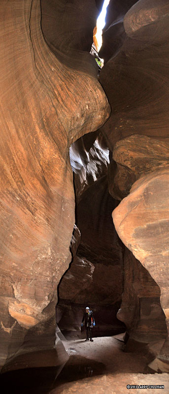
Pine Creek canyon is a deep crack in the mountain and one of Zion's hidden gems of light and stone. We make our way into shallow pools, over boulders and flood debris and through chest-deep hallways of water. The absence of direct sunlight and presence of multiple pools of cold water make a wetsuit mandatory for this mid-June hike. The thickness of your wetsuit makes a difference, as there is 2+ hours in the canyon before reaching sunlight, and a big drop at the end that will be much easier if you're not shivering. My 4/3 wetsuit keeps me well-insulated.

At the Cathedral, we drop 20 feet in to a deep, shadowy pool, swim across and clamber out onto some rocks before unhooking. This big, dramatic
Making my way down Pine Creek canyon. Photo by Rick.
silo is filled with light at certain times of day. But there are many others sights to discover and my neck aches from constantly looking up. I keep my Nikon DSLR in a dry bag, but face the photographers dilemma every time I take it out. In a waist deep slot canyon, the camera can be ruined with a single accidental splash. I find that despite my hands staying wet, I'm able to keep my camera relatively dry, thanks in part to my hiking companions indulging me.

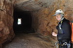
We exit the slot canyon onto a ledge of giant boulders beneath soaring red walls of stone, and still a long ways up from the exit. High above is a ventilation window for the Mt. Carmel tunnel. Some climbing and another rappel put us at the final drop - a 100 ft. free ride onto the deck via a big hole through a warped pitcher of stone. Rick shows me a well-anchored log protruding over the abyss from which I can get some nice shots of the others going down. We finish the rappel portion among big, calved boulders, strip off our wetsuits, have a snack and get ready to re-enter the hot afternoon sun. We climb, boulder-scramble and route-find down creek in about an hour, and jump in the big pool at the exit, where a running flip off a slanted boulder gets you bonus points.
Day 3: Left fork of North Creek - the Subway
The Subway hike begins 25 miles up Kolob Reservoir road in the east plateau of Zion. At mile 15, we drop one car at the Left Fork trailhead, our exit trail, and continue north 11 miles
Slickrock plateau above Russell Gulch
to the entry trailhead at Wildcat Canyon. The hike starts with a mile through cool pine forest, then another navigating a wide, slickrock plateau in the sun to the lip of a gorge - Russell Gulch - where North Creek flows 250 feet below. After a steep climb to the stream bed, we wade through a waist-deep pool, then find a spot to take a break. After lunch, there are a series of obstacles to overcome.
My wide angle lens makes the first obstacle look small.

The Obstacles
The first obstacle on the Subway hike is the big boulder encountered from above. It's a 6-10 foot drop into sand or shallow water from about anywhere, but no technical gear is necessary. There are 3 options to get down. You can downclimb the crack where the boulder rests against the wall, you can lower yourself down the Rabbit Hole - possibly with a strap, or go on top of the boulder, downclimb the face as low as possible and launch yourself in to the creekbed. On this hike, there was 3 feet of water to land in. Rick aces the 15 foot crack downclimb option, dropping skillfully to the sand and helps me find slivers of footholds. Using sticky canyon shoes, wedging and lowering yourself as much possible, you can reach a better 6 foot drop to the sand. The Rabbit Hole option can be almost too dark to see in to from the brightness outside, but is clearly the easiest when assisted from below. The leap from the face should be the last choice. Leaps and bad landings are the number one injury in Zion, requiring expensive evacuations every year.

It would be a mistake to underestimate this first obstacle. The rock is bigger than it appears, the years of traffic have made it slippery, the crevices are dark and the cracks you need to jam your foot in to are out of sight below. The smooth-looking sand you might leap onto could have jagged boulders hidden just under the surface. You could easily twist an ankle jumping or falling here if you didn't have an experienced canyoneer to show you the way, help you out and to make it look easy.

Just downstream, Rick demonstrates swimming through the underwater tunnel at the Black Hole of the Subway.

The second obstacle comes within half a mile - the "cannon ball", a round boulder stuck in a narrow, water-filled slot. Even with the added log from the 2010 winter, it's still a short wade, duck under and easy 30 foot swim, but the water is very cold.

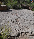
The Dinosaur Tracks. Left fork of North Creek, Zion National Park, Utah
As we make our way toward the center of the hike, the stream channel starts forming the familiar tube-shaped base. The cliffs become more vertical and the walls come together. We manuever around the slippery 6 foot drop at Keyhole Falls by swinging tarzan-style with a piece of webbing through the Keyhole, off a ledge in to the stream.
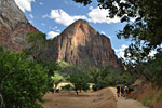
Around a bend is the final obstacle, a 15 foot platform above the iconic main section of the Subway. This sloping ledge has been free climbed, but we have a rope to make it easy. The sun highlights the cascade of green pools. We wade through some waist deep crevices and round a bend to the Shower, where the stream drops into a conical chamber from above.

The stream has become wide and we walk down the slippery center on the flat bedrock through dozens of cascades. Soon the big walls close in again, and there are rockslides and downed trees to navigate, boulders to climb and flood debris to scramble around. Then come 3 miles of route-finding down an un-maintained stream-side path, crossing the creek dozens of times, climbing boulders and dropping down cracks, scrambling through branches and over downed trees. There is no path, and then there is one, then none. It's tiring effort in the heat, though there is some shade and it's all down hill. Close to 4:30pm, we pass a young guy and a struggling older man doing the "bottom up" route, starting from our exit trailhead about 3 hours previously. They look beat and still have an hour of scrambling up hill, then 3-4 hours back. I don't even ask if they have headlamps.

Dinosaur tracks
We take a rest at the Dinosaur Tracks, a broken slab that has fallen to the creek, with some famously well-preserved footprints. I'd never seen them and didn't know what to expect. I have to admit to being under-whelmed, as the Tracks look like some concrete slag dumped out of a truck onto a slope. This pic might save you a long hot hike, if you don't know what to expect. Another 1.5 miles of scrambling along the stream is the trail to climb out.

This is it
The sign

The sign for the climb out
After almost 3 hours scrambling down canyon from the Subway, it's time to look for the trail to climb out, marked by a footprint sign. When the high west side ridges down canyon appear predominantly black after miles of red, it's time to be on the southwest/righthand side of the creek, in order to see the sign. We run across a young couple at the bottom of the very steep switchbacks from the rim. They're hiking to see the Dinosaur Tracks. They look dressed for a round of golf. How far?, they ask. I ask helpfully if they'd know the Tracks if they saw them. When they say no, I explain what they look like. They survey the tangled path for a few moments, consider the exertion and time, and climb all the way back up the hill again.

The final segment begins with a steep climb up a half mile of switchbacks. Once out of the canyon, we traverse some woods and are back at the shuttle car before 6pm.

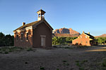
Grafton ghost town.
Grafton ghost town.
Grafton ghost town
After fetching both cars, we take a detour off the highway back to visit the ghost town Grafton, about 6-7 miles over a bridge, then down a dirt road in Rockville. Established in 1859, Grafton was settled as a farming expansion from Springdale, but flooding and Indian attacks led to it being abandoned. Several buildings are restored. The surrounding area is privately owned, well-kept pasture.

Afterwards, we head to Oscar's Cafe in Springdale, where a lovely young lady serves us giant burgers and sodas on the patio.
Day 4: Lower Refrigerator canyon
On the picnic ledge of Lower Refrigerator canyon, Zion National Park, Utah
When you're ready to scare the @#! out of yourself, Lower Refrigerator has that kind of sheer vertical, one-way, no-turning-back, go-for-it adrenaline rush to thrill even the most grizzled noob.

We begin with a steep hike from the Grotto bus stop, up the West Rim trail towards Angel's Landing.Dropping off the trail before the bridge, we squeeze down a crack to the canyon wall and rope down 35 feet to a picnic size ledge on the face of a 350 foot wall. We pull the rope and discuss our descent. 140 feet down and out of sight is a sliver of a ledge that we'll drop and clip in to. The ledge is the halfway point, and reportedly has only space for 3. In addition, we have to make sure the rope doesn't slip away when we pull it from below, so we go over a series of rope manuevers.

Rick goes over first, finds the ledge and sets up the rope for the final rappel. The rest of us rappel to the exposed ledge and safety in. Then we pull the upper rope. Adrenaline levels peak as we each step off the ledge and lower ourselves down the final 190 foot drop. The last 100 feet are free!

It's a short scramble from the base to the West Rim trail. In no time we're back on the shuttle bus, trying to casually fit in among the crowds of tourists who have walked a tiring half mile on a paved trail. Once again we hit the Pizza & Noodle for the couple's last night.

Day 5: Behunin canyon
The first rap of Behunin canyon, Zion National Park, Utah
In the morning, we're joined in camp by 3 new experienced canyoneers who have been on outings with Rick before - Tim and Gina, and Tim P.

Behunin starts with a steep hike up the face on the West Rim trail, then a series of rappels in a steep-walled canyon connected with sandy hikes through crevices.

The five of us catch a shuttle bus at the Visitor Center, get off at the Grotto stop again, and up the West Rim trail again, this time past Scout's Landing and Angel's Landing, up another mile and across a slanted plain of stone. We scramble through a narrow slot and scramble along the overgrown canyon, then Behunin opens up with a sweeping vista of sandstone and cliffs, the first rappel.
With an experienced crew, we move smoothly through Behunin, dropping down big terraced walls, manuevering over pockets of water, taking time to try a guided belay over a pool. We rappel over formidable obstacles, down several steep levels, down onto a ledge of no-turning-back, high in the air. Then we finish Behunin with the 165 footer, scramble through some brush and are back on the trail out in 4 hours.


I learned a lot about technical climbing on this trip. And about my own preconceived limitations - how big a drop is too big, etc. (Our biggest drop was 190 feet!) The one thing I learned that stood out among all the others is that having an experienced and accomplished group leader is the key to an enjoyable experience vs. an ordeal. These canyoneering adventures involved taking big leaps of faith that the anchors are secure, the ropes are in good condition (and long enough!), that we have the gear and skills to get out in an emergency, that we bring wetsuits to the canyons that need them, etc. There's a lot of pressure on the group leader who brings untested strangers into the canyons to keep it fun. Canyoneering adds many variables - e.g., the importance of weather and conditions, new obstacles that have appeared over the winter, pulling the ropes and bringing the right gear - that add to the effort of hiking in the wilderness. It's especially nice to safely run these canyons without having to know everything, and just be able to enjoy the moment. So a big thank you to Rick, our fearless leader!

Now I'm addicted. I want to come back and do the more challenging Zion canyons like Imlay and Heaps, and others in the vicinity. The entire Colorado Plateau is a smorgasbord of canyoneering adventure. I'll certainly be joining the American Canyoneering Association to find some more of this closer to home. Hanging from ropes over cliffs isn't for everyone, but if you miss these exquisite, hidden canyons, you miss experiencing the most memorable parts of Zion.

Info
Zion is 170 miles northeast of Las Vegas, Nevada
Zion National Park is located next to Springdale, in southern Utah, about 3 hours drive east of Las Vegas, and is open year round. Entrance fee is $25 per vehicle per week. The large, modern Visitor Center at the south entrance is the park's hub. It has exhibits, a souvenir store, information desk and clean bathrooms. The Backcountry Ranger station is inside, but also has an outside window that is open at 7:30am, before the Visitor Center is open. There are taps in the courtyard to fill up with all the fresh drinking water you need for your hikes.

The main Zion canyon is closed to cars. All visitors park in the large Visitor Center parking lot and take free articulated shuttle buses, which run every few minutes and stop at every stop. This parking lot fills up by noon each day, so overflow lots are available throughout Springdale. Free shuttle buses run a regular schedule from Springdale to the Visitor Center. Guests of Zion Lodge are allowed to drive in the main canyon as far as Zion Lodge, but you must display a guest pass.

Springdale is a small but lively tree-lined town along the Virgin River, with many motels, good restaurants, shopping centers, 2 decent grocery stores, banks, outfitters and a theater. If you can't find it in Springdale or Rockville, there's a Walmart in Hurricane. My favorite places to eat were Oscars Cafe and Pizza & Noodle Company.

Camping
There are 2 very large public campgrounds in the park - Watchman Campground and South Campground, both near the parks southern entrance. Watchman spaces are completely reservable, while South is completely first come, first served. I've found that it's not difficult to get a space at South, even during a busy weekend, if you arrive at 7:30-8:30am. Prices in June 2011 are $16 a night per site. You're allowed up to 3 small tents per site, but only 2 vehicles. There are numerous bathrooms with cold-water sinks, mirrors and flush toilets. There are taps for fresh drinking water near the bathrooms. You can get a shower in Springdale - see info at right.

There is also dispersed camping on Bureau of Land Management (BLM) - a federal government agency - property at the Coal Pits Wash, a signed pull-out on the north side of Hwy. 9, 2 miles west of Rockville. Two weeks of free camping is allowed on all BLM property, but expect unregulated, festival-type behavior. The Wash is only a trickle -bring your own water. Across the highway on the south side, a dirt road leads to another less-known public campsite, big enough for a group. The BLM owns a sliver of property on both sides of the Wash and along the Virgin, although the surrounding land is private. A 4WD is recommended to go down into the deep sand there.

Permits
Zion has a far-reaching permit system governing backcountry hiking. Permits are required from the Zion Backcountry Ranger office, located in the Visitor Center, for all overnight hiking and for every canyon requiring ropes during the 3 most visited seasons. Permits can be reserved online months in advance, and some are held for walk-in visitors too. The NPS website has extensive information on every Zion hike so you can plan your backcountry visits months beforehand. It would be wise to join up with an experienced group for your first backcountry canyoneering trip. Guiding for hire is not allowed in Zion National Park, but the surrounding areas are unregulated.

Planning
Summer in southern Utah can be scorching hot -over 100 degrees F. is not unusual. Hikers need to carry more water during the hot months. In the winter, it snows and stays cold into the Spring. Water levels are carefully monitored and many canyons like the Virgin Narrows are routinely closed well into June. Whenever it rains, there is a potential for flash floods. Even a storm over the horizon can bring flooding, so keeping on eye on the forecast is essential to any backcountry plans.

Popular spots to visit in the main canyon are Emerald Pools, an hour hike from the Zion Lodge stop, the River Walk, a paved, mile long path beside the Virgin River in the Narrows at the last shuttle stop, and Angel's Landing, from the Grotto stop. Angel's Landing involves a steep 5.4 mile roundtrip hike on a paved path to Scout's Landing, then an adrenaline-fueled, scrambling climb up a sheer cliff face to the park's most iconic vista. There are chains bolted in the rock at the most exposed sections, but Angel's Landing isn't recommended for the unfit, the elderly, pre-teens or those with fear of heights. Another outstanding overlook hike is Observation Point, a strenuous 8 mile roundtrip to the high rim far above Angel's Landing. Bring lots of extra water on this one. No permit is required for any of these hikes.

An enjoyable drive is up Highway 9 to the colorful formations on the east side of the park and through the Zion-Mount Carmel tunnel. Those who are passing through Zion on Highway 9 still have to pay the entrance fee. If you leave the park, make sure you keep your receipt handy. The Kolob Plateau on the east side of the park is less traveled, but has nice views also.


Zion National Park Service website: www.nps.gov/zion
Zion Backcountry Ranger desk in the Visitor Center: 435.772.0170
Current National Weather Service forecast for Springdale UT

Camping
All national park reservations: recreation.gov (self) or 877.444.6777 (fee)

Food
Oscars Cafe
948 Zion Park Blvd., Springdale UT 435.772.3232
Pizza & Noodle Co. 868 Zion Park Blvd. Springdale, UT 435.772.3815

Public showers
Zion Rock & Mountain Guides 1458 Zion Park Blvd., Springdale UT 435.772.3303 $5/up to 8 minutes, honor system. Cash only. Sink & mirror, bring your own towel, soap, shampoo. In front of store. Call for hours.

Canyoneering
Zion Adventure Company 36 Lion Blvd. Springdale, UT 435.772.1001 Well-equipped canyoneering outfitter for equipment, gear rental, guides.
bogley.com Focused on Southwest outdoors, busy canyoneering forum
Yahoo groups - Canyoneering Active and involved canyoneers, mostly Utah and Colorado Plateau
CanyoneeringUSA.com Zion Canyoneering guidebook author Tom Jone's info/resources site
American Canyoneering Association canyoneering.net A non-profit advocacy organization to promote safety, education and training; with forums, trip reports, photo galleries & more
.

Pictures

Around Zion
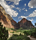
Zion National Park is a canyon land formed by the power of water, with sheer vertical walls and deep, twisted slot canyons.
The Virgin River flows through the center of the park, benign and idyllic. But flash floods can turn it into a raging torrent of mud and debris.
Over millenia, the river has scoured and carved the red rock in to majestic landscapes.
The bridge at the Grotto bus stop is the beginning of the West Rim trail to Angel's Landing.
The Virgin River is running higher and faster in 2011 than usual due to a record wet winter and snow accumulation.
Colors of dusk transform the river  from its customary reddish brown hue.
Colors of dusk transform the river from its customary reddish brown hue.
Sunset in Zion
Sunset in Zion
Pasture at dusk in Springdale
Restored buildings at Grafton ghost town
     

Day 1 - Birch Hollow
__________________________________________________________________________________________________________________
The streambed we're scrambling down ends at this 80 ft. waterfall. We take a steep path around to here.
Once in the stone canyon, this is our first rappel. The water spray was refreshing in the hot sun. Birch Hollow is usually dry, but it was a wet winter.
Making our way down canyon, the high walls provide relief from the hot sun.
We rapped several obstacles that the more experienced might down-climb.
The chockstone adds a unique touch to this last rap in Birch Hollow. Then, a long hike out in the hot sun.
Another careful descent over slippery rocks in to a pool
A 75 ft. drop down a slick half-tube is the halfway point for this rap...
...which finishes in another pool. You can see the top half-tube behind the peops.
Avoiding slipping and banging your elbows and knees is difficult
Another short drop in to another pool
Climb over a boulder, avoid a slippery tree, in to a pool.
Drop through a warped, water-carved cavern
 

Day 2, am- Keyhole Canyon
__________________________________________________________________________________________________________________
Climbing in to Keyhole Canyon, Zion National Park, June 2011
Climbing in to Keyhole Canyon, Zion National Park, Utah June 2011
Keyhole begins with a steep climb up the slickrock from Highway 9.
Keyhole begins with a short steep climb up the slickrock from Highway 9.
Then a butt-scraping scramble down a vertical trail of loose dirt and slippery rock.
Then a butt-scraping scramble down a vertical trail of loose dirt and slippery rock to the stone canyon entrance.
Keyhole is a brief but cool water-filled slot. Time to don our wetsuits.
Keyhole is an all too brief water-filled slot. Time to don our wetsuits.
Colorful light in Keyhole Canyon, Zion National Park
After some swimming, this hallway of light
As clouds pass overhead, the light flickers and fades. In less than an hour, we are out the other side into the hot Utah sun for the short hike back to the cars on the highway.
As clouds pass overhead, the light flickers and fades.
FInishing off Keyhole with a cooling passage under the highway.
Day 2, pm- Pine Creek canyon
After lunch at the car nearby, still in our wetsuits, the quick descent into Pine Creek Canyon starts with a splash.
From moment to moment, from corridor to corridor, the light changes moods.
Wading in murky waist deep water with an expensive DSLR is risky but rewarding.
The Cathedral of Pine Creek canyon.


Each bend in the canyon walls rewards us with more sublime light. My neck ached from gaping upwards.
Rarely in direct sunlight, the cool canyon sometimes opens up to glimpses of the hot landscape above.
.Finally we exit the slot onto a plateau high above the canyon floor, beneath sheer vertical walls
Finally we exit the slot onto a plateau high above the canyon floor, beneath sheer vertical walls
Making our way down giant boulders to our final 2 raps.
The last drop at Pine Creek has an awkward entry that requires squatting and launching sideways into the abyss. A few steps on rock - then 100 ft of air!.
The previous group finishes down below as we drop in.
How much water would it take to carve this hole?
There's gurgling spring at the bottom. We strip off our wetsuits, bag our ropes and have a snack.
We pace ourselves to give the previous group plenty of space
Rick glides down the final 100 footer at Pine Creek canyon.
There's still an hour of tricky scrambling down canyon in the hot sun, not without mishap, to get out.
A big free rap like this is much more challenging when you're thoroughly chilled after hours in the cool, wet canyon.
Our Pine Creek journey ends with a rewarding splash at the swimming hole at the bottom.

Day 3 - Left fork of North Creek - the Subway, from the "top down"
__________________________________________________________________________________________________________________
Two miles in, this panorama south and east as we exit a pine forest and cross a slickrock landscape.
A cliff edge perch offers this view down into Russell Gulch and North Creek, which we'll descend to at right via a steep vertical trail.
Once down on the water, we climb through unique rock formations and through icy pools.
Around every bend are intriguing new shapes and colors.
Much of the hike is in the creek bed itself, made easier with our special water shoes.
New obstacles from the  record flooding of Winter 2010 are now lodged in the narrow channel that holds Keyhole Falls.
New obstacles from the record flooding of Winter 2010 are now lodged in the narrow channel that holds Keyhole Falls.
The Keyhole and Keyhole Falls of North Creek
The lower canyon walls begin to take on a distinctive tubular shape.
The play of light and shadows in these deep canyons is a feast for the eyes.
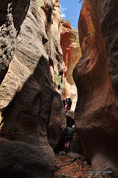
It helps to add human scale to appreciate this chasm of stone
A tree lodged in the watercourse is an icon of the Subway
Although there were 60 others permitted in this canyon today, we had this magical place completely to ourselves until the end of the day.
It's easy to stand in this remote canyon in the wilderness, listening to the wind in the trees, the birds and the water, and imagine you are the first ever to experience it.
I brought my wetsuit after seeing big water images on the park website, but the water was low and slow as Rick predicted. I didn't take it out of my pack.
I brought my wetsuit after seeing big water images on the park website, but the water was low and slow, as Rick predicted. I didn't take it out of my pack.
By early afternoon, we must be close. Every bend adds to the anticipation.
Finally, we arrive at the iconic Subway scene. We were lucky to get the full sun on these pools as the light changes dramatically from hour to hour
This ledge prevents "bottom-up" Subway hikers from continuing up stream without a rope.
The famous pools and curved wall of Zion's "Subway"
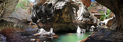
The Subway, Zion National Park, Utah. It was a thrill to have this magical garden of stone and water completely to ourselves. This 180 degree pano is a compilation of 6 images.
The Subway, Zion National Park, Utah
It was a thrill to have this magical garden of stone and water completely to ourselves. This 180 degree pano is a compilation of 6 images.
In contrast to its noisy, dirty urban namesake, this Subway is a truly special place, one of the most wondrous natural creations I've seen.
These parallel crevices could be interpreted as the "tracks" of the Subway
High canyon walls keep people both in and out of the the Left Fork of North Creek. You can see Rick in the shadows bottom right.
Cascade below the Subway
After this wide stretch of open water, the creek bed becomes choked with giant boulders, landslides and overgrowth. Much of the remaining 4 miles are scrambling, boulder-hopping and route-finding. Then, a final strenuous climb to the rim and we're out.
     

Day 4 - Lower Refrigerator canyon
__________________________________________________________________________________________________________________
The route to LR follows the West Rim trail to Angel's Landing - one of the most popular hikes in Zion. It starts with a steep climb up the face of this cliff.
LR is a short but sheer vertical drop out of the right side of the saddle in the center. It's difficult to gauge how big and steep the climb is from a photo.
Starting up the face, you can see the verticality of the walls we'll soon be rappelling down.
 
From the bridge over Refrigerator Creek, this is the view into the narrow crevice where we begin.  LR is a rather new route yet to be listed by the Park Service.
From the bridge over Refrigerator Creek, this is the view into the narrow crevice where we begin. LR is a rather new route yet to be listed by the Park Service.
Staying discretely quiet to discourage the unprepared from following us, we make our way to the exposed precipice.
We can't see the ledges we'll need to land on. It's a long way down!We can't see the ledges we'll need to land on. It's a long way down!
After some tricky maneuvering, we land on a platform 400 feet up with this sweeping view. Then come long moments strategizing our drop to a tiny exposed ledge halfway down that has room only for 3 of us.
Back on solid ground after the final rap, belaying for the next to appear over the edge.
The verticality of this rugged face adds to the drama of a challenging rappel.
The last rap at Lower Refrigerator
Our fearless leader Rick making it look easy.
Watch out for the poison ivy at the bottom!Watch out for the poison ivy at the bottom!
The big adrenaline surge slowly dissipates on the scramble back to the trail.
Now it's just another walk in the park back to the shuttle bus and camp, but it feels hard to blend in among the tourists on the bus after such a rush!
       

Day 5 - Behunin Canyon
________________________________________________________________________________________________________________________________
A new crew, a new day. Up the West Rim trail again, and the Walter's Wiggle stairs.
After 50 minutes of climbing, we pass Angel's Landing, and continue up the mountain.
Behunin runs right to left at the base of the big wall before us.
Setting up the first drop at Behunin canyon, Zion National Park, Utah
A wide slanted slab drops us into the narrow, overgrown entrance to the canyon.
A wide slanted slab drops us into the narrow, overgrown entrance to the
The big wall over Behunin
Coming down the first drop
Tim R. is first down to the edge.
One by one, all 5 of us make our way down to the edge. We use the tree to anchor the next drop.
Over the edge and down 150 ft. to a small platform filled with water.
Happiness is distilled into a big wall and adequate friction
We all try to avoid dropping into the pool
Waiting on the platform for the final climber
Rick prepares the anchors
Down we go again.
Down we go again.
A multi-level drop leaves us on another plateau
From here, we break out from the tall peaks and the main Zion canyon comes into viewFrom here, we break out from the tall peaks and the main Zion canyon comes into view I learn that using bags is an efficient way to manage ropes
I learn that using bags is an efficient way to manage ropes
Tim R. is first to take the plunge off a 120 footer
Tim P. goes over. Note the rope grooves in the rock.
The Arch of Behunin and Rick on a 120 footer.
Ropes bagged, we hike shady corridors through the sand to the next drop.
Steep walls of Behunin
     
We'll set up a guided rappel - like a zipline - over this pool. Tim P. is volunteered to go first, which means a dunk in the chilly water. Poor guy doesn't get to warm up again for an hour.
Once he's below, our "meat anchor" finds a spot to wedge himself in
Then the rest of us lower ourselves over the pool

The entry is an awkward transition, but it beats getting wet.
Our next rap is an obstacle course over ledges and water-filled caves
Keeping the lines straight and untangled is an important job for the last one down
Gina shows this 130 footer who's in charge
A rainbow of slings reveals a lack of trust in any one
This drop has a tricky ledge to overcome.
Pulling the rope can be intense and nerve-wracking. If it gets stuck, then so do we, 200 ft. up. Rick and Tim flip it simultaneously and it comes loose.
Using dual anchors on the final 165 ft. rap at Behunin
Ever watchful group leader Rick makes sure everyones safe
The down crew waits under the giant boulder for the last one down
 Rick floats to earth and Behunin is done
Rick floats to earth and Behunin is done
We pack the ropes, then a quick scramble through brush and we're back on the trail to the Emerald Pools
Enjoying the cooling waterfall mist at Emerald Pools
 

More photos in the Trip Report top of page

TOPHikes Index


Since 10.06