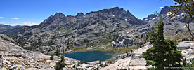
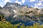
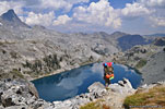
View Ediza and lakes of the Ritter Range in a larger map
Ediza and lakes of the Ritter Range Sierra Nevada, Ansel Adams Wilderness, Inyo NF, Central CAAug.29-Aug.31, 2013
3 day cross-country loop exploring some remote high Sierra lakes


Overview

The Ritter Range in the Eastern Sierra Nevada is home to some of the most spectacular wilderness lakes in the lower 48. Dominated by 13,149ft. Mt. Ritter, Banner Peak and the jagged peaks of the Minarets, this area is easily-accessible via the Mammoth Lakes gateway and is popular with hikers and climbers.

The Ritter Range is located in the Ansel Adams Wilderness west of Mammoth Lakes, CA, a lively tourist town and home to Mammoth Mountain Ski Area, which is also a mecca for mountain bikers in the summer.

Spanning this rugged terrain, the Pacific Crest Trail (PCT) and the John Muir Trail (JMT) link together some of the larger, more stunning lakes in the Sierra - Garnet Lake, Thousand Islands Lake & Marie Lake, among others. Many more lie out of view and without maintained trails, and this hike is a discovery of some of those hidden gems accessible only by cross-country exploration.

Besides their remote locations, what really sets these gems apart is the lofty backdrop of some of the most distinctive peaks in the Sierra - the Minarets range. I first experienced the Minarets while hiking the JMT years earlier, and knew I had to come back for a closer look. The jagged stiletto peaks of this soaring wall epitomize the naming of the Sierra - saw in Spanish.

Ediza Lake is a relatively easy-to-access Sierra backcountry destination just a a few hours hike from the Agnew Meadows trailhead, a 20 minute bus ride from the ski area parking lot. Ediza is often used as a basecamp for climbing Mt. Ritter and Banner Peak, which despite their imposing facades, can be done as a non-technical dayhike in good weather.

Hwy. 203 west of Mammoth Lakes, the access road, is a narrow, steep winding road which ends at Devil's Postpile National Monument. Because of the popularity of this park and it's proximity to several bustling resorts, Hwy. 203 beyond the ski area is closed to regular traffic during the summer and transportation to and from Devil's Postpile and points in between is by bus shuttle service from the ski area parking lot.

There's a well-maintained trail for the approximately 7 miles to Ediza Lake so it can be done as a long dayhike for the quick and tireless. But where's the fun in that? Savoring this magnificent landscape is key to the adventure. Also, it's mostly uphill from the trailhead. Most hikers return via the same route but I prefer to make loop hikes to explore new vistas and worked out a cross-country trek that ended at another shuttle bus stop further south.

The larger lakes explored on this trek are Shadow Lake, Ediza Lake, Nydiver Lakes, Iceberg Lake, Cecile Lake and Minarets Lake. You can see from the map above that this hike is counterclockwise from Agnew Meadows. From the trailhead, you climb south on the River Trail to Ediza. The further south you go, the higher you climb. At serene Shadow Lake, the trail merges with the JMT for about 1/2 mile before that trail turns north. It's a steady climb up to Shadow, Ediza and Iceberg lakes until you reach the highest one - Cecile.

The 3 inter-connected Nydiver Lakes lie in a high plain about a mile NW above Ediza, and make for a good dayhike from an Ediza basecamp. Cabin Lake is well hidden on the high eastern ridge and also well worth the effort. South beyond Ediza, there's an unmaintained but popular and easy-to-follow trail up to Iceberg Lake, where the trail ends and the boulder-hopping begins. A big push up a steep scree slope on the south end of Iceberg gets you to transcendant Cecile Lake, and another even more challenging scramble back down a steep cliff leads to a use trail to Minaret Lake, where you can pick up the well-maintained trail down to the road again.

Total mileage for this 3 day loop, not including circuitous dayhikes to Nydiver and Cabin Lakes, is about 23 miles. As in most Sierra backcountry destinations, an overnight permit is required from the administering agency, in this case the Inyo National Forest Service. Quotas are in effect from May 1 - Nov. 1 and reservations should be made in advance at Recreation.gov.


Trip Report

A journal of planning and hiking to Ediza and lakes of the Ritter Range, with some info that may be helpful to those considering this hike.

This is a must-see area for any serious Sierra explorer. The scenery is gorgeous and access is not strenuous, but challenging enough to escape the crowds at Mammoth Lakes. The cross-country loop I did is pretty popular and there were others doing the same thing. It could be done in 2 days if you left out daytrips to other lakes. The end of August is still high season, but with a Thursday entry, I didn't have trouble reserving a permit on Recreation.gov just a few weeks before the trip.

It takes about 5 hours to make the drive from LA to Mammoth Lakes and I arrive around 9:00 at night. I've reserved a tent site at Old Shady Rest Campground on Old Sawmill Rd. - not to be confused with much larger New Shady Rest Campground across the street. It's about $20 plus the reservation fee. The Visitor Center/Ranger Station is easy to find - one of the first structures you'll see coming into town.

Although I have a general idea of where it is, Sawmill Rd. turns out to be difficult to find at night because there's no road sign when I am there and it's very dark. (FYI, it's 2.8 miles from Hwy. 395, on the north side of the road, across from a McDonalds.)After more than one pass up and down the highway, I finally spot a campground sign with my flashlight.

Shady Rest is a convenient place to overnight because it's right behind the Ranger Station where you pick up your Wilderness Permit.

When I have to overnight somewhere close to the permit station, I bring a separate tent and sleeping bag so I don't have to unpack my backpack. This saves time in the morning so I can be first in line when they open.

Day 1: Agnew Meadows trailhead to Ediza Lake. Dayhike to Nydiver Lakes & Cabin Lake

After a Big Breakfast™, I'm first in line at the Ranger Station, getting "the talk" from the ranger about fires (none), waste (bury it deep) and bears (cans required). Inquiring about the Rim Fire burning in Yosemite, I'm told the smoke is blowing mostly north and shouldn't impact this area. Permit in hand, I drive up to the ski area to park and catch the shuttle bus to the trailhead. Although it's not even 9am on a Thursday morning, there are already a lot of people and cars in the immense parking lot, unloading mountain bikes and picnic baskets, heading for the lifts. A big touring style bus pulls in while I'm finalizing my pack. It's only after several minutes of waiting in line to board when I find out that you have to pay in advance and everyone in the queue has already bought their ticket. So I race the 50 yards to the ticket booth, where there's another line, and I'm sure I'll miss this bus and have to wait an hour for the next. Luckily, I make it aboard, and soon we're underway up the steep winding highway, so narrow in places that the bus has to stop to let oncoming cars pass. (Permitted vehicles are allowed.)

After the driver drops me off at Agnew Meadows, (make sure you tell him ahead of time!),
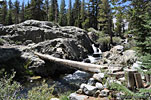
One of many waterfalls along Shadow Creek trail
I follow a dirt road several hundred yards into the woods, but at a clearing, there's a tangle of trails going every which way - and no signs for River Trail or High Trail, just one for "Trailhead". Perusing my map and compass, I get my bearing and soon feel relatively confident that the trail I've chosen has to be the right direction (doesn't it?) After a few hundred more yards, there's a junction and sign for the Pacific Crest Trail (PCT) - aka "High Trail". I know I'm not going that way so at last I'm certain I'm on the River Trail and going the right way. The PCT splits from the John Muir Trail (JMT) just south at Devils Postpile park and veers north away from two of the most beautiful large Sierra lakes I've ever seen - Garnet Lake and Thousand Islands Lake. It's a shame PCT through-hikers, for all their effort, don't get to experience these two amazing lakes that JMT through-hikers get to see.

Shadow Lake

The River Trail follows the Middle Fork of the San Joaquin River up a beautiful shady valley. It's a clear and sunny morning and it feels good to be
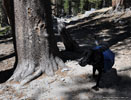
Hiking dog carrying his own pack, his owners in background
Hiking dog carrying his own pack, his owners in the background
climbing away from civilization, getting accustomed to the weight of everything I need to live
Serene Shadow Lake
Serene Shadow Lake
comfortably in the woods for 3 days. Soon I'm climbing some switchbacks and arrive at serene Shadow Lake, which I remember well from my JMT through-hike a few years back. Shadow Lake is surrounded by welcoming flat boulder ledges that invite sunning and relaxation, but there's no camping allowed here due to its fragile nature and the tons of JMT hikers that come through. On the west side of Shadow Lake, the trail merges with the JMT for half a mile, climbing high up a mountainside before splitting north. It seems to get steeper the more you climb, and after about 3.5 hours, I reach Ediza.


Ediza Lake
Climbing to Ediza Lk. along Shadow Creek
Because the south end of the lake is fragile wetlands and the north is mostly rocky, camping is allowed only on the southwest shore, where there are plenty of spots in the dense woods. The main trail follows the east and south shore, circumnavigating much of the lake before you get to the camping spot. There are several places in the wetlands where the trail splits off or becomes challenging to follow in the high reeds. On the way, you pass the trail south up to Iceberg Lake. Some choose an alternate route around Ediza to the camping spots - boulder-hopping and scrambling their way over the big rocks that line the west and north side. The distance is less, but there's no trail and the chance of twisting an ankle here is high, so it's not worth the couple of minutes saved IMHO.

Looking for a campsite near a creek, I climb an overgrown path due west up to a big noisy waterfall, but there's no good camping here, so I head back down and find something closer to the shore.


Nydiver Lakes, Cabin Lake

After I set up camp, I have the whole afternoon for exploring. Climbing due
The south end of Ediza and a route up to Nydiver Lakes (ctr.)
The south end of Ediza & a route up to Nydiver Lakes (ctr.)
north up the steep slope above treeline, I reach the first of the 3 Nydiver Lakes, which lie to the northwest of Ediza behind a ridge. After touring these remote and exposed high lakes, I head back down in a circuitous loop and come across a unique pond on a high ledge overlooking Ediza - a pond with a view! I make my way back down to the lake then spend the afternoon climbing and exploring the other side, the east side. The highlight is Cabin Lake, with its rocky island, hidden from view on a high ledge. There are several other small lakes and ponds on the eastern flank. The view of Ediza Lake below Mt. Ritter and Banner Peak from up here is magical.

That night, a distant thunder storm to the north lit up the sky with lightning bursts. I was hoping against rain - let's see...


Day 2: Ediza Lake to Iceberg, Cecile and Minaret Lakes

The next morning after breakfast, I'm taking pictures back at the north end of the lake, when a petite young lady solo-hiking with a light day pack asks me for directions to Nydiver Lakes. She's climbing Mt. Ritter she says, and had basecamped further down the mountain than Ediza. I was a little surprised as I wasn't aware that imposing peak could be done without ropes and gear, much less as a dayhike. But she had done her homework and showed me all the route and planning info she had on her iPhone. A brave and hardy soul she was - may her batteries hold a charge, and the weather stay clear. I told her of how I got to and from Nydiver yesterday.

I learn later that 4 climbers died on Mt. Ritter in May 1971 when their party of 5 encountered an unusually severe Spring snow storm, considered to be one of the worst accidents in the history of modern Sierra mountaineering. Bad weather, lack of preparedness, summit fever & desire to please others/not be labeled a quitter were reportedly to blame. In fact numerous climbers have lost their lives in this area over the last decades, detailed here. Famed millionaire/record-setting balloonist Steve Fosset's plane crashed on a nearby ridge. Accidents happen in the wilderness all the time. Rather than morbid curiousity, it's important for outdoor enthusiasts to learn from others mistakes. (Ok, there's some morbid curiousity too!)

As I'm packing up, the clouds start moving in. There's a well-beaten trail up to Iceberg Lake and it passes through some interesting terrain. As I'm climbing, some misty drizzle floats down, but soon gives way to a sky full of impressive cumulous clouds, the perfect backdrop to the magnificent peaks of the Minarets towering above.

Iceberg Lake
Without having seen pictures beforehand, I arrive at Iceberg Lake completely unprepared for the dramatic setting of the giant serrated peaks of the Minarets mirrored in the clear blue water. It's a breathtaking scene.

The trail hugs the eastern shore for a few hundred yards through the last vestiges of soil and flora, before disappearing into rocks. From here on, its scrambling up and over boulders to the base of the steep scree slope that is the route up to Cecile Lake. There are others in front of me, which helps to
A tough elderly lady climbing the last few feet up the steep slope above Iceberg, under the watchful eye of her companion
A tough elderly lady climbing the last few feet up the steep slope above Iceberg
make out a route of sorts, but it's really just a matter of avoiding the places they're having difficulty. In the distance, there are probably a dozen others climbing to and on the scree slope and on top of the ridge.

High on the loose rock slope is a very steep ridge and it becomes straight up rock climbing, challenging carrying a pack. Near the top, I pass a pair of older ladies—one of whom is clearly in her seventies or older—making their way slowly up the steep rocks with their full packs. I ask and she says 72, but I'm suspicious as she looks much older. She didn't want any help. "How can I say I climbed this if someone helps me?" she says. Tough lady!

Cecile Lake
You've probably already seen my photos of magical Cecile Lake beneath the the majestic stiletto peak of Clyde Minaret, but it's hard to imagine the incredibly vivid colors and scale, the deafening silence and sublime presence without standing there yourself after a hard climb. It's one of the most impressive of all the lakes I've seen in the Sierra and I can't take enough photos trying to get it all in. It helps that the clouds and the sky are very dramatic today. As with Iceberg, there's no trail, only boulder-hopping. It's become hot now, and I slowly make my way to the south end to enjoy a sun break lunch atop a boulder cliff. Wow! I can still feel the restorative power of that transcendant scene just looking at the photos, one of the main reasons I continue this website endeavor.


Hikers inch their way down the steep north side cliff between Cecile & Minaret Lakes
The climb from the high cliffs eastward down to Minaret Lake proves to be the most challenging part of this trek. Despite trip reports and maps I'd studied beforehand, there doesn't appear to be any route down the steep cliffs below the south shore of Cecile. Some suggested the best way is on the north side of the bowl, but I have a look and don't see it from above. The south side seems to hold more promise so I make my way around the lip of the bowl, bypassing several steep chutes covered with bushes, trying to find one less vertical than the others. Finally,
Looking back at the bowl between Cecile & Minaret lakes
I find one that looks only marginally treacherous and lower myself over boulders, slipping and sliding down rocks and sand, until I reach the the base of the bowl where there's a use path to Minaret Lake. High on the north ridge, some other hikers are descending the steep cliff at the spot I'd read about, but it looks equally difficult as the south ridge I'd just descended. However, there's an obvious use trail past the mid-way point. I just didn't scout east far enough to find that route.

Minaret Lake
With each new lake, there's an expectation that nothing could top that last one, but Minaret Lake doesn't disappoint. At 9,800 ft, it's back in treeline again, and stands of big Jeffrey and Lodgepole pines line the western shore. Lush grass and wildflowers are everywhere. Minaret is amoeba-shaped, with a tangle of peninsulas and inlets, but with surprisingly few un-exposed camping spots. From high up, I spot a bank of trees with a view of Clyde Minaret that must be the primo spot to camp at the lake. There doesn't seem to be other people here and soon I'm having a siesta in my shady tent with a view. Before long, I hear many others start to trickle down to Minaret from the high lakes, and to my dismay, one group sets up their camp just a few yards from me on the other side of some trees. They didn't even see me until I made some noise. I didn't hike all the way out here to have neighbors that close, so I pack up and hike a mile around the lake to the rocky eastern shores, where I find a sheltered spot on a peninsula outcropping. Fortunately, no one follows me here.

By late afternoon, the wind has changed direction and the sky has steadily been growing hazy. A vague scent of smoke hangs in the air. The Yosemite Rim Fire has found me. But it's still clear enough, and it's such a beautiful setting that the haze actually adds to the atmosphere, complete with a moody and dramatic sunset behind Clyde Minaret.


Day 3: Minaret Lake to exit

Looking back to Minaret Crk. cascading east from Minaret Lk.
The next morning is sunny and warm but the haze and smoky scent is still prevalent. The 8+ mile hike out is on a well-maintained trail and it's downhill all the way. The trail follows the gurgling song of Minaret Creek, which adds to the enjoyment. Along the route is a beautiful cascade that flows several hundred yards down the mountain. At Johnston Lake, the Minaret trail merges with the JMT and then with the PCT and descends the mountain mile after mile. All morning, I don't see a single other person and can enjoy every sight and sound of this wilderness just like it's my own. In a few hours, much closer to the road, I pass a few intrepid dayhikers climbing up from Minaret Falls campground areas. Soon, I'm back at the road near the campground bus stop with other tired backpackers and visitors.


When we arrive back at the ski area parking lot in the early afternoon, I'm amazed by the crowds. The sheer number of noisy, excited groups flocking here to ride the ski lifts up the mountain for sightseeing and mountain biking is unsettling after quiet days in the wilderness. The giant parking lot is packed full, as are the overflow lots. People have to park in town and take a bus to get here. This is what a regular here would expect I suppose, as the summer is coming to an end and it's a beautiful Saturday. So the Thursday entry of this trek was perfect timing.
     
Info

Reservations and Permits
Anyone who's spent time in the American wilderness recently has also spent time on Recreation.gov - the private company to which the Fed has leased control of all wilderness permit reservations and purchases, as well as camping and lodging reservations in most of the national parks, forests and recreation areas. In the past few years, their website has steadily gotten more streamlined and painless to use and they actually have humans to speak with if you have questions.

USFS-Inyo_MinaretsMap
USFS map pdf

The trailhead for this hike on Recreation.gov is Inyo National Forest/River Trail AA08 at Agnew Meadows. Another trail that starts in the same place is Shadow Creek AA07 trail which is combined with the River Trail for the first 2 miles. Confusingly, a third trailhead starts here - the High Trail, which accesses and becomes the Pacific Crest Trail. The good news is that when one trailhead quota fills up, you can try the other and still go to the same place.

After you receive your permit in the mail, don't overlook that there is one more step recently implemented. You must contact the Ranger Station to confirm party size or your reservation may be cancelled.

Camping
For in-season overnight camping before the trip, you can't beat Shady Rest - it's right behind the Visitor Center where you pick up your permits:
Old Shady Rest Campground, Old Sawmill Rd., Mammoth Lakes
New Shady Rest Campground, Old Sawmill Rd. Mammoth Lakes
Open Jun.5-Sep.12

Shadow Lake - no camping
Ediza Lake - no camping on the east side
Nydiver Lakes - no camping restrictions, but exposed
Iceberg + Cecile Lakes - no camping
Minaret Lake - no restrictions

bear canBear canisters are required for food and trash.

No open fires are allowed at any spot on this trek


Pictures
Getting there
Lone Pine CA evening
The Eastern Sierra from Hwy. 395 on the return trip The Eastern Sierra from Hwy. 395 on the return trip Butt models in Mojave CAButt models in Mojave CA


On the trail
After a couple of miles up the River Trail, looking back down the valley towards the trailhead
The first few miles follow lively Shadow Creek. The mountain is one of the Two Teats
Shadow Lake is bordered by invitingly sunny flat shelves
West of Shadow Lake, the route follows the John Muir Trail into Ansel Adams Wilderness
Shadow Creek flowing from Ediza Lake
Hewn logs bridge
Hewn logs bridge

First view of Ediza Lake and the Minarets
13,149' Mt. Ritter (L) & 12,942' Banner Peak (R) tower above Ediza Lake
Lively waterfall SW above Ediza Lake
View north to the entry from the western shore, the only place camping is allowed
High on the western ridge, the cross-country route to Iceberg & Cecile lakes in the center
If you climb high enough, you can see Iceberg Lake to the south

One of the 3 Nydiver Lakes, which lie northwest of Ediza Lake
Another Nydiver Lake, Mt. Ritter & Banner Peak
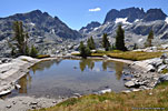
A steep climb above Ediza's western shore reveals this hidden cliff-edge pond (L)
Pond with a view above Ediza Lake
There are several other lakes hidden in the crevices of the mountain east across Ediza Lake

Sierra bear country with Mt. Ritter and Banner Pk.
Cabin Lake hides up the mountain east of Ediza Lake
You'd never know hidden Cabin Lake was up here without a map
Cabin Lake
Cabin Lake
A small lake NE of Ediza and Shadow Lake in the distance
 

A small unnamed lake high on a ridge east of Ediza Lake
Ediza Lake from the east. From L-R, the Minarets, Mt.Ritter & Banner Pk
Beautiful Ediza Lake
Intrepid souls brave the frigid water. It's freezing cold!
A storm lit up the northern sky in the distance

Leaving Ediza on the morning of the second day
The trail south up to Iceberg Lake
Iceberg Lake, where the trail ends, and the steep scramble up the loose scree (ctr L) to Cecile Lake begins
 

The Minarets mirrored in Iceberg Lake
Each of the peaks has a name. The highest is Clyde Minaret at left
Iceberg Lake and the Minarets
Theres no trail here, just boulder hopping, and then a scramble up the steep slope at left
Storm clouds threatened rain throughout the morning but the good weather held up

Iceberg Lake from the south
A fellow hiker admiring Iceberg Lake after a tough climb up the wall of scree
Cecile Lake and the Minarets
Cecile Lake
Cecile Lake
Cecile Lake
Cecile Lake

A lone red rock at Cecile Lake
Cecile Lake
Cecile Lake
Clyde Minaret dominates the sky above Cecile Lake
Cecile Lake
Cecile Lake
Looking south down to Minaret Lake from Cecile Lake

Cecile Lake view north
Cecile Lake and Clyde Minaret
Minaret Lake from Cecile Lake
This steep wall is the cross-country access between Cecile Lake & Minaret Lake

MInaret Lake is amoeba-shaped with numerous peninsulas
The rocky shores of Minaret Lake, my campsite in the center
The haze from a wildfire in Yosemite adds a moody touch to Minaret Lake
Minaret LakeMinaret Lake

Minaret Lake
Minaret Lake
My campsite at Minaret Lake below pointy Clyde Minaret
Dusk on Minaret Lake
Dawn on Minaret Lake
Minaret Creek looking east down a long cascade
Cascade on Minaret Creek

Back to civilization - dayhikers at a meadow near Minaret Falls campground

More photos in the Trip Report top of page

TOPHikes Index


Since 15.01