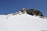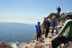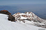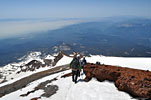
Mt. Shasta

View Mt. Shasta in a larger map

Mt. Shasta, Shasta-Trinity Nat'l. Forest, Northern CaliforniaJun. 6-8, 2014
3 days summiting the 14,179' volcano via Avalanche Gulch

Overview
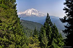
Mt. Shasta from Lake Siskiyou ©2014 by LarrySullivanPhotography.com
Just wow!
Anyone who has driven I-5 through Northern California
Approaching Mt. Shasta from I-5 south, view from Scenic Overlook roadside pullout 40 miles south
Mt. Shasta from I-5 south
Approaching Mt. Shasta  from I-5 south
in the daytime can attest that Mt. Shasta is an impressive sight, appearing like a mirage in the distance, then slowly growing unbelievably larger, soaring above the surrounding terrain.

Mt. Shasta is one of fifteen California "14'ers" - peaks over 14,000'. Only two of these, Mt. Shasta and White Mountain Peak, are outside the Sierra Nevada range in Central California. Mt. Shasta is only 50 miles south of the Oregon border and is part of the Cascade range, its 2nd highest peak after Mt. Rainier in Washington state, which is only 250' higher.

What distinguishes Mt. Shasta is it's vertical prominence above the surrounding landscape. At 14,179' (4,322m), it's unmistakable dome rises 10,000' above the rolling hills of Northern California and can be seen from up to 100 miles away. In contrast, the highest peak in the contiguous USA, 14,497' Mt. Whitney, 450 miles south, is difficult to distinguish from the surrounding peaks from below, even
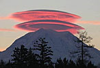
Lenticular clouds, Mt. Shasta, by Dahlia Rudolph
Lenticular clouds, Mt. Shasta
Lenticular clouds, Mt. Shasta, by Jane English
Lenticular clouds, Mt. Shasta
by someone who has climbed it. A sub-peak below the summit is Shastina, with its conical formation and clearly formed volcanic caldera. At 12,329', Shastina is the third tallest peak in the Cascade range.

Mt. Shasta makes its own weather, scraping the sky and churning the air around it, its summit plain covered with snow year round. The strong winds across Shasta's summit often create unusual and beautiful lenticular clouds which are routinely described as UFO's!

Legends
Because it protrudes so dramatically into the heavens, Mt. Shasta has long been a spiritual symbol of creation and eternity to native tribes. Legends have continued to flourish even by non-natives, abetted by the sometimes otherworldly lenticular clouds. Some purport that Shasta is a central point of Earth's harmonic convergence. One of the more inventive legends is that of the Lemurians, ancient descendants of a lost continent. Lemurians have been variously described as an advanced society of humans, mythical creatures, and even an alien race of shape shifters that live under the mountain and feed on energy from magical crystals in the earth. Aligned with mystical legends are many crystal shops in town to help believers with their vision quest.

Mt. Shasta the town
Mt. Shasta is also the name of the small town at the west base of the mountain along Interstate 5. Not surprisingly, the main source of income is tourism, so you'll find the people outgoing and friendly. The mountain and the surrounding area is a year-round destination for outdoor recreation and wilderness enthusiasts and you can hear accents from all over the world. There are many choices for lodging, dining, shopping, banking, etc., but like most small towns, opening hours are typically from breakfast time to dinner time, so don't expect a bonanza of late night activity. Hopefully it's easy enough to distinguish between the usage of Mt. Shasta for the town vs. Mt. Shasta the mountain by noting the context.

Geology
The last time Shasta erupted was thought to be in the late 1700's, when a
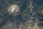
Mt. Shasta from space, 2012 (NASA). North is at the bottom, the town of Mt. Shasta at right. At the bottom, you can really see how the flowing lava shaped the land.
Mt. Shasta from space (NASA)
French explorer saw a massive eruption from the sea, over 120 miles west, but apparently there's no solid proof it was Shasta he saw. Volcanologists have somehow determined it's likely to erupt roughly every 600 years.

Just below the summit is an area of volcanic activity called Shasta Springs, where there's an active fumerole of sulphuric gas that has scalded the rocks into ash. The odor wafts across the summit to remind all climbers that the mountain could erupt again at any time.

Famed writer/wilderness activist John Muir climbed
John Muir at 32
John Muir at 32
Mt. Shasta several times in the late 1800's and his last attempt almost turned deadly when he was caught off guard at the summit in a storm and stayed warm near the fumerole. Only by turning his body over repeatedly against the intense heat did he survive until the storm passed, but the exposure and heat and fumes nearly killed him and he never summited Shasta again.

Shasta has 7 active glaciers which hold a year round snow base for backcountry ski adventurers. The multi-year drought California is enduring has drastically reduced the snow levels on Mt. Shasta, so much that the Mt. Shasta ski area is going out of business.


Avalanche Gulch
3D map of Avalanche Gulch route I created in Google Earth
There are many routes to summit Mt. Shasta, and a description of all of them is beyond the scope of the this site, but Avalanche Gulch on the west face is the most popular and arguably the "easiest" route—if a 1.4 mile elevation gain over snow and ice can be called easy. It's an extremely strenuous and challenging physical climb, not just for the exertion and stamina required, but also for enduring the frigid temps, the thin air and altitude effects and the nuances of climbing on ice in heavy alpine boots while roped together.

Avalanche Gulch isn't a technical climb, but alpine boots, crampons and ice axe are essential year round. The most challenging obstacle of this route is a barrier of high cliffs called Red Banks, covered with snow and ice much of the year.

From Bunny Flats trailhead, the Avalanche Gulch route to the summit is only about 6 miles, but it's a 7,300' elevation gain through snow, ice and loose, crumbling volcanic rock. The time for the ascent depends on the pace but sources report between 8-10 hours for the ascent and 4-5 for the descent. Many Avalanche Gulch climbers make their overnight basecamp at or near 10,400' Helen Lake, a flat spot below the Red Bank cliffs, then depart for the summit before dawn and return to the trailhead at Bunny Flats the same day.

Guides
Climbing to the summit of Mt. Shasta is commonly referred to as a "summit attempt" because there's a good chance of the effort being thwarted by bad weather. The best advice is to pick the right time of year to go, and an experienced guide.

Unlike Mt. Whitney and most other California 14'ers, Mt. Shasta is not a mountain to climb for the first time without an experienced guide. There's no trail to the summit - it's all cross country, and the route changes depending on conditions.


Two local year round guide services, Shasta Mountain Guides and SWS Mountain Guides, both offer similar guided group 3 day outings via Avalanche Gulch in the $500-$600 per person range (2014), as well as other custom-tailored climbs. Although the climb can be done in 2 days or less, 3 days gives more time to acclimate to the altitude, to get accustomed to the rigorous climb using rented boots, crampons and axes, to practice safety and climbing techiques like self-arrest and glissading, and mainly to enjoy and appreciate the majestic setting at a less demanding pace.

In addition to their years of successful summiting and thorough knowledge of the mountain, the guide companies often lead multiple groups simultaneously, and connected by radio, they can communicate conditions and recommend to each other the best routes up and down in real time. They provide breakfast and dinner (bring your own lunch), climbing harness, and take care of acquiring permits and passes and camping fees (Horse Camp). The required ice axe, alpine boots, leg gaitors (prevent snow from getting in boots) and crampons are typically rented locally, as well as any/all gear, apparel and accessories needed.

When to go
From late Spring to mid-Summer, the snow cover makes for an easier ascent up Avalanche Gulch. In the late Summer, without snow to climb on, the loose volcanic rock is difficult footing and there's a greater chance of rockfall, but experienced climbers and enthusiasts summit Mt. Shasta on all routes year round.


Trip Report

A journal of planning and summiting Mt. Shasta, with some info that may be helpful to those considering their first summit attempt. If you only have a few minutes, you'll probably find Day 3 the most interesting.

On the summit of Mt. Shasta
The idea to climb Shasta started when I first saw it passing through in the early nineties. It's a phenomenally huge and beautiful mountain - so serene and imposing. But with the expense of flying and driving a rental to the somewhat remote location, acquiring ice climbing gear and hiring a guide service, and locking in vacation days from work, it was easy to procrastinate. Also, it's a huge physical challenge that necessitates many months of training - not a relaxing peaceful vacation by any means. In fact, most people would consider 3 days of strenuous, exhausting climbing, oxygen deprivation and camping in the snow to be torture! Finally, after many years of hiking and backpacking in the Sierra, I felt like I could no longer procrastinate on a Shasta climb if I was ever going to do it, and began planning in earnest in 2013, reading about different routes and times to go. As an avid snowboarder, I wanted to ride down after my first summit. I'd read trip reports stating there was often enough snow to ride much of the distance between the summit and Horse Camp. But circumstance (a severe draught in California) and schedule (couldn't take off work) dictated a more modest all-hiking trek. I'd hoped for a 2 day summit attempt, but there was no guarantee that enough others would sign up for a 2 day and the trip could be cancelled at the last minute, after I'd paid for plane fare. Also, the snow was very rough by June and skiing down on my first ascent might be more of a hardcore challenge than fun. So I'd need to book a 3 day hiking trip, which was assured to happen. I settled on climbing via Avalanche Gulch and late May/early June was the perfect time, when the weather becomes more cooperative, and before the snow melts and the route becomes a difficult scramble over loose rock.

I'm usually a self-supported solo hiker, but for my first high altitude ice climb, I'll join up with a guided group. I have a lot of questions about gear and method and logistics, fairly certain more than anyone would be willing to answer! Both of the local full-time guide companies, SWS Guides and Shasta Mountain Guides, have good websites with a lot of info. SWS also has many YouTube videos about technique and gear and I spent a lot of time online to weed out my lamest questions. Also I research climbing boots, comparing stiffer insulated double plastic vs. leather shells, and the practicality of purchasing vs. renting. For those who don't know, climbing boots are extremely rigid with a shank sole that will hold steel crampons firmly in place for climbing on steep ice. Regular hiking boots don't cut it because the torqued stress between the crampons, boots and ankle from the weight of a climber and pack on steep ice is phenomenal. These alpine expedition style boots start new at over $600 and go into the thousands of dollars. They're rigid and tough enough to withstand all kinds of punishing terrain and conditions a mountain climber might encounter. The down-side is that most of the climb up the Avalanche Gulch route doesn't require crampons and hiking in stiff boots is hot, heavy and unwieldy. If you don't climb ice regularly, it's not cost-effective to buy a pair, so most climbing tourists like me will rent.

In the first months of 2014, I spoke on the phone with SWS Guides at length and the gentleman (whose name I forgot) was extremely patient and helpful in answering all my questions. Equally helpful was Chris Carr, the owner of Shasta Mtn. Guides, and his wife Jenn. It's a tough "choose-me" business because they have to take their time answering a myriad of first-timer questions from potential customers to close the deal, without being curt or demeaning.

Trying to decide on which guide company seemed straight forward enough as SWS Guides was almost $100 cheaper for the 3 day outing, but I just liked that I could talk with the company owner at Shasta Mountain Guides, a guy who'd summited dozens of times, according to his website. Chris and Jenn Carr are a young couple who hike and ski the mountain for fun, and their roster of guides is impressive. And they were the only guide service listed on the Forest Service website, though I don't know why. Included in the package is "snow school", to practice self-arrest with an ice axe, glissading and roped climbing.

I booked with Shasta Mountain Guides, half up front, half the week of the hike, and they sent me a gear list and climb outline. They let me know which (mostly 3 season) gear I own is appropriate for this climb (my biggest pack, trek poles, down sleeping bag & pad, helmet), what they supply (winter tent, alpine-style climbing harness) and what I'll need to rent (boots, axe, crampons). They typically have 2 guides leading groups of 7-8 climbers, who pair up into 4 double tents. But I wasn't looking forward to spending my vacation trying to catch 2 good nights sleep beside a (possible loud snoring) stranger and Chris said he'd let me use one of his solo tents. Good thing, as one of the guys' insanely loud thunder-snoring echoed across the camp sites both nights, despite my ear plugs.

Then there's buying a plane ticket to Redding (the nearest mid-size airport), getting a rental car and booking a room for the first and last nights of the trip.


Let's roll!
In the preceding months, I work hard at getting in shape, climbing 10,000' Mt. Baldy, the highest peak in Los Angeles county, then 10,834' Mt. San Jacinto, 2nd highest in So.California, and many others every weekend. During the week, I ride my mountain bike on 25-30 mile outings every other evening after work. Finally the weeks of anticipation slip by. I pack my gear in to my largest expedition backpack and I'm ready.

I fly from Burbank CA on Thursday, June 5 into the little airport at Redding CA . The temperature is mid-90's - very hot. I rent a SUV for the 90 mile drive north to the town of Mt. Shasta, arriving mid-afternoon and I'm thankful it's much cooler here in the mountains. I check into Cold Creek Inn, recommended by the guide service, and purported to offer a discount through them. It's tiny but nice enough for a few hours sleep coming and going.

Gear rental

Top on my list is hitting the outfitter store The Fifth Season to try on some rental alpine boots. The main reason I arrive the afternoon before my group is to gather is to have plenty of time to try on and decide on which hiking boots to rent, and avoid having to make a rushed decision the next morning when everyone in my group and others will flock to the rental counter to rent boots.

I'm very apprehensive - for good reason it turns out - about hiking in poorly fitting rental boots, easily the most critical gear of the trip, because I'm certain I'll get bad blisters. Over the years, I've rented a lot of ski and snowboard boots, and knew to bring my own alpine hiking socks to the fit. The Fifth Season website promises old school fitting expertise, but I find they just got me a couple of pairs to try on, and then a third, and that was pretty much the selection. It was up to me to decide if the stiff, clunky things fit properly, and I didn't really know what to expect. It would be helpful if they had some kind of ramp or incline so you could stress them in different angles and positions before deciding. While I was trying on boots, a customer came in who'd rented boots earlier and had just returned from a shakedown hike. He was complaining they were killing his feet and needed a different brand or style for his summit attempt. I felt certain this was a common experience and an unsettling omen. I didn't have time for such a shakedown hike, but the boots I settled on were somewhat broken in, seemed okay walking around in the store, and were less uncomfortable than the other two.


I rent ice axe, crampons, boots & gaitors, pick up some "cheap" dark lensed summit sunglasses ($85), sunscreen and a neck buff. There happen to be a couple of guides from Shasta Mtn. Guides in the store who offer some helpful advice on the hike and where things are in town.

After dinner and some errands, I have time to explore, having a look around the short downtown strip. There seem to be quite a few festival types in the area - you know, white youngsters with dreadlocks and knit hats, piercings and ink galore. But they're colorful and everyone is friendly and laid back. It's said that Mt. Shasta is a destination for spiritual healing and enlightenment as well as mountain climbing.

Then I drive around Lake Siskiyou for a short hike along the SW shore at a spot recommended by the guide, with an awesome view of the mountain. Afterwards, I drive 15-20 miles out Hwy. 97 around the north side of the mountain for a different perspective. That night I lay everything out then load up my pack. The forecast for the next 3 days looks good. I try to get some sleep.

Day 1Friday June 6Bunny Flats to Horse Camp 1.6 miles, 1000ft. elevation

Friday morning is sunny and gloriously clear. The plan is to check gear in the morning and then a short hike to our first camp. I have a full breakfast at Black Bear Diner on Main St., one of those authentic mountain town restaurants where the waitresses seem to have worked their entire lives and know every other person who comes in.

Everyone who's hiking in a Shasta Mountain Guides group this weekend gathers at the parking lot in the alley behind The Fifth Season gear shop, probably 20-25 climbers and guides. We then move across the street to SMG owner Chris Carr's house, conveniently located across from the gear shop, and spread out our stuff in his yard for a gear check to make sure we all have the essential gear from the list we received at signup, and that nothing was overlooked.
We get introduced to each other and our guides, hired guns from out of town who stay in Mt. Shasta for the season. Lead guide Joe lives in Truckee, CA,
Gear check in Chris Carr's yard
Gear check in Chris Carr's yard. This is a video
near Lk. Tahoe and co-guide Pearson is from the Bay Area. Apparently another climber cancelled at the last minute, and a third guide Johnathan, also from the Bay Area, had been scheduled, so our group gets 3 guides for just 6 climbers. The guys in my group are experienced hikers of all ages, 3 friends from the Bay Area, an retired guy from Sacremento, a young guy from California, myself from LA and a young engineer who's come all the way from Kentucky. It's the first time up Shasta for all of us. Shasta Mountain Guides has been summiting groups regularly the last few weeks we're told. The weather has been perfect and we're assured it's very unlikely we will be turned back. The common items like food and cooking gas get divided up and each of us carries a share. We're given some WAG (Waste Alleviation Gelling) bags for carrying out waste. No poop on the mountain! After gear check, we get a chance to pick up last minute items at the gear shop before we regroup in an hour at the Bunny Flat trailhead, 10 miles up Everitt Memorial Hwy.

Escaped convict
Escapee on the loose!

When I get up the mountain to Bunny Flat, the parking lots are full, the place is buzzing with dozens of hikers and half a dozen state police are milling about with automatic weapons. Turns out an escaped convict is on the loose and was spotted in the the area. How exciting! There's slim chance he'd be on our trail, because it's unlikely the desperate guy is going to climb up a big mountain. They caught him later, I heard.

This first day is an easy break-in hike to Horse Camp, under 2 miles and about 1000' of elevation. The following day will be a tough climb, and then Sunday will test everyone's limits. We won't get to see the summit until the third day as it's behind a high ridgeline.


It's 12:30 when we set off from Bunny Flats at a trudging pace, our packs full, and quickly fall into a slow steady rhythym. Joe explains he wants to keep the same pace our entire hike and climb, to become accustomed to an optimal gait by the time we're on steep ice and the air is thin.
Climbing into Shasta-Trinity Wilderness

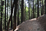
Soon we're climbing into the Shasta-Trinity Wilderness, through big ancient conifers. It's beautiful but steep and hot and it feels nice to hike in the shade. As I feared, the boots are already rubbing my heels badly after only an hour. On our first break, I change socks and put on some blister pads, but it's time consuming and they're little help.

Horse Camp
By early afternoon, we arrive at 7,950' Horse Camp, a flat clearing in the forest with a natural spring. It's a popular destination for day hikers. Horse Camp offers the first clear view of the Avalanche Gulch route up an immense bowl. There's a Sierra Club stone cabin, built in 1923, with a library of Mt. Shasta books and maps, staffed by a live-in seasonal caretaker/information lady. There is also a nice new composting toilet, the only toilet above Bunny Flat. After we leave Horse Camp, all waste will have to be packed up and hauled out!
Horse Camps' first caretaker, a man named Olberman, spent many years paving the trail east out of camp up the mountain with large flat stones. The stone portion of the trail extends over one half mile up the mountain and is now called Olberman's Causeway.

There are numerous established campsites in the adjacent woods
Horse Camp. Photo by Pearson
and our group sets up in close proximity to each other. I clean and bandage the growing blisters on my heels. The guides put together a simple dinner and we talk about what to expect in the coming days as the evening sets in. After dinner, I wander around and chat with other campers and the caretaker lady. Among other things, she explains the composting toilet and all the regulatory difficulties that had to be overcome to get permission to install it here, high on the mountain in the fragile eco-system of a heavily used corridor. Apparently it was a contentious decision and a lot of effort went into mitigating environmental impact. Each user adds a couple of scoops of provided sawdust after doing their business. Then in the winter time, the rangers climb up on skis, open the bottom door in back and haul a big chunk of frozen sawdust and doodoo down the mountain on a sled to dispose of it! The toilet itself is clean and new and smells like fresh sawdust - the nicest outhouse I've ever used.

After dark, a fire is started at the cabin fire pit, the only place fire is allowed, and becomes the gathering spot for late night conversation. We hear about the mystical Lemurians, inhabitants of a lost continent who supposedly live inside the mountain. I stay up later than everyone else, to capture some star shots, and maybe get to see a Lemurian.

Someone in our group is snoring up a storm and even with ear plugs, it takes me a long time to fall asleep.


Day 2June 7Horse Flats to Helen Lake 2.5 mi., 2500ft elevation

We awake to a routinely beautiful day. The guides put together some oatmeal and coffee, then we break camp. I tape up my blisters best I can with duct tape and we head up the mountain out of Horse Camp on the Olberman Causeway. A few climbers are in front of us and others behind. We'll climb about 2.5 miles with an elevation gain of 2500ft. to our basecamp for the summit attempt, Helen Lake at 10,400ft.

After half a mile of slow incline up the flat stones, we leave treeline and the trail begins a seemingly endless series of switchbacks through loose dirt and dust. The rocks crumble and slip away underfoot as we climb, and the sun beats down mercilessly.

Switching from the dirt and rock path to the snow route

Higher and higher we trudge up the brown treeless landscape, the incessant sameness of the steep dusty route sucking out our energy. There is still snow in the low ravines so leader Joe decides we'll be cooler switching to a snow climb. The snow is mostly soft, but some sections require kick-stepping to get a foothold. To keep from postholing, we step in each others footsteps, but it's hard to get a rhythym and very slow going. Still, the snow is a refreshing change. Then the hill becomes incredibly steep and the snow is rough and churned up. We take 10 minute breaks every hour, but after 3 hours we're all beat. I can feel nasty blisters on the back of both heels. Helen Lake is still a long ways above us.

As we climb the final mile to Helen Lake, the imposing crags of the surrounding ridges tower above and the sky is magically deep shade of blue. The view down the mountain to the western landscape has opened up nicely.The energy drain from the thin air is now very obvious and at the same time, the grade becomes even steeper. Its a strenuous effort to keep climbing and I'm thankful I've been pushing myself hard the preceding months. Some of the others are having problems and climbing very slowly far below.

The two rocky mounds where lakes had once been (Helen Lake being the higher of the two) and the band of cliffs called Red Banks above them fills our views. We can see that the red crumbly volcanic rock of Red Banks is a distinctively different shade from the surrounding rock and appropriately named. As we inch closer to todays destination, the mountain seems to have doubled in size, growing steeper and way more difficult than it appears from below. We see our first glissaders sliding down on their butts, which breaks up the serious business of the ascent. Even though its a very steep climb, the snow has softened enough that they have to push themselves along some to slide down. Many of the other groups turn off at the first rocky mound to make their basecamp, but we push on to the second.

Almost there. The long climb to Helen Lake

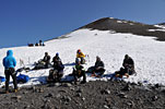
After five strenuous hours, we finally reach the snowy flat spot that is Helen Lake. We all plop into the snow for a well-earned break, marveling at the immense bowl that stretches up to the cliffs of Red Banks high above us. The panoramic view to the western landscape is nothing to sneeze at either. We are apparently the some of the first climbers up here today and have our pick of sites. A backcountry ranger who is stationed here in season has a large sturdy canvas tent at Helen Lake. He comes around to visit us (and check permits) later.

Soon the stragglers catch up and its time to set up camp. On the south side are several excavations in the snow where tents had been recently so that's a big time saver not to have to dig new platforms. Everybody sets to work erecting tents in the snow and then it's siesta time! There are other sites without snow on the west ridge of Helen Lake, but they're more exposed to the wind and are a little tight for the larger tents.

When I get my little camp set up and
ouch @#! boots!
ouch @#! boots!
arranged and pull off my boots and the duct tape, I'm not surprised at how bad my heels look, because they've been burning all day. @#! boots! The sun is beating down but the breeze across the snow is the perfect remedy to cool down my tired, hot aching dogs. I clean my feet, pop a couple of extra strength anti-inflammatories I'd gotten prescribed and then chill in my tent for an hour. After a siesta, we're called to gather for Snow School. It's a real effort to get my wet boots back on. One of the guys has had enough and bows out of tomorrows summit attempt.

Snow School
We grab our ice axes, don our helmets, harnesses and crampons
Stone enclosure, one of many at Helen Lake
Stone enclosure
and climb down to a steep snowy slope to learn the proper techniques of self-arresting from a sudden fall on ice. After a demo of how its done, we take turns dropping, sliding and jamming the axe into the snow, once, twice, three times - until we've all gotten it down. Then we practice climbing while roped together. The trick is to avoid letting the rope get anywhere near the sharp crampons, especially challenging when switching from a left traverse to a right traverse. Finally we practice glissading technique and how to brake and roll stop using the axe.

There's time to look around while the guides put together dinner.
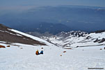
The summit isn't visible until we climb much higher up
As the sun sinks lower on the horizon, gusts of wind blow through and the temperature drops dramatically. At dinner, we gather in one of the built up stone enclosures they've called the kitchen and the guides talk about every detail of tomorrows summit attempt. Tomorrow is the most serious and potentially dangerous part of the journey, when the guides are responsible for much more than just leading us in the right direction. Climbing up the steep ice and over the cliffs is just the beginning. It's going to be the most strenuous climbing yet and the longest day.

We need to keep a tight schedule if we're to summit, return here to basecamp and then hike all the way down to the trailhead before dark in one day. We'll spend only 15 minutes or so on the summit.

Everything needs to be done in unison so one person doesn't hold everyone up on the steep ice. It will be pitch black and well below freezing at 2am when we start and the giant 40 degree angle slope up to Red Banks will be a sheet of ice. We'll rope up in three groups of three, our trek poles stowed, ice axes in hand, headlamps on, all layers on except puffy jackets because we'll warm up quickly once climbing and can't stop to take them off mid-slope. In our packs we'll take just water, lunch and snacks so we'll be dramatically lighter.

We'll take short breaks every hour and that's when we're to put on our puffys because the chill will set in fast when we stop moving. We'll need to chip out sitting ledges in the ice with our axes for the first few hours breaks. We're to bring water in our Nalgene bottles because hydration bladders (aka Camelbacks) are known to freeze over, denying any water. This means we'll only get to drink once an hour on breaks, which I don't realize will be a problem for me until later. It's critical we don't have anything that will fall out of our packs or pockets and slide down the mountain into others below, and that we don't kick any rocks. If someone above yells "rock", we're to immediately make a solid axe plant, hunker down and look up the mountain to try to spot the projectile. If one of us has trouble and can't make it, one of the guides can stay with them and take them back down.

As we've chatted, it's become a spectacular clear night. The sky is filled with stars and the wind has completely stopped. We turn in early. As I lie there contemplating the effort we've been through today and everything that's ahead of us tomorrow, 'snoring guy' slowly starts his apneatic song. Within an hour, his snorting and honking has built to a roaring crescendo, echoing all over Lake Helen. This guy can really blow a nose horn. His poor tent mate, how is he sleeping? Despite inserting earplugs, I don't get much sleep... again.


Day 3Sunday June 8Helen Lake to summit to Helen Lake to Horse Camp to Bunny Flat trailhead

It seems like only minutes after closing my eyes that I hear the shout in the dark to get up and get ready. It's very cold - mid twenties - and rousing from the warm cocoon of my down bag takes all my will power. I do want to get this done don't I?

Headlamps dart about in the frigid moonless darkness as the team slowly comes to life. I tape up my feet, which are stinging. My heels are raw but I'm just gonna have to tough it out to pull this off. They've got some hot oatmeal (again) ready in the "kitchen" and I down an obligatory cupful. At 2, we're all assembled and roped into 3 teams, checking gear. Already the dark bowl above us is alive with flickering headlamps of other climbers. We start the long slow trudge through the crunchy snow out of Helen Lake, one heavy labored step after another, like a an old steam locomotive just barely moving. The pace Joe established back at the beginning is second nature now.

"ROCK!"
Above the relative flatness of Helen Lake, the slope becomes sheer ice and the strain on calves begins as we have to walk on the edge of our feet, balancing carefully. We zigzag back and forth to relieve some of the stress, and it's an effort not to catch the rope with crampon when stepping over it on every traverse. After an hour, calves are burning and we take a break at a rock outcropping. As we set off again, Joe accidentally dislodges a softball-sized rock and immediately yells "ROCK!" at the top of his lungs as it goes bounding down the slope into the darkness. It was kind of a startling wakeup call. We're all real careful about rocks after that. At least twice in the next few hours, we hear the unsettling cry "ROCK!" again from above and then below, and each time we cringe and strain to see where it is. Thankfully no one gets injured.

As we climb this immense and steep icy slope in the cold, silent darkness under the stars, I enjoy the surrealness of the moment, a rush hour of lighted ants ascending a massive icy anthill. High above, we see headlamps from early-risers. Others are a few hundred yards away, and more are just reaching Helen Lake from the first rocky ledge now far below. Most are zigzagging like us, others climb straight up. There are a group of Japanese, and another speaking some eastern European language. I wished I could've captured the scene, but it would've required timed pics on a tripod, and there was no time.

Red Banks
After almost 3 hours, the first light of dawn begins burning away the darkness,
Taking a break at dawn on the ice slope above Helen Lake
and slowly the colossal shadow from the Mt. Shasta forms across the western landscape. It's still another couple of hours before the sun will rise over the huge peak above us. We reach the base of Red Banks cliff and one of the many chutes is chosen. They're all very steep and icy, impossible without crampons, and risky without ropes. There's no room for misstep here. Once atop Red Banks, the sun breaks out in earnest. It's a little disheartening to see the hill continues up steeply out of sight. My heels are aching but that's not what's bothering me now. I'm used to sipping water from my bladder tube regularly when I climb, and the once an hour water break has left me very dehydrated.
Joe leads 2 of the guys above Red Banks. You can imagine walking on the edge of your feet like this for 4 hours is murder on calves! Photo by Pearson
Joe leads 2 of the guys above Red Banks
I try to eat a snack but the exertion and thin air really diminish appetite, and I'm having a poor feeling overall.

Misery Hill
At the full light of day, we've reached the base of
Misery Hill, so called because it presents its incredibly steep pyramid of crumbling volcanic rock just when a climber is thoroughly exhausted. We can un-rope from each other for the rest of the climb. Another 40 minutes and we arrive at a large snowfield above Misery Hill. For the first time, we see the huge rocky mound that is the summit.
Shasta summit across a big snow field
Although it seems so close, it's still another 45 minutes of climbing and I'm feeling very weak from dehydration and oxygen deprivation. I'm actually not sure I can make it.

Our last break is at big rock pile at the edge of the snow field. Some of the other climbers leave their packs and jackets here and continue with just an axe. After taking a toilet break into a WAG bag (Now I have to carry that around the rest of the day…ug!) and drinking lots of water, I find a small reserve of energy, enough to push on.

Fumerole
Across the snowfield at the base of the summit mound is large swath of smoldering gray rock that smells badly. It's a fumerole - a volcanic hole from which hot gases and vapors are released. The sulphuric odor is a very powerful reminder that this is a living volcano and could erupt at any time.

The top!
The final push to the summit is a steep path-free route of boulder-hopping
Second summit mound from the first, and view northeast
Second summit mound from the first, and view NE
and then loose slippery rock to a saddle between two summit mounds. Finally we are on top! A dozen others are scattered around, catching their breath. The phenomenal view to the east opens up for the first time. Everyone trades atta-boys - we're all very happy. It's absolutely windless and the sky is brilliant, a perfect day to summit.
Arriving at the summit. Photo by Pearson
Arriving at the summit
Joe says its the nicest of all the dozens of trips he's led. We clamber around taking pictures, basking in the sun. For some reason, there are a lot of flies up here; a 14,000ft. peak seems like an odd destination for a fly. Other climbers arrive and still more are coming so we get ready to leave. All the Mt. Shasta climbers start for the summit about the same time from about the same basecamp areas at or below Helen Lake, so we all tend to arrive within the same hour window. It's wise to get down from the high ridges before late afternoon, when the accumulated heat can quickly change the weather for the worse. We take a group shot, then head out. We've been on top about 20 minutes.

The summit is only half way
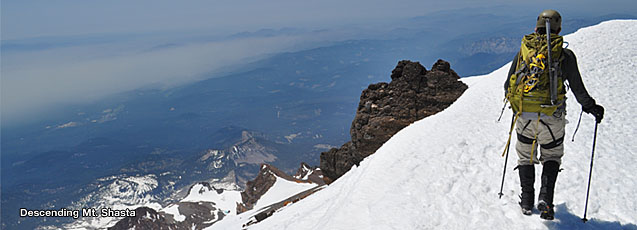
Descent from the summit. Photo by Pearson
Descent from the summit
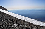
On the way down, we really get to enjoy the panoramic view west for the first time, spread out to infinity in front of us. We see the beginnings of Whitney and other Shasta glaciers. It's the most beautiful part of trip, high on the mountain above looming drop-offs. The element of danger serves to heighten the senses and highlight the fragility of humans - tiny figures clambering over gargantuan terrain. At the same time, we can marvel at the audacious human spirit that would undertake such an adventure. My feet aren't bothering me any more.

The slopes are almost as difficult to descend as ascend, as the crumbling
Above Red Banks, we find a clear route down near Thumb rock
rocks are extremely slippery and traction-resistant. Every footstep is carefully placed. Without trekking poles, it would be doubly stressful and dangerously risky, but some of the other climbers felt no need to use them.

We find a different route down Red Banks around the southwest side near The Thumb rock, and then we're back atop the giant bowl above Helen Lake. Now we get to glissade for the first time. I pull on my waterproof overpants and push off down a chute, but the friction of the melting snow doesn't allow much speed and I end up pushing myself more than sliding. It's early afternoon and once again very hot. This mornings ice has mostly melted, so most of us resort to walking again, disapointed to miss the long-awaited sliding fun. We posthole continuously in the softened snow, sometimes sinking up to our knees, which sucks out much more energy than allotted. With camp in sight, everyone breaks into their own pace and one by one we trip and glide down the steep slope. Because of the postholing, it takes almost 2 hours to get down the massive bowl from Red Banks and back to camp, where I collapse in my tent for 30 minutes. Once again the guides rouse us to pack up - we have to break camp and start the long descent down and out.

The trip down from Helen Lake to Horse Camp seems to take twice as long as coming up, when the anticipation of discovery and exploration is high. Some try more glissading, but it now requires more effort than walking and soaks pants thoroughly, adding weight. It's easier to descend on the dirt and rocks than the snow we came up on, so we move to the path. The slippery rocky switchbacks down the dusty brown landscape seem endless. Each carefully placed step rubs my boots against raw flesh. The sun is beating down mercilessly. Finally we reach treeline again, where there's some shade and the welcome stability of Olberman's flat stone trail for the final half mile to Horse Camp.

Back at Horse Camp Sierra Club cabin, dozens of exhausted summiteers occupy every shady seat, and more are arriving. We all know how each other are feeling! And we're all wearing that same satisfied grin of accomplishment that emanates from the soul. We've tackled a massive mountain, challenged our physical limits and come back (mostly) intact. In front of us there's still 2 hours of hiking down to the trailhead. One of the guys who summited is having extreme cramps from poorly fitting rental boots and he's not sure he can go on. The others head out, but I hang back with guide Johnathan to make sure the fellow gets out alright. On the way down, Johnathan tells me about his other job, a Waverunner lifeguard at Mavericks, the insanely colossal surfing wave near Half Moon Bay south of San Francisco.

Aprés hike celebration
It's after 6pm when we reach Bunny Flat trailhead and everyone is dead tired. But we all agree to meet up for an aprés hike burger and beer at a pizza joint in town. Once there, we find they close early on Sunday, so at lead guide Joe's suggestion, we make our way to the Wayside Grill south of town, an outdoorsy tavern/restaurant with gourmet burgers and sandwiches, pizza and seafood. It's perfect for a bunch of grungy hikers. We find a big table on the deck out back. I'm not sure how much is an appropriate tip, but I give the lead guide $40 and the other two $20 each. It doesn't seem like enough… After a delicious meal, many laughs and several pitchers of beer, we end our Mt. Shasta experience and part company.

The Fifth Season has an after hours deposit box to return rental gear and I find it's stuffed full after a perfect June Sunday. It's typical of my big city thinking that I'm concerned someone could steal the gear that doesn't fit in before they open and credit the return. But this
double ouch
double ouch
is a small town and I guess that kind of thing just doesn't happen enough for them to worry about it.

After the longest shower I could take before the hot water runs out, I get to treat my blisters properly for the first time. Ouch! It takes months for my feet to heal completely. Was it worth it? Absolutely!

Thanks for reading this far. If anything helps you, or you have comments or questions, please let me know. -Larry

Victory! Photo by Pearson
Victory!
 
Info
MtShasta 3D from Google Earth

Permits, Passes
Both wilderness permits and passes are required. Most of the area above tree line and some of the area below treeline are located within the Mt. shasta Wilderness. Permits are required for entry into the wilderness area at all times of the year, but there are no quotas or limits on the number of permits available, nor are reservations required. Permits are issued at the Mt. Shasta and McCloud Ranger District Offices, or may be self-issued at the trailheads. Permits may be self-issued at the station outside the front door of the Mt. Shasta District Office after business hours.

Summit Passes ($15 per person/$20 for 3-day permit) are required for everyone over age 16 who climbing above 10,000'. (Under 16 free) Passes may be obtained at USFS offices, The Fifth Season gear shop and at self-serve kiosks at the major trailheads.

There's a $5 fee to camp at Horse Camp.

Human waste packout
Everyone using the Mt. Shasta Wilderness is required to remove their waste in free provided bags and deposit it in special bins at the trailhead upon their descent. This system is in place in other highly visited mountain areas like Mt. Whitney where the environment has been negatively impacted by high volumes of traffic through narrow travel corridors. There's a composting toilet at the Horse Camp camping area, the last toilet on the Avalanche Gulch summit route.

Elevations:
Bunny Flat ........................6,950ft.
Horse Camp.......................7,900ft.
Helen Lake........................ 10,400ft.
Red Banks ....................... 12,500ft.
Summit ............................ 14,179ft.

Best of Mt. Shasta - My picks of local highlights
by Larry Sullivan, 2014

Best breakfast restaurant
Black Bear Diner is a big down-home old-school restaurant with rustic mountain lodge decor and tables, booths and counter. The staff seem to know everyone that comes in, and serve giant platefuls of food. There's also a gift shop.

Best aprés summit restaurant
Wayside Grill is a large tavern/restaurant on the south end of town. Just a few minutes down the main drag from downtown, the Wayside has tasty sandwiches and burgers, pizza and seafood, a full bar, friendly staff and later weekend hours than most others along the main drag in Mt. Shasta. There's a nice deck area overlooking a grassy field and the place is large enough for many groups. Recommended by lead guide Joe, we all loved this place. Don't shower first, come straight from the trailhead!

(2nd) Best Mt. Shasta climbing site
SummitPost.org has an excellent information and history page on Mt. Shasta

Best Outfitter
The Fifth Season reigns as the place to rent and buy any/all mountain gear, clothing, accessories, everything you need to climb. It's a big store with a lot to choose from and the staff seem knowledgable and helpful and experienced. (caveat - they're the only gear shop in town.)

Pictures
Getting there
Mt. Shasta is the biggest mountain in Northern California, visible from 100 miles away Mt. Shasta is the biggest mountain in Northern California, visible from 100 miles away Mt. Shasta from Lake SiskiyouMt. Shasta from Lake Siskiyou Mt. Shasta from Lk. SiskiyouMt. Shasta from Lk. Siskiyou Mt. Shasta is also the name of the town
Mt. Shasta is also the name of the town
Mt. Shasta and Shastina (R) from the north on Hwy. 97

On the trail
Day 1, Fri. morning: Gear check by our guide company, who run several groups up the mountain each weekend
Day 1, Fri. morning: Gear check by our guide company, who run several groups up the mountain most weekends
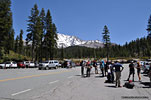
Bunny Flat, the trailhead at 6950' where our group of 6 climbers, 1 lead guide & 2 co-guides meet up. Our group is all ages, all experienced hikers.
It's warm and clear and the weather forecast is ideal for the summit attempt 2 days away
The first miles are a steady break-in climb through shady forest. Lead guide Joe keeps a slow gait so we can adjust to our clunky alpine boots, and the altitudeThe first miles are a steady break-in climb through shady forest. Lead guide Joe keeps a slow gait so we can adjust to our clunky alpine boots, and the altitude
After 3 hrs, we reach Horse Camp, where there's a Sierra Club cabin (and composting toilet!), and not much else. We set up our tents at camp sites in the adjacent woodsAfter 3 hrs, we reach Horse Camp, where there's a Sierra Club cabin (and composting toilet!), and not much else. We set up our tents at camp sites in the adjacent woods We study our route up Avalanche Gulch. Tomorrow we climb to Helen Lake, the plateau where the snow stops in the center of the picture
We study our route up Avalanche Gulch. Tomorrow we climb to Helen Lake, the plateau where the snow stops in the center of the picture

 
After dinner, there is time to learn about the mystical Lemurians who inhabit the mtn. I stay up to try to spot one...
Day 2: All of the groups begin climbing slowly out of treeline, the first mile on a stone path called Olbermans CausewayDay 2: All of the groups begin climbing slowly out of treeline, the first mile on a stone path called Olbermans Causeway It's soon very hot. After 3 miles, we get off the dusty trail & switch to the snow route to cool off. Others follow
It's soon very hot. After 3 miles, we get off the dusty trail & switch to the snow route to cool off. Others follow
You can see the 2 plateaus below Red Banks. Helen Lk, is the higher of the two, still a long tough climb above us...
We take breaks every hour, but by mid afternoon, we're all beat from the exertion, heat and thin airWe take breaks every hour, but by mid afternoon, we're all beat from the exertion, heat and thin air

A pair of glissaders slide past us. Fun! But it has to be steeper for much of a thrill
A pair of glissaders slide past us. Here's the video. If it doesn't auto-play in your browser, right click the link to download

The summit is behind the ridgeline and can't be seen until we're much higher on the mountain
Finally, we make it to Helen Lake, a flat spot on the slope, our destination for today's hike
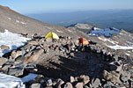
Helen Lake will be our base camp. My tent is the yellow one, top center. A park ranger stays up here during the season in the tan tent at right
Red Banks is the strip of cliffs across the center of the ridge. We'll turn right halfway up and climb the right side, where some climbers are descending
Helen Lake is a seriously tough climb and its only half way to the top. We're all exhausted! One of the guys bows out of tomorrows climb & will wait here for our return. After a welcome break, we gather on a steep slope to practice roped-climbing, self-arrest with ice axe and glissading.

We'll set out up this huge bowl by headlamp at 2am in freezing temperature, roped together in 3 groups of 3. All the snow melting in the midday sun will have turned to ice overnight
Room with a view
Room with a view
West below Helen Lake, other climbers settle in on the lower plateau
Day 3: After 3 hours of surreally quiet ice climbing in the pitch black predawn, our world slowly rotates in to the sun. Half a dozen groups are all climbing at the same time, some straight up, others zigzagging up like us
This pic shows a little bit of how steep this slope is. It's sheer ice, impossible without crampons. We have to chip sitting ledges out of the ice with our axes. One slip would send you hurtling thousands of feet down the slopeThis pic shows a little bit of how steep this slope is. It's sheer ice, impossible without crampons. We have to chip sitting ledges out of the ice with our axes. One slip would send you hurtling thousands of feet down the slope Shasta's peak shadow appears over the western landscapeShasta's peak shadow appears over the western landscape

Several times someone above yells "rock!" and all the groups immediately hunker down, straining to sight the dislodged projectile before it clobbers us
Four hours and we've climbed above Red Banks
Four hours and we've climbed above Red Banks.
Walking with crampons is unlike any other activity. Your foot is never flat on the surface, so the strain on calves is phenomenal
View southwest, climbing above Red Banks through 13,000ft.
View SW, climbing above Red Banks through 13,000'
Misery Hill is the last impediment, so called because it presents its very steep grade when everyone is exhausted from the exertion in thin airMisery Hill is the last impediment, so called because it presents its very steep grade when everyone is exhausted from the exertion in thin air At the top of Misery Hill, we see the actual summit for the first time, across a big snow field. It's still another significant climb
At the top of Misery Hill, we see the actual summit for the first time, across a big snow field. It's still another significant climb

Finally on top, 9 hours later. The first in our group queue to stand on the highest spot
Most of the climbers on the mtn. reach the summit about the same time, because it's wise to get down before afternoon weather arrives
This northeast view shows a bit of the size of the summit. The east side is a looming dropoff
The big summit snowfield tapers down to the pinnacle of Misery Hill, where you can see climbers silhouetted.
Our tired but jubilant crew. There was no wind at all, and our experienced lead guide Joe (top row, 3rd from L) said it was the nicest he'd ever seen it
The gray rock area at right is an active volcanic fumerole with steam vents, hot rocks and a strong sulphur odor

Traffic jam. Guide Pearson recognized famed free-climber Alex Honnold on the summit and we chatted some
The summit is only half way - now we'll return to basecamp, break camp and hike all the way out before darkThe summit is only half way - now we'll return to basecamp, break camp and hike all the way out before dark Climbing down from the summit, there's really no path to speak of and it's very steep, loose rockClimbing down from the summit, there's really no path to speak of and it's very steep, loose rock You can see how the snowfield funnels everyone to the top of Misery Hill
You can see how the snowfield funnels everyone to the top of Misery Hill
The top of Whitney glacier, one of nine on Mt. ShastaThe top of Whitney glacier, one of nine on Mt. Shasta The trek down is the when we really get to enjoy the spectacular view
The trek down is the when we really get to enjoy the spectacular view

View northwestView northwest 12,329' Shastina is a sub peak, but the 3rd highest in the Cascade range. You can see its clearly formed volcanic caldera12,329' Shastina is a sub peak, but the 3rd highest in the Cascade range. You can see its clearly formed volcanic caldera
The steep slope above Misery Hill leading down to the Red Banks

Making our way down from Misery Hill
Above Red Banks, we choose a different descent route than the one we took up, turning to the right just before the peak called Thumb RockAbove Red Banks, we choose a different descent route than the one we took up, turning to the right just before the peak called Thumb Rock This pic shows how steep the slope is we ascended and descended. Guide Pearson (L) kept things lively and fun
This pic shows how steep the slope is we ascended and descended. Guide Pearson (L) kept things lively and fun
You can see a solo climber (left of top ctr.) making his way down the snowfield above Red BanksYou can see a solo climber (left of top ctr.) making his way down the snowfield above Red Banks Slipping through a crack
Slipping through a crack
The Red Banks of Mt. ShastaThe Red Banks of Mt. Shasta

Below Red Banks, we enter the big bowl above Helen Lake once againBelow Red Banks, we enter the big bowl above Helen Lake once again A pair of climbers glissadingA pair of climbers glissading After some glissading and lots of walking/postholing through deep snow, all of our group slowly straggle back to campAfter some glissading and lots of walking/postholing through deep snow, all of our group slowly straggle back to camp After breaking camp, we begin the long journey out, fully loaded with all our gearAfter breaking camp, we begin the long journey out, fully loaded with all our gear Some try more glissading (center left) on the way out, but its hot now and the snow has already melted enough to make it more of an exertion than walkingSome try more glissading (ctr. left) on the way out, but its hot now and the snow has already melted enough to make it more of an exertion than walking We took the snow route up to Helen Lake, but coming down is easier on the established dirt pathWe took the snow route up to Helen Lake, but coming down is easier on the established dirt path

After many hot hours of alpine descent, approaching the welcoming shade of treeline againAfter many hot hours of alpine descent, approaching the welcoming shade of treeline again Returning to Horse Camp on the Olberman CausewayReturning to Horse Camp on the Olberman Causeway Exhausted summiteers from many different groups, including several women, squeeze into every available shady seat at the Sierra Club cabin at Horse Camp. We all know exactly how everyone else is feeling right now! It's still 1.5 more hours down to the trailheadExhausted summiteers from many different groups


More photos in the Trip Report top of page

TOPHikes Index


Since Oct.2014