 |
|
| Big Pine Lakes & Jigsaw Pass, John Muir Wilderness, Inyo National Forest, California 4 days exploring a high Sierra basin surrounded by dramatic peaks and brilliantly colored lakes |
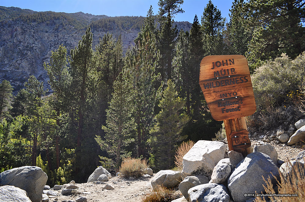
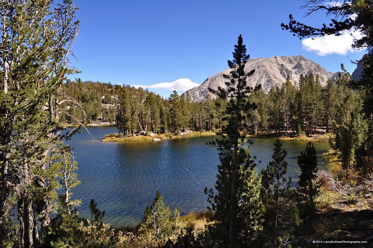
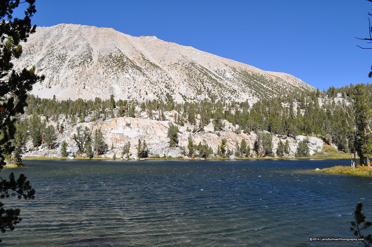
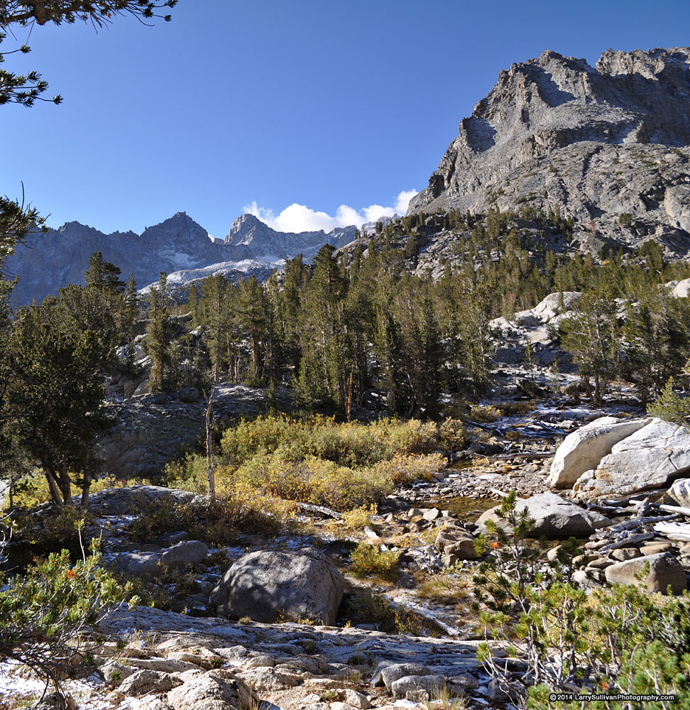
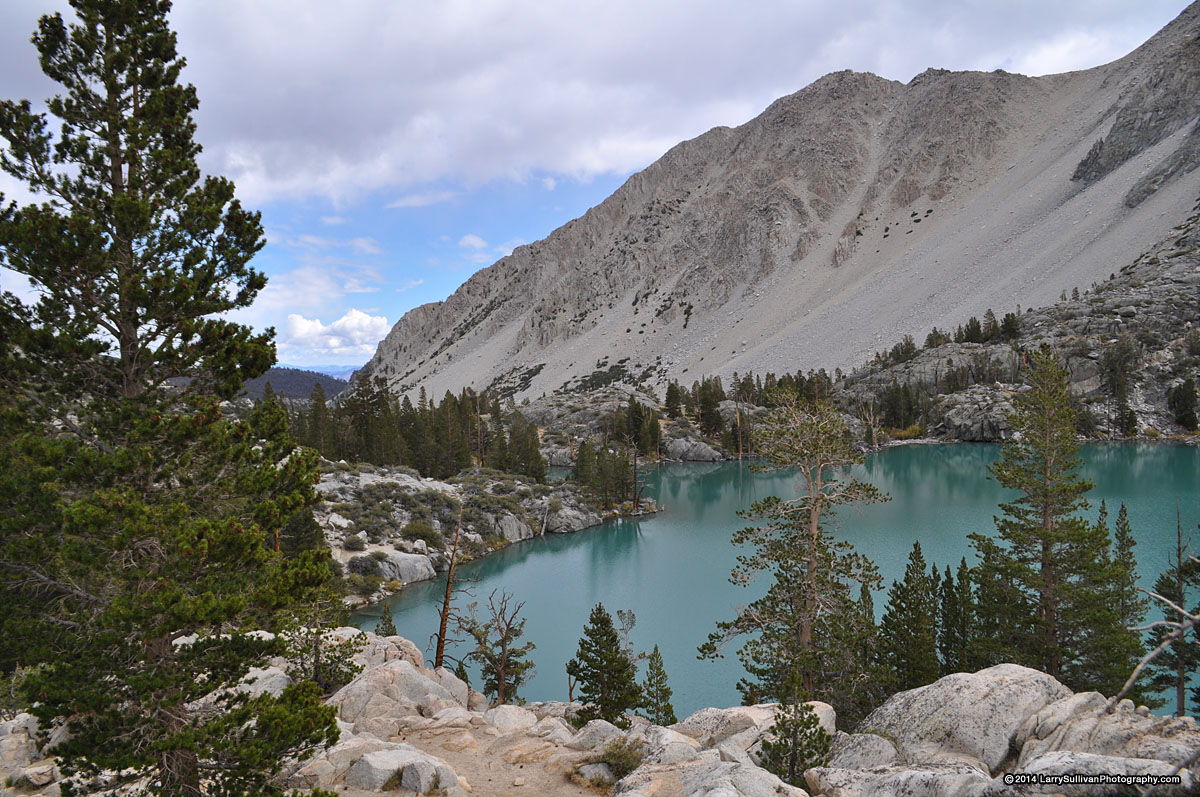
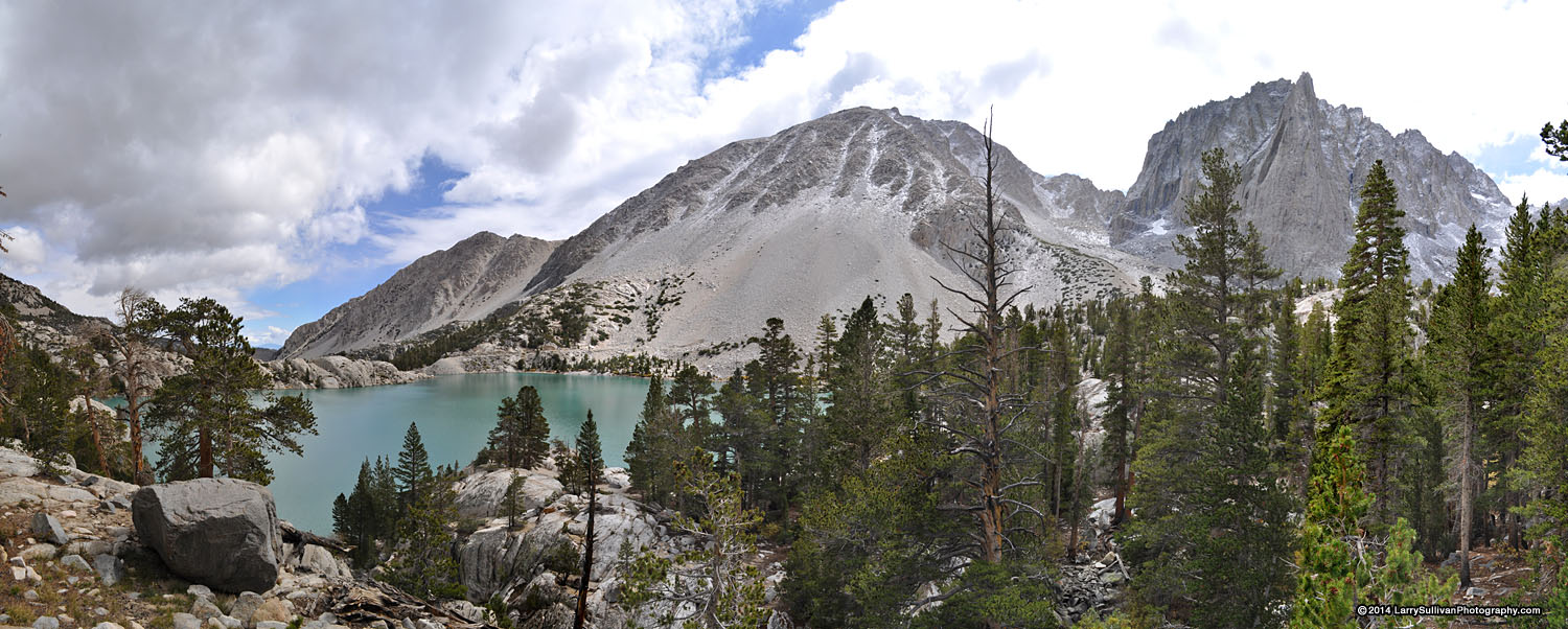
The Big Pine Lakes basin is an easy-to-access high mountain wilderness near the little town of Big Pine in Central California, situated in the John Muir Wilderness in the eastern Sierra Nevada range. The entry portal to this basin is just 10 miles west of Hwy. 395, so it's popular with hikers, climbers and fisherman. Surrounded by 12,000-13,000' peaks, all of the nine major lakes offer spectacular mountain vistas—the higher you climb, the more impressive the settings. The basin has many well-maintained and signed trails as well as several more remote lakes available to to intrepid cross-country explorers. Many of the lakes can be visited on a long day hike.
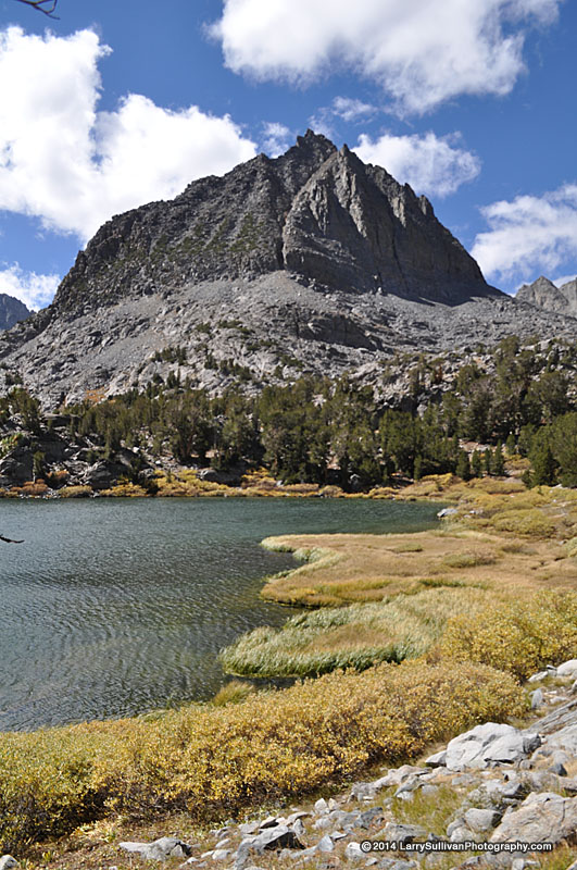
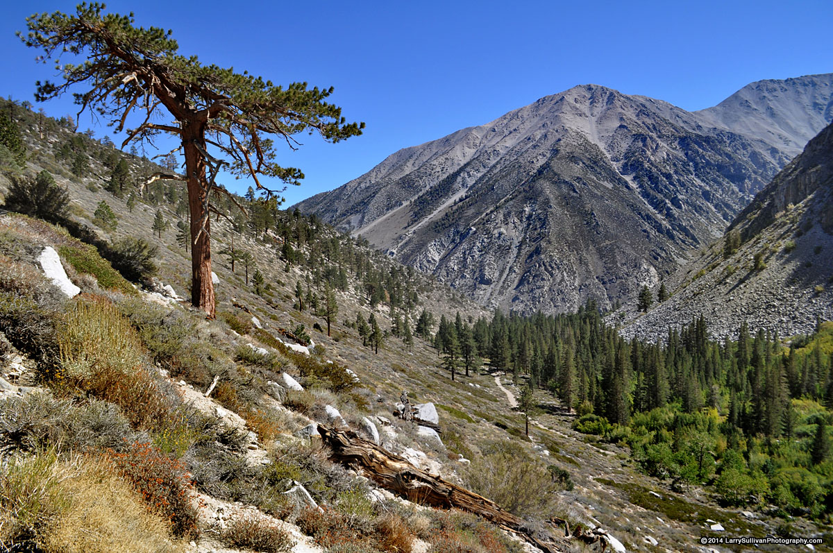
Expect a challenging climb from the trailhead to the first two lakes, and then more climbing to each subsequent lake. It takes about 2.5-3 hours to get to First Lk. The early explorers were busy attaching interesting names to the surrounding mountains like Temple Crag, Thunderbolt Pk. and Cloudripper, and seemingly named the nine larger lakes as an after thought, with uninspired names like First Lake, Third Lake & Seventh Lake. But someone managed to come up with Black Lake and Summit Lake too. As expected, the numerical lakes are named in order of appearance from the trailhead. The astonishing aqua color of the water is a result of glacial silt from the adjacent Palisades Glacier. Lon Chaney cabin |
Trailhead The well established and signed trail begins as a dirt road under shady trees beside energetic Big Pine Creek.The trail to Big Pine Lakes is the North Fork trail. The trailhead for the South Fork, to Willow, Brainerd & Finger Lakes also starts nearby. Also at roads end are several seasonal residences. After 1 mile, the dirt road becomes a single track. One quarter mi. east, just west of the group campground, a larger overflow parking area services stock parties as well as hikers. The trail from this lot joins up with the main trail after a quarter mile climb, but before it begins the steep ascent of the canyon. This is an unshaded climb and not as nice a start. It would be a good idea to familiarize yourself with the dual trailhead situation via Google Earth or Maps as there are several divergent trails where the two meet, but all eventually lead to the canyon Northwest and up. |
A journal of planning and hiking Big Pines Lakes and Jigsaw Pass, with some info that may be helpful to those considering this hike. |
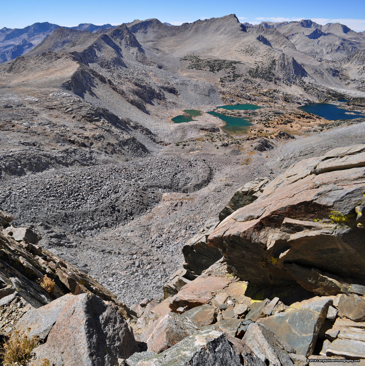
This trip was my season-ending solo backpacking/photography outing for 2014. As planned it was more ambitious than circumstances allowed. Here's a map of my planned route, a point-to-point trip of around 30 mi., including some out-and-back trips to explore some of the more remote lakes. I'd leave my car at South Lk. in the Bishop Creek basin, then find rides to my starting point at Big Pine Lakes, a distance of about 75 highway miles. After exploring the Big Pine Lakes, I'd climb over Jigsaw Pass, then over Bishop Pass into Dusy basin for a couple of days and finally back over Bishop Pass and up Bishop Creek basin to my car at South Lake. Some snow was forecast for the final 2 days, and although I wasn't expecting it to be much of an impediment, I wanted to get over Jigsaw before that. I was looking forward to a dusting of white to add to the experience. |
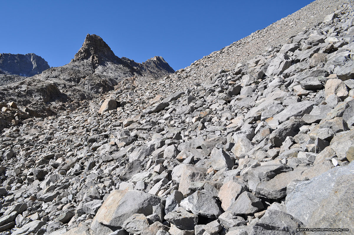
I spent considerable time reading and researching online to find out if the west face of Jigsaw Pass was doable from an average hikers perpective, rather than from that of a technical climber, which I'm not. Sierra expert Secor's book noted Jigsaw Pass was an "easy col", but I wasn't so sure. I spent many hours pouring over maps, photos, trip reports and Google Earth and it looked like a tough wall to tackle, especially with a loaded backpack. Apparently Jigsaw had once been a viable trailed pass, but an avalanche wiped out any semblance of a trail many decades ago. Despite this, several people had posted descriptions and photos of successful climbs, which routes to take, which to avoid. A ranger suggested I bring a rope to lower my pack, which I did. So I decided that I could probably pull it off. If not, I'd turn around and climb back down the way I came. But since I'm leaving my car on one end and finding rides to the other, it would be unfortunate if I'd have to retrace that part too. Turns out, Jigsaw Pass was much more difficult than I anticipated and after a long tough climb on day 3, I knew looking over that sheer precipice in fierce gusting wind that turning around was the only option. Oh well, c'est la vie. Big Pine Lakes basin is still a beautiful area to return to. |
| Day 1Wednesday Sep. 24Trailhead to Summit Lake | ||||||||||
|


| Day 2Thursday Sep. 25Summit Lake and Fifth Lake to Jigsaw Pass | ||||||
|


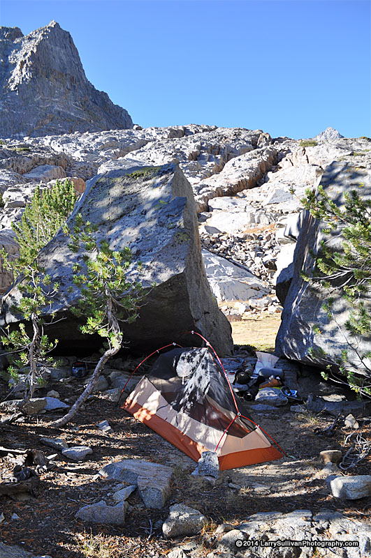
| Day 3Friday Sep. 26 Jigsaw Pass, Fifth Lake | ||||||||||||||
|


| Day 4Sat. Sep. 27 Back to the trailhead | ||||||||||
|


Permits or If you're climbing over 10,000', its a good idea to acclimate to the altitude by camping one night at trailhead elevation to avoid altitude sickness. Large stock (horses,mules) parties are allowed throughout the Sierra. Usually they are private expeditions but some resupply the backcountry rangers in season. Expect to sidestep piles of manure on any trail. When stock approach, hikers are encouraged to step off and below the trail, so as not to spook the animals. |
Camping There are no campfires allowed in Big Pine Lakes basin.
More info:
|
|
| ||
 Bear canisters are recommended in Inyo National Forest but not required. If you're parking in a trailhead parking lot, you are required to remove all food from your car, mark it with your name and place it in the provided steel bear boxes at the trailhead. It will be discarded after one week.
| Getting there & back | ||||||||||
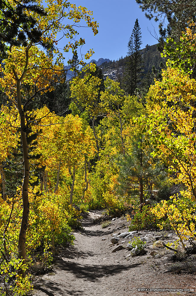
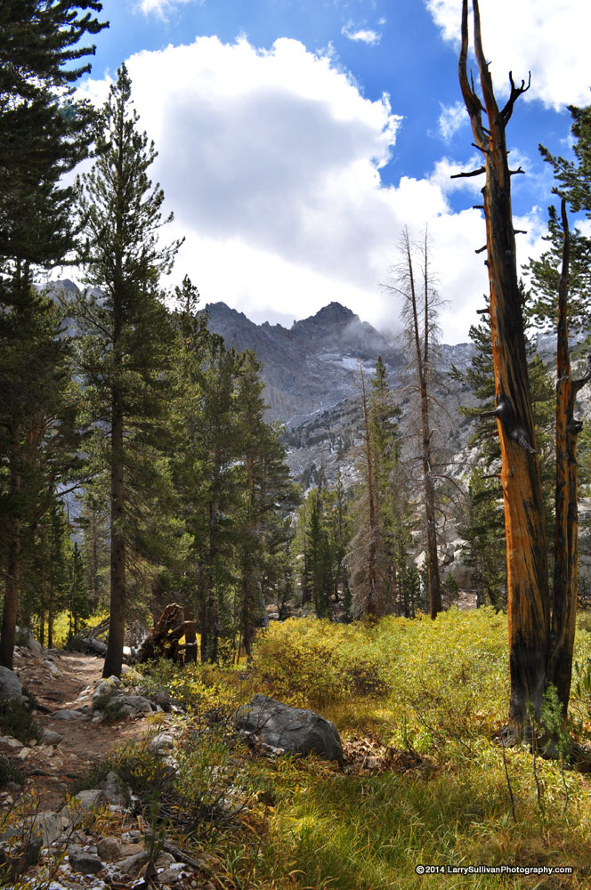
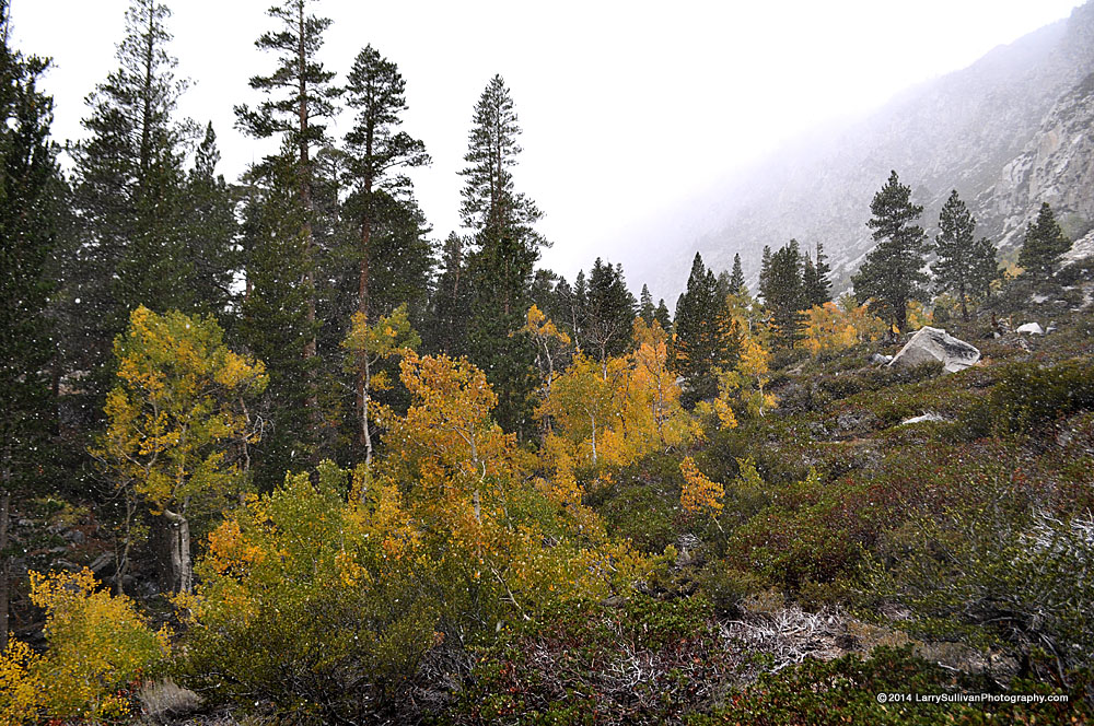
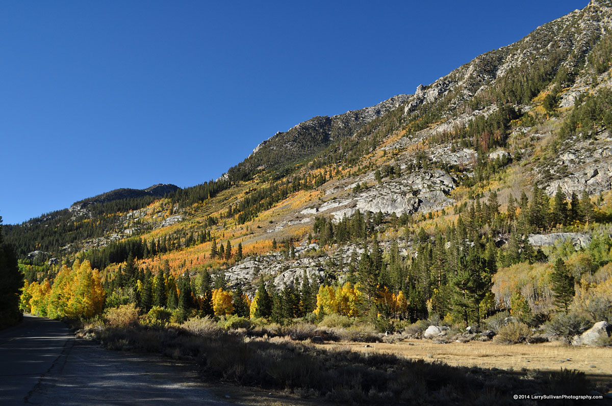 It isn't New England but the Sierra puts on a respectable autumn foliage show It isn't New England but the Sierra puts on a respectable autumn foliage show |
 Sierra aspens turn their most golden late Sep.- early Oct. Sierra aspens turn their most golden late Sep.- early Oct. |
 Hwy. 395 south on the drive out Hwy. 395 south on the drive out |
||||||||


More photos in the Trip Report top of page
TOP![]() Hikes Index
Hikes Index
Since Oct.2014