Exploring a giant rock formation near the highest peak in the Santa Monica mtns.
| Boney Mountain to Citadel Rock via Backbone Trail Exploring a giant rock formation near the highest peak in the Santa Monica mtns. |
| Back to Boney Mountain and beyond Sandstone Peak—the highest point in the Santa Monica mountains— to explore the caves and crevices of a fortress-like rock formation at the far western end of the area that I didn't have time for on my last trip here. | The area this immense rock is in is called the TriPeaks, but according to a map, lives in an area further south than the TriPeaks. Because of its fortress like appearance, I'm going to audaciously name it and refer to it as The Citadel until sufficiently chastised by the proper authorities. Very hot - in the mid nineties - but a clear and beautiful day for exploring. |
| Sandstone Peak trail
starts as a gated fireroad at the north end of parking lot and climbs
up through switchbacks to the ridgeline. About 3/4 mi. up, you'll pass
the footpath for the Mishe Mokwa loop on the right. Stay on the Sandstone Peak trail for 3-4 mi. You walk at least 1/2 mi. beyond this rock before you get to an intersection with a trail going west. Follow this trail west and then south at the split and you'll soon climb up through some dense brush to a clearing, marked by a large cairn with a dead yucca plant (i made) where you'll find access to a tiny overgrown path up the north flank of the rock. Be alert for rattlesnakes, poison oak and ticks. |
|
| STATISTICS |
| Boney MountainSanta Monica mountains, Ventura county Height: Approx. 3000 ft. Elevation change: Approx. 1800 ft. Distance: 3.5 mi. one way Duration: Approx. 2 hrs. one way. Difficulty: Moderate. Water availability: None |
| From San Fernando valley in Los Angeles, take Hwy. 101 north to the town of Westlake Village. Exit Hwy 23 south/Westlake Blvd., T/L (southwest) over freeway. Follow Westlake Blvd. 10-15 miles up the mountain, where it becomes Mulholland Hwy. Go 6-7 mi.on twisty Mulholland and T/R at stop sign, staying on Mulholland. About one half mi., T/R Little Sycamore Canyon Rd. and go 15 mi. or so. After a few miles, LSC road becomes Yerba Buena road. You'll see parking area for Boney Mtn. on right. | From the Pacific Coast Hwy., go 30+ mi. north of Sunset blvd. T/R at Yerba Buena Rd., which is on the north side of the restaurant Neptunes Net., and follow 10+ mi. it to the Boney Mtn. parking lot on left. | |
|
||
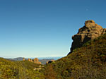
 Shot this view before, but it never gets old. This giant rock is over 200 feet tall. South to Santa Monica bay, with Santa Catalina Island. |
 Moon over the mountain. This area is about as far west as you can hike before you have to go down the Pt. Mugu trail. Or off the cliffs... |
 Exploring the back side of this unique cave-riddled formation I'd seen from across the canyon, scouting a way up... |
 Its an impressive citadel, scarred with caves and crevices. All the obvious approaches were covered in spiky thickets, bramble and cactus. Looking North from the back. |
 After trail-blazing and scrambling to the top of the "fortress", looking north toward Oxnard and the Los Padres range. |
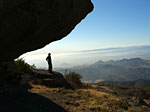
 This overhang is big enough to be called a cave, with a nice fire pit. Looking northwest toward Ventura as an onshore flow brings the clouds in from the Pacific. |
 Lots of unique formations to discover. Facing east from the summit. |
 South to Malibu and Catalina Isand. |
 It's not pollution - the clouds roll into the coastal mountains like this all the time. |
 Climbed up on this outcropping across the way last trip. The pic here shows where I was sitting and taking pictures from, looking back this way. Can't tell from here, but it's up there! |
 |
|
 |
|||||
Since
Jan.09
|