A steep climb through an explosion of flowers above a lush, green valley
| Santa Paula Peak Los Padres mountains,
Ventura county A steep climb through an explosion of flowers above a lush, green valley |
4730 ft. Santa Paula
Peak is part of a ridge towering above the fertile Santa Paula valley,
a wide swath of rich farmland northwest of LA between Santa Clarita
and the Pacific Ocean. This south-facing wall of the Los Padres mountains
serves as the southern boundary of the immense Los Padres National
Forest and the Sespe Wilderness. Year round sunshine and the protective
mountains creates a favorable growing climate and the majority of
the valley is covered with citrus farms. A few miles northeast is
the Sespe Condor Preserve, where California Condors are making a comeback
from the brink of extinction. |
Santa Paula Peak shares
the ridge with an unnamed cone-shaped peak one quarter mile to the west.
This unnamed peak is several hundred feet taller and the most prominent
on the ridge when viewed from below. I'd hope to bag this peak in addition
to Santa Paula Peak, but there's a steep, craggy promontory on the razor-like
saddle between the two and it appears that there is no non-technical
approach from Santa Paula Peak. Cattle Be aware that there is at least one gigantic, shiny hornless black bull that probably weighs 1200 lbs. I found myself face to face with him, and to my dismay, he didn't race off as I approached like the  cows
behind him. Instead he stood near the road ahead of me, all gleaming,
bulging muscle, his neckless head as wide as my shoulders, chewing his
cud and glaring disdainfully as if to say "you're on my grass, puny
human". Needless to say, I stopped and began slowly side-stepping up
the hill away from him to give him a wide berth, talking to him as soothingly
as possible. Was I wearing red? I did a quick scan of my clothes, not
sure if that was just a myth or not. Whew! No red! I sure didn't want
to scramble up the steep hill to get away if he came after me because
he could bound up on to me in a few easy leaps. Having trekking poles
for defense gave me only a twinge of comfort as the impasse lasted 20-30
extremely long seconds as he stared me down. He started moving and for
a moment, I thought I was dead meat. Then he turned very slowly and
trotted off into the brambles. "Yeah, run home, ya big sissy!"
I called after him. cows
behind him. Instead he stood near the road ahead of me, all gleaming,
bulging muscle, his neckless head as wide as my shoulders, chewing his
cud and glaring disdainfully as if to say "you're on my grass, puny
human". Needless to say, I stopped and began slowly side-stepping up
the hill away from him to give him a wide berth, talking to him as soothingly
as possible. Was I wearing red? I did a quick scan of my clothes, not
sure if that was just a myth or not. Whew! No red! I sure didn't want
to scramble up the steep hill to get away if he came after me because
he could bound up on to me in a few easy leaps. Having trekking poles
for defense gave me only a twinge of comfort as the impasse lasted 20-30
extremely long seconds as he stared me down. He started moving and for
a moment, I thought I was dead meat. Then he turned very slowly and
trotted off into the brambles. "Yeah, run home, ya big sissy!"
I called after him. He was actually a beautiful animal - so powerful and imposing. I've gained a lot of respect for cattle by hiking mountain pastures. They are incredibly agile and sure-footed, moving easily through steep and difficult terrain on which humans must use extreme caution. It's a good idea to make noise as you approach tall thickets so as not to spook the cattle, as they often graze near the trail where they can't be seen and tend to stampede when surprised. The explosion of noise is startling to say the least... |
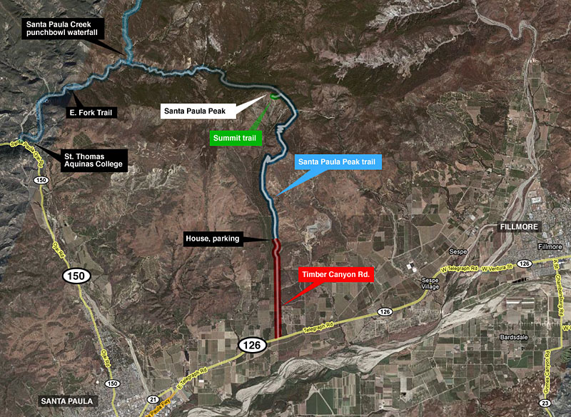
There are two ways to hike Santa Paula Peak - the short way and the long way.
Timber Canyon is a private road that's gated just a few yards off Hwy. 126 and it's 1.8 miles from the gate to the house that is the beginning of the hike. It's basically a long driveway which ends at the Diamond residence, the only house on the road. The Diamonds are nice, gracious people who allow hikers to park on their property and walk up their driveway and behind their house. Call the Diamonds the day before to get the gate code. (Email me for their phone number, I'm not listing it online.) Apparently, most Peak hikers are members of the Sierra Club, who get the Diamonds' contact number through the club. I had to drive out the day before to get it from neighbors. Beware of their large, scrappy-looking dog of undeterminable species. From the gate at Hwy. 126, Timber Canyon Rd. passes through several private orchards and farm road intersections. Stay straight at a fork and through another gate which stays open. Below the Diamonds house, park on the right shoulder of the road at the bottom of the driveway, and walk up the driveway to the farm road on the right/east side of the house. Following the dirt road a half mile, there is a heavy steel barbed-wire topped gate you'll have to climb over. From here to the first switchbacks, you're in cow country and may come across a herd at any time. The road is little more than a tractor path full of deep hoof ruts and droppings. After a mile, you'll see a grassy ridge, the spine of which points north to Santa Paula Peak. Follow the road around the left/west side of this ridge. After about 2 miles, get off the main road at an overgrown road/cattle trail on the right through an oak grove along the base of the grassy ridge. Follow this path north, then south up the hill at a switchback. |
As you follow this overgrown,
grassy road south and up, look for a footpath on the left. This is the
beginning of the main trail and leads directly to the first series of
switchbacks up the west face of the first mountain. I stacked some rocks
on the way down, as it was unmarked, but it's an active cow trail and
they'll get knocked over and scattered. If you miss this path and continue south up the hill, you'll come across a barbed wire fence 20 yards further atop the grassy ridge. Next to this fence is a substantial-looking path up the ridge, but it quickly climbs away from the main path into thickets and brambles and the tall grass hides deep cow hoof holes in the mud that will trip you up. Soon, there's a steep clambor up a loose rock spine with long dropoffs on 2 sides, then more tall thickets and brambles. I went up this way because I had no more info for my hike than "stay on the right side of the canyon and you'll find the trail". I got many scratches and tripped and fell over a hidden stump that could've been disastrous. Get on the switchbacks, as you won't have fun going this way! It was easy to determine the main path on the way down. After the lower switchbacks, the trail winds around the east side of the mountain to the upper switchbacks on the south face of Santa Paula Peak. The upper switchbacks put you on high on top of a ridge where you can first see the Los Padres backcountry that is blocked by the Peak. Around the north side of the mountain, look for the summit trail up on the left. Except for a broken, worn out sign that says "National Forest", it's easy to overlook. (If you go straight, you'll end up far down the back side of the mountain at Santa Paula Creek) Near the summit, there's a scramble up a long red rock scree slope and you're there. The long way to Santa Paula Peak is via the Santa Paula Creek trail from St. Thomas Aquinas College. It's between 8-10 miles from parking lot to the summit, and involves several miles of boulder hopping and scrambling along the creek trail up to and beyond the punchbowl waterfalls. (See that hike here). It's mostly public land through the Los Padres National Forest. Overnight camping is allowed with a Wilderness Permit from the Forest Service. Campfires aren't allowed in much of the Los Padres mountains as fire danger is extreme most of the year. The Diamonds plan on selling their home in 2010 and the new owners may not allow hikers on their property, so the long way may become the only way to Santa Paula Peak in the near future. |
| STATISTICS |
| Santa Paula Creek Peak via Timber Canyon Rd. Elevation gain:3620 ft. Distance: 5-6 miles one way Duration: 3 hours up, less down Difficulty: Challenging Water availability: None. |
| Santa Paula Peak is
halfway between Fillmore and Santa Paula on the north side of Hwy. 126.
From LA, you could take I-5 north to Hwy. 126 west out of Santa Clarita
to Fillmore, but I recommend the scenic route through Grimes Canyon: From the San Fernando valley in LA, get on the 118 west to Moorpark and exit westbound on Los Angeles Ave. T/R on Moorpark Ave. / Hwy 23, which is the 3rd or 4th light. Follow Hwy. 23 10-15 miles, through a sharp left and a sharp right through the orchards, then down into amazing Grimes Canyon and into Fillmore. T/L on Hwy. 126/W. Ventura St. and follow it 8 mi. to Timber Canyon Rd. It's 34 miles from Topanga Canyon Blvd. and Hwy. 118 to the trail head. |
|
|
| ||
| Getting there | |||||
 Approaching Fillmore and the Santa Paula valley on Hwy. 23/Grimes Canyon Rd. in Ventura county. |
 The Santa Paula mountains mark the southern boundary of Los Padres National Forest, home of the Sespe Condor Sanctuary and the Sespe Wilderness. |
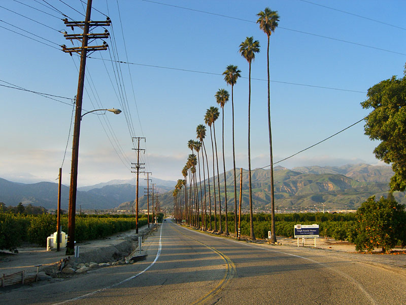
 The ridge with Santa Paula Peak towers above orange groves in the Santa Paula valley. In this photo, SP Peak is obscured by San Cayetano mountain (The peak on the right) directly in front of it. |
 Looking north up Timber Canyon Rd., a private, gated road through several farm properties to the Diamonds' house, where you park and begin the hike. SP Peak is just right of the tower. |
 The trail starts at the dirt road to the right of the driveway beside the Diamonds house. |
|
| The Trail | |||||
 After almost a mile, you have to climb over this barbed wire-topped gate. Hope you're good at climbing. Now you're in cattle country. |
 The road accesses numerous orchards and grazing meadows.The fence keeps several herds of cattle in, including a gigantic horn-free black bull that may scare the bejeezus out of you, but he's not confrontational, thank god. |
 The grassy ridge is a significant landmark. The wooded mountain just beyond it is where the footpath starts in earnest. Follow the road around the west/left side of the ridge. |
 Looking back, south. |
 After about 2 miles, look for these trees, where you leave the main road and turn right onto an overgrown road/cow path which follows the western base of the grassy ridge. |
 You can see a cairn I made, which will be knocked over in course by cows like others cairns here have been. It's a major bovine thoroughfare, apparently. It's easy to miss this road if you're not paying attention... |
 Good idea to make noise as you walk through these densely thicketed meadows, so as not to spook a stampede. The racket can be a little unnerving at close quarters... |
 The overgrown road goes north then switchbacks south up this flower strewn ridge. Looking back north to Santa Paula Peak, center. You can see what once was a road is just a wide grass trail. |
 Look for this faint footpath on the left that I've marked with cairns. It leads directly to the first set of switchbacks. |
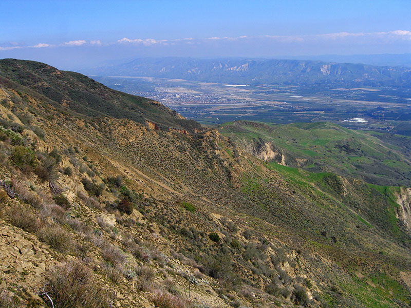
 Looking
south down the valley just ascended at the switchbacks on the west
side of the first mountain and the grassy ridge below it pointing
toward the entrance.This is probably the single
most important pic to orient the trail position to the road. Looking
south down the valley just ascended at the switchbacks on the west
side of the first mountain and the grassy ridge below it pointing
toward the entrance.This is probably the single
most important pic to orient the trail position to the road. |
 Lots of erosion-formed terrain. |
 Southeast towards Fillmore and the Santa Susana mountains behind it |
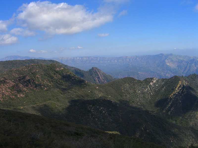
 Santa Paula Peak (right) and its unnamed neighbor peaks |
 To the west, the Pacific Ocean and Channel Islands are visable, but don't show up well in this photo. |
 Looking northwest at the summit of Santa Paula Peak and the steep narrow, saddle connecting it to its sister peak |
 The summit path turns off to the left. If you go straight, you'll end up on the Santa Paula Creek path to St. Thomas Aquinas College (if you go the right way) The sign says "National Forest". |
 The last few hundred yards are a scramble up scree. |
|
 The unnamed sister peak is less than 1/4 mi. west but would be a risky climb from Santa Paula Peak without technical gear. This is the peak seen most prominently from the valley floor. |
 From the summit, looking south down the canyon just ascended. You can see the switchbacks and the grassy ridge beyond them. The mountain to the south is cleverly named "South Mountain." Behind it in the distance is southern Ventura county and the Pacific Ocean. |
 Summit marker reads "US Coast & Geodetic Survey Triangulation Station. For information, write to the Director, Washington, DC. $250 fine or imprisonment for disturbing this mark. Santa Paula" Elevation is illegible |
 Vic
and Sue Henney, from West L.A., have bagged an impressive number of
local peaks. They arrived at the summit just 10 minutes before me. Vic
and Sue Henney, from West L.A., have bagged an impressive number of
local peaks. They arrived at the summit just 10 minutes before me. |
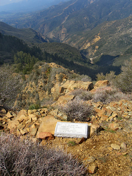 Tombstone of a 45 year old guy whose ashes are scattered here, I'm told. |
 Looking northwest |
 The deep valley northwest holds the E. Fork trail along Santa Paula Creek which begins at St. Thomas Aquinas College on Hwy. 150. |
 . |
 |
 Looking northeast. In the distance is TopaTopa Peak and the Sespe Condor Sanctuary. |
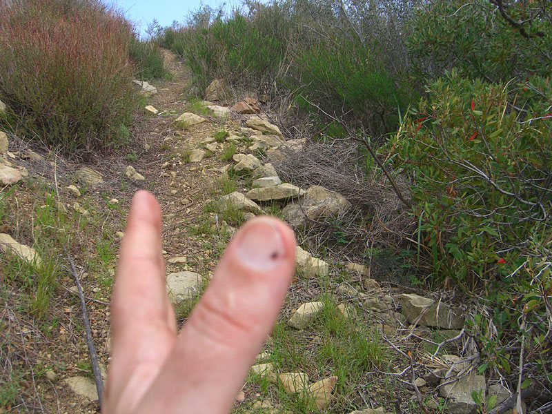 Make sure you check for ticks. Flicked off 6 of the little buggers I found crawling on my legs while hiking, and #7 on the bathroom floor after a shower. |
|
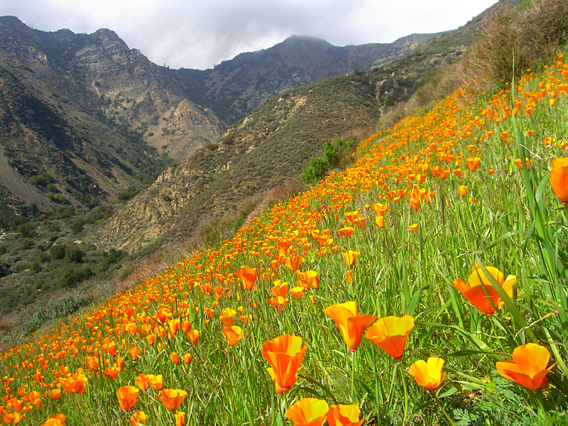
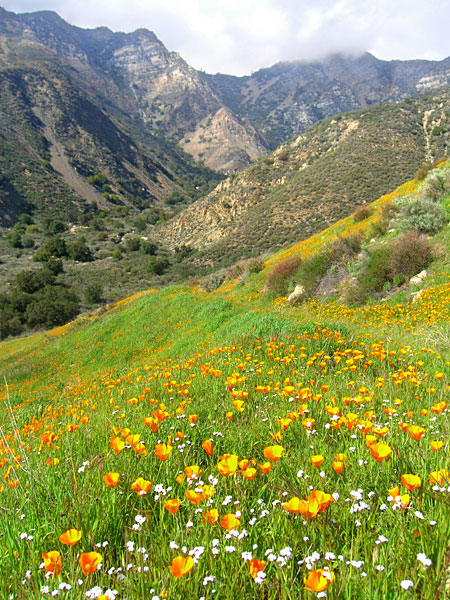
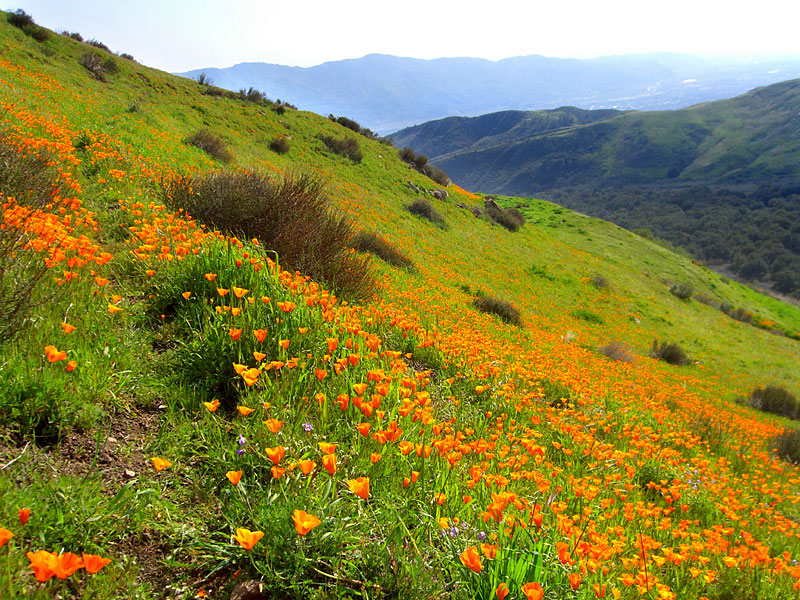 Explosion of flowers. |
 . |
 . |
 |
 . . |
 . |
 |
 Some
clouds had moved over the peak as I came down, but I waited for a while,
and eventually they cleared off. Some
clouds had moved over the peak as I came down, but I waited for a while,
and eventually they cleared off. |
 |
 |
 . |
 . |
 These cows were grazing in tall grassy thickets yards away from the trail, hidden from view. Before I saw them, they all took off in loud crashing thunder of hooves and breaking bushes and in few seconds were high on this ridge, from where they eyed me disdainfully. It was startling to say the least. |
|||||
Since
3.09
|
|||||
