Massive white rock formations on a summit hike in Sespe Wilderness
| Piedra Blanca & the Gene Marshall
National Recreation Trail, Los Padres mountains, Ventura county Massive white rock formations on a summit hike in Sespe Wilderness |
| The giant white sandstone
formations of Piedra Blanca ("white rock") are one of the more impressive
geologic oddities in Southern California. Deep in the Los Padres back
country in Ventura county, and visible from miles around, their erosion
and fault-formed shapes follow the path of nearby Sespe Creek for one
quarter mile below a backdrop of high forested ridges. Three crossings
of seasonal Sespe Creek (at times knee deep, dry by summers end) and
a half hour hike uphill from the parking area at the end of Rose Valley
Rd. puts you atop this rocky playground. There are hours of discovering
and clamboring here - giant corrugated stone ripples, smooth sloping
boulders, passages and crevices. Much of the south-facing "front" side
is easy to walk on and scramble up. The north/back side is steep cliffs
high above seasonal Piedra Blanca creek. Part of the creek area is closed
to help re-establish the last habitats of the endangered Arroyo Toad.
The Gene Marshall-Piedra Blanca National Recreation Trail, often referred to as the "NRT" on area maps, starts at Piedra Blanca and continues miles into the northern Los Padres National Forest, with connections to numerous other area destinations like Pine Mountain, Mt. Pinos and the Cuyama Valley. After the Piedra Blanca, the trail meets the Sespe Creek and follows it up a deep canyon past campsites, waterfalls and several crossings. As the elevation increases, the terrain changes from chaparral and oak to pine forest. Several hundred acres along the lower trail burned during wildfires a few years back, but regrowth has been fast. At the top of the first high ridge is Pine Mountain Lodge Camp, a large site with a nearby year-round spring. My hike I've been to this area numerous times, including an overnight hike up Sespe Creek. My main goal of this hike was summiting one of the high peaks to savor the view of this wide wilderness valley, which didn't turn out as expected. I saved climbing on the Piedra Blanca formations for the return trip. |
When you arrive at
the sprawling Piedra Blanca valley, the giant white rocks and high
peaks north above them beckon for exploring. Only one trail traverses
these tall northern peaks and climbs out of the Piedra Blanca valley
- the Gene Marshall/Piedra Blanca NRT. From topo maps, it appears
that a sweeping valley view from any of several summits the path ascends
would be a given. Throughout the first three hours climb up the NRT,
there are engaging views southeast, but disappointingly, only a narrow
view of the wide Sespe valley below, as the trail ascends a hidden
canyon most of the way, and summits at a saddle behind a ridge.
A quarter mile climb cross-country push through prickly bramble and chaparral
would get me to an actual peak summit view from here, but it was
turn-around time for this day hike by the time I found out.
The view over the Sespe/Piedra Blanca valley from summit of these
high northern peaks should be spectacular, but it will have to wait
until another trip. It was a cool, sunny day with chance of rain so I brought plenty of warm clothes. I set out about 12:30 after a 75 mile drive up from LA. Scattered clouds moved in after a couple of hours and tiny little specks of white drifted down through the sunshine for an hour. I thought it was small blossoms at first, then ash because it was so light and small. Toward the summit, there was snow all over and strong winds - it was cold - but still sunny. I put on all my layers, hat and gloves for lunch before heading back. The sun was setting dramatically by the time I made my way down to the rocks, bathing puffy clouds in pink and orange hues, throwing long shadows across snow capped green mountains. It was chilly as the sun disappeared and everyone had climbed back out, so I had the entire Piedra Blanca to myself for some exploring and sunset shots. The last mile to the parking lot was in fading light. Balancing on rocks, I made the final three stream crossings accompanied by a chorus of Arroyo toads. |
| Two access trailheads start at the east end of the parking lot—the northeast one for hikers, the far east one by the bathrooms for stock—and meet up. There are three creek crossings in the first half mile. In the winter/spring, they are 30-40 ft. wide and fast after rains. Many remove boots and wade through, I was able to balance on the rocks using poles. T/L where the access trail T's in to the Gene Marshall National Recreation Trail (NRT). There is a closed area for the Arroyo Toad preservation. At the next split, T/R on the Gene Marshall trail, which climbs around and then through the Rocks. Be careful through the rocks as the trail isn't always easy to follow over the stone. The trail descends the back/north side of Piedra Blanca and meets up with Piedra Blanca creek, which it follows several miles north up the mountain. After 4 miles, trail maintenance was seriously lacking through a low, bushy overgrown section on my trip, but picks up again. |
You'll share the trails in this wilderness with stock. Bikes aren't allowed. Temperatures fluctuate dramatically in this wilderness. Bring plenty of warm clothes in the spring. Summer temps are routinely in the 90-100 degree range. Bring plenty of water, a hat and sunscreen. |
| STATISTICS |
| Gene Marshall trail from Piedra Blanca
to Pine Mtn. Lodge camp Elevation gain: 3100 ft. one way Distance: 6 miles one way Duration: 3 hours one way Difficulty: Moderate Water availability: Piedra Blance creek flows most of the year |
| From LA, the simplest
way to get here is the 101 freeway north to Hwy. 33 to Ojai. It's about
75 mi. from Hwy. 101/Topanga Cyn. Blvd. in LA to Piedra Blanca this
way. I prefer the scenic route through Moorpark, Fillmore and Santa Paula which takes a little longer. From the north San Fernando valley in LA, get on Hwy. 118 west for 15 mi. to Moorpark. Follow the 118 as it exits westbound on Los Angeles Ave. T/R on Moorpark Ave. / Hwy 23, which is the 4th light. Follow Hwy. 23 for 12 miles, through a sharp left and a sharp right through the orchards, then down into amazing Grimes Canyon and into Fillmore. T/L on Hwy. 126/W. Ventura St. and follow it about 10 mi. to Santa Paula. Exit Hwy. 150/Tenth St. At the bottom of the ramp, T/R, go straight through light. 1/4 mi. through town, stay right at light at fork. Stay on 150 / Santa Paula Ojai Rd. 15-20 mi. or so into Ojai. |
A Forest Adventure Pass is required for parking. Leave nothing visable in your vehicle that looks valuable. |
|
| ||
 Rose Valley and Piedra Blanca from Rose Valley rd. |
 After 3 creek crossings, and 2 trail splits, the Gene Marshall NRT begins below the rocks. Nice new sign after fires a few years back. |
 The trail climbs into the heart of the rocks |
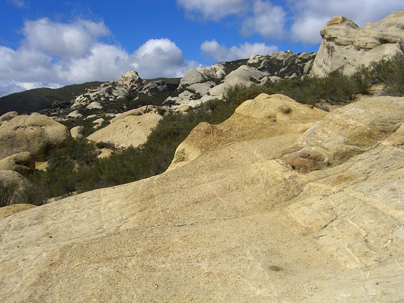 You have to keep on your toes to follow the trail over hard stone areas |
||
 People (center) sitting on the rock give scale |
 Looking back to the south towards the path up |
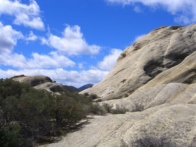
 The rocks from the other/north side on the way up the mountain |
 The north side of the Piedra Blanca have steep dropoffs. View south. |
 The rugged canyon trail follows Piedra Blanca creek up the mountain |
|
 Long water carved shoot |
 View southeast back at the canyon just climbed. Note the snow -topped distant peaks. |
 Some weather moved in as I got higher |
|||
 Another view back. |
 The light changed dramatically from minute to minute |
 Getting closer to the ridgeline |
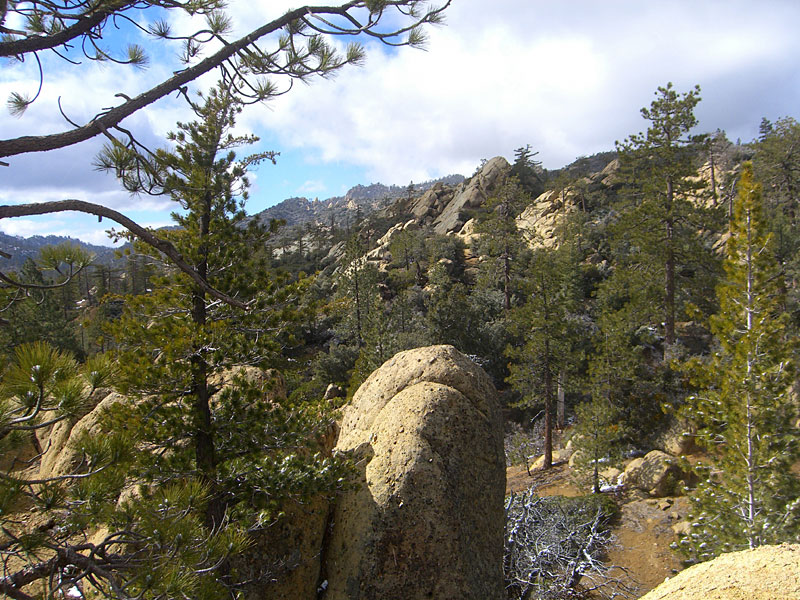 At the top near Pine Mtn. Lodge, which is a large campsite. Pine Mtn. is several mi. west. |
||
 It was very windy and chilly at the top and I put on all my layers, hat and gloves. After a relaxing lunch, it was time to head back. |
 Near Twin Forks camp |
 The rocks come into view. |
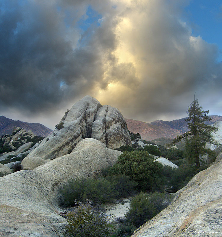
 The wind was really pushing the clouds around. Sunbreaks made for dramatic lighting |
 |
|
 The Piedra Blanca have amazing diverse formations, set in a wide valley surrounded by tall peaks. |
 The smoothness and roundness are inviting to exploration. |
 |
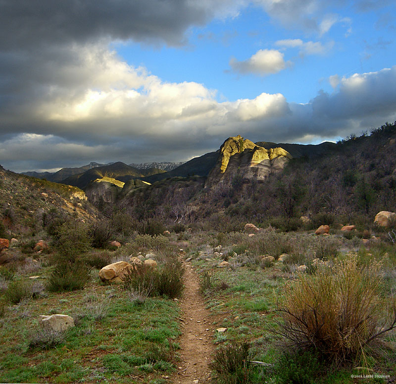
 Sunset |
 View southeast to the road out. |
|
 |
 Having a human for scale would've helped to show that these rocks are immense. |
 The last light of March 22, 2009, as the Arroyo toads croaked a loud chorus. |
|||
| 09.05
|
|||||

