 |
|
| Bench Lake via Taboose Pass, Inyo Nat. Forest & Kings Canyon Nat. Park, California A tough climb to a magical and remote Sierra lake |
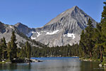
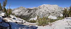
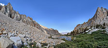
| Bench Lake is a glistening jewel of the Sierra Nevada in a remote part of northeast Kings Canyon National Park in central California, so-named because it sits on a high ledge, or bench, above an intersection of two deep valleys. Bench is a big, pristine lake with an expanse of open water at the western end and an amoeba-shaped shoreline full of rocky peninsulas and inlets on the east. Towering above is dramatic 11,300 ft. Arrow Peak, a symmetrical pyramid that dominates the western end.
There's no easy way to reach Bench - access requires an intense climb over steep and rugged Taboose Pass or several days from other passes along the John Muir Trail. Although it's only a few miles from the popular JMT, it's along a remote section and up a mountain so it's well off the beaten path. Generally the only people you'll see at Bench Lake have chosen it as a destination - an idyllic spot for solitude and wilderness rejuvenation. Camping is fairly limited. There are 3-4 established campsites among shady trees along the north shore foot path, the only path at the lake. The west and south shores are mostly boulders and scree. Through the tangle of peninsulas and inlets at the east/southeast end, suitable spots are challenging to find among the dense growth and boulders. |
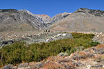
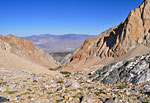
Taboose Pass is an infamously steep and strenuous climb over the eastern Sierra front range, with an elevation gain equal to summiting Mt. Whitney (tallest peak in the contiguous USA) from Whitney Portal - over 5700 vertical feet in about 6 miles. Taboose is one of the few eastern entrances to Kings Canyon, an access passage to the John Muir Trail and the gateway to the Lakes Basin, one of the more remote wilderness areas in the Sierra. From a dirt road in the Owens Valley, the Taboose Pass trail follows Taboose Creek west up the mountain and out of the desert, ascending a deep v-shaped, flower-filled valley beneath soaring canyon walls, beside a dramatic waterfall and up endless switchbacks to a boulder-strewn high alpine plateau of perennial ice and snow. Crossing in to Kings Canyon National Park at the top is a dramatic change from stark desert brown walls into an open arena of lush green. |
| I spend considerable time researching hiking destinations and this is an area I'd been through briefly on my John Muir Trail trek that I want to see more of. Exploring the Lakes Basin in northeast Kings Canyon National Park has been on my list ever since I read of it in the excellent novel The Last Season about a vanished backcountry ranger. I didn't have enough time off to hit the Basin this season so a 3 day scouting trip over Labor Day weekend would have to suffice. I'd heard tales of Bench Lake being a fine destination of itself and it was mostly the same route to the Lakes Basin, so I reserved my permit and made plans. I'd hike up and over Taboose Pass and into Kings Canyon on day one, then do the last few miles to Bench Lake the next morning, set up camp and enjoy a day exploring the lake. The third day would be a long trek back to the trailhead and the drive home. This is a very ambitious timeline and not conducive to a leisurely fun amble, but going solo means I have only my own limitations and set my own pace. It's important that I've been working out regularly and feel good about long, hard hours climbing. |
I'd recommend doing this hike as a minimum 4 day outing to lessen the exertion: Day 1, camping at one of the nice sites below the big cascade around mile 4, then topping the pass and making Bench Lake late morning on Day 2. On the return trip, a late start on Day 3 will get you back to the same camp site and then a 4-5 hour descent for Day 4 to reduce the stress on the joints. I did the return trip back down in a little over 7 hours but the last few miles and hours took a toll on my knees that I suffered through for the next two weeks, and I still had a 3.5 hour drive home in the dark. |
| Day 1: Trailhead to the top of Taboose Pass and 2 miles into Kings Canyon Nat. Park | ||||
|
| Day 2: Hike to and enjoy a day at Bench Lake | |||||
|
| Day 3: Bench Lake, over Taboose Pass to trailhead | |||||
|
Reservations and Permits |
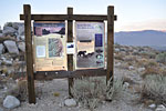
Preparedness Taboose Pass is a long, tough climb up an enormous mountain in hot, dry desert wilderness conditions. If you're not in very good shape, it will not be a fun trek and could even kill you. Although the trail is well maintained, there are exposed sections where you need to stay alert. To avoid altitude sickness, it's recommended to acclimate the day(s) before by hiking and camping at higher elevations. Drinking a lot of water before your hike is said to help. Even though the water supply in the high Sierra seems straight from the sky, it's recommended that you filter all drinking water. Trekking poles are essential to avoid unnecessary strain on the joints. Directions from the south Route 395 north of Independance is a 4 lane divided highway through a big open desert with few landmarks. It's easy to miss Aberdeen Station Road as there is no large highway sign marking it, only a small road sign on a post. From Independance, it's 14 miles north. After passing Goodale Creek Campground, look for a left turn lane to Aberdeen Station Rd. On Aberdeen Station Rd., it's 5.7 mi. from Hwy 395 to the Taboose Pass trailhead. There were no signs for the trailhead on my trip. After 1.2 miles the pavement ends and becomes a series of dirt roads meandering generally west/northwest. There are half a dozen forks splitting off but it's not too hard to tell which is the main road to stay on. At 3.9 miles the main road splits in two. A sign should show the left fork is Road 11S02 which looks like it takes you up the mountain to the correct place. Stay right - the trailhead doesn't begin up the mountain. The last 3 miles is rough dirt and sand with sharp fist-sized, tire-puncturing rocks protruding and it's slow going unless you have big thick 4WD tires. (It's recommended you have a spare tire at the ready) I have a sedan and it took about 20-25 minutes from Hwy. 395. The surrounding scrub and berm hides the true direction and there is little to go on but faith that you're driving out into the desert on the right road. Then, suddenly, around a turn, the road just ends among the rocks, with virtually no turn around. Hopefully there will be cars there to alert you. There's no parking lot, parking is along the shoulder. If the dozen or so spaces are full, there's no place close to park - but you're a hiker. The trailhead is up on the mound east of the road. |
|
| ||
More photos in the Trip Report top of page
TOP![]() Hikes Index
Hikes Index
Since 12.06

