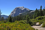
View John Muir Trail in a larger map
John Muir Trail, CaliforniaJuly 18 - August 1, 2010
215 miles, 15 days south to north solo across California's Sierra Nevada from Mt. Whitney to Yosemite


Overview

The John Muir Trail (JMT) is arguably America's premiere long distance
Metal JMT sign
Metal JMT sign
wilderness trail, a 215 mile foot path through the most remote part of California's Sierra Nevada from Yosemite Valley in Yosemite National Park to the summit of Mount Whitney, the highest peak in the contiguous United States. The Sierra Nevada range contains one of the longest stretches of protected wilderness in the lower 48 states. In addition to Yosemite, the route traverses the backcountry of John Muir Wilderness, Ansel Adams Wilderness, Sequoia Kings Canyon National Park, Devil's Postpile National Monument and Inyo National Forest. The JMT climbs and descends 9 mountain passes, 7 of them with elevations over 11,000 feet. Total elevation gain/loss has been estimated at over 70,000 ft. There are dozens of river and creek crossings with only a handful of bridges.

Scottish-born naturalist and writer John Muir (1838-1914) called the Sierra (Spanish for saw or serrated mountains) Nevada
Sierra buck
Sierra buck
the "Range of Light" for the dramatic illuminations of alpine ridges above glacier-carved valleys. Known for it's vast forests and sublime vistas, the Sierra welcomes the outdoor enthusiast with luminescent blue skies and temperate climate. Beneath soaring granite peaks are expansive green valleys, flower-filled alpine meadows, pristine mountain lakes, idyllic streams and thundering waterfalls. Abundant wildlife lets us reconnect to our primal heritage and overcome our fears; brown bears, deer, eagles, owls, Golden trout, bighorn sheep, mountain lions and rattlesnakes remind us that humans are as much a part of this wilderness as those creatures who never left.

History
The John Muir Trail began at the end of the nineteenth century as an idea to connect and protect the remote Sierra wilderness. After extensive lobbying by the Sierra Club, co-founded by John Muir, the
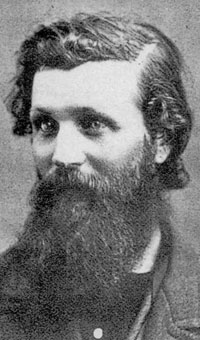
John Muir at 32
John Muir at 32
California legislature provided funding and an engineered route was established. Construction began in 1915 by the US Forest Service on what was then called the High Sierra Trail. After John Muir's death, the name was changed to the John Muir Trail to honor his lifetime of exploration and wilderness advocacy. The High Sierra Trail moniker was given to another trail. Trail construction continued to be funded by the State of California until the Depression of the 1930's, after which the U.S. Congress authorized funds and the National Park Service stepped in to help finish the final difficult sections. The John Muir Trail took 46 years to complete.

Some parts of the JMT are a marvel of engineering - steps blasted out of sheer cliffs, high in the mountains, miles from anywhere. All 215 miles were constructed by hand by work crews who lived in the backcountry for months at a time, hauling supplies by mule - the same way it's maintained by work crews today.

When to go
Prime hiking season in the Sierra is late Spring to early Fall as the mountain passes become inacessible from snow and ice for many months. The Sierra is known for it's agreeable climate, but midday summer temperatures can rise to 90 degrees (32C) or more. Snow lingers on the high passes throughout the summer and cold weather fronts can bring unseasonably cold temperatures at any time, so carrying multiple layers of non-cotton clothes is advised. Spring snow melt means high water crossings and a deluge of mosquitoes. Late in the summer, most of the mosquitoes have died, but the trade-off is very hot days and the chance of sudden storms.

Logistics
Yosemite Valley is approximately 250 road miles away from Whitney Portal - the name given to the base area at 8000 ft. elevation where the access road to Mt. Whitney ends at a store, restaurant, campgrounds and trailhead parking. Most through-hikers arrange a shuttle car - dropping off a vehicle at the end and leaving one at the trailhead. There is seasonal bus service between Yosemite and Mammoth Lakes, and you can catch a different bus on a different day between Mammoth Lakes and Lone Pine, which adds two days to both ends of your trip. There's no public transportation the 8 miles between Lone Pine and Whitney Portal. Most solo hikers arrange for a ride. For some, hitchhiking is an option.

Resupply is one of the most critical aspects of a multi-week through-hike. The JMT traverses a vast, rugged mountain wilderness. There are no towns within miles and it doesn't cross any roads with the exception of a brief loop into Yosemite's Tuolumne Meadows across Tioga Road. There are only 4 places along the route to re-supply, so hikers mail their supplies to these outposts in advance, then claim them upon arrival. (See Info)

Conditioning is extremely important. Carrying a heavy pack 12-20 miles a day, and up and down 9 mountain passes is taxing on the legs, the back and especially the feet. A serious cardio routine in the months ahead is critical, as well as test outings with all your gear, especially your footwear.

A permit is required to overnight in all of the wilderness areas the JMT passes through. You get this permit from the agency which manages the trailhead you enter from and it's valid for your entire hike. A bear-resistant food cannister is required in Yosemite and the Whitney Zone. You're required to pack out human waste in the Whitney Zone. (See Info)

North-to-south or south-to-north?

Most through hikers start in Yosemite and go south. Some good reasons: There are more places to drop out and get to civilization in the north section if a problem arises at the beginning. Acclimation and physical conditioning can be built up slowly before climbing into the more remote and rugged high altitudes of the southern section. The final climb to 13,650 ft. Trail Crest on Mt. Whitney (or to the 14,495 ft. summit) is done after weeks of conditioning, when your food is almost gone and your pack is at it's lightest. Climbing Yosemite's Mist Trail to Vernal and Nevada Falls and Halfdome is a most spectacular way to begin your trek. The downside: Virtually everyone is going this way. Good campsites go early in the afternoon.

Some reasons to travel south-to-north: Fewer hikers to share the trail with. Backpackers tend to overnight below the high passes and hit them first thing in the morning, so it's easier to find a camping spot on the opposite side of the pass. You meet more people. Hikers you pass on the trail are usually interested in upcoming terrain and conditions, so you can get beta from and impart your experience to everyone you meet. The down side is tackling the strenuous exertion of not only climbing Mt. Whitney to 13,650 ft. Trail Crest at the beginning, but climbing it carrying 7-9 days of food and supplies.You'll need to be more physically and mentally prepared.

Trip Report

Hiking 215 miles in 15 days solo was the most difficult physical thing I've ever done.
If I hadn't been training hard for months beforehand, I don't know how I would have made it. This trip report is a journal of what I did to prepare and how it turned out. I've posted a lot of additional photos here. If you're thinking of hiking the JMT, you may find something useful in my experiences that will make your trek easier and more enjoyable, and learn from my successes and slipup's as well.

The planning and preparation for a wilderness through-hike can be daunting, and even more so when going it alone. I'm an experienced solo backpacker, but the Sierra is a vast and rugged mountain wilderness and conditions can change dramatically in a short time. It's one thing to plan a trip knowing you can walk 15 miles a day on a flat trail and an altogether different plan when you're hauling a full pack up and down 11,000 ft. mountain passes in thin air, tripping over roots and boulders and fording rushing, icy streams, some times as many as 5-6 a day, day after day. When something goes wrong out here, you need to be prepared and have a backup plan. Nothing should be left to chance - gear, shelter, clothing, water, food and the critical re-supply, emergency plans, weather and conditions, permits and the logistics of hiking hundreds of miles from the car into the wilderness and getting back to it. And yet, there's always the element of risk.

So I read alot. Park websites and forums and trip reports about river crossings and snow accumulation and storms. I poured over gear lists, weather statistics, water levels and re-supply details. I made lists. I kept notes of everything I could think of. I'd wake up in the middle of the night and jot something down.

Which way to go?
I climbed Mt. Whitney the year before, so I knew of the preparation, conditioning, exertion and time required to do it, and the logistics of going to the Visitor Center in Lone Pine the day before the hike to pick up a permit and a WAG bag. If you've never climbed Whitney, it's a challenging accomplishment on it's own and you might want to consider north-south to get your trail legs.

After many trips in the backcountry, I'm so familiar with Yosemite that it seems like coming home. And I like the idea of going against the flow - there are more people to meet and more campsites available. So it was a natural choice to buck the north-south trend and hike the JMT from south to north.

Getting back to the car
Next came the logistics of leaving and fetching my car - one of the stickiest points of hiking the JMT solo. I could've searched and found someone local online I could pay to shuttle me, but that would be expensive and the logistics of hooking up could be a problem. I could go the bus to bus route but that's time-consuming - two days - and inconvenient and there's no bus to Whitney Portal. I could hang around the campgrounds, lodges and gas stations and ask everyone that came through for a ride. That's a decent way to get a ride, but it's invasive and intruding is not my style. And most people say no.

So I decided to leave my car in Yosemite and hitchhike to Whitney Portal. Hitchhiking means I go on my own time and inconvenience no one. I'd drive from LA to Yosemite Valley, arrive early afternoon and leave my car at the big dirt trailhead parking lot just beyond Curry Village. It's about half a mile from the end of the JMT (or the beginning as the case may be) at Happy Isles. Free parking is included with the $20 park entrance fee. There's no time limit for parking, but the $20 is good only for one week. Feel free to pay another $20 on your way out if you stay in the park longer after you return, but the gate attendants don't stop those leaving.

From the Valley, I'd hitchhike the 50 miles up Tioga Rd. to the Tuolumne Meadows backpackers camp, where I'd spend the night. In the morning, I'd hitchhike east out of the park to Mammoth Lakes on Hwy. 395, then south to Lone Pine, over 200 miles total distance. I'd pick up my permit at the Inyo Visitor Center south of town and then try to catch another ride the 2 miles back to town and 8 miles up to Whitney Portal. I figured if I started early and got lucky, I could get from Tuolumne Meadows to Whitney Portal in one day, where I could camp near the trailhead if necessary.


I've thumbed in Yosemite and other parks before, to return to my car from hikes. It's not difficult to catch a ride with another outdoor enthusiast, as you long as you don't look too creepy and are obviously backpacking. There's an art to hitchhiking I perfected as a teenager - choosing a place where someone can pull over easily, looking friendly and un-threatening (your trek poles look like weapons), getting your gear into their car quickly so they don't lose their place in traffic and where to stand if someone's already hitching there (further down the road). Getting someone to stop is easier in the daylight, when you can be scrutinized from further away. Generally, hitchhiking in the US is to be shunned because of the weirdo factor, but in a National Park, most drivers are vacationers, hikers, climbers and outdoor types who work and play there. It's not uncommon for women to hitchhike here. You can always pass up a ride that doesn't suit you for whatever reason. I often offer some gas money at the end to make people glad they stopped.

Because it's easier to catch a ride at the beginning of a long hike, when you're not so grubby and frazzled, it makes more sense to leave your car at the end of your hike and hitchhike at the start. And it's nicer to finish up a trek at your car, with access to everything left behind and immediate mobility, than to concern yourself with getting back to your ride when you're dirty and tired.

Permit
I got my permit reservation in the Whitney Lottery months ahead of time. You're required to show up in person at the Inyo Visitor Center the day before or early morning of your hike to claim your permit and get the "talk" about Leave No Trace from a ranger. And you get a WAG (Waste Alleviation & Gelling) bag to haul out your poo. You're not allowed to bury it in the fragile ecology of the Whitney Zone. There's a special dumpster at Whitney Portal to drop off your used WAG bag - tons of waste are packed out each year.
Re-supply logistics
There are four re-supply posts to choose from. (see Info) For my southern section, I pick the closest from Whitney - Muir Trail Ranch, and Red's Meadow Resort for the northern section. I pack two five gallon buckets full of lunches and dinners, trail mix and nuts and jerky, cookies and snacks - and mail one to MTR and the other to Red's. I call ahead and to verify both places sell denatured alcohol for my stove, so I don't have to worry about mailing anything flammable or hauling two weeks worth of heavy fuel.

Gear and preparations
I'm somewhat of a gear junkie. When I'm jones-ing for some new thing I've heard or read about, it's always a thrill to get hold of it and get out on the trail to try it out. I bought some nice gear and tested it on several multi-day trips earlier in the year. I've been slowly getting my pack lighter and lighter, partly in order to carry my heavy Nikon DSLR more comfortably. Although I'm not a true lightweight backpacker - I prefer a certain level of comfort - I have a lot of light gear and a minimalist attitude. I have several precision scales to scrutinize the weight of everything I carry, always looking for some way to reduce it and I tune in to resources online for help in reducing pack weight. I have a nice Garmin Oregon GPS unit but decide not take it because the JMT is such a popular and established foot path that I don't think it justifies the additional weight. I'm glad as I didn't need it. I did use my compass.

Food is one of the critical elements of backpacking that can always be improved upon. In general, I try to keep it simple and lightweight. Nothing gourmet, I happily trade pizzazz for weight reduction. For dinners, that
7 days of food goes in my bear can. Uncle Eddies cookies - yum!
7 days of food goes in my bear can. Uncle Eddies cookies-yum
means a variety of freeze-dried dinners - they're lightweight and compact, require only hot water and are surprisingly tasty and satisfying. They cost $6-7 each. In bear country, it's wise to avoid the greasy, deep fat smells of cooking fresh food in the evening, saturating your clothes and gear before you turn in for the night. For lunch, I've grown fond of a high carb mixture of almond butter, cashew butter, agave syrup and honey on tortillas. It's a big energy boost, very lightweight and the tortillas fit flat on the bottom of my bear cannister. I break up the monotony with noodles and packaged meats. I carry a variety of snacks - jerky, nuts, trail mix, energy bars, dried fruit - and powdered electrolyte drink mix. I round that out with a few treats for after dinner like cookies or cocoa.

I'd been working out regularly all year, 35-40 minutes each morning doing crunches, lunges, pushups, lifting weights, skipping rope and more. Three times a week, I'd run 5 miles at night when it was cool, and did a lot of swimming too. Backpacking is hard on the neck and the back and the shoulders as well as the legs. You need arm strength to pull yourself by your trekking poles on those interminable pass ascents and descents, and to heave your heavy pack up onto your back when you're tired and sore. So all parts need a workout to be ready. I paid close attention to how much food I ate and how much I weighed. I'm at a good weight already and don't want to drop below it much on my trip.

I monitored the all-important pass conditions on the park service websites and hiking forums every day. The higher passes don't melt until late spring and sometimes into July. Reports say the biggest JMT passes - Trail Camp, Forester, Glen and Muir - had some snow and ice but were clear enough to hike without crampons, which would mean I could hike without heavy boots and ice gear.

With the melting snow comes high water levels and potentially treacherous river crossings. The bigger crossings are Evolution Creek, Bear Creek and South Fork of the Kings River, all reported at waist high levels. Crossing a 100' wide, waist deep, icy cold mountain river with a strong current deep in the wilderness by myself was the one aspect of this hike that gave me the most trepidation.

The week before, I got my car serviced, paid off my bills in advance, notified friends of my plans and arranged to have my mail picked up. I took out $80 cash for emergencies but planned on using my credit card for the few expenses I'd planned to encounter.

I packed and repacked my stuff incessantly, adding and dropping items to reduce weight, until I had all my food and gear finalized. My place was a total mess for days. Then, I packed it all up for the last time.

The National Weather Service forecast for the Mt. Whitney area was mostly cloudy followed by a week of clear skies. Good news.

I was ready.

Day 0July 17 SaturdayLos Angeles - Tuolumne Meadows in Yosemite National Park

Getting there, Part 1

I leave Los Angeles Saturday morning July 17 at 9:30am, stop once to refuel and eat, and arrive at Curry Village at 4:30. I drive to the big dirt lot, pull out and check all my gear one last time. That's when I realized that I'd lost my credit card - something I've only done once before in my life - a screwup that would haunt me for the next two weeks. I must have left it at the last gas station. Very frustrating after all my planning. My phone won't get reception in the Valley, so I grab $5 of quarters I have in the car so I can call my bank from a payphone. It's useless to carry a heavy cell in the wilderness as there's no reception. I'm leaving it behind. I need to catch a ride the 50 miles to Tuolumne before dark, so I'll have to try to take care of the card tomorrow.

I take the shuttle to a good hitchhiking spot I know of on the road next to Camp 4. In less than 15 minutes, I get a ride from Ashley, a cute 19 year old who works at the big lodge, and her cousin Amanda, who's visiting. They're going all the way to Tuolumne. Ashley is a petite rock climber who has climbed El Capitan and Halfdome, two very impressive accomplishments.


At Oak Flats, they pick up another JMT-bound backpacker asking for a ride at the gas pumps, a jovial fella with an Alabama drawl named Andy and rearrange the packed little car to get him in. We get to Tuolumne Meadows campground around 7:30pm. I show Andy the way to the backpackers Walk-in Campground, which is not easy to find in the sprawling campground at dusk, and we set up camps together. He's hiking north to south, so we agree to look out for each other in about a week or so.


Day 1July 18 SundayWhitney Portal - Trail Camp

Getting there, part 2

I'm up at 5:30, have a bite, break camp and head out to the payphone at the campground entrance. Reception is abysmal and I waste $2 trying to get the correct number for my bank's lost cards department. More long, frustrating minutes pass explaining what's happened, how I'm running out of quarters, that I'm heading out in to the wilderness for 2 weeks and I want them to send a new card to my second re-supply outpost Red's Meadow Resort. But they can't grasp my dilemma and I get passed from one rep to another. As my quarters run out, I have little hope that I'll have a new card. Still, I've got $70 left, and all my food and gear and only need to pay the $55 for my re-supply at Muir Trail Ranch. (I didn't realize it could've been paid in advance when I mailed it, as the website wasn't specific. That was a mistake). I should be okay.

It's 6:45am. I walk east on the highway to the bridge over the Tuolumne River and stick out my thumb. It's a beautiful cool morning and the river below sparkles. Last year, I followed this river for 30 miles through the Grand Canyon of the Tuolumne. There's almost no traffic, but in 15 minutes I get a ride from Ha, a cute 20-something asian chic. Ha's been rock-climbing some big slabs with a partner, and now she's heading home to Bishop, a great ride of 85+ miles. Someone stole her brand new Deuter pack from a spot in the wilderness where she left it partially hidden to climb - a potentially disastrous situation. The thief left her partners pack and emptied hers out, so at least she had some water and a jacket for the long hike back. Nice of them...

In Bishop, I find a sympathetic hostess at a breakfast restaurant who lets me use the phone to try again to have a replacement card sent out to my re-supply station. A bank rep tells me they can't possibly send a card to my destination - it can only be sent to the address on my account. They add helpfully that I could get one at a branch - but it's Sunday and the banks are closed. Then another rep tells me the opposite - I'm assured that the card will be waiting for me when I arrive at Red's Meadow Resort.

I walk a couple of miles to the south end of this sleepy little town before sticking out my thumb. There's not much traffic and the sun is heating up dramatically so I stop in at an outfitters and get an extra dinner for tonight. After 25 minutes, a woman stops. She's a hiker going to Independance, another great ride of 50 miles. Her friend is in the car in front of us. All 3 of my rides so far are from women!

In Independance, I get a ride from a big rig trucker the last 20 miles to the Visitor Center south of Lone Pine. I've made amazing time. I've got my permit in hand by noon. I can start up Whitney today. Now I need to get to Whitney Portal road, 2 miles north up the highway in the center of town - in the scorching midday sun. My luck runs out bumming a ride at the Visitor Center so I set out walking up the highway. I take a lunch break at a deli store then finish walking the 1.5 miles along the highway into town.

On Whitney Portal road, a big tree makes a nice shady spot to wait for my next ride 8 miles up this steep road to the trailhead. Only one car passes every five minutes and it's becoming a long wait. Finally a guy named Eric stops in a beater of a truck. He's a Grand Canyon guide on vacation. His foreign girlfriend is following behind in a rental car. I don't follow the story of why they're in two cars, but she's driving extremely slowly and he has to slow down and wait for her constantly. Apparently she's terrified of driving up this winding mountain road and agitated with him about it. After 4-5 miles, she's had enough and simply stops, so Eric drops me off and does a U-turn and I have to hitch again.

My last ride is with a friendly young guy who cooks at the Whitney Portal restaurant, famous for their tasty burgers, a traditional stop for summiteers.

At the trailhead, a guy in a leg cast strikes up a conversation. He was doing a week long hike with his grown sons when he scraped his leg on an old tree. Not a major gash, but it got infected with something nasty and within a couple of days became deadly serious, giving him nausea and fatigue. His group had to turn back. A doctor told him if he'd waited a few more days, it may have had to be amputated. He showed me a picture on his phone - it was unbelivably nasty after just a few days. That's why I carry soap, disinfectant and bandages!

On the trail
Bighorn Park
Bighorn Park
At 2:00, I begin hiking up the Mt. Whitney trail, elevation 8000 ft. It's a beautiful afternoon, partly cloudy and still very hot. The weather will certainly get worse as I climb higher but I'm confident it will improve overnight as forecast. I just have to get to 11,300 ft. Trail Camp before dark. It's only six miles, but it's a very steep climb which I know should take about 4 hours. There are very few others on the trail, and none coming down. Within the next hour, the day's first summiteers start coming down from the top, first a handful, then dozens of them. The clouds are steadily choking out the blue as I climb and soon it's mostly gray.

At 4:00, a light drizzle starts. I pull on my soft shell jacket and tuck away my camera and gear. A half hour later, the rain starts seriously coming down. By the time I get to Mirror Lake, it's pouring buckets and I take shelter under a big tree. Frazzled hikers coming down tell me of hail and lightning at the top. When it eases up, I start up again. One kid exclaims that only a masochist would go up there. I smile.

Whitney has unbelievably dramatic weather shifts - sudden snow and lightning storms can gather or blow in from seemingly nowhere. If I hadn't been up Whitney before and known how quickly she absorbs bad weather then blows it off, and didn't have the latest weather forecast or the proper gear, this storm would be very concerning.

At 5:30, it starts hailing - first, pea-sized, then dime-sized crystals and the temperature drops ten degrees. It hurts! Even with water-resistant gear, I'm soaked and shivering. I take shelter under fallen boulders, change into dry clothes and wait it out for half an hour.

East from Trail Camp after the storm
I reach Trail Camp at 6:30. The skies have cleared dramatically and a beautiful but cool evening has arrived, as forecast. The air is crisp and colors are amplified after a storm up here. It's one of the most beautiful times to experience the mountain. I set up camp at my favorite spot, north of the humped ridge along the trail and across the hidden stream in a sandy spot. A hot dinner fixes me up to enjoy a spectacular clear starfield. Tomorrow is the grueling climb up the 97 Switchbacks to Trail Crest.


Day 2July 19 MondayTrail Camp - Trail Crest - Tyndall Creek

I'm fed, packed and starting up the 97 Switchbacks at 8:45. I'm not climbing to the Whitney summit or I would have left earlier. The actual beginning of the John Muir Trail (or the end as the case may be) is the summit of Mt. Whitney, which is 2 steep miles and 900' of elevation one way up from 13,650' Trail Crest. Since I've been up to the summit last year, I'm foregoing the extra 4 miles and hitting the JMT directly from Trail Crest.

The morning is warm and clear, with little to show of yesterdays storm.
The Mt. Whitney Cables. The rocks left of the snow are actually building size boulders half a mile below.
Other small groups are making their way slowly above me. Looking up this steep face from below, it seems unlikely that a trail could climb such a long, sheer drop. If you stop and focus on a spot above, you can detect movement of hikers and see where the trail goes. After 45 long minutes of one foot after another, I'm at the cables, steel and braided wire rails that traverse a steep and often snow and ice covered drop off. Even on this hot summer morning, there are plenty of icy patches along the way where caution is required and trekking poles are very useful. The water on the trail freezes each night and thaws each day a little more.

Trail Crest
I arrive at 13,650' Trail Crest at 10:30, where several groups are relaxing and enjoying the view. Some aren't going any further, others are going to the top. A few hundred yards down the back side on the trail to the Whitney summit, the John Muir Trail intersects from below. Many JMT hikers leave their packs here to summit Mt. Whitney and fetch them on the way back.

It's a long, long hike down endless switchbacks to Guitar Lake, the sun is baking me and I'm glad to be going down instead of up. The climb up to Trail Crest from Guitar Lake on the JMT is equally as challenging as from Whitney Portal to Trail Crest on the other side - it's steep and rocky and exposed. I pass a pair of older guys finishing up their trip with this climb and on the verge of collapse.
Guitar Lake (right) is 2500 vertical ft. down from Trail Crest
Finally I'm at Guitar Lake where I take a welcome lunch break on the lush grassy shore. After Guitar Lake, the serrated peaks of the Owens Valley slowly fall behind as the JMT drops down into a forested green valley following a playful stream to Timberline Lake.

A few miles later, there is a ranger station several hundred yards down the trail to Crabtree Meadows, and then the JMT hooks up with the Pacific Crest Trail and turns north. These two trails are one and the same for most of the length of the JMT, but diverge at several points further north.


After Crabtree are a series of lush meadows full of flowers
Cooling it in the shade
and deer, pure pleasure to walk through on a beautiful Sierra day. At Wallace Creek, the terminus of the High Sierra Trail joins the JMT. I hiked much of the HST over the Great Western Divide a couple of years back.

I'd planned on stopping for a break at Wallace Creek, 10 miles from Trail Crest, but the
Such a nice lake - so many mosquitoes!
mosquitoes are swarming and vicious here as it's the most active waterway through a forested low land. They come out hungry in big numbers near water as the afternoon heat slowly dissipates, but they're much more active than in previous years.

I continued on without a break to find some place where they weren't so concentrated. I picked out a small lake on my map at a treeless plateau about 3 miles further, a mile south of Tyndall Creek, thinking it was higher elevation, away from the wetlands and more exposed. I arrived as evening approached and hordes of mosquitoes swarmed from every direction. I was the only thing to eat for miles apparently, and every bug at the lake set upon my heat signature. My soft shell, gloves and bug net became survival gear as I set up my tent. They surprised me with their numbers and viciousness but I didn't get bitten much. Of all my treks in the Sierra, I've never seen so many mosquitoes. There was simply no outdoor enjoyment to be had this evening under the relentless assault, so I climbed into the tent and napped until dark, when I could get out and move about freely again.

Thankfully, most of the bugs had disappeared after just a few hours and dinner was a pleasure. Later, when nature called, not a mosquito was around and I had this high alpine plain all to myself. The night was crystal clear, the moon was close enough to touch and the entire universe was on display. Shooting stars streaked across the Milky Way and clouds of distant galaxies floated among a billion stars.

Day 3July 20 TuesdayTyndall Creek - Forester Pass

South from the approach to Forester Pass
I'm on the trail at 8:30, elevation 11,000', heading toward the second biggest climb of the JMT - 13,200' Forester Pass. Two days of arduous mega-climbs in a row - this is where all the working out pays off.

North of the forested glens of Tyndall Creek, the JMT climbs above treeline, up onto an expansive plain of stone. The south side of Forester is rocky and exposed and as you approach the massive wall, it seems unlikely that this giant granite barrier could be surmounted. Only within the last mile can you tell which direction the trail will go - and which ridge is the Pass.

Forester Pass
This south side trail approaches Forester from an already high alpine basin with a slow steady elevation gain over many miles, then confronts the giant wall all at once in a series of dramatically steep switchbacks up and over. The north side is a much higher elevation gain from low-lying Bubbs Creek valley - almost double the elevation gain - and there is only one level section for many miles. The final approach from the north isn't as steep but is much, much longer. Forester Pass from the north is an infamously strenuous climb.

Southbound hikers tell me the JMT is covered in ice and snow on the north side of the pass and which routes they found easiest. Some like the high route stomped through the deep snow, while others prefer the low route over giant slippery boulders. This kind of trail beta is extremely helpful when conditions aren't ideal. Especially enlightening is learning about the water levels at the river crossings in the days ahead.

The final segment near the top climbs up very steep and exposed stairs skillfully engineered into the cliff face. If you are standing atop 13,200' Forester Pass, you are exhausted. I'm on the top at 1:15. The view north from here is outstanding, one of the most dramatic in the Sierra, warranting a well-deserved lunch break. Much of the north side trail is covered with snow and ice so there's little to do but follow the path in the snow blazed by others.
Detour across snow
Detour across snow
The next mile descent from the pass would be a series of arduous traverses over slick and treacherous terrain.

Postholing
The difficulty here is postholing, or suddenly sinking up to your knee or thigh in a hole when the snow gives way. Up here on this remote alpine pass, this is much more serious than just an annoyance. When you posthole carrying a heavy pack, the weight drives your body forcefully in to the hole and it's possible there's no solid ground where your foot finally rests to push yourself out. You could be badly stuck or injured.

The sun is high in the sky, magnifying the brilliant whiteness and erasing the shadows, making it difficult to see variations in the terrain, even with polarized sunglasses. As I carefully make my way down the high trail through uneven and slippery ice and snow, there are many places where people have postholed. Most are shallow but some of the holes are so deep you can't see the bottom because of the brightness of the sun - just inky black holes. Because the entire slope is covered by a steeply angled drift, you can't know if the snow path is close to the ground or if it's six feet up on top of jagged boulders. Some holes drop you between two boulders and there is danger of getting wedged into a crevice. On the rocks inside one hole, I see someones blood from a scraped leg. My trekking poles save me from slipping in over and over again.

The north side of Forester Pass looking south
After a couple of disconcerting and downright scary posthole drops, I decide the high path is too dangerous. I make my way down to the lower path, a route described by jumping and scrambling from exposed boulder top to slippery boulder top. It's twice as strenuous and time-consuming but at least I can see what I'm stepping on - most of the time.

Finally I'm down below the snow and ice and the majesty of this north side of Forester can be thoroughly enjoyed.
The north side of Forester Pass
The north side of Forester Pass view north
There are vivid blue tarns and sweeping vistas and flowers galore. I pass many groups of south bound hikers plodding up the long, strenuous grade one foot after another. Everyone wants to know the conditions at the pass. I feel like a weatherman who can relate their future.

After 4 long hours of seemingly endless descent, I reach the treeline at an idyllic high plateau with a hidden lake and a meandering stream with grassy banks. Just north
High plateau north of Forester
below this enchanting stony meadow are several campsites among the shade trees above Bubbs Creek and one of them makes a perfect home for the night. I knock off at 4:15 today - it's been an exertion-filled day and it feels good to make a cozy camp, wash some things and read my book in the sun with my feet in the creek. When the mosquitoes come out in force, I retire for a nap, then get up after dark to make dinner, a habit I'll be accustomed to in the next weeks.

Day 4July 21 WednesdayForester plateau - Glen Pass & Rae Lakes

Felt good to sleep in today. The JMT's two biggest passes in two days has taken its toll on me and I'm sore all over. I manage a bite to eat and break camp in an insanity of mosquitoes. It's 10:15 before I'm on the trail. Another gorgeous morning to hike through one the Sierra's most magnificent areas - Bubbs Creek valley north of Forester Pass. It feels good to be going down
North down Bubbs Creek valley
this long grade instead of the other way. I've experienced the 8 mile climb from Vidette Meadows to the top of Forester Pass before - it's one of the most seemingly endless ascents on the JMT.

After 2 1/2 hours descending beside the exuberant creek, the Bubb's Creek trail turns west to Road's End and the easy descent is replaced with a steep climb to the Kearsarge Pass/Charlotte Lake junction which sits atop a sandy plateau. On the switchbacks up, ancient redwoods soak up the sun, part of a sweeping view of majestic pyramid-shaped East Vidette Peak and the long valley up to Forester Pass that I've just descended.

Glen Pass
The trail climbs high above Charlotte Lake, out of the trees and into the rugged alpine basin below 11,978' Glen Pass. As you enter this bowl surrounded by giant sheer walls, it appears to be absolutely impassable, but the trail builders found the only route up and carved a steep switch-backed trail into the face of the cliff. Despite the strenuous climb in thin air, I appreciate the effort in constructing this difficult segment of numerous ramparts and reinforced slopes built by hand. Sudden gusts and gaping dropoffs keep you on guard.

Taking it all in atop Glen Pass
Near the the top, the wind rushes up from below, and then the view north to Rae Lakes opens before me, a wondrous scene of lakes and forests beneath dramatic ridges.

There's a lot of ice and snow on the switchbacks down so it's a cautious and tiring descent. It takes an hour to get down to the first south lake. It's late afternoon as I arrive and the mosquitoes are out in force. Most of the hikers tend to camp around the grassy shores and stone platforms on the west/trail side of the big south Rae Lake because it's one of the nicest views. But the wind whips through here at night, rattling tents and preventing sleep. I hike around the north part of the lake and in to the backwoods above a rocky slope to find a protected spot.
Passing the buck at Rae Lakes


On the way, I pass right next to a large buck lounging in a shady bower who's too comfy to get up and run away. I set up at a nicely sheltered spot and once again duck the vicious mosquitoes by napping until after dark.

Day 5July 22 ThursdayRae Lakes - Pinchot Pass - Lake Marjorie

I'm on the trail at 7:45. It's cool and calm with luminescent blue skies reflecting in the lakes.
Sierra morning and Painted Lady above the large south Rae Lake
It's a long downward slope - 7 miles and 2000 feet of elevation - from Rae Lakes north to the swinging bridge - a JMT milestone in this area. The trail follows a lively creek formed from the drainage of Rae Lakes basin. Along the route are dramatic Fin Dome, serene Arrowhead Lake and Dollar Lake and a regal grove of redwoods.

There are numerous crossings over stones and logs. I come close to falling in on one slippery crossing - one of those awkward saves where I catch myself from falling backward with my trek pole. I'm knee-deep mid-stream, leaning backwards for long seconds pushing against my pole behind me at an awkward angle to keep from dropping in and getting soaked, including ruining my camera. It wasn't even a dangerous crossing, just surprisingly slippery rocks caught me off guard. I'm more careful about stowing my camera at crossings after that.

The final two miles north are down the V-shaped valley filled with the picturesque Castle Domes range, streams cascading down it.

It's very hot when I get to the swinging bridge, 3 1/2 hours after I began, and the tall shady trees make a welcome lunch stop. The bridge takes you high over Woods Creek, just after the confluence with the stream from Rae Lakes. There is a large stock camp here as well as several tent sites. The bridge is too flimsy for stock - they have to wade across a hundred yards downstream.

As I'm dropping 2000' from Rae Lakes, I know that means I'll be climbing
Woods Creek rushing south
back up that much and more to Pinchot Pass, 8 miles north of the swinging bridge. After the bridge, the entire afternoon is spent climbing up, up and up - 3,500' higher.

The ascent starts nicely along beautiful rushing Woods Creek, it's granite banks cloaked in flowers, frogs croaking, birds chirping. The trail climbs through shady glens and verdant meadows, past racing water slides and roaring cascades, following the twisting zig-zagging contours of the v-shaped valley north, east, west. After 4 miles, the tree cover thins as the elevation reaches the alpine zone, exposing me to the full heat of the sun.

Leaving treeline on the climb north to Pinchot Pass
Pinchot Pass
Higher up, the approach to Pinchot winds almost 2 miles away from the pass up and around a barrier ridge, then along a plateau with numerous small rocky lakes which seem to be alive with insects. It's late afternoon when I start the final climb up the switchbacks, a strenuous undertaking, especially after the other three tough passes in previous days. There are times climbing these passes when I'm so tired and focused only on putting one foot after another that everything else goes away and my only thoughts are - It's hot. Am I thirsty? I better be careful on these rocks or I'll twist my ankle. But it's always a thrill to summit a barrier ridge and experience the sweeping vista on the other side that's been hidden from view.

Among these high ridges, evening arrives fast in the Sierra and I hustle down the north side to find Lake Marjorie for the night. On the way, the trail disappears under several snowfields. I can only hope there's something solid underneath as I follow the tracked path across, but at one point, I can hear water gurgling beneath me - a scary sound. The snow could collapse at any moment and drop me into the freezing stream. If it's deep, I could get sucked under the ice forever.

The sun has dropped behind the ridges and with it, the temperature dives and the wind picks up. Lake Marjorie is a big alpine lake beneath a rugged peak and her sloped rocky shores offer little in the way of campsites. It's cold, down in the low 40's, but at least there are only a few mosquitoes up here. I settle in a few hundred yards south of a group who have the only flat spot anywhere, using piles of rocks to stake the tent as the ground is all stone.

While setting up camp and eating dinner, a pretty girl named Katy comes over to ask about pass conditions and invites me to hang with them. So I bring my hot chocolate and go visit after dinner. They're a happy, friendly bunch who've been on the JMT a week and a half and we stay up late and chat. Besides Katy, Ryan and Tom are architects from Portland OR, and Dennis is a German solo hiker who fell in with them and stayed on. Dennis explains how he didn't ship any re-supply buckets and got all his food from what others left behind at the re-supply posts. They relate that water levels at the big crossings in the coming days were not waist-high so much as thigh-high - info I'm relieved to hear.

Day 6July 23 FridayLake Marjorie - Mather Pass - Road's End trail junction

At 7:15, I'm fed and packed and on the trail, descending north towards the Bench Lake ranger station. It's almost 9 miles to Mather Pass, but I've started higher than usual at Lake Marjorie so it's not as dramatic an elevation gain. It appears that I'm becoming habituated to the exertion and no longer wake up achingly sore, although Tylenol is still a morning staple. And my food supply is dwindling so I'm traveling lighter.

The Bench Lake ranger has posted a sign on the trail describing a route across the swollen South Fork of the Kings River at the bottom of the valley. A big tree fallen across high banks makes a perfect bridge, but it's several hundred yards upstream through the brush so most wouldn't scout that far and miss it. When the JMT arrives at the water, I'm surprised at the conditions - 120' across, waist deep in the middle and a strong current. The water's icy cold and numbing. This is a dangerous place to cross - I wouldn't attempt it solo at this spot. I make my way through the woods and find the log and once across, make my way back to the trail through the brambles. I pass a lot of hikers camped in the woods along the north bank. I feel sorry they don't know about the easy way across.

After the crossing, the trail climbs up through open, boulder-strewn plains.
One of many fast, deep creeks to wade across
There are 4 different creek crossings in just 1 mile. To avoid blisters, I don't backpack with wet feet. I take off my shoes and socks at every crossing that's too wide to jump across on stones and wade across barefoot. Then there's 7-8 minutes spent to dry my feet, put my shoes back on, climb into my pack and fasten my camera harness, so each crossing is time-consuming. Then to find another creek a few hundred yards away and start all over again... Annoying, but just part of hiking in the wilderness.

On the way up to Mather, the friendly Whitney-bound hikers I meet are all delighted to learn of the Kings River log bridge. The trail-pounders who don't have time to say hi will just have to get wet. The mosquitoes are out again, not swarms, but painfully accurate individuals find their way between openings in my shirt and socks and defy my repellent to get my blood.

Mather Pass
Aside from the bugs, 12,100' Mather Pass is much easier to climb than the previous passes. The approach from the south is steady and undramatic and soon I'm at the top enjoying the new landscape unveiled. I drop into the stark, treeless terrain on the north side down to the Palisades Lakes, two glistening jewels that catch all the Mather Basin's water and funnel it down the steep valley below the lakes.

Upper Palisades Lake & Mather Pass (center) from the north
Palisades Lakes mark the beginning of treeline and it feels good to descend into the greenery. There is a fast, deep stream to cross between the lakes. Rounding the valley below Lower Palisades Lake, the walls of the surrounding peaks close in and the force of the stream is magnified. Waterfalls echo from gorges far below and the path is surrounded by flowers and plants.

The Golden Staircase
From the serene lakes to the rugged gorges below them, the trail arrives at the head of the Palisades Valley, an almost sheer wall 1000' above the distant
Switchbacks (bottom) up the sheer Palisades cliff are the Golden Staircase
valley floor, accessed by a series of switchbacks known as the Golden Staircase. This wall was considered impassible by early explorers as the only route up was choked with giant boulders calved from the adjacent cliffs. The JMT originally bypassed the Palisades wall and swung into Lakes Basin and over Cartridge Pass north of Bench Lake. After several industrious expeditions navigated the Palisades, a route was determined feasible, and eventually a trail was chiseled out with pick and dynamite. The Golden Staircase was the final section of the JMT to be constructed and is one of the steepest sets of switchbacks in the Sierra - on par with the climb to Nevada Falls on Yosemite's Mist Trail. I'm happy not to be one of the struggling hikers I pass on their way up. At the transition between the switchbacks and the valley, I find the trail is in seriously bad condition - blocked by rockfall, eroded and covered in muck and badly overgrown.

It's a hot but clear afternoon and I'm making good time so I keep on hiking late into the afternoon and reach the junction of the north trail to Road's End at 6:15. Hiking mostly downhill, I've put in almost 20 miles today. My stopping point along the Middle Fork of the Kings River is right at 8000'. Tomorrow will be another long, intense climb up to 11,955' Muir Pass - almost 4000' - akin to climbing from Whitney Portal to Trail Camp. A pair of older guys camped nearby tell me they've heard a storm is forecast. Tomorrow could turn out to be my most challenging day yet...

Day 7July 24 SaturdayRoads End trail junction - Muir Pass - Evolution Lakes

Big miles and the melody of a rolling stream gave me a restful sleep and I'm on the trail at 8:00, ready to tackle yet another long day of climbing. This will make 6 passes in 6 days. I still feel the cumulative effects of all that exertion deep in my core, but the show must go on. It's another routinely spectacular, clear morning and the Sierra, exuberant with life, awaits discovery.

The JMT north to Muir Pass climbs alongside the Middle Fork of the Kings River, which is more of a big stream than a river.
Middle Fork of the Kings River rushes south from Muir Pass
The soothing gurgle of the water accompanies me as I ascend forested valleys and flower-filled meadows. A Sierra stream is pure pleasure to follow as it carves a path into the wilderness. There are endless unique rock formations to discover as the water slithers down granite slides, breaks up into multiple channels to cascade around brush-covered boulders and thrashes over cliffs with pounding waterfalls. It simply must get to where it's going and nothing can stop it. I feel the same way.

I climb past Le Conte Canyon ranger station and a series of stream crossings. I stop counting how many. After passing through several meadows, the trail diverts from north and turns west as it leaves treeline. As I climb into the rugged alpine zone, big cumulus clouds roll in. The temperature has dropped dramatically - a storm is coming. There's a lot of
The rugged south approach to Muir Pass
snow on the ground up here and the path is sometimes difficult to find. There are numerous creek crossings and each becomes wider and more of a challenge to avoid getting wet. The water is near freezing. Up here would be a bad place to cross barefoot or fall in.

A southbound couple is struggling to find a route across one difficult wide section and I show them how it's done by hopping on tiny clumps of wet sod and shaky stones, using my poles for balance. As I climb through boulder fields covered with patches of snow, I often have to stop, backtrack and scout for the trail.

The sun is fighting to stay out, but it's no match for the heavy clouds. By the time I finish lunch, the deep blue sky is choked with gray. Distant thunder echoes down the canyon and sporadic flashes of lightning rip across the horizon. I push on though I'm beat from the incessant climbing - I don't want to be on top when the storm hits.

I'm looking for Helen Lake, the final lake south of Muir, a landmark that tells me I'm almost at the pass. But each bend I climb around seems to have a big alpine lake. Again and again I think I'm at Helen only to find I still have a long way to climb. At one tricky crossing, I have to backtrack several hundred yards after inadvertantly taking a spur trail that becomes a steep animal path. I climb back down, re-cross the stream and scout again. It's slow going. A few rain drops here and there becomes a drizzle and I put away the camera and get into water-resistant gear.

With each twist and turn of the canyon, another big exposed snow and ice-dappled plateau presents itself and must be carefully crossed. At times, the trail vanishes so completely, I have to use my compass until I pick up footprints in the snow leading in the general direction I want to go. In places the snow drifts are so deep, it's necessary to step into others footprints. Finally, I reach a lake that is far bigger than the others, Helen Lake.


Muir Pass
It's 3:00 when I arrive at Muir Pass, 7 hours after I started. North before me is Evolution basin, an immense barren, treeless terrain - a moonscape. The low, ominous clouds amplify the remoteness and absence of life and color. It's cold and wet and the wind whips into me as I make my way down from the pass, but I've escaped the full force of the storm. The first hikers I see in hours are exploring the Muir Hut, an iconic stone shelter a mile north from the pass, built by the Sierra Club in the 1930's. Inside are bunkbeds, cabinets with emergency supplies and knickknacks left by hikers, and a woodstove. Unfortunately, there is no wood to burn within miles, except for the door and the bedframes.

Evolution basin is a mile wide boulder field, an exposed high plateau covered in large patches of snow where the trail becomes impossible to follow. I use my compass to figure out where I need to go, then zigzag back and forth until I find the path again, which has deteriorated to a series of connected puddles. The rain starts in earnest then becomes hail. There's no shelter up here and I get pelted until I'm damp and chilled. Even with all my layers on, I have to keep moving to stay warm, so I hustle to exit this exposed alpine terrain and drop back into treeline for shelter.

As I make my way down through Goddard Canyon to Evolution Canyon, I regret not having the chance to experience this dramatic setting on a clear day. Finally there are trees again, first a few here and there, then groves. It feels good to come down from the cold, barren pass into warmer air. The drizzle persists unabated.

Upper Evolution Creek crossing in the rain
My map shows a crossing above Evolution Lakes that concerns me because of all the rain. I find it's wide and fast and not too deep, but my shoes and socks get thoroughly soaked. It's too wet to stop, so I'll just hike on. Evolution Lake is a mile long and as I reach the north end, the drizzle has stopped and the mosquitoes are back. The park service has put up No Camping - Restoration in Progress signs in all the nice flat, sheltered camping spots around Evolution Lake and instead steer campers to an exposed rocky ledge at the north end where the wind and bugs are the worst. Very annoying to hike so many days away from civilization only to be directed to camp next to every other hiker in the area. The mosquitoes attack in vicious swarms so I retreat to my tent thoroughly damp and unable to enjoy the warming evening on the lake.

Later that night, an immense full moon, brilliantly orange and ochre, hangs over lower Evolution Lake, as if to reward me for enduring the difficult day behind me - 4000' of vertical up, 1500' down and 16 miles, much of it in the rain.

Reflecting on the first week of my journey, I'm pleased at my progress - I've tackled and overcome the most challenging high alpine part of the John Muir Trail, the biggest, most rugged, snow-covered passes, while carrying the fullest of loads. I've held up well physically and except for the unusually harsh mosquito conditions which depleted my bug spray faster than anticipated, things have gone according to plan. I've had very good weather for the most part. One can expect 3-5 days of sunshine before every summer rain storm in the Sierra and I've had 6. At 2:00 tomorrow, I'll have been hiking 7 days - one week from Whitney Portal to Muir Trail Ranch. I'm looking forward to retrieving my bucket and devouring some of the delicious treats I packed. In the following days, I'll confront what could be my biggest challenge yet - fording Evolution Creek at the bottom of the mountain, where the flow is biggest.

Day 8July 25 Sunday Evolution Lakes - Muir Trail Ranch
Evolution Creek gorge

I'm on my way north at 8:30 in overcast but bright skies. From 10,850' Evolution Lakes, I'll drop over 3000' to Muir Trail Ranch in about 17 miles.

The strong flow from the Evolution basin has cut a deep gorge into the granite valley and the JMT follows along mile after mile, sometimes high above it on cliffs, sometimes right alongside. The canyon walls on both sides are steep and eroded and following the creek is the only way through. Incessant wishful thinking may account for sporadic bursts of sunshine, but fast, low clouds soon send down mist and drizzle until the rocky path is slick. The wet hike from yesterday has brought on my first blister of the trip, but I get it fixed up and continue to make good time. The gorge twists and turns
After dozens of crossings over stones, finally a bridge! Evolution Creek at the Piute Creek trail junction, where the JMT leaves Kings Canyon N.P. and enters John Muir Wilderness
east and west, widens and narrows, squeezing the creek into noisy whitewater froth. It rains off and on, clears some, then hails. I'm pretty damp, but I get into a good rhythym, enjoying the canyons dramatic path down the mountain, and the morning slips easily into afternoon.

Strangely enough, as I drop down the mountain, the mosquitoes taper off and flies start becoming a problem as the biting pest to avoid. The valley becomes dramatically v-shaped and steep and the trail descends back and forth on endless switchbacks and then begins to level out just as the sun breaks through.

Evolution Creek crossing
Theres a sign on the trail noting the Meadow Crossing of Evolution Creek is a good alternative when the water is high. And it's high. Several southbounders have told me about this so I take the fork west and hike to the meadow. The river here is 60 ft. wide, icy cold and moving fast. But it's only knee deep and no problem and I reach the other side without incident. The Meadow Crossing trail continues for another 1/4 mi. through some mucky, swampy lowlands and then into the forest and arrives back at the JMT at the main Evolution Creek crossing.

I'm surprised at how wide and fast and loud the creek is here. There's another explanation sign pointing to the meadow crossing here too, but at least a dozen people on both sides are waiting to cross here at the main crossing, which is way more difficult. All eyes are on a woman backpacker struggling through the fast current - first knee deep, then thigh deep and finally crotch-deep in the middle, struggling to stay balanced with her trek poles. It's icy cold so you have to get across fast, but you can't because the stones are so slippery and if you fall in, you'll be immediately whisked downstream, probably lose your pack or much worse. This lady is young and tall and strong and still having a tough time, but makes it across in less than a minute. Some of the others waiting here are older and shorter and not in top shape - they'll have a difficult time here. I relate my meadow crossing experience to some of the people and point out the sign, but they're all part of group and have decided to cross here.You have to be tough to hike the JMT so I continue on my way. The drizzle starts up again.

Finally, after 6 1/2 hours of continuous descent, I reach the junction for the Muir Trail Ranch as the rain tapers off. Dropping down a steep, wooded trail for another 1 1/2 miles, I finally see the first low-slung brown buildings and enter the gate at 3:30, 7 hours after leaving Evolution Lakes.

Muir Trail Ranch
Muir Trail Ranch is rustic and quaint, with log structures and stables around a central open area. All the structures are made to be sturdy and bear proof and not designed for aesthetics, but the tiny log cabin that houses the store is a classic. It's easily 100 years old and decorated with old fashioned knick knacks as well as camping supplies for sale. I ring the bell and one of the young ladies who works there takes the receipt I've carried with me and pulls out my bucket from the dozens stacked in the storage shed. Pat, the no-nonsense elderly proprietor is sympathetic to my lost credit card situation and kindly allows me to keep the little money I have and pay the bucket fee upon completing my trip. Part of the reason is so that I can spend some of my cash renting the satellite-connected computer to send off an email and to purchase some much-needed bug spray.


Six or seven other JMT hikers, guys and gals, are gathered around the supply shack, going through buckets. We're all wet and pretty disheveled and grungy looking after a week on the trail. Although there are several benches under a roof, there's only one dry sheltered picnic table to spread out and organize on, so the area around the storage building is a mess with everyone's packs open and contents inter-mixed. Each day, the MTR staff puts out 10-11 buckets full of items hikers have left behind, sorted into food, toiletries, hardware, etc. There's expensive, high quality stuff - freeze-dried meals, chips and nuts and every sort of packaged goodies, store-bought and home-made, enough food and supplies to feed dozens of people for a week. We're all incredulous about how much amazing free stuff is ours for the taking but we can't take it because it's heavy and big and we can only pack the bare essentials we need to get to our next destination. We all have a good laugh at some of the rediculous items people have brought on this rugged trail and discarded here, including a lacy blue garter belt.

After I gorge on some excellent cookies, chocolate bars and slimjims, I realize I too have shipped much more than I want to carry and regretfully leave $25-$30 worth of freeze-dried meals, cookies and snacks behind. Better to ship too much than not enough. The MTR closes it's store and storage at 5, so we all have to clear out. I find out there is a hot springs across the river from the campground I want to check out. I make my way back up the hill to the campground area a few hundred yards away along a 100' wide, rushing river. Although there are campers across the river, the current is fast and thigh-deep icy water. Holy $%#...how'd they get over there? I'm not going to risk my neck crossing that for any hot springs.

Scouting out the entire campground, I discover several nice spots available. There's only a handful of other hikers, so I pick out a nice large one near the water and set up. Because it's certainly going to rain more tonight, I pitch my tent off to the side under the branches of a big pine. Then I scour the area for dry firewood, cut a bunch with my folding saw and get a nice campfire going. After dinner, and washing some socks and things in the river, I have time to relax with some hot chocolate and fresh snacks, enjoying the first relatively bug-free evening in the quiet firelight along the river.

Loud ones
Soon after dark, a pair of loud 40-something hikers stumble through the campground and into my campsite shining their light into my eyes, saying mine was the same site they had on another trip here, walking around discovering how nice a site it is like I wasn't even here. At first I'm annoyed, but they tell me they've been hiking 8-9 miles over the mountain from a town and are totally beat, which makes me laugh. I've hiked 17 miles and descended over 3000 feet today...lightweights. So I'll help them out and give them my best neighborly attentions to find a site of their own in the dark. I let them drop off their packs at my site (mistake 1) then grab my light and give them a guided tour around the campground, which is somewhat of a maze at night. But after they see all the empty sites, they ask if they can set up on one side of mine.

I haven't done much visiting, it's a bigger than usual site, and they seem like alright guys - one's a little loud maybe - but I feel sorry for them and say okay (mistake 2). The loud one is fascinated with my beer can stove and all my lightweight gear, but I'm pretty tired, all finished with dinner and ready to turn in. I let them build my dying fire back up again (mistake 3) as I turn in. Instead of securing their tarp for the coming rain, they proceed to gab loudly, making dinner and carrying on for 2-3 more hours until I'm thoroughly annoyed I didn't kick them out at the beginning. No sooner do they turn in toward midnight and it's finally quiet, then the rain comes pouring down with bursts of thunder and lightning, and their hopelessly amateurish tarp pitch gets them soaking wet. So there ensues another 45 minutes of frantic scurrying about re-setting their tarp, bitching and moaning, moving things, making noise. They obviously couldn't keep dry and twitched and shifted continuously into the early hours.

I was pretty disgusted as they kept me awake all night when I desperately needed to rest for the long uphill the next day. I didn't hike for a week into the wilderness just to share my campsite with lazy, inconsiderate morons. What was I thinking? The lesson for me and everyone - don't allow anyone to share your campsite if other sites are available. Just say no!


Day 9July 26 Monday Muir Trail Ranch - Selden Pass - Bear Creek

A quiet, overcast morning echoes the stormy, unsettled night, and it takes extra effort to get moving. The latecomers aren't stirring. I get a bite and pack up my damp gear, and as I hit the trail at 9:45, one offers an apology, which helps a little.

It's long steep, climb north out of Muir Trail Ranch, not the most enjoyable task to do first thing in the morning, after a restless night and with a pack full of supplies for another week. I remind myself that even a hard day out in the mountains is better than an easy day stuck behind a desk. I'm headed for Selden Pass today, a 3000 ft. elevation gain.

It's almost a mile up the steep switchbacks of the "CutOff Trail" until I'm back on the JMT going north through the deep green forest. A few sun breaks become partly cloudy skies and then it's once again a full-on beautiful Sierra morning, alive with birds, deer and flowers. Up I climb, then up some more - a long, switchbacked ascent to 10,000 ft. The extra 6-7 lbs. of food and fuel feels dramatically heavier than I've become accustomed to wearing over the last week.

A cascading stream connects upper and lower Sallie Keyes Lakes
By 1:45, I'm ambling lakeside around pristine Sallie Keyes Lakes. I chat with a Muir Ranch guest who's catching fish just as fast as he can throw in his line. It's a very, long steep hike up from the ranch so I'm glad it's paying off for him.The trail winds north above treeline to valentine-shaped Heart Lake. A southbound group is relieved to know their re-supply stop is just hours ahead, and all downhill. I'm also anxious - to see what's north on the other side of this pass.

Selden Pass
Finally, after a long, hot climb, I'm standing atop of 10,880ft. Selden Pass, and I'm blown away. Sprawled beneath high distant peaks is one of the
Remote Marie Lake, looking north from Selden Pass
most beautiful scenes I've seen yet - deep blue, amoeba-shaped Marie Lake, chock full of rocky islets and tentacle-like peninsulas, her inviting grassy shores covered in wildflowers. I wish my mother, whose middle name is Marie, could experience the dramatic feeling of discovering this sublime wilderness lake so far from anything. I climb down and take a long sun break, cooling my tired dogs in the icy water and reading my book. The recent rains have exacerbated the insect problem and I have to move on much sooner than I'd have liked.

Bear Creek starts as a meandering stream
The long, rocky valley descends north from Marie Lake, the trail winding through meadow, forest and stoney mounds, following Bear Creek down the mountain. Bear starts as a meandering stream at the top, but by the bottom of the mountain, fattened with tributaries, it's a formidable obstacle. I'm apprehensive of how big and bad the infamous Bear Creek crossing really is. A series of signs give the dwindling mileage to Lake Italy, which is apparently an enticing destination 5 mi. off the JMT.


I'm catching up to a rare northbound group of several adults and teens, when I see the large woman in the back trip and take a nasty fall down a narrow stair-like stone passage. She doesn't hit her head or break anything but she's pinned under her heavy pack in the confined space. Her arm and leg are twisted around her trekking pole behind her, and she's splayed out down the rocky ramp, wedged in and can't get up or move. I wait for a few seconds to see who will help her, but none of the healthy-looking men or teens move in. She's blocking the path, so I step down to help her and start untangling the mess. The only way I can get her out is to grab her under her arms and pull her straight upright backwards up the ramp exactly opposite of the way she fell in, which is a chore, considering her girth, the weight of her full pack and the lack of good footing. Turns out she wrenched her knee and got a few cuts and gashes, but was hiking again when they passed me at a lunch stop a little later. Backpacking in the Sierra is certainly about stepping over and navigating through countless potentially dangerous tripups and pitfalls.

Late in the afternoon, there's a fast creek to cross, and then another, and I arrive at Bear Creek, just as a southbound couple is fording it. It's about 50 ft. wide and only mid-thigh deep, but the current is fast and strong. It's always interesting to watch people crossing these rushing wilderness streams. It's never routine - something dramatic can happen at any moment. The bottom is covered in round, slick rocks and the icy water turns your muscles numb in seconds, so you have to get across quick. Without a staff or trekking poles, it would be extremely difficult to stay upright in the swift current. I find the worst part is being attacked and devoured by mosquitoes midstream when I'm helpless to defend myself, but soon I'm on my way.

Around 5:00, I run into Andy, the southern boy I shared a ride with to Tuolumne Meadows campground 9 days ago. He's coming from a day's rest at Vermilion Valley Resort, where he cleaned them out of his favorite beer. I'm certainly half-way now, as we started from opposite ends about the same time, although I've been hiking an extra day. The biting bugs don't give us a chance for much more than to wish each other luck.

Woodland spirits
As evening arrives, I find an agreeable campsite through the pines beside Bear Creek.
Bear Creek
Bear Creek
Channeling woodland spirits
A flat, stoney peninsula extends into the stream for a perfect deck, and a flat rock dais makes a handy alter on which I'll sacrifice a concoction of beef stew to the hunger gods. I pitch my tent the requisite 100 ft. away from the water, then gather up some logs into the nicely built firepit and have the first, and best, campfire of the trip - a comforting oasis of warm light in the cool evening beside a noisy rushing stream. As I eat, I move with the smoke in a dance to keep the mosquitoes at bay. High above, jagged peaks poke into the star-filled sky. Ahh...this is what it's all about. I find a big old gnarly stump, that once afire, burns spastically for hours, like a snarling buffalo head with flames shooting out its eyes and mouth. The thing rages and crackles with magical powers, orange tentacles writhe spastically to the rhythym of the breeze and the rushing stream, showers of sparks rise into the sky channeling transcendant thoughts from the woodland spirits who hold dominion here, ancient ones who gain their power from those who reunite with the land to shed the materialistic weight of civilization, to absorb and contemplate the serenity and sublime isolation of this wilderness moment.

Day 10July 27 Tuesday Bear Creek - Quail Meadows

Today I decide the spot I've found along exuberant Bear Creek is so nice that I'm going to
Another routinely brilliant morning along Bear Creek
stick around and enjoy it some more before I hit the trail. After breakfast, I wash the dirt out of all my clothes and gear in the stream and lay everything out on the smooth flat rocks to dry. Then a long soak in the warm sun with my feet in the stream gets me thoroughly relaxed.

No sooner does the JMT climb 1000' to Bear Ridge, then down we go again, 2000' down toward the VVR trail.
At 1:30, I'm on the trail north again in my freshly cleaned apparel. There's a 1000' elevation gain shortly after I get started and my clothes are soon sweaty again, but at least they're not dirty - a comforting distinction.

No sooner do I arrive at the top of Bear Ridge, then I'm on my way back down again - a steep 2000 ft. descent to Quail Meadows, where the trail to Vermilion Valley Resort connects. I smile sympathetically at many heavily burdened southbounders I pass plodding slowly up the steep hill, unaccustomed to the new weight of their re-supply of food and fuel on the 8-9 day hike to Whitney Portal. Seems like the mountains are way steeper when your pack is full. There's only a brief glimpse of the big Lake Thomas Edison through the tall trees on the way down.

Aspen grove near Quail Meadows
It's a hot and clear afternoon, so I appreciate the dirt path passing through shady glens and thick forests of teetering conifers and elegant aspens. Aspen bark has curious circle and slash markings that look almost man made, which unfortunately seems to compel defacement by initial-carving morons.

At one smallish gorge north of the VVR trail, hikers find themselves at a very modern and handsome steel, concrete and wood bridge over the North Fork creek. It seems more than a little out
Bridge north of VVR trail
of place here in the wilderness, and almost feels like cheating to get a bridge here when JMT hikers have forded many rivers and streams in much more challenging terrain and conditions.

After hiking about 8 miles today, evening shadows have arrived and I spot a campsite a mile north of the bridge, in some thick woods near a stream crossing. I get another campfire going in no time and make dinner. It's a pleasure to camp at a lower altitude where fires are allowed and quell the mosquitoes with smoke, as their peskiness has sucked the enjoyment out of many an evening on this trip.

Day 11July 28 Wednesday Quail Meadows - Silver Pass - Purple Lake

Giant granite walls north of Pocket Meadow
Feeling pretty relaxed after hiking only half a day yesterday, I'm on my way at 9:20 this morning, hiking to 10,900' Silver Pass, a climb of 3000 ft. in about 6 miles. Much easier to tackle a big mountain pass when the grade is spread out over many miles.

The trail follows the North Fork creek between impressive granite walls that soar unbelievably high into the sky. After climbing to the edge of treeline at 10,000 ft., the landscape opens up to wide angle views and the temperature drops.

At a high plateau, the trail winds around Silver Pass Lake and then back and forth up the mountain to Silver Pass.
Vista south with Silver Pass Lake (right)
Far in the distance, I make out a group in front of me who is also traveling north and over the next miles, I slowly catch up and pass them. They are 4 middled-aged Korean men and 3 women with lots of nice gear but heavily ladened and making slow progress. They're in an alpine club and have come to the states to hike the Sierra. I'll see them every morning for several days. It's a long and tiring ascent to the top, but it helps boost my energy level to overtake others - sort of brings out my competitive nature.

Silver Pass

Silver - the "false" pass
I remembered reading about a "false pass" and the term came back to me as I reached the sign for Silver Pass. Beyond the sign, the trail continues to climb hundreds of feet higher for almost half a mile more before it reaches the actual top of the pass where the other side comes into view. From the top, the inspiring vista north over Chief Lake to the Cascade Valley is well worth the strenuous climb. There's a group of 5-6 young ladies at the top, having a joyous and high-pitched summit celebration, and for the first time, I'm aware that I must look pretty grungy and trailish. There's still a lot of snow on the ground here and several long, slippery drifts to navigate.

North below Silver Pass, I backtrack across a boulder field to rocky Chief Lake for a lunch break. Strong winds amplify the cool air here and it's a challenge to keep things
Steel bridge over Fish Creek
from blowing away. The JMT leaves the exposed alpine terrain around the pass and drops 1000' down the mountain, descending a valley beneath giant peaks and crossing a small gorge on a steel bridge. So many bridges in these last few days since Muir Trail Ranch - I'm really feeling spoiled! Then it's another 500 ft. climb right back up the mountain. Arrgh! The trail builders could have saved me a lot of effort if they just put some tunnels through these mountains!

For the last few days, I've been looking forward to see what I'll find at the spot on my map labeled Tully Hole. It takes a long, tiring climb in the mid-afternoon sun to find out. Tully is a verdant meadow below the trail, a sunken playing field in a bowl of soaring peaks with a serpentine creek drifting lazily through the center. It may have prompted it's namers to label it as a depression, but it's a beautiful setting and far from depressing. The trail drops down steep switchbacks into the Hole. Then there are more steep switchbacks to climb north back out of Tully Hole.


Wrong way
Tully Hole and the wrong way hiker
Tully Hole and wrong way hiker
In the late afternoon, near the base of the switchbacks, I meet a southbound solo hiker, a small Asian-American woman with a big pack, who relates a sorrowful tale. You see, she'd camped near Tully the night before, and in the morning, had a confusing moment of misdirection and climbed these steep switchbacks north - the same ones she'd just descended the evening before. Even though she had a good map, she continued north for half a day without checking it before she got a déja vu feeling and spoke with some other hikers who confirmed that she was indeed going the wrong way. She'd just spent the entire day hiking - climbing and descending mountain after mountain - only to return to where she'd left from this morning - here at Tully Hole. Her frustration was palpable and she was on the verge of tears, but was too tough to let them flow.

I told her I'd also done that before, hiked the wrong way for many miles before discovering my error - in my case, a missed sign. I'd hiked on for miles never even considering I was on the wrong trail, making discrepancies in the terrain fit my perceptions and overlooking details that in hindsight should have set off alerts. Backtracking for miles is a hard-won lesson in humility. It's one of the many disadvantages of backpacking solo - only one pair of eyes to watch for landmarks and signs, and no one to question one's sense of direction or bounce ideas off. It's critical for a solo hiker to stay vigilant and oriented, especially when fatigued or in adverse conditions. One thing I learned from my mistakes is the importance of checking my map and compass regularly. I've learned to never pass a trail sign or junction in the wilderness without verifying on my map that I'm where I'm supposed to be. A GPS helps too.

I give her my sympathy and wish her luck and we part. At the top of the mountain, I find a small womans glove recently dropped in the middle of the trail - it must be hers. She'll be hurting without it because it gets very cold at night up here and she'll never know what happened to it. The best I can do is carry it with me north until I meet another southbounder who might be able to return it to her if they knew who to look for. A half hour later, I relate the tale to the first southbound hikers I see. They say they've heard about her from other hikers earlier and are happy to try to return it in the off-chance they come across her.

North of Tully Hole, beautiful blue Lake Virginia sparkles in the late afternoon sunshine. I'd love to camp here but feel like I have another hour of hiking left in me, just enough to reach the next lake north. The sun's dropped behind the high ridges and I'm feeling pretty beat when I arrive at
Evening on Purple Lake
Purple Lake, which lies under some picturesque peaks, but the shores are either marshy or steep rock with no flat space for camping at all. I hike another quarter mile up and back on a use trail around the north side of the lake to check out 2 big campsites I was told about earlier. But they're high on the hill with no water access and a group of fisherman has taken one. I backtrack to another lowland spot a few hundred yards from the lake in the woods southwest down Purple Creek trail. But who wants to hike to a lake and not have a view? So I find a very marginal spot on the side of a hill and set up. I'm really exhausted today and the mosquitoes are vicious and attack non-stop. Some other hikers arrive from the north and set up in an even worse position that I'd rejected earlier. My advice: skip Purple Lake for camping, and just admire the view on your way through.

Day 12July 29 Thursday Purple Lake - Red's Meadow - Gladys Lake

I'm anxious to move on from Purple Lake and hit the trail by 7:10. It's a clear, sunny morning as I start a long climb northwest through the forest and the views south over the John Muir Wilderness are inspiring. On the way, I pass the middle-aged Korean group, who were on the trail before dawn. The ladies aren't particularly athletic looking and don't seem like outdoors types at all. I'm impressed with their stamina, even though they're taking a break mid-slope. The guys are ahead 1/4 mi. waiting, and ask me what they're up to.

After the long but gradual grade north from Purple Lake, the trail levels out and becomes a stroll in the woods, crossing playful streams, sunlight filtering through the canopy of conifers, jays screaching, pikas and chipmunks scurrying about. It's another great morning to be out in the Sierra. The flat trail is a welcome change and I'm making good time but not in a hurry. I'm looking forward to getting my supplies at Red's Meadow Resort today - and also my replacement credit card. I overtake a group of 3 guys who are trail maintenance volunteers and offer them my thanks. I stop to chat with a southbound couple who've just re-supplied the day before. He's from Seattle and lived just a few blocks away from where I used to live on Phinney Ridge.

There are many streams to cross, several on wooden plank bridges. At one crossing, I meet a middle-aged woman and her 15 year old teenage daughter, a cherubic-faced blue-eyed blonde who looks like she belongs at the mall. They look dirty and trail-weary and tell me they've been hiking the PCT by themselves for two months and fill me in on some of their travails. Tough ladies - I'm impressed.

From the trail, there are glimpses of Red Cones,
A group on a Red Cone (left) and Mammoth Mtn. structures
giant reddish hills with no vegetation. Far in the distance, I see a group of a dozen or so people silhouetted atop one of these mounds. I've been in the forest so long that this seems like such an oddity - why would all those people hike so far into the wilderness to climb a bald hill? Miles away, there is a huge structure atop another bald mountain - or is it bizarre rock formation? It's only after I scrutinize my map that I realize it must be structures at the Mammoth Mountain Ski area and that I'm closer to "civilization" than I'd thought.

The final miles north to Red's pass through a marshy meadow and drop 1000ft. down a steep, forested mountainside. It's a long way down! To the west are the dramatic serrated ridges of Mt. Ritter and the Minarets. There is a large burn zone in the valley below, full of blackened, snapped off trees. The JMT turns down into this burn zone, which is now covered in chest high growth and an explosion of beautiful flowers. It's quite a contrast to see these blackened, amputated trees surrounded by so much color and regrowth. Particularly curious is that the top halves of all these trees aren't lying on the ground - they've all disintegrated into ash. There are several places where the trail disappears into tall shrubs. Not wanting to surprise a bear here, I make plenty of noise.

Finally, the trail emerges from the burn zone into the hot sun and the path
A mule train leaving Red's Meadow kicks up dust
changes from dirt to sand. There are numerous trails intersecting the JMT near Red's and the sign doesn't point in a clear direction. I need my compass to choose one that looks like it might be the right way. Soon I see a departing mule train and then the first stables. I pass outbuildings and stable after stable full of horses and finally arrive at the center of the sprawling dusty ranch in the sweltering heat of the afternoon.


Red's Meadow Resort
Scratching his back
Scratching his back
Red's is a busy destination for visitors who want to ride horses in the Sierra. There is a restaurant, grocery store, dozens of cabins and outbuildings. There are SUV's and minivans and tourists, a real road, and a touring style bus to town.

At first the nice lady at the general store can't find my bucket, but a thorough search locates it. Unfortunately, no mail has arrived for me from my bank or my friends so I'm without a credit card and down to my last dollar with several trail days and a long drive home ahead of me. And Red's is out of denatured alcohol for my stove, even though I called ahead to make sure they had it. I have only a little fuel left, so now I'll have to ration. I check into the logistics of taking the bus to Mammoth Lakes and finding a branch of my bank, but it's several dollars and hours on the bus and I don't have enough time or money to do it. I don't even have enough to buy lunch in the restaurant.

I blow my last buck on a soda and bring my bucket to the redwood stumps in the courtyard to sort through my stuff. Like the other hikers, I gorge on goodies I've packed that I don't have enough room for or need to take with me. I shipped the charger for my camera batteries and they let me plug it in the store's back room for an hour. Also in the back room are boxes full of extra food and supplies hikers have shipped but left that you can have for free. Then I spend some quality time washing off the dirt, topping off water and getting ready to split. I'm pretty disappointed to leave broke and without critical fuel for cooking, but I have enough food and snacks to get by regardless. After a couple of hours at Red's, I start to feel the wilderness calling. There's a car alarm going off, a noise welcomely absent from my life for a week and a half. I'm anxious to get back on the trail and away from this sprawling commercial operation full of tourists.

Southbound and northbound JMT hikers enter and exit Red's from two
Bridge into Devils Postpile National Monument
different trails. The signs are confusing; I wish someone would look into this. The trail to go north backtracks south then west towards Devil's Postpile National Monument. I cross a bridge and enter Devil's Postpile and start a slow climb up. I can hear a dumpster truck on the park road below. The path for the next 2 miles is deep, powdery sand trampled by stock and covered with manure - a difficult and tiring trek with a full pack in the hot sun. There are a few interesting rock formations but the trail doesn't pass by the famous postpiles. At the north border of the park, the Pacific Crest Trail splits off from the JMT - and misses Garnet Lake, one of the jewels of the Sierra - but joins up again at 1000 Island Lake about 10 miles later.
Good samaritain Dan and son from Watsonville CA


On the way, I run into a southbound father-son pair who ask about trail conditions. We chat and I relate my financial woes. To my surprise, Dan offers me $20 on the spot and I happily accept, writing down his address. Very nice gesture that gives me gas money to get from Yosemite to the next town with my bank at the end of my trip so I can get a replacement card.

The rest of the afternoon is spent climbing 7-8 mi. and 1700 ft. up to a series of lakes on top of the mountain and a small one that I've picked out for the evening. I arrive at pleasant but non-descript Gladys Lake just before dusk and hike around through the woods on the north side to the only good established spots. The mosquitoes are out in force but soon I have a smoky fire and can enjoy some time outside by the lake as nightfall arrives.


Day 13July 30 Friday Gladys Lake - Garnet Lk. - 1000 Island Lk. - Donohue Pass

A crystal clear morning welcomes a new day of discovery in the Sierra. Today I'm hiking into an area with lots of big lakes.

Rosalie Lake
Rosalie Lake
North of Gladys, the lakes start getting more and more beautiful. The JMT descends to Rosalie Lake from the south via steep switchbacks, then skirts the east and north shores, giving only tantalizing glimpses through the tall trees. A single clearing let's you admire the big granite mound rising out of her deep blue waters. The Korean group is already on the trail in front of me as they're early risers.

North from Rosalie, it's up then down another steep grade and big blue Shadow Lake fills the valley, shores lined with pines and dotted with sun bathing boulders. I've been seeing many more hikers since Red's Meadow.
Shadow Lake
Shadow Lake
Shadow Lake has a full complement of campers and fisherman because there are several trailheads to reach this area from the June Lake Loop, a road 6-7 miles away.

The JMT crosses over and climbs up beside rushing Shadow Creek, a
Shadow Creek rushes down to Shadow Lk. (distant center)
drainage from Mt. Ritter and the big ridges to the west, which fills the lake in a series of lively cascades. Shadow Creek has carved a deep trough in the granite and seems to enjoy itself immensely, splashing noisily down through it, cartwheeling this way and that, spray flying. From Shadow Lake, it's a slow, steady climb up 700 ft. over 3 1/2 mi. to a high shoulder, and then a 400 ft. descent to Garnet Lake.

Other hikers had raved about 1000 Islands Lake, but I wasn't expecting Garnet Lake as I'd heard nothing of it. Walking over the ridge and seeing this big blue lake under soaring Banner Peak for the first time is breathtaking - one of the most beautiful lakes I've ever seen. The shores are covered with green grass and wildflowers perfect for a long luxurious break. Even the mosquitoes were cooperative. It's a long mostly west-east lake and the JMT circumnavigates much of the eastern half, so you get to enjoy it from many angles.
1000 Islands Lake
1000 Islands Lake

North of Garnet, it's a steep climb into a rugged sub alpine terrain and Ruby Lake appears - deep icy blue waters trapped in a snow-lined granite basin.

No matter what you've seen or heard, the full beauty of 1000 Islands Lake on a clear Sierra day cannot be conveyed until you're standing there on the banks with sun glimmering off the waters. A hot hiker is braving a quick swim, but the water is close to freezing and he doesn't last even a few strokes before bolting for dry land. I wonder if someone actually counted all the islands? Nah - 373 Island Lake just doesn't have the same panache. The JMT strokes only a small part of the far eastern shore of 1000 Island Lake where the wind is strong, then moves on into the woods.

North of the lake, there's a 10,200 ft. high point on my topo called Island
Creek rushing south from Donohue Pass
Donohue Pass from the south
Pass but it's really not a pass. In fact, I wouldn't have noticed any geologic feature if there wasn't a sign. The trail drops down 500 ft. then starts the long slow climb to Donohue - my last big pass and the entrance to Yosemite.

Following a lively creek, I climb up the mountain for the rest of the afternoon. When the sun drops, I find a somewhat sheltered spot to make camp near a gurgling creeklet among the tufts of grass and boulder fields in the sub-alpine southern slopes of Donohue. It's windy and chilly up here but the mosquitoes are buzzing frantically as usual. I've seen no one in hours, and even though the random spot several hundred feet off the trail where I choose to stop seems remote and unique, I find someones polarized sunglasses on a rock. They've also carelessly left a bag of chocolatey trail mix and I'm surprised that no animals have scavenged it. I wouldn't eat it but I stash it in my bear can so it won't lure a hungry critter into my camp. Tomorrow I'll be back in Yosemite, and I'm really looking forward to being there again.

Day 14July 31 Saturday Donohue Pass - Cathedral Lakes

I'm on my way north at 7:30 on a bright but chilly morning. Although I camped pretty high, I still have 1200 ft. up to climb over the next 2 miles to get to the top of Donohue. A northbound couple that passed by while I was breaking camp is well ahead of me on their way to being the first over today, but I kick into high gear on the long zigzag ramps and claim first over rights this morning.

Donohue Pass
Because the grade on the south side of the pass is spread out over many miles, 11,056 ft. Donohue Pass doesn't seem to be an alpine pass as much as high spot on a rocky, windswept mountain among patches of snow and tufts of grass. The Ansel Adams Wilderness ends at the top at a sign that marks the entrance to Yosemite. A fine view of Yosemite's Cathedral Range and remote Clark Range fills the western horizon. Serene Lyell Canyon lies north below, where the jagged stone terrain ends in a long, green, u-shaped valley slung between high, rolling ridges. Just below the pass, there are several spots coming down the rocky north side where I lose the trail in the snow and have to stop and scout the route repeatedly.
Dropping into Lyell Canyon from the south, a serpentine creek slithers lazily through the meadow.

It's a long steep drop of almost 2000 ft. down to Lyell Canyon from the top of the pass. The JMT here gets lost among the big rocks and I end up backtracking several times. After leaving the alpine zone and dropping through a forest where the deer are scampering and the jays are screeching, several creek crossings present themselves. The biggest is McClure Creek, 40 ft. wide and fast with only slippery, wobbly boulders to hop on.

This being the start of the weekend and high season in Yosemite, I'm seeing more and more outbound hikers on their way south. It's easy to tell I've been on the trail awhile and many question me about conditions ahead.
View south from Lyell Canyon towards Donohue Pass (behind the mtn. at left)


Once down on the valley floor, it's 8-9 enjoyably flat miles to Tuolumne Meadows through beautiful green Lyell Canyon, much of it beside lazy blue, icy cold Lyell Creek, birthplace of the Tuolumne River.

From the Vogelsang/Ireland Lake trail intersection to Tuolumne Meadows, there are numerous idyllic spots along the creek to stop for a siesta on the flat rocks at waters edge. But even though the late
Lyell Creek is lined with flat rocks perfect for a siesta
morning temperature is into the nineties, the icy cold water is just too uncomfortable for swimming, so I cool down by hanging just my legs in.

After a welcome break, I finish the last miles to Tuolumne Meadows. The trail is often deep sand, which makes for slow going and sometimes is more of a trench than a path, but there is plenty of entertainment observing deer grazing and hawks wheeling, while marmots, pikas and chipmunks scurry about.

I've been through much of Tuolumne Meadows on previous trips and it's not to be missed. But on this hike, rather than follow the JMT into the 3 mile Tuolumne Meadows section - which goes north to the highway into the most touristed area and through the meadow itself - I take the 2.3 mi. cutoff trail west through the forest toward the Visitor Center. I've never been on this trail and find it virtually empty of people, with some nice woodlands, streams and meadows to discover. It's a great way to completely avoid the hectic Tuolumne Meadows area, and premature return to civilization. Below the Visitor Center, the cutoff trail reconnects with the JMT, which turns south for the first time since I began. Now there is a long 3 mi. ascent up 1200 ft. to Cathedral Lakes skirting the base of Cathedral Peak, which is a popular backcountry destination for rock climbers.

Camping near Cathedral Peak
It's become a hot afternoon and although much of the climb is in the welcome shade of the forest, it's still a tough one-foot-after-another slog to the top. The dramatic spire of Cathedral Peak becomes visible through the forest canopy only toward the top of the mountain. I climb past the southernmost of the two Cathedral Lakes, and past the 9700 ft. elevation they call Cathedral Pass. I find a spot behind a boulder on a ledge above the trail with a nice view of Cathedral Peak. I hear climbers shouting to each other from the distant heights of Cathedral Peak well into the evening. Since arriving in Yosemite, I've noticed a distinct and agreeable change in the volume of mosquitoes. It feels good to be back.

Tomorrow, I'll hike to Sunrise Meadow, past Halfdome, Nevada and Vernal Falls, into Yosemite Valley and finish.

Day 15Aug 1 Sunday Cathedral Lakes - Yosemite Valley

I didn't sleep much and get a late start in the warm morning sun. South of Cathedral Lakes, the JMT drops down the mountain and through a series of wide green meadows, separated by tracts of forest. The biggest meadow is called Sunrise, and out of sight through the woods is the Sunrise High Sierra Camp (HSC). Each of the 5 seasonal HSC's throughout Yosemite offer large canvas walk-in dormitory-style tents with cots that cater to families, groups and those who want to get out in the wilderness without carrying their own food and shelter.

South of Sunrise meadow, the terrain grows more mountainous as the JMT
The Clark Range above the headlands of Yosemite valley
approaches the headlands of Yosemite valley, where the glacier formed topography is dominant. From the ridge tops, it appears all of Yosemite is one giant warped sculpture of rounded gray granite wearing a ragged coat of forest green. There are many miles to cover here under the mid day sun, numerous steep climbs and drops as the trail wraps around these stone mountains through deep forest, following Sunrise Creek towards the valley. Hours drift lazily by, reminding me of how vast Yosemite really is.

JMT hikers admiring a ridge of peaks in the Cathedral Range
Through the forest are glimpses of Clouds Rest and Quarter Domes. Once past the Merced Lake trail intersection, hikers are rewarded with a unique and hard-won view of Halfdome from the north. I stop to see if I can make out anyone on top because I know there are crowds of hikers climbing Subdome and the cables, but I can't even see the cables. Many JMT through-hikers plan to climb Halfdome on their trek, but I'm going to pass it up this time as I climbed it previously on my Mono Meadows to Tenaya Lake outing.

Hard-won view of Halfdome and Subdome from the other side
As big as Halfdome is, it soon disappears behind the canopy of tall trees as the trail winds through the deep forest, making it's way inexorably down to Yosemite valley. At the Halfdome trail intersection, dozens of dayhikers join me descending the JMT, chatty and excitable and in high spirits. Rather than be annoyed at the interruption, I actually enjoy listening to their animated conversations about the thrill of climbing Halfdome.

It's a quite a hike just to get down from the Halfdome trail intersection to Little Yosemite Valley. The path is an obstacle course of roots and rocks and most of the dayhikers don't use trek poles, so even though I'm loaded with all my gear, I can easily pass by them on the endless steps and ramps down the mountain. Several backpackers beginning the JMT stop me for input. One big guy is having a hard time on the steep climb and is very distressed to learn that the mosquito situation is much worse south of Yosemite. And then I'm back alongside my old friend the Merced River.


JMT mileage sign atop Nevada Falls
By late afternoon, I've arrived at the intersection with the Mist Trail just above Nevada Falls. The old-timey metal sign says 215.0 miles to Mt. Whitney and I'm feeling every mile, although technically I deviated from the JMT 4-5 miles. Some sources say it's 212 miles or some other figure, but I'm going with the sign. It's still almost 3 miles to Happy Isles trailhead from the sign so maybe it's more like 218 miles? If they want to call it 180 miles or 200 miles...whatever.. I'm good with that!

I always enjoy cooling down in the pool above Nevada Falls on a hot day. There's an an offset section with very little current and you can splash about without risk. The Merced River is icy cold but feels good after a couple of minutes. Then there are some perfect flat rocks to dry off on. Watch out
The Merced River leaps off a cliff at Nevada Falls
for thieving squirrels here though! Before I go, I can't miss getting a close up of the spectacle of the Merced River leaping over the precipice and dropping hundreds of feet onto the rocks. The rush of water and thunder of spray is mesmerizing and can easily consume hours. Across the Nevada Falls bridge is the last 2.5 miles and 2000 ft. drop down to the valley. For a mile down, I chat with a young Dutch couple who relate their warm impressions of the Sierra and America after an extended stay here.

The JMT bypasses Vernal Falls and when it connects with the Mist Trail at the footbridge, I'm back among the tourists for the final descent to Happy Isles. I feel a little out of place walking here with all the families and kids and clean, bright colors but I'm happy to be "home".

At 6:15, I'm back at my dust-covered car, after 15 days on the trail and 16 days since I left. I sneak a long hot shower in the Curry Village camp - one of the most pleasurable showers I can remember. Then I head over to the backpackers' campground behind North Pines Campground for the final night, where permit holders get to stay a night before and after their trip without any reservation - sweet!


Home

I'm packed up and ready to go bright and early the next morning. Because I only have money for gas, I have to skip my cherished last day big breakfast at Yosemite Lodge tradition. Twenty dollars doesn't buy much gas near a national park and I'm running on fumes when I arrive at the bank in Oakhurst. Replacing my card is easy enough there - I'm told I could replace it even if I'd lost my wallet. Soon I'm on the highway for the 200 mile drive back to L.A.


In the stack of mail waiting for me is the replacement bank card that was promised to arrive at Red's Meadow. One more learning experience to add to my checklist.

Epilogue

Living for weeks in the remote Sierra Nevada wilderness and discovering it's many moods and wondrous, ageless beauty is a transcendant experience. There aren't enough adjectives to describe the vivid sensory overload of hiking the John Muir Trail, but the word sublime covers many aspects, a term John Muir himself would embrace.

Immersion in the awe-inspiring grandeur of a mountain wilderness is nourishment for the soul, promoting introspective reflection and spiritual renewal. There's a re-emergence of self-discovery in the thrill of danger, pushing yourself to your physical limits, enduring and overcoming self-doubt and adverse conditions, and the innately visceral satisfaction of "returning to the land" - living in and for the moment in one of the most beautiful natural places on Earth.

For those who have hiked the entire JMT, the triumphant sense of accomplishment is a well-earned privilege that relatively few people on our planet are lucky enough to experience.

- Larry Sullivan August 2011


Info

Updated Sep. 25. 2011
BASICS
To enjoy the JMT, you'll need the right gear and apparel, backcountry experience, physical conditioning, maps and good information. Hiking in a mountain wilderness is potentially dangerous and even dayhikers should not go up unprepared. Among the things that can go wrong:
- Getting lost, group separation
- Weather conditions (darkness, rain, hail, ice, snow, lightning, wind)
- Landslides, rockfall, forest fires, flash floods
- Dehydration, hypothermia, altitude sickness, injury, water/food-born illness
- Food/gear stolen or destroyed by animals
- Animal attack - bears, mountain lions, rattlesnakes
These are in addition to health, medical or fitness related issues one might experience during normal physical exertion outdoors like blisters, poison oak/ivy, ticks & sun burn or losing/forgetting medications or glasses.

A permit is required to hike the JMT. You can get it online at the agency which manages your departure trailhead and it's valid for your entire hike. The JMT passes through numerous federal parks and forests and each has rules and regulations to consider. In addition, the Whitney Zone is a specially designated "sensitive environment" around Whitney Portal and Mt. Whitney where even dayhikers need a permit and all must pack out their waste in provided bags. That means if you start the JMT at Whitney Portal, you're required to carry your WAG (Waste Alleviation & Gelling) bag all the way to Muir Trail Ranch or VVR (7-9 days) to dispose of it. You may want to consider holding it in the first day until you exit the Whitney Zone.

A bear-proof food cannister is required in Yosemite and the Whitney Zone, and recommended everywhere in the Sierra. They're bulky and add to your pack weight, but convenient and practical. Sierra bears are becoming more accustomed to seeing bear cans and know to avoid them. It gives me peace of mind to know my food will still be there when I want to leave camp to explore a waterfall or after I turn in at night.

Brown bears live throughout the Sierra. They're extremely smart, strong and adaptive. They frequent popular areas where hikers don't practice proper cooking and food storage, looking for an easy meal. It's extremely rare that they attack humans but they can slip in stealthily in just seconds and steal your food or your pack anytime you leave it unattended. You may see or hear nothing and never know what happened to it. Learning all about bears and other animals that can impact your trip is beyond the scope of this site, but you should know and practice proper food techniques, animal safety and Leave No Trace hiking and camping.

The Sierra Nevada is home to many species of snakes, including dozens of variations of the non-venomous king snake. The only venomous snake here is the Western Diamondback Rattlesnake, which lives in the lower elevations. They like to lie on rocks in the morning sun or hang out in cool shady places during the afternoon. I didn't see even one rattler on my JMT hike but I kept a watch out for them at all times in the lower elevations. There are mountain lions here too. They're a concern for people with small children or pets, but consider yourself lucky if you ever get to see one.
WILDERNESS / TRAIL CONDITIONS
There are dozens of river and stream crossings on the John Muir Trail. The biggest are Lower Evolution Creek, Bear Creek and Kings River south of Mather Pass. Most are relatively easy to ford throughout the summer, but conditions change rapidly after a storm. There are half a dozen bridges over the more challenging creeks.

Finding current conditions - water levels, snow on passes, weather, etc - is always a challenge as no one source has them all. Conditions change daily and weekly throughout the season and the weather forecasts are only good for a few days. Boosting your confidence is a balance between gaining knowledge from others and preparing for adverse conditions with the proper gear, experience and attitude. Keep in mind that conditions beyond anyone's control - eg. storms, avalanches or wildfires - may interrupt, re-route, delay or cancel your trek at anytime and you should prepare exit strategies.

1) Ranger stations. First choice should be contacting the various park /forest service agencies the trail passes through - Yosemite, SEKI & Inyo - and speaking with a ranger at the backcountry desk. They usually know of problem spots and get updates from Backcountry Rangers who man stations along the trail in season. Depending on how enthusiastic the info ranger is, you can get a variety of answers, as there's a shared human tendancy to exaggerate the depth of their knowledge. Try to corroborate any info with a second source.

2) Park/Forest service agency websites
The official sites have a wealth of info on general conditions, preparations and procedures and offer overall seasonal stats and averages. These agencies are strapped for cash and don't have the resources to update their sites daily or even weekly, but they post timely trail closures and alerts and are a valuable 24/7 source of information.

3) Hiking forums and sites. Read recent trip reports and pose a question to the hiker yourself. I've gotten some of my best info from informed folks who frequent these sites.

4) Speak with other hikers you meet on the trail. They just came from where you're going. Chances are, they can even show you a picture. Also, not everyone on the JMT or PCT is a through-hiker. Maybe they just dropped in and have the very latest forecast and conditions.


Yosemite National Park:
National Park Service / Yosemite main site
Backpacking Info
Wilderness Permits
Wilderness Permit Stations
Trail/Wilderness Conditions

Sequoia Kings Canyon National Park (SEKI)
National Park Service / SEKI main site
Trail conditions in SEKI

Whitney Portal:
Eastern Sierra InterAgency Visitor Center
Visitor Services/Wilderness Permits/Ranger Station
760-876-6222
Junction, Hwy US 395 & SR136 (1 mi. south of Lone Pine)
Lone Pine , CA 93545
Hours: Daily 8:00am to 4:30pm

Official USFS/Inyo website (actual URL is silly long)
WEATHER
National Weather Service (NOAA.gov)
NOAA forecast, Yosemite
NOAA forecast, Lone Pine, CA (Whitney area)

MAPS
John Muir Trail Map Pack by Tom Harrison Maps $20.95
8.5" x 11" pages break the trail into 13 sections. Lightweight, waterproof, tear-resistant topo's - hands down best bet.
Amazon.com

Forums / Info sites
Whitney Portal Store Forum Good current Whitney and environs info
WhitneyZone.com Similar forum, trip reports, trail conditions.
Backpacker Magazine forums
BackpackingLight.com forums
SierraWild.gov Overview site run by NFS, NPS & BLM

Whitney Portal Hostel Cheap overnight stay
238 South Main Str.
Lone Pine CA
760.876.0030
$25/night shared room with 8 beds, private rooms available too
(Same owners of Whitney Portal Store on the mountain)


RESUPPLY
A critical decision is weighing how much food and fuel to bring versus how many days it will take to hike between re-supply points. There are only 4 places to re-supply along the entire 215 mile wilderness trail - Tuolumne Meadows and Red's Meadow Resort in the north and Vermilion Valley Resort and Muir Trail Ranch in the center. (Toulumne Meadows, 22 miles from the Yosemite Valley trailhead, is more of a starting point than a re-supply.) These privately run businesses collect and store 5 gallon re-supply buckets for JMT hikers for a fee, as a side business. Yes, you can mail a plastic bucket at the post office. Check each business for specific rules about payment, delivery, weight, labels, etc. You'll need to mail your bucket far in advance to make sure it arrives on time.

The greatest distance between re-supply points is that between Whitney Portal and Muir Trail Ranch, over 100 miles, typically requiring 7-8 twelve-fifteen mile days. Many plan on 9-10 days between these two points, carrying more weight, traveling slower and stopping more often.

Most re-supply at Red's Meadow Resort because it's situated at the common 4-6 day interval from both north trailheads and south re-supply outposts.

One of the perks of these re-supply posts is the giveaway food and toiletries - astonishing amounts of unused good stuff that hikers leave behind because they mailed more than they can carry away. It's entirely possible to avoid sending any re-supply bucket and get more food than you'll need to continue your trip for free, although it's usually the more mundane, generic, heavy and home-made items that get left behind.

Most will receive and deliver mail, provide internet connectivity and sell common hiking supplies like stove fuel and bug spray. All allow trash dropoff.

John Muir Trail re-supply outposts
Muir Trail Ranch muirtrailranch.com No direct phone
Pickup/Storage fee: $55 (2011)
Mail your supply buckets to:
Your Name
Muir Trail Ranch
PO Box 176
Lakeshore CA 93634
Open 8am - 5pm 7days


MTR is a rustic and remote log cabin horse ranch that caters to clients who want to ride in the surrounding mountains and don't mind roughing it. MTR is a small family-type business with a tiny and tough but nice elderly lady named Pat as a proprietor. This is the most remote of the four, deep in the wilderness, a mile down a steep hill from the JMT north, 1.5 mi. from the south. They pick up mailed buckets once a week from Lakeshore, 25 miles away via lake ferry and rocky roads. They have a tiny store in a weathered log cabin that offers many hiker needs, and also rent a satellite internet-connected laptop. Dinners, shower and laundry are reserved for guests. Backpackers stay in a nice if not well-maintained free campground several hundred yards away with large sites along the rushing river. If the water isn't too high, there are more sites on the other side as well as a hot spring.

Vermilion Valley Resort (VVR) edisonlake.com 559.259.4000
Pickup/Storage fee: $18 (2011)
Mail your supply bucket to:

via UPS
Your Name
Vermilion Valley Resort
c/o Rancheria Garage
62311 Huntington Lake Road
Lakeshore, Ca. 93634
via US Mail:
Your Name
General Delivery, Mono Hot Springs
c/o VVR
California 93642
Open 7am-9pm, 7 days

VVR is a modern and well-stocked "backpacker-friendly" resort on large, scenic Lake Thomas Edison and accessed by a small ferry. 18 miles north of Muir Trail Ranch, VVR is also a mile off the trail and you have to wait for the ferry, which runs only twice a day and takes 1/2 hour to cross the lake. Some take an extended break here but accomodations aren't cheap and reservations for rooms are usually filled months in advance. There is a free campground for backpackers. You can buy a shower and do laundry.
Red's Meadow Resort redsmeadow.com 800.292.7758
Pickup/Storage fee: $35 (2011)
Mail your supply buckets to:
Your Name
Red's Meadow Resort
PO Box 395
Mammoth Lakes CA 93546
Open 7am - 7pm, 7 days


Red's is a sprawling horse ranch resort with a full size grocery store, restaurant and rental cabins. The long road up is accessible to private vehicles ($7 fee for non-guests) and there is public bus service to Mammoth Lakes. Pick up your re-supply at the General Store. The signs to get to and from Red's and the JMT are confusing as there are several paths and dirt roads to chose from.

Tuolumne Meadows Post Office No direct phone
No fee
Mail your supply buckets to:
Your Name
c/o General Delivery
Tuolumne Meadows, CA 95389
8am-8pm through Sep. 6, 9am-6pm Sep. 7-close (mid Sept)


You can mail your bucket to the Tuolumne Meadows Post Office and they'll hold it for 2 weeks. The Post Office is a window in front of the Tuolumne Meadows Store, a privately operated concessioner with a grocery store, snack bar and gas station. It's situated directly on Hwy. 120/ Tioga Pass road near the Tuolumne Meadows Visitor Center, 1/4 mi. from the JMT. Tuolumne Meadows is only 22 miles from the JMT trailhead in Yosemite Valley, so those doing the entire trail usually won't need to get off the trail here. Among the reasons to pick up your bucket at Tuolumne Meadows - those without cars who bypass the Valley and start their JMT hike here and those who want to hike the first 22 miles from the Valley, including the steep ascent of the Mist trail, without all the extra weight. Note - all overnight hikers are required to carry a bear cannister in Yosemite.


CAR SHUTTLE
It's approximately 250 miles between Yosemite Valley and Whitney Portal by road. With 2 drivers, you can leave one car at the beginning and one at the end. Most solo hikers leave their car at one end and arrange a ride to the other. There are local people who will do this. Check the forums above.

Long-term parking is free at Whitney Portal at a large multi-section parking lot. However this lot fills up quickly in the summer. Because of bear prowls, you are not allowed to leave food, coolers, toiletries or scented items in your car - they must be stored in one of the numerous steel bear boxes on the perimeter. Plan on having nothing or minimal, small items to leave in the bear box as they are often full and anyone can open and go through them.

In Yosemite, the best parking lot for JMT hikers is the trailhead parking for Mist Trail, a large dirt lot just east of Curry Village, 1/2 mile from Happy Isles, the beginning of the JMT. This lot fills up early each day with HalfDome and Mist Trail hikers. You'll have better luck finding a space in the afternoon. Sometimes they leave a "Lot Full" sign on the road even after spaces become available, so always have a look first if possible. You can also park in the Curry Village parking lot. Food, coolers and toiletries must be stored in the steel bear boxes. Alternatively, you can take the free shuttle bus from anywhere in the park to the Happy Isles stop. Service begins at 7am.


Bus service:
You can get most of the way between Yosemite and Whitney Portal by using public bus service if you plan ahead and have 2-3 days on each side of your trip.

From Yosemite Valley or Tuolumne Meadows, you can take the YARTS bus to the town of Mammoth Lakes on Hwy. 395. From there, you take the CREST bus, operated by Eastern Sierra Transit Authority, to Lone Pine. In the past there has been only one CREST bus a day and it stops at every town on Hwy. 395. The YARTS bus arrives in Mammoth Lakes after the CREST bus leaves, so it will take 2 days by bus in each direction. The YARTS bus requires reservations. The CREST bus doesn't offer reservations but the dispatcher assures seating is available. From Lone Pine, there is no public transportation between town and Whitney Portal (8 miles).

Yosemite - Mammoth Lakes
YARTS (Yosemite Area Regional Transportation System)
369 West 18th Street, Merced, CA 95340
877.989.2787
YARTS.com

Mammoth Lakes - Lone Pine
Eastern Sierra Transit Authority
800.922.1930
EasternSierraTransitAuthority.com
Pictures

On the trail
Mt. Whitney (center) from Lone Pine
Lone Pine Lake, Owens Valley and the White Mountains from the Mt. Whitney trail
A pair of hikers (bottom center) at Consultation Lake near Trail Camp.
View east to the lakes of Trail Camp and valley up to it from the 97 Switchbacks
A hiker nears the top of the 97 Switchbacks.A hiker nears the top of the 97 Switchbacks. At 13,650' Trail Crest, the first look at the west side of Whitney
At 13,650' Trail Crest, the first look at the west side of Whitney
From Trail Crest, it's 2 steep miles north to the summit. The JMT veers west shortly beyond.
West from Guitar Lake to the Kaweah range
The JMT drops west and the jagged peaks of the Whitney Range slowly disappear
View east from Timberline Lake
Expansive meadows and lots of wildlife near Crabtree
Approaching Bighorn Plateau
Tyndall Creek area
Tyndall Creek area
South from the Forester Pass switchbacks
Panorama south and west near the top of Forester Pass.
If you're standing at this sign atop remote 13,200' Forester Pass, you are exhausted
The valley north of Forester is one of the most splendid in the Sierra
A large tarn north of Forester Pass. You can see the trail bottom left
Icy blue tarn above treeline
View south in Bubbs Creek valley
Southwest to the Vidette mountains and Bubbs Creek valley
Northwest to Charlotte Lake
In the distance southwest of Charlotte Lake are the peaks of the Great Western Divide
The trail (center) winds above several tarns on the climb to Glen Pass
180 degree view north from atop Glen Pass. The JMT (right) traverses several icy snow fields on the switchbacks down.
Rae Lakes from Glen Pass
Idyllic morning on Rae Lakes
Fin Dome at Rae Lakes
Arrowhead Lake
Arrowhead Lake
Arrowhead Lake
Arrowhead Lake
A hiker (center) by Dollar Lake below Baxter Pass
Regal redwoods in the valley south of Castle Domes
The swinging bridge across Woods Creek. One at a time - it really sways!
North up Woods Creek towards Pinchot Pass
View south from 12,130' Pinchot Pass. You can see the switchbacks at right
High country north of Lk Marjorie
South Fork of Kings River
A group of backpackers descends the south side of Mather Pass (center)
View south from Mather Pass. To the left in the distance is the route to Taboose Pass.
View north from Mather Pass - the trail winds down to the Palisades Lakes, right of center
The southern-most of the two Palisades Lakes
Lower Palisades Lake
The JMT turns due west for several miles following Palisades Creek through Deer Meadow
Palisades Creek rushes down from Palisades Lakes and Mather bowl
Palisades Creek has carved deep gorges with dramatic, thundering waterfalls
Go west down Palisades Creek valley and turn right. The view from atop the Golden Staircase.

Middle Fork of Kings River on the way to Muir Pass Middle Fork of Kings River on the way to Muir Pass
The southern approach to rugged and exposed Muir Pass
A storm moved in, adding drama on the climb to 11,955' Muir Pass.
Muir Hut, just north of Muir Pass, built by the Sierra Club in the 1930's. Inside are wood bunkbeds, a stove and emergency supplies and knickknacks left by hikers
View north of upper Evolution Lake at the end of a rain storm
Heart Lake and Selden Pass (right)
A JMT hiker looking south at Heart Lake
View south on the climb to 10,880' Selden Pass
Enjoying the view north of Marie Lake from atop Selden Pass
Remote Marie Lake, a hard-won treasure only for JMT hikers
Looking north from 10,895' Silver Pass, the JMT at far right
Chief Lake
Chief Lake
A look back south to Chief Lake and Silver Pass (left of center)
South to Chief Lake and Silver Pass
Tully Hole is a verdant meadow surrounded by high ridges
Lake Virginia
Lake Virginia
View southwest over the John Muir Wilderness north of Purple Lake
A large burn zone south of Red's Meadow with shoulder high Lupine
First look at Garnet Lake in Ansel Adams Wilderness First look at Garnet Lake in Ansel Adams Wilderness Garnet is one of the most magical of all the Sierra lakes
Garnet is one of the most magical of all the Sierra lakes
The JMT circumnavigates much of Garnet. At the far end is 12,936' Banner Peak.
Grassy shores of Garnet Lake
Last glimpse of Garnet Lake
Ruby Lake
Ruby Lake
Thousand Island Lake
A pair of backpackers (left) admire the view of Thousand Island Lake from the John Muir Trail
Thousand Island Lake
North to Lyell Canyon and Yosemite on the climb down from 11,056' Donohue Pass
Looking south at the mountain descended below Donohue Pass
Lyell Creek in Lyell Canyon, a few miles south of Tuolumne MeadowsLyell Creek in Lyell Canyon, a few miles south of Tuolumne Meadows Cathedral Peak in Yosemite
Cathedral Peak in Yosemite
Halfdome from the north. You can see the dramatic elevation gain just from the JMT, not counting the height above the Valley floor.
Halfdome, Liberty Cap and Nevada Falls from the John Muir Trail
       

More photos in the Trip Report top of page

TOPHikes Index


Since 11.08